Elva Plain Stone Circle: A Neolithic Ceremonial Enclosure in Cumbria
Site at a Glance
- Popularity
- Very Low
- Country
- United Kingdom
- Primary era
- Stone Age
- Eras represented
- Stone Age
- Civilizations
- Unclassified
- Site type
- Religious
- Remains
- Sanctuary
On this page4 sections
History
Elva Plain Stone Circle is a prehistoric monument near Cockermouth in the United Kingdom. It is generally dated to the mid-to-late Neolithic, around 3200–2500 BC, and is among Cumbria’s largest surviving stone circles. It belongs to the regional group known as Cumbrian circles, large, open stone enclosures.
The emergence of large stone enclosures in the Lake District has been linked to the spread of Irish passage-tomb culture across western Britain. This tradition is associated with burial chambers reached through passages. Elva Plain is considered part of a wider Neolithic tradition of ceremonial monuments, with affinities to Brú na Bóinne, a passage-tomb landscape in eastern Ireland. Its scale and form have also been compared with Mayburgh Henge and King Arthur’s Round Table, regional enclosures made of earthworks rather than stones.
The open interior may have provided a setting for ritual and communal gatherings, and some interpretations allow for astronomical observation. The name Elva has sometimes been connected to “elfshot,” an antiquarian term for prehistoric arrowheads, though this proposed origin is speculative. The monument received scheduled status in 1995.
Remains
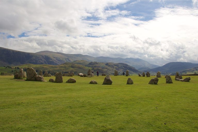
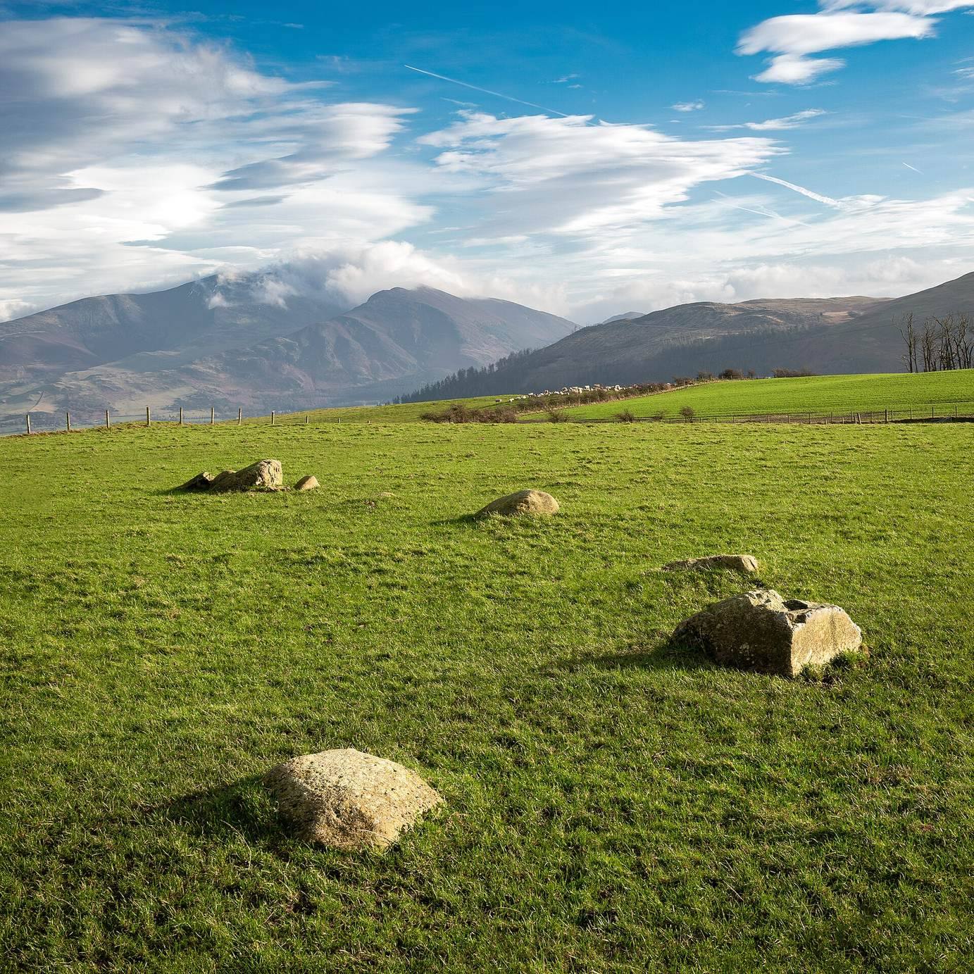
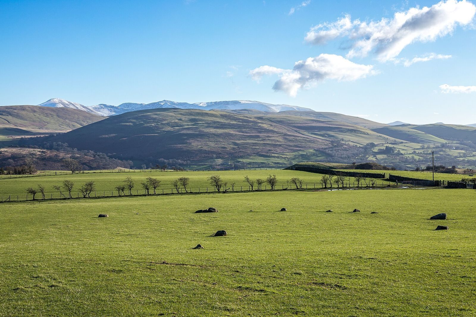
The circle occupies elevated ground on the lower slopes of Elva Hill, north of Bassenthwaite Lake, overlooking the northern Lake District. Its broad, roughly circular layout is formed by widely spaced megalithic stones, meaning large stones used in a prehistoric monument, around an open interior.
Stone circle
About fifteen stones survive, while the original arrangement is estimated to have included around thirty. Many of the remaining stones are small, fallen, or partly embedded in the ground, a condition that may reflect long-term stone loss or later disturbance. The surrounding fells include Grisedale Pike and Skiddaw, and have been interpreted as forming a natural amphitheatre with particular visual emphasis to the southwest. Nineteenth-century antiquarian descriptions placed an outlying stone southwest of the circle. If its position was accurately noted, it may have marked the point where the midwinter sun set beyond the western horizon.
Field evidence
Medieval ridge-and-furrow plough marks remain visible in the surrounding field. This later agricultural activity may have sealed Neolithic deposits beneath the topsoil, and buried features associated with the circle may survive.