Castlerigg Stone Circle: A Neolithic Monument near Keswick
Site at a Glance
- Popularity
- Very High
- Country
- United Kingdom
- Primary era
- Stone Age
- Eras represented
- Stone Age, Bronze Age
- Civilizations
- Unclassified
- Site type
- Religious
- Remains
- Sanctuary
On this page11 sections
History
Neolithic date and proposed uses
Castlerigg is a stone circle near Keswick in the United Kingdom, generally assigned to the Neolithic, the later part of the Stone Age, and dated by comparison with other monuments to around 3200 BC. This places it in the late fourth millennium BC, but the circle has not been scientifically dated. It is considered one of Britain’s earliest stone circles. Its proposed date falls within a period when Irish passage-tomb traditions, burial monuments with chambers reached through passages, were present in western Britain. Any connection between those traditions and Castlerigg remains uncertain.
The circle’s original purpose and later uses are unknown. It has been interpreted as a ceremonial or ritual place, an assembly site, and a location for observing the sky. Antiquarian Aubrey Burl grouped it with what he called Cumbrian circles, large, open stone enclosures that might have hosted gatherings. A possible link with the Langdale axe industry, which produced polished stone axes in the Lake District, has also been proposed. On this interpretation, exchange and ritual may have overlapped at Castlerigg. Nineteenth-century reports of roughly made stone clubs from the circle’s north-western quadrant have been used in support, but their connection to the monument is unclear. Production at the Pike o’ Stickle axe factory probably ended by 3300 BC, at least a century before Castlerigg’s proposed date.
Antiquarian accounts and literary reception
William Stukeley made the earliest known written description after visiting in 1725; it appeared in his Itinerarium Curiosum in 1776. The name Castlerigg is associated with his rendering of an earlier form, Keswick Carles, as Castle-rig. Stukeley also described a larger circle in a neighbouring pasture, which may have been a natural feature.
The monument drew attention during the Romantic period. Samuel Taylor Coleridge and William Wordsworth visited in 1799, while a passage in John Keats’s Hyperion has been linked to a visit, although that attribution is uncertain. Robert Sears published an early description in 1843, drawing on an earlier landscape account by Ann Radcliffe.
Investigation and stewardship
C. W. Dymond visited in 1878 and 1881 and produced the first accurate plan. In 1882, W. K. Dover directed the only known archaeological excavation. It examined the eastern interior, but its results did not settle whether that setting had served as a burial place or a ritual enclosure. English Heritage carried out a geophysical survey in 1985, using physical measurements to investigate the ground without excavation, across the protected area and the field to its west. In 2004, archaeologist Margarita Díaz-Andreu commissioned laser scanning to examine a claim of a spiral carving and create three-dimensional records of the stones.
Castlerigg was included in the Ancient Monuments Protection Act 1882 schedule, which provided early statutory protection for ancient monuments, and entered state care the following year. The arrangement covered the monument but not its land. In 1913, a public subscription organized in part by Canon Hardwicke Rawnsley bought the field and gave it to the National Trust. The Trust owns the site, while English Heritage is responsible for the monument. Solstice celebrations continue at the circle.
Remains
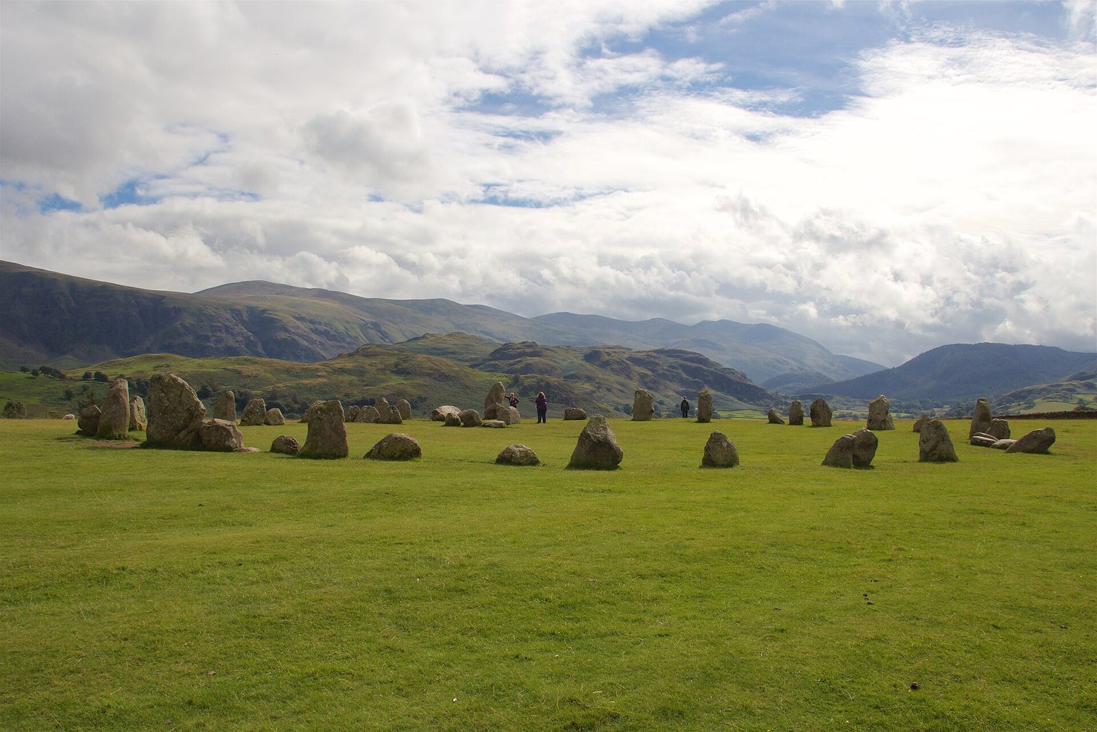
The site’s layout centres on a flattened ring of stones with a roughly rectangular arrangement set within its eastern side. The monument stands on a hilltop plateau, and its stones are glacial boulders.
Hilltop setting
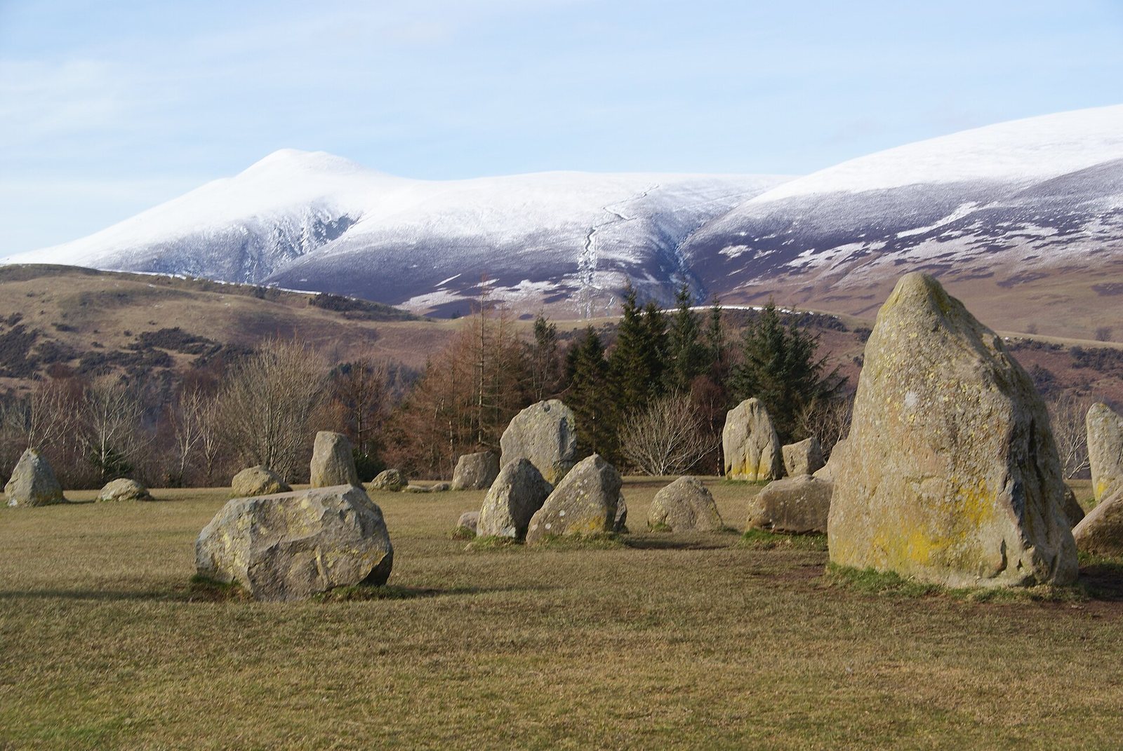
The circle occupies the apex of a rounded hill east of Keswick, on a plateau forming the raised centre of a natural amphitheatre surrounded by fells. From within the ring, the distant peaks of Helvellyn, Skiddaw, Grasmoor, and Blencathra are visible. Proposed horizon alignments include the autumn-equinox sunrise over Threlkeld Knott, about 3.5 kilometres to the east, as well as winter-solstice sunrise and lunar positions. These remain proposed interpretations rather than established explanations of the monument’s orientation.
Outer ring
The ring is 32.6 metres across at its widest point and 29.5 metres at its narrowest. Its stones are glacial erratics, boulders carried by ice and deposited away from their original geological setting, made from volcanic rock of the Borrowdale Volcanic Group, including andesitic lava and tuff. They rest on glacial till, the unsorted sediment left by a glacier. The heaviest stone is estimated to weigh about 16 tons, and the tallest stands approximately 2.3 metres high. A gap about 3.3 metres wide interrupts the northern side and may have been an entrance.
Stone counts vary from 38 to 42, partly because some observers include small stones beside the larger uprights. These smaller stones may be packing stones, originally buried to brace the uprights and exposed as soil has eroded. An English Heritage information panel gives a count of 40; another count describes 38 surviving stones from an original 42, with 32 still standing. The circle is relatively intact, though its original appearance is uncertain and some stones may have been moved or removed. Wear in the centre includes pits associated with fires or cremation deposits, which have damaged the site.
Eastern interior
Ten-stone setting
Ten stones form a roughly rectangular setting against the eastern part of the circle. Its purpose has not been established. In his 1725 description, Stukeley identified it as a grave. During the 1882 excavation, Dover measured the setting at 22 feet east to west and 11 feet north to south. His trench revealed dark surface soil over undisturbed yellow soil at a depth of 14 inches. At the western end, dark soil mixed with stones continued to three feet; near its base, Dover noted material he thought might be small pieces of burned wood or charcoal, along with dark, greasy earth. The recorded soil layers may help establish the sequence between the inner setting and the stone ring.
Low mounds
Low mounds in the eastern half were described by nineteenth-century antiquarians as cairns, or possible burial mounds. A cairn is a mound made of stones. Their form is unclear, and interpretations have often placed them in the later Bronze Age, the prehistoric period associated with the use of bronze. A 2021 reassessment of Benjamin Williams’s 1856 description proposed that one mound may have contained a Langdale tuff axe, raising the possibility that some burials could date to the Neolithic.
Carving and outlying stone
Stone 13, at the western edge of the ring, bears a lozenge motif, a diamond-shaped figure. About 90 metres to the south-west, a farmer erected an isolated stone in the early twentieth century. Linear marks along its side are consistent with repeated plough strikes, suggesting it had been buried before it was dug up. It may once have belonged to the circle, or it may be a naturally deposited boulder.