Calakmul: An Ancient Maya City in Campeche, Mexico
Site at a Glance
- Popularity
- Very High
- Country
- Mexico
- Primary era
- Medieval
- Eras represented
- Iron Age, Classical, Medieval
- Civilizations
- Maya
- Site type
- City
On this page22 sections
History
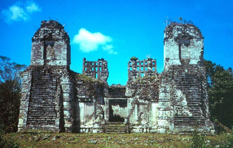
Calakmul is an ancient Maya city in Calakmul Municipality, Campeche, Mexico. Occupied from the Middle Preclassic through the Postclassic, it was already a large settlement in the Preclassic and later became a major political power in the central Maya lowlands. The Classic period was a long era of Maya political and cultural development, between the earlier Preclassic and later Postclassic. The city’s central area was called Ox Te’ Tuun, meaning Place of Three Stones. Calakmul is a modern name associated with the meaning City of the Two Adjacent Pyramids. Chiik Naab’ may have named the city or a broader area.
Early settlement and rulers
Inscriptions indicate that a Calakmul king probably took power in 411. Another inscription, from 514, refers to a site ruler who was not of royal rank. The early history of the ruling dynasty remains unclear. Its authority may have grown out of the Preclassic cities of El Mirador or Nakbe, and a dynasty from the Mirador Basin may later have moved to Calakmul. The Kaan dynasty’s capital may also have shifted there from Dzibanche in the late sixth or early seventh century, though the relocation is uncertain. The connection between the rulers’ title, Divine Lords of the Snake, and Calakmul itself is not established.
Alliance and rivalry in the sixth and seventh centuries
By the mid-sixth century, Calakmul led a broad political alliance and had become a major rival of Tikal. At its seventh-century height, its polity was known as Kaan, meaning Snake. Whether the Kaan emblem, a hieroglyphic sign identifying a Maya polity or ruling house, was associated with Calakmul at an earlier date is uncertain. Calakmul’s influence grew during the second half of the sixth century and the seventh, but it did not completely defeat Tikal.
A damaged inscription at Caracol says that in 562 the Calakmul ruler Sky Witness defeated Tikal and sacrificed its king, Wak Chan K’awiil. Tikal’s recorded history then pauses for roughly 130 years. Sky Witness probably died in 572. In 599, Calakmul’s king Uneh Chan attacked and sacked Palenque with help from Lakam Chak, ruler of Santa Elena. Uneh Chan led another assault in 611, after Palenque had recovered some independence. The campaigns may have been intended to secure valuable western Maya trade routes. Palenque’s ruler Ajen Yohl Mat and the royal noble Janab’ Pakal died soon afterward, and the city entered a prolonged decline.
Calakmul’s control of Naranjo weakened after Uneh Chan’s death. In 631, King Yuknoom Head regained the city, whose ruler was already captive when it fell. The captive’s punishment is described by a term that can mean either tortured or eaten. Yuknoom Head also conquered an unidentified city in 636.
Yuknoom Che’en II and Calakmul’s peak
Yuknoom Che’en II became king in 636 and probably commissioned major palace complexes in Calakmul’s center. He expanded and sustained an extensive network of allied cities, helping install rulers in several of them. In 648, his forces defeated Tikal’s military outpost at Dos Pilas and captured its ruler, B’alaj Chan K’awiil. Rather than sacrifice him, Yuknoom Che’en II restored him as a subordinate ruler. B’alaj Chan K’awiil later campaigned against Tikal. Calakmul intervened at Dos Pilas again in 677, and Dos Pilas, probably with Calakmul’s support, defeated Tikal in 679.
Yuknoom Che’en II reinforced alliances through gifts and political marriages, including the marriage of a Calakmul princess to the ruler of El Perú. Calakmul’s influence reached Naranjo, Caracol, Dos Pilas, and other Maya centers. The king also oversaw the installation of rulers at Cancuen in 656 and 677. When he died, probably in 686, Calakmul was the most powerful city in the central Maya lowlands.
Defeat and political decline
Yuknoom Yich’aak K’ak’ succeeded Yuknoom Che’en II in 686. In 695, he led Calakmul’s forces against Tikal’s king Jasaw Chan K’awiil I and suffered a decisive defeat. Tikal captured an image of Calakmul’s deity Yajaw Maan. The defeated king’s fate is uncertain: a Tikal sculpture shows a captive, but it is not clear that the figure represents him. The loss ended Calakmul’s period of greatest power and sharply reduced its diplomatic influence.
A ruler known as Split Earth was in power by 695, though it is uncertain whether he belonged to Calakmul’s dynasty or had been installed by Tikal. Yuknoom Took’ K’awiil later commissioned monuments in 702 and 731, and Dos Pilas, El Perú, Naranjo, and other allied centers remained connected to Calakmul. A further defeat by Tikal, probably between 733 and 736, weakened the city.
In 736, a Calakmul ruler, possibly Wamaw K’awiil, visited Quiriguá as it moved toward rebellion against its overlord, Copán. Calakmul probably backed the revolt to weaken a Tikal ally and gain access to trade along the Motagua Valley. In 738, Quiriguá captured Copán’s king, Uaxaclajuun Ub’aah K’awiil, and ritually executed him. The alliance helped Quiriguá secure independence while damaging Tikal’s network. Calakmul’s alliance system weakened further when Tikal defeated El Perú in 743 and Naranjo in 744.
Calakmul’s political authority had probably collapsed by about 830, although elite activity continued until around 900 or later. Monuments were still erected in the late ninth or early tenth century, when some inscriptions used crude, meaningless imitations of hieroglyphs. The city was abandoned during the tenth century. The Kejache Maya, a Yucatec-speaking people encountered in the region at the time of Spanish contact, may have descended from Calakmul’s inhabitants.
Rediscovery and protection
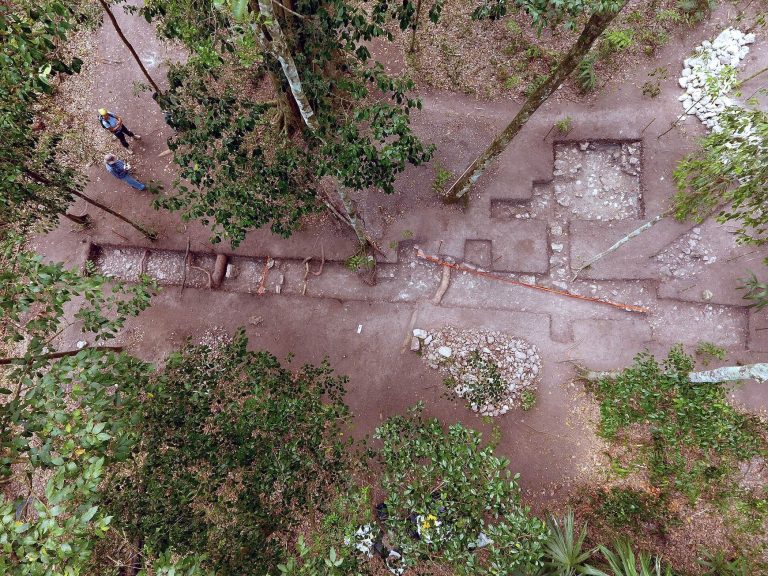
Biologist Cyrus L. Lundell rediscovered Calakmul from the air on 29 December 1931 and reported it to archaeologist Sylvanus G. Morley in March 1932. Morley visited later that year for the Carnegie Institution of Washington. Surveys in the 1930s mapped the central area and recorded 103 stelae. Work stopped in 1938 and resumed in 1982 under archaeologist William J. Folan of the Universidad Autónoma de Campeche, who worked at the site until 1994. A large-scale project led by Mexico’s National Institute of Anthropology and History followed under archaeologist Ramón Carrasco. The ancient city and its protected tropical forests became a UNESCO World Heritage property in 2002, extended in 2014. Calakmul also lies within the Calakmul Biosphere Reserve.
Remains
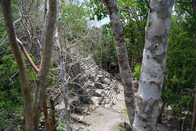
Calakmul’s buildings and carved monuments spread across a limestone dome that rises about 35 metres above the surrounding lowlands. The Maya levelled the dome to create the city. To its west, El Laberinto is a seasonal swamp about 34 kilometres long and 8 kilometres wide. It supplied water during the rainy season, while its edge offered fertile soil and flint. Settlement in the Preclassic and Classic periods concentrated near the swamp; during the Classic period, people also built on higher ground and small islands within the wetland.
Urban layout and construction
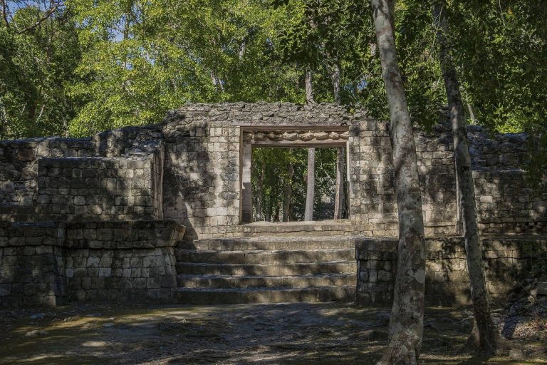
The city’s roughly concentric layout includes a central zone of about 1.75 square kilometres, with 975 mapped structures, around 300 of them built with vaulted stone masonry. The broader core covers about 2 square kilometres and contains roughly 1,000 structures. Around 92 structures stand on large pyramidal platforms arranged around plazas and courtyards. Beyond the core, a residential area extends over more than 20 square kilometres, where about 6,250 structures have been mapped. In total, around 6,750 ancient structures have been identified; at its Late Classic height, the city is estimated to have covered more than 70 square kilometres.
A limestone wall about 6 metres high bordered the core to the north, controlling access from that direction and possibly serving a defensive purpose. Many commoner homes stood along El Laberinto’s western edge, interspersed with some high-status residences and public buildings. People used the spaces between homes for horticulture. The buildings were made of soft limestone, which has weathered severely and contributed to the erosion of carved sculpture.
Water management
Canals and natural and artificial gullies managed water across an area of about 22 square kilometres around the core. A network of 13 reservoirs has a combined estimated capacity of more than 200 million litres, enough to supply an estimated 50,000 to 100,000 people. Five reservoirs were major facilities. One, fed by a small seasonal river, measures 242 by 212 metres. Aguada 1 has the greatest surface area, covering 5 hectares.
Causeways
Eight constructed causeways, called sacbeob in the plural, connected Calakmul to nearby settlements and distant cities such as El Mirador, El Tintal, and Nakbe. Two have been mapped, three identified on the ground, and three detected remotely. Causeways crossing the swamp were raised above the wetland; they now tend to support denser vegetation than the surrounding forest.
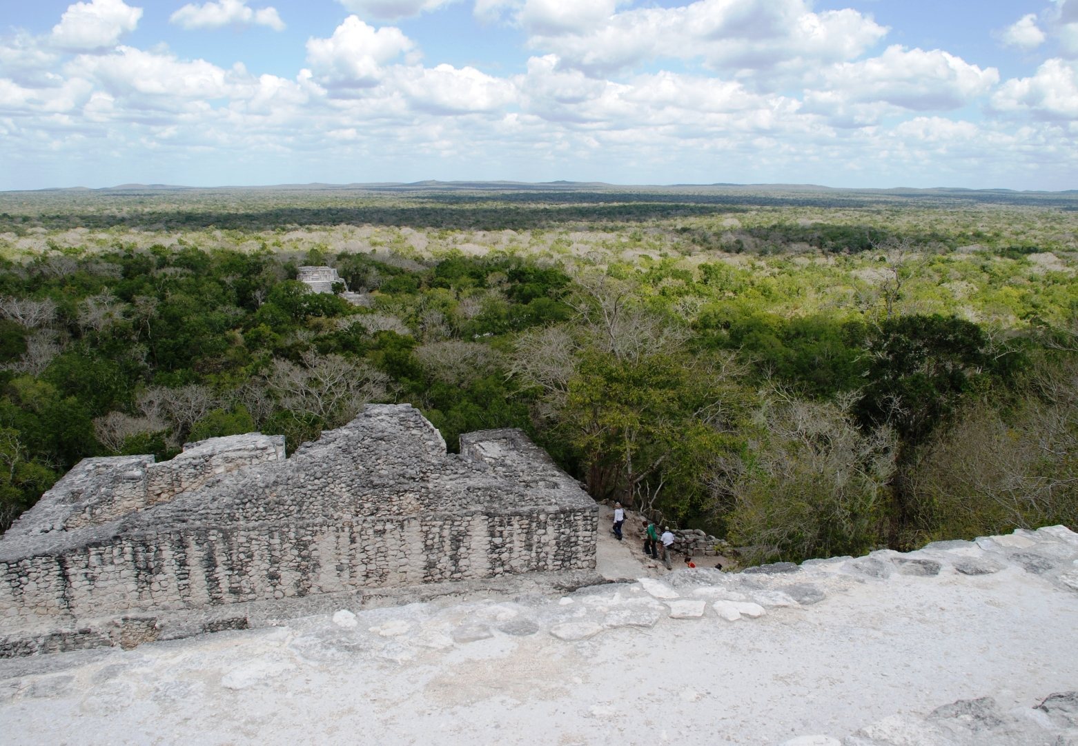
Sacbe 1 runs for 450 metres within the mapped urban area and is lined and filled with stone. Sacbe 2 is a 70-metre packed-earth route, found while a nearby quarry was being excavated; it may have carried stone for Structures 1 and 3. Sacbe 3 extends 8 kilometres northeast from the core, while Sacbe 4 runs 24 kilometres southeast. Both were found in 1982 and can be seen from the summit of Structure 1.
Sacbe 5 heads west from the main watering place, crosses El Laberinto, and continues at least 16 kilometres toward Sasilha. Sacbe 6 crosses the swamp to link Calakmul with El Mirador, 38.25 kilometres away, and continues another 30 kilometres to El Tintal. Sacbe 7 lies south of Sacbe 6, crossing the swamp for at least 5.1 kilometres. Sacbe 8 is on the swamp’s western side and does not appear to continue across it to the city core.
Monumental buildings
Structure 1
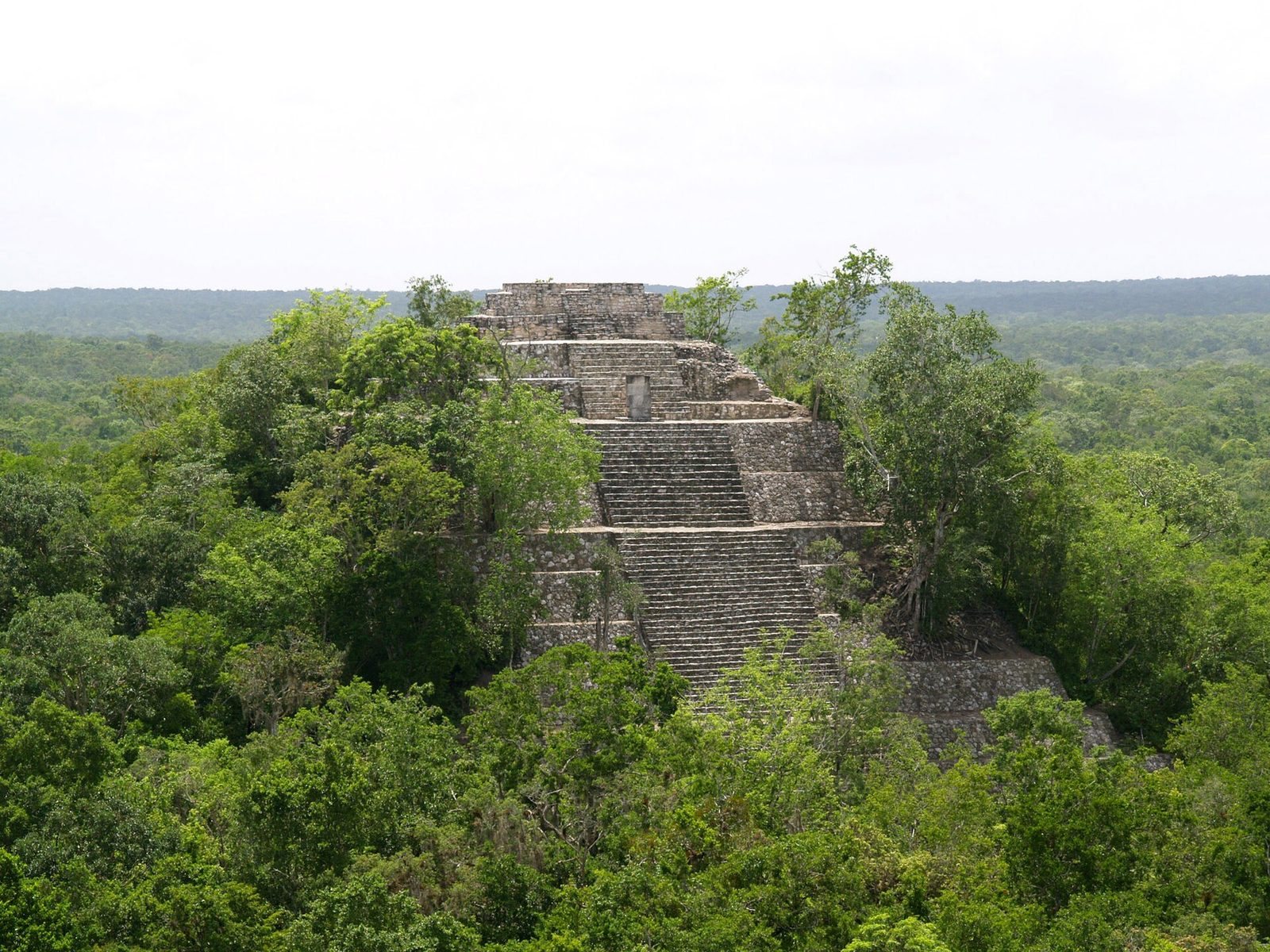
East of the core, Structure 1 is a pyramid 50 metres high, built on a low hill. Its position makes it appear taller than Structure 2, although it is not. Yuknoom Took’ K’awiil had stelae set at its base in 731.
Structure 2
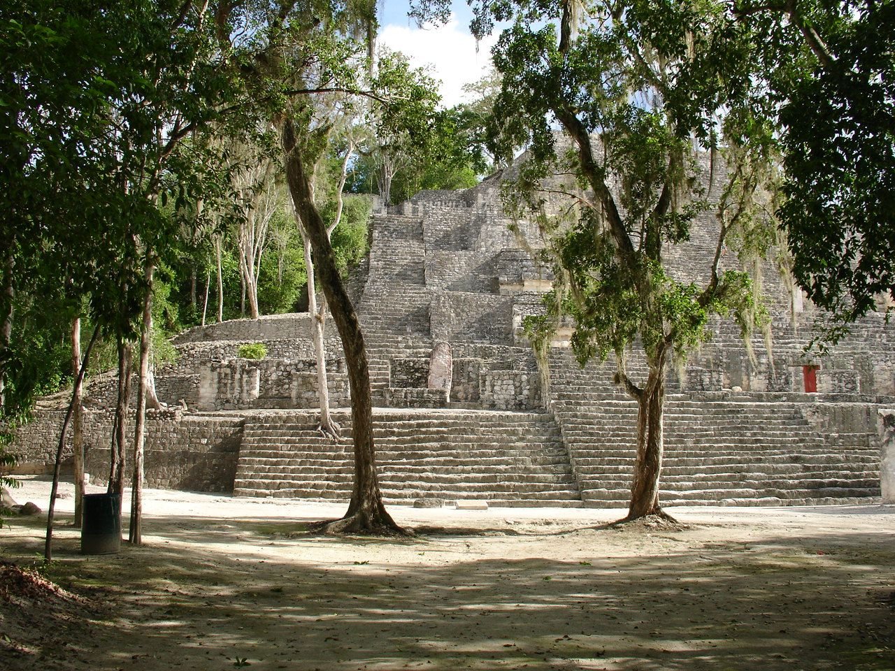
Structure 2 is a north-facing pyramid temple with a square base measuring 120 metres on each side and a height of more than 45 metres. Successive building phases enlarged an earlier structure. The core, Structure 2A, is a Late Preclassic ceremonial complex with three temples on a shared platform, and remains the pyramid’s highest point. In the Early Classic, builders covered an earlier stucco-faced building on the north side with a large extension. Three shrines stood on this extension: Structure 2B in the center, Structure 2C to the east, and Structure 2D to the west. Each had its own stairway. Six large masks decorated the front, three on either side of the central stairs. The pyramid resembles El Tigre at El Mirador in date, scale, and design, and ceramics associated with the two buildings are also similar.
Later buildings containing stelae were added along the pyramid’s front. In the eighth century, a larger pyramid enclosed Structure 2B and a stepped facade covered the masks. Another facade was placed over this frontage, though it may not have been completed. In the Late Classic, a palace was built on the summit beneath a roof comb, a tall feature rising above the roof, decorated with painted stucco relief. Its nine rooms formed three groups of three, with each room set behind another. The palace measured 19.4 by 12 metres. Rooms 1 through 6 had hearths and grinding stones for food preparation; Room 7, at the southwest, was a sweatbath.
Four tombs have been found within Structure 2. Tomb 4, placed in the floor of Structure 2B during the eighth century, contained a male skeleton wrapped in textiles and jaguar pelts, partly preserved with resin. Offerings included Early Classic jade ear ornaments, a jade mosaic mask, shell and bone beads, spiny oyster shells, unusual obsidian blades, fine ceramics, and remnants of wooden objects. A ceramic plate names Yuknoom Yich’aak K’ak’ as its owner, and the burial is thought to be his. The remains and offerings had been placed in a carved, painted wooden bier with hieroglyphs. The wood had almost entirely decayed, leaving its shape impressed in the surrounding mud. Stelae 115 and 116 may also be connected with the burial.
Structures 3 and 4
Structure 3, also called the Lundell Palace, is a multi-room building southeast of Structure 4, on the east side of the Central Plaza. Structure 4 is a group of three temples, numbered 4a, 4b, and 4c, on the plaza’s east side. Its central building, Structure 4b, stands on a Preclassic substructure.
Structures 5 and 6
Structure 5, north of Structure 2, was first built in the Preclassic and is surrounded by ten stelae, many dating to the seventh century. Structure 6 stands on the west side of the Central Plaza. Together, Structure 6 and Structures 4a to 4c form an arrangement associated with observing the sun’s seasonal positions. Observations in 1989 confirmed that, on the vernal equinox of 21 March, the sun rose behind Structure 4b when viewed from Structure 6.
Structures 7 and 8
Structure 7 is a south-facing pyramid temple, 24 metres high, on the north side of the Central Plaza. Five plain stelae stand along its southern side. Built in several phases from the Late Classic into the Terminal Classic, it had a three-room temple at the top and a tall roof comb covered in stucco. A board for playing patolli, a Mesoamerican game, was carved into the outer room’s floor. Structure 8 is a small building north of the plaza and east of Structure 7. Stela 1 and its altar are associated with it.
Stelae and inscriptions
Calakmul has 117 stelae, upright stone monuments, the largest total in the Maya region. Many were set in pairs portraying rulers and their wives. Soft limestone has eroded much of their carved detail. Stela 1 is associated with an altar near Structure 8; Stelae 38 and 42 stand at the base of Structure 2. Stelae 28 and 29, erected in 623, show a royal couple whose names cannot be read.
Early inscriptions
Stela 114, dated to 435, was moved in antiquity and reset at the foot of Structure 2. Its long inscription may commemorate a royal accession in 411. Stela 43, dated to 514, was placed in a vaulted chamber near the pyramid’s base. Its damaged text includes an early form of a title used by non-royal nobles at Calakmul and in the Mirador Basin.
Monuments of the sixth and seventh centuries
Stela 8, erected after Uneh Chan’s death, describes a ceremony he held in 593. Yuknoom Che’en II commissioned Stela 33 in 657 to commemorate an event from Uneh Chan’s reign, probably in 593; Uneh Chan may have been his father. A thin slate monument, Stela 9, dates to 662 and gives the birth and full royal title of Yuknoom Yich’aak K’ak’. Stelae 76 and 78, both badly eroded, date to 633 and probably belong to Yuknoom Head’s reign.
Later royal monuments
Stela 51, Calakmul’s best-preserved monument, depicts Yuknoom Took’ K’awiil and dates to 731. Stela 54, also from 731, depicts one of his wives. B’olon K’awiil commissioned the pair of Stelae 57 and 58 in 771 east of Structure 13; Stela 57 is tall. Stela 62, unfinished and bearing the damaged name of Ruler Z, was carved for a ceremony marking the end of a 20-year Maya calendar period in 751. Stela 88, on Structure 13’s stairway, dates to about 751 and depicts an unnamed queen. It may have been paired with Stela 62 and appears to refer to B’olon K’awiil.
Monuments from the city’s final years
Stela 50, one of the last monuments from Calakmul’s decline, carries a roughly executed portrait. Stelae 84 and 91 are very late monuments, probably from the early tenth century; their inscriptions imitate hieroglyphs but convey no meaning. Stela 61 bears the name Aj Took’, a badly eroded portrait, and a shortened date that probably corresponds to 909, though 899 is also possible. Stelae 115 and 116, from Yuknoom Yich’aak K’ak’s reign, were broken and buried within Structure 2.
Murals and ceramics
Murals in Substructure 1-4 of the Chiik Nahb complex show market activity rather than elite life. Painted scenes depict people preparing or drinking atole, a maize-based drink, eating tamales, using tobacco and ointments, and selling textiles and needles. Glyphs describe the actions. A prominent figure appearing repeatedly has been identified as Lady Nine Stone.
Ceramic remains help trace production and political connections. Their composition can identify the region or polity where they were made, while vessels bearing Calakmul’s Snake emblem at other Maya sites provide evidence of ties with the city.