Egnazia: An Ancient Coastal City and Archaeological Park in Italy


Site at a Glance
- Rating
- 4.6
- Popularity
- Medium
- Country
- Italy
- Primary era
- Classical
- External website
- Open
- Eras represented
- Bronze Age, Iron Age, Classical, Medieval
- Civilizations
- Roman
- Site type
- City
On this page31 sections
History
Egnazia is an ancient coastal city in Italy near Fasano, developed over many centuries by Bronze Age communities, Iapygian groups, Messapians, and Romans. Occupation began with a settlement of huts by the fifteenth century BC, and the site remained active through the medieval period. Set beside the Adriatic on a limestone promontory, Egnazia became a Messapian coastal settlement, a Roman municipium, an episcopal center, and eventually an archaeological park.
Bronze Age and Messapian Egnazia
The earliest settlement consisted of huts placed on the underlying rock platform. Occupation is also attested in the thirteenth century BC. Iapygian groups, ancient peoples associated with movements from the Balkan region, occupied the area during the eleventh century BC. From about the eighth century BC, the Messapians, a people of southeastern Italy who lived across much of Salento before Roman expansion, became the dominant community.
During the Messapian period, Egnazia developed as a coastal settlement and trading center. Its material culture shows Greek influence, particularly in pottery and funerary customs. Defensive works reflect conflicts with Taranto during the fourth century BC. The city’s necropolises developed mainly outside its defensive circuit, while the acropolis continued to rise through successive layers of occupation.
Roman incorporation and expansion
Rome conquered the surrounding region from the third century BC. Egnazia probably became a civitas foederata, a community linked to Rome by treaty, after 267 to 266 BC. After the Social War, the conflict that extended Roman citizenship and reorganized Italy, it became a municipium, a community incorporated into the Roman state with local administration and defined civic rights. Under Roman rule, it was known as Gnatia or Egnatia and entered its most prosperous period.
Egnazia’s port, Adriatic position, and road connections supported commerce and travel. The Via Minucia passed through the area before the Via Traiana improved the route in the early second century AD. The Via Traiana was an imperial road linking Beneventum and Brundisium along the Adriatic side of Apulia. Egnazia consequently served merchants, travelers, soldiers, officials, and other traffic moving between the two cities.
The poet Horace passed through Egnazia on his journey from Rome to Brindisi in 37 or 38 BC and mentioned the city in his Satires. Pliny and Strabo also referred to it. Horace ridiculed a local religious marvel in which incense was said to vanish from an altar without fire, a practice also associated with Pliny’s account of the city.
A major Roman building phase is associated with Marcus Vipsanius Agrippa, a close associate of Octavian Augustus. It included or contributed to the construction of the covered cryptoporticus, port facilities, civil basilica, trapezoidal public square, so-called amphitheatre, and an early phase of the public baths. A second building phase accompanied Trajan’s improvement of the road system and involved the Via Traiana, the sanctuary of the eastern deities, a nearby basin, and other structures along the road.
Late antiquity and the medieval settlement
Late antiquity brought major religious and urban changes. Christianity became dominant, the former civil basilica was transformed into a church, and the sanctuary of Cybele was destroyed or substantially altered. The sacred theatre area was covered by later structures. Egnazia was an episcopal center by the fourth or fifth century, and Bishop Rufentius took part in councils held under Pope Symmachus in 501, 502, and 504. The see was probably established before 400 and was suppressed or transferred in the sixth century, although its later continuity remains uncertain.
The city’s decline has been associated with warfare, insecurity, malaria, and changing trade routes. A destruction by the Ostrogothic king Totila around 545 is possible, but the final end of the city is not securely established. Coastal attacks by Visigoths, Saracens, and possibly later groups weakened the settlement. Occupation continued in reduced form on the acropolis, where a fortified settlement developed between the eighth and tenth centuries. Later finds indicate activity into approximately the tenth to fifteenth centuries, and some Messapian chamber tombs were adapted as dwellings.
Egnazia was gradually abandoned as a settlement, while its buildings supplied reusable construction material for Fasano, Monopoli, and nearby communities. The surrounding necropolises were systematically looted, especially during the eighteenth and nineteenth centuries. Antiquarian interest is recorded from 1745, when Francesco Maria Pratilli produced a schematic plan of visible monuments. In 1882, Ludovico Pepe described the ancient structures in detail and criticized clandestine excavation.
Excavation and preservation
Official archaeological investigation began in 1912 under Quintino Quagliati, director of the excavations office and National Museum of Taranto. Systematic campaigns followed in 1939, 1963 to 1971, 1978, and from 2001 onward. Later research was carried out by the University of Bari with the regional archaeological authorities and revealed additional urban structures, including the remaining half of a porticoed square first investigated by Quagliati.
The archaeological area covers approximately 40 hectares, although less than one-third has been fully excavated. The park and museum preserve evidence from the Bronze Age through the medieval period. Egnazia also gave its name to Gnathia ware, a Hellenistic pottery style produced in several Apulian centers from approximately 370 to 200 BC. The site is one of its production centers and contains an especially important concentration of the pottery. The archaeological park forms part of the UNESCO World Heritage property Via Appia. Regina Viarum, inscribed in 2024, and is administered as a national archaeological park and museum complex.
Remains
Egnazia occupies an elongated plateau running roughly parallel to the coast. Broad terraces descend toward the sea, while flat-bottomed ravines or watercourses carry rainwater toward the Adriatic. The acropolis stands between two coastal inlets that offered natural protection and sheltered boat use. The excavated city combines Bronze Age settlement layers, Messapian defenses and tombs, Roman streets and public buildings, late-antique churches, and a medieval fortified complex.
Early settlement and defenses
Bronze Age huts
The Bronze Age settlement was built on the natural rock platform. Excavated huts have oval or probably oval plans, pressed-clay floors, and curving stone walls. An early defensive wall measured approximately 2.90 metres across at its base and was originally about 2.20 metres high. A carbonized destruction layer separates one settlement phase from a later village.
Messapian walls
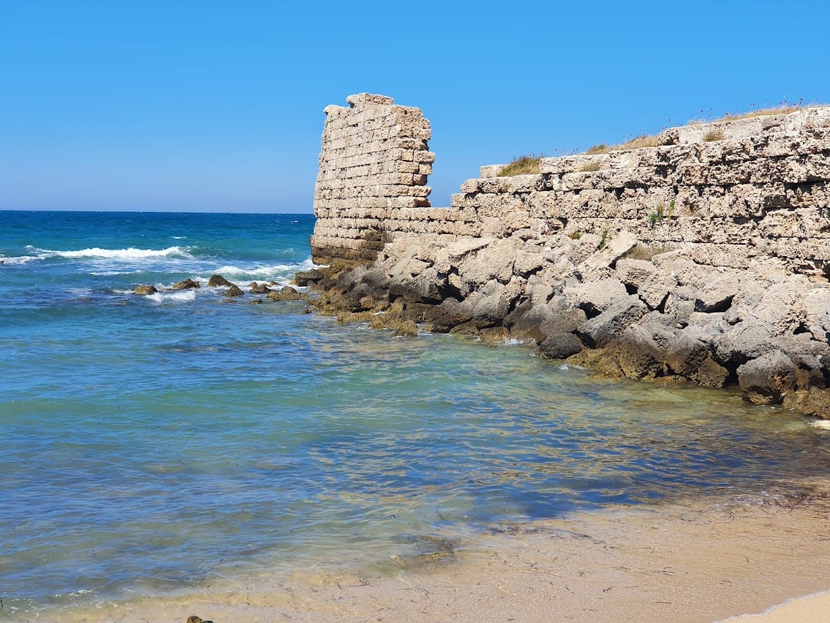
The Messapian defensive system enclosed an urban area of about 40 hectares. It developed through several phases, beginning with an earthwork-and-wall system accompanied by an external ditch and continuing with a curtain wall of regularly laid limestone blocks. The principal surviving section, known as the muraglione, was originally about two kilometres long and extended toward the sea. In places it survives to approximately seven metres high and sixteen courses. The walls were built largely with dry-laid limestone blocks, with substantial sections surviving on the northern and eastern sides. An older wall of large tuff blocks remains along the eastern limit.
Acropolis and fortress
The acropolis formed a raised settlement mound through accumulated occupation between the Bronze Age and the ninth century AD. Its remains include a Hellenistic Italic-type temple with a moulded podium, probably built in the third century BC, and a later fortified complex. The fortress, or castrum, used blocks taken from earlier buildings and included a chapel with a semicircular apse.
Necropolises and tombs
Messapian tombs
The Messapian necropolises lie mainly beyond the defensive circuit, although some pre-Roman tombs occur within the city. The tombs include shaft graves, semicamber tombs, and chamber tombs cut into the local limestone known as carparo. Some chambers have corridors, stairways, vestibules, or stone closures. Several were decorated with painted architectural and geometric schemes.
Western necropolis
The western necropolis contains family tombs dating particularly from the fourth to the second centuries BC. Painted decoration includes geometric zones, architectural framing, plants, vines, ivy, wreaths, lotus leaves, and, in some cases, a torch. The southern necropolis remains largely unexcavated.
Hypogeum of the Pillar
The Hypogeum of the Pillar is an underground tomb with two chambers connected by a short dromos, a corridor leading to a burial chamber. The larger and earlier room contains a structural pillar, a niche with a stone grille for storing bones, and painted architectural panels. The smaller chamber has more limited decoration and a ceiling design resembling a stretched carpet. This second room may date to the third century BC.
Port and Roman urban fabric
Harbour and streets
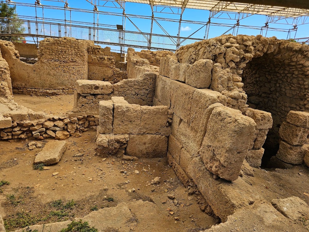
An artificial harbour was developed in the northern inlet during the Roman period and enlarged with two artificial piers. Warehouses and commercial buildings later occupied the port area, which was partly constructed over deposits left by a seaquake or tsunami. Agricultural tools, fishing hooks, amphorae, furnaces, and other objects were found there. Across the city, irregular blocks were separated by the Via Traiana and secondary streets, some unpaved. Houses, workshops, channels, cisterns, wells, and water-collection basins have been identified, while many domestic and productive buildings survive mainly as foundations.
Via Traiana
The Via Traiana crosses Egnazia longitudinally. Its surviving pavement consists of polygonal limestone slabs bearing wheel ruts and bordered by curb stones. Additional protective stones occur on some curves. Shops and other public buildings stood beside sections of the road.
Forum and porticoed square
The Forum is a trapezoidal public square opposite the civil basilica. Only part has been excavated. Tuff slabs paved the square, which was surrounded by a drainage channel and a Doric colonnade. A speakers’ platform, a commemorative base, and traces of other monuments occupied the space, while a paved pedestrian passage connected it with the Via Traiana.
A separate irregular porticoed square was long confused with the Forum. It connects westward with the so-called amphitheatre, northwestward with the temple of Cybele, and southeastward with an L-shaped colonnade. Two straight colonnades closed by projecting arms form the square. Its Doric portico belongs to the Augustan period, while the surviving local-stone paving belongs to the Trajanic period and replaced an earlier surface.
So-called amphitheatre
The so-called amphitheatre is an elliptical enclosure approximately 37 metres long and 25 metres wide. Its walls use opus africanum, a Roman technique combining upright stone blocks with smaller masonry, and retain traces of paint and plaster. A paved walkway surrounds much of the exterior. A stone seating platform survives to the northeast, while pseudo-radial supporting walls at the southwest contain two entrances.
Its identification as an amphitheatre remains conventional and uncertain. The building is relatively small, centrally located, and offers limited evidence for conventional seating and underground installations. It may instead have served as an auxiliary space connected with the adjoining public or religious complex.
Sanctuaries and religious buildings
Sanctuary of Cybele
The sanctuary complex known as the Phrygianum or Metroon occupied the lower slopes of the acropolis. It included buildings dedicated to Cybele, also called the Magna Mater, an ancient mother goddess whose cult spread from Anatolia through the Greek and Roman worlds, and to Attis, the youthful deity associated with her myths of death, renewal, and seasonal rebirth. The complex included a temple, a sacred theatre or performance area, the Campus Magnae Matris, and the sanctuary of the eastern deities.
The Temple of Cybele is an elongated quadrangular building constructed with opus africanum. Its original floor used stone or marble slabs, and its low-plinth podium may belong to the late Republican period, while the floor is probably Julio-Claudian. The temple was built in antis, with projecting side walls and a Doric colonnade. Yellow, red, and green frescoes decorated the walls. Associated finds include fragments of lions, a kernos, a ritual vessel made from connected receptacles, a votive mask, and a marble relief of the enthroned Magna Mater.
Basin room and eastern sanctuary
A basin room was architecturally connected with the Temple of Cybele and the sanctuary of the eastern deities. Its basin was lined with hydraulic mortar. Its function is uncertain. It has been interpreted as a purification basin, a container for sacred fish associated with the goddess Syria, or a facility connected with the lavatio, the ritual bathing of Cybele’s statue.
The sanctuary of the eastern deities is a rectangular area entered through a limestone threshold. Its stone base or altar carried representations of two flutes, a tympanum, and a cymbal. An inscription on its front commemorated Flavia Cypare, priestess of the Magna Mater and the goddess Syria. Nearby finds include a marble head of Attis, another marble relief, and a terracotta representation of Cybele. The decoration is associated with the Augustan period, while the marble head and a hand holding a syrinx, a small panpipe-like instrument, date to the Hadrianic period. The head was discovered in 1964.
Cryptoporticus and religious enclosure
The cryptoporticus is a first-century structure with four arms of unequal length. A cryptoporticus is a covered or partly underground vaulted passage that could support circulation, storage, or structures above it. At Egnazia, parts were cut into the rock and other sections were built in concrete and covered by vaults. Entrances and internal openings changed over time. Because no superstructure is known, the building may have served as a grain store.
The so-called sacellum of the eastern deities stood between the amphitheatre and the civil basilica and shared part of the basilica’s perimeter wall. Its central altar or base carried reliefs of musical instruments associated with religious ceremonies. A headless marble statuette of Attis was found in the sacred theatre area in 1963.
Civic buildings and baths
Civil basilica
The civil basilica, also called the Hall of the Three Graces, was a rectangular public building for assemblies, legal proceedings, and commercial discussions. Its internal colonnade formed a four-by-eight arrangement, and its principal facade and entrances faced southeast. Toward the acropolis, it connected with a large room paved in mosaic. A mosaic depicting the Three Graces is associated with that room and is preserved in the archaeological museum.
The basilica belongs to the Augustan period. It was refurbished in the late third or fourth century and later converted into a Christian church. The building preserves examples of the successive reuse of civic architecture as the religious and urban organization of Egnazia changed.
Public baths
One bath building stood south of the civil basilica, and other probable bath structures lay near the Via Traiana. Some walls use opus vittatum mixtum, a Roman masonry technique with alternating courses of squared tuff blocks and bricks bound with mortar. Egnazia also preserves opus incertum, opus reticulatum, and opus testaceum, techniques distinguished by irregular stonework, net-patterned facing, and brick facing.
Christian and medieval remains
Episcopal Basilica
The late-antique Episcopal Basilica had three aisles, a transept, an apse, and a narthex, or entrance hall, with a baptistery attached. An earlier basilica beneath the fifth- or sixth-century building probably dates from the fourth or fifth century. Surviving mosaics use geometric and plant designs together with Christian imagery, especially in the right aisle. The baptistery contains facilities for immersion baptism.
The upper structure was destroyed by fire or another destructive event, and traces of burning survive. The precise cause is uncertain. Blocks and slabs from earlier buildings were frequently reused during the Christian phase.
Southern Basilica
The southern, or Quagliati, Basilica, also called the Paleochristian Basilica, dates from approximately the sixth or seventh century. It has three aisles, is smaller than the Episcopal Basilica, and probably overlies an earlier building. Its single apse projects into the former road of the central basilica district. A narthex is absent or remains unexcavated.
Furnace and reused tomb
A fourth-century furnace for firing terracotta objects has a circular combustion chamber, a perforated firing floor, a hemispherical dome, and two narrow openings. It was built over the shaft grave of the Messapian priestess Tabara. Her name or title appears on one of the tomb slabs.
Museum collections
The archaeological museum was built outside the ancient city in 1978 near the Messapian necropolis. It contains excavation finds, mosaics, architectural fragments, Messapian bronzes and ceramics, Roman sculpture, and a large collection of Gnathia ware. This pottery has a glossy black ground with applied white, yellow, ochre, red, and occasionally purple decoration. Its motifs include plants, geometric patterns, theatrical masks, birds, garlands, mythological figures, and Dionysiac imagery, ranging from household vessels to elaborate theatrical compositions.
The collections also include Messapian inscriptions, terracotta objects, painted tomb furnishings, Roman marble sculpture, an African red-slip lamp decorated with a fish, and a late-antique gold ring bearing the image of a building topped by a ruby. The ring has been interpreted as a Middle Eastern object possibly connected with a bishop or an episcopal employee. Together with the mosaics, ritual objects, architectural fragments, and marble images of Attis and Cybele, the museum’s material traces the history and topography of Egnazia from the Bronze Age through the Byzantine period.