Dykyi Sad: A Fortified Late Bronze Age Proto-City in Ukraine
Site at a Glance
- Popularity
- Medium
- Country
- Ukraine
- Primary era
- Bronze Age
- Eras represented
- Bronze Age
- Civilizations
- Unclassified
- Site type
- Settlement
- Remains
- Town
On this page22 sections
History
Dykyi Sad is a fortified proto-city of the Belozerka culture in present-day Mykolaiv, Ukraine, occupied during the Late Bronze Age from the 13th to the 10th century BC. The Belozerka culture was a society of the northern Black Sea region during the later Bronze Age, when bronze tools and objects were widely used. Near the confluence of the Southern Bug and Inhul rivers, Dykyi Sad developed into a regional center for crafts and exchange. Its history belongs to a period long before Greek colonies were established around the northern Black Sea, about five centuries later.
Community and economy
Dykyi Sad has been described as a leading center of the Belozerka culture, whose influence extended from the lower Dnieper to the lower Danube. Its position at the meeting of land and water routes suited exchange, and a port with docks has been proposed, although its existence and location remain unconfirmed. The settlement’s compact plan and artifacts have also prompted comparisons with Troy and Mycenaean Greece, a Bronze Age civilization centered in mainland Greece.
The settlement’s division into an inner fortified area and surrounding neighborhoods has been interpreted as evidence of planning, social distinctions, and centralized leadership. The inner area, or citadel, may have housed an elite, while much of the wider population lived beyond it. Concentrated craft activity has led to the suggestion that skilled workers also held an elevated social position. The orderly layout has been taken to imply leadership and knowledge of geometry. A population of roughly 500 has been estimated by allowing about ten people for each of at least 50 dwellings.
Residents worked in bone, pottery, leather, weaving, rope and rigging, wood, and metal. Fishing, livestock raising, hunting, and farming also supported the community. Fish bones, stone weights used with anchors, and bronze hooks point to fishing; animal pens indicate livestock keeping. Sickles, grain remains, hand-operated grain grinders, and grinding tools show that crops were cultivated. Millet, barley, wheat, and grapes were among the crops, while hunting appears to have played a supplementary part. Soil evidence suggests that wetter conditions in the 13th and 12th centuries BC favored farming and animal husbandry. As the climate became drier, these activities grew harder, regional communities shifted toward nomadic life, and Dykyi Sad was abandoned by the 10th century BC.
Beliefs and later activity
Interpretations of the ritual evidence associate religious practice with the Sun, Moon, and fire, as well as the veneration of ancestors and heroes. Other proposed elements include animism, which attributes spiritual agency to natural beings or objects; totemism, which links a community symbolically with a natural emblem or species; and belief in spiritual power associated with particular objects. One interpretation describes rites at a sanctuary as proto-Mithraist, suggesting a possible precursor or resemblance to Mithraism, a later cult centered on Mithras. The connection is unproven, and other finds have been linked with fertility rites.
People returned to the abandoned settlement after its main Bronze Age occupation, and activity continued intermittently from antiquity into the early modern period. Some researchers have proposed that the ruins were the Cimmerian fortifications near river crossings mentioned by Herodotus, an ancient Greek historian, but this identification remains uncertain. Others have connected Dykyi Sad with the legendary Cimmerian city in Homer’s Odyssey. The Cimmerians were an ancient people associated with the northern Black Sea region, and the proposed connection to the poem is not established.
The garden and archaeological investigation
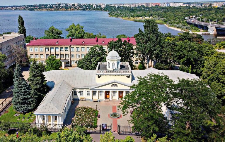
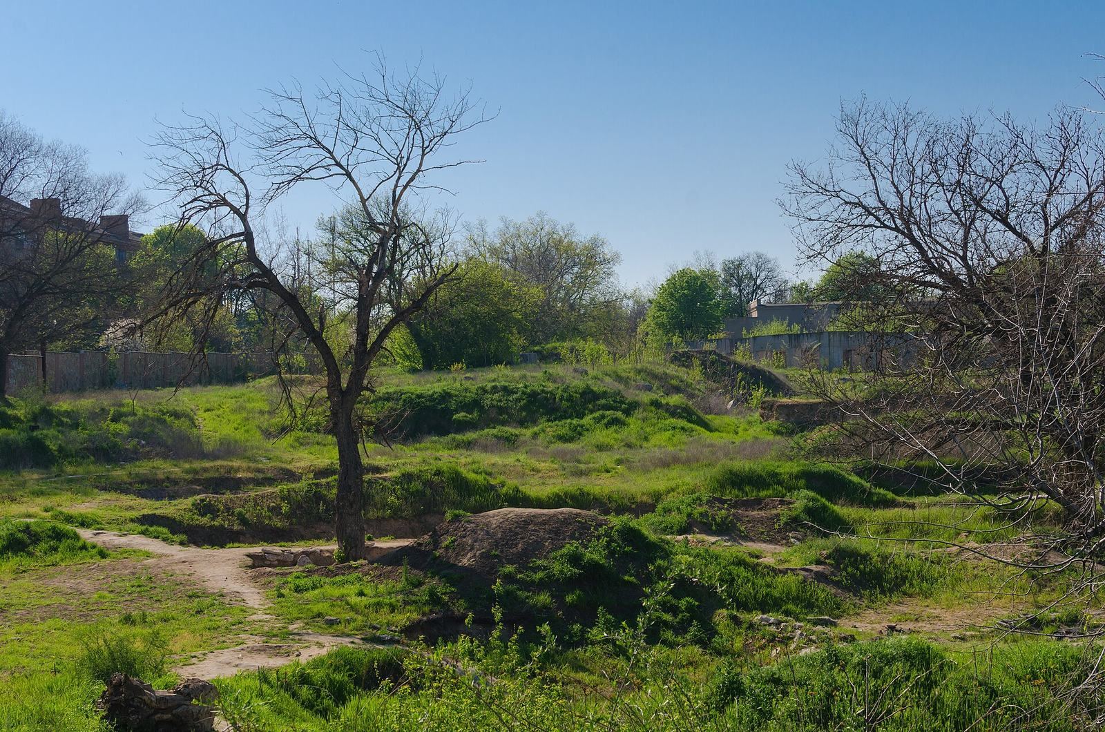
The modern name comes from a garden established in the area during the first half of the 19th century by Admiral Aleksey Greig, a Russian naval commander and governor of Mykolaiv. Officially called the Admiral’s Garden, it became popularly known as the Wild Garden because its trees grew wild and bore no fruit. The popular name eventually prevailed. During both world wars, residents cut down trees for fuel amid shortages of firewood and coal. After the Second World War, little of the garden remained beyond wasteland and scattered bushes; building covered part of the area, and two hectares were sold for housing. The name nevertheless endured.
Modern archaeological work began on August 15, 1927, when archaeologist and local historian Feodosii Kaminsky started collecting material at Dykyi Sad and nearby. By June 1929 he had transferred 74 artifact fragments to a museum. He was repressed that year, bringing research to a halt. Investigations resumed in the 1950s under Lazar Slavin. Kaminsky returned from exile after his rehabilitation in 1956 and again collected finds.
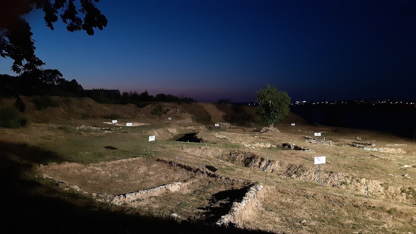
Regular excavations restarted in the early 1990s under Yurii Grebennikov, with Kyrylo Horbenko leading the expedition from 1998. By 2008, investigations covered 5,822 square metres, about one fifth of the known site. Excavations and surface finds led archaeologists to interpret Dykyi Sad as a planned proto-city with residential, craft, and ritual areas rather than as a simple settlement. Work to create an open-air museum began in 2017. In 2020, archaeologists investigated part of an outpost on the opposite bank of the Inhul.
Remains
Setting and layout
Dykyi Sad occupied a high point of land at the confluence of the Southern Bug and Inhul. Its oval plan stretched from southeast to northwest, and the present ground surface lies 19 to 21 metres above sea level. Erosion has worn back the eastern riverbank; the retreat over roughly 3,000 years is estimated at 60 to 80 metres. The ancient settlement is thought to have covered 4 to 5 hectares. Finds in adjoining areas may point to an outlying settlement and a cemetery, bringing the proposed total area to 6 to 7 hectares. The present archaeological area is slightly more than 3 hectares.
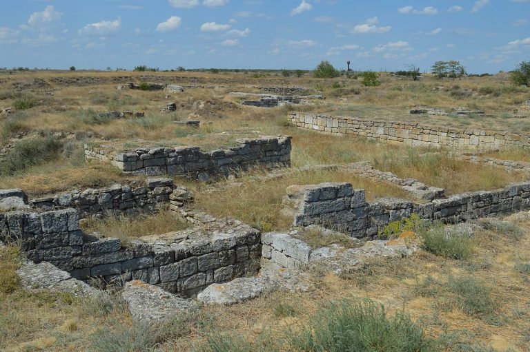
More than 50 rooms or building remains have been excavated. They form a close-set arc in three or four rows along the Inhul. The settlement had a fortified inner area, called the citadel, a suburb beside it, and an outer settlement quarter beyond. The suburb lay inside a larger ditch, while the outer quarter was beyond that boundary. The outer ditch was dug before buildings filled the enclosed area, and the arrangement of buildings in the suburb has been interpreted as planned rather than haphazard.
Fortifications and crossings
Citadel defenses
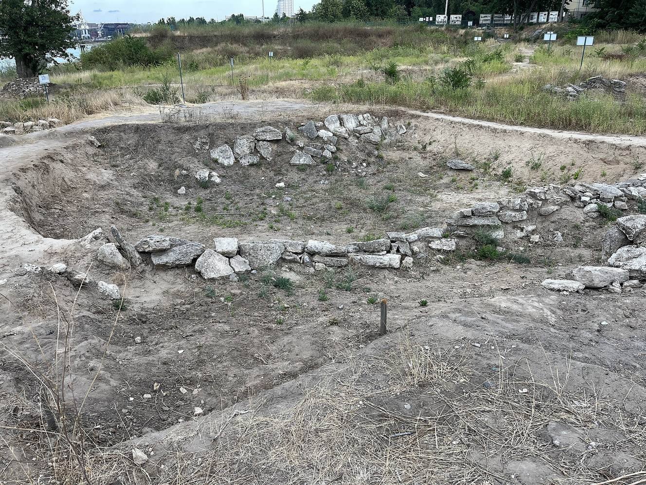
The citadel occupied the southeastern part of the settlement and is its oldest and most extensively investigated zone. Its defensive wall was about 2 to 2.5 metres high and 3 metres wide. A steep riverbank defended the rear, while deep ravines protected two other sides. A curving ditch, about 120 metres long, 5 metres wide, and 3 metres deep, enclosed the citadel. Limestone slabs lined its inner face, and two bridges crossed it.
Bridges
The southern bridge provided the main approach to the citadel; the northern one linked it with the suburb. Both had stone foundations supporting wooden structures, and the foundations survive. The bridges date to the mid-13th century BC and have been described as the oldest known bridges across fortified ditches in Eastern Europe. An earlier bridge in Europe is known from Achaean Greece and dates to about 1300 BC.
Buildings and settlement areas
Citadel rooms
The citadel contained 15 rooms used for residential, economic, and ritual purposes, as well as a ritual ramp. Most rooms were rectangular with rounded corners and measured 4 to 8 metres across. Their long axes followed the Inhul. They were sunk partly into the ground, generally by 0.4 to 1 metre, and commonly had stone foundations. Other spaces served as pens, workshops, or storage areas. Surviving features include stone at the bases of some walls, floor-level storage and ritual features, postholes, and open hearths. Proposed workshop activities include working bone and pottery, butchering animals, and casting metal. One room has been identified as a watchtower guarding the northern bridge entrance. A building where the citadel met the nearby suburb may also have been defensive, though it could have been a residence.
Room 19
Room 19 was a rectangular building with rounded corners, measuring 7 by 8 metres and covering 56 square metres. Its walls were made of sun-dried mud bricks, each about 0.40 by 0.20 metres, bonded with clay and ash. The eastern floor had a clay-and-sand coating; the western floor consisted of compacted clayey soil mixed with lime mortar. Pits beneath the floor were sealed after use with clay or compacted soil. During rebuilding, a stone lining strengthened the western wall. Among pits and collapsed material, one feature has been interpreted as a post support and another as an air vent. The room’s purpose is uncertain. It may have been used to process animal carcasses, perhaps by smoking meat, or to make casting moulds and furnace air nozzles; an air nozzle was found there.
Room 20
Room 20 measured 8 by 7.5 metres and had clay-built walls. It shared its northern wall with room 19 and its southern wall with room 10. The western wall rested on stone foundations and included five to seven courses of limestone rubble and slabs. The surviving section extended 6.3 metres and varied from 0.50 to 1.80 metres in width; some stones bear working marks. The floor was levelled and compacted. Shaped trapezoidal limestone slabs found near the center had once stood on edge beside a central post. A clay deposit has been interpreted as a small altar within a clay barrier, with three upright stone slabs at its center. A single-slope roof angled toward the defensive ditch has been proposed. A pit holding many cattle bones may relate to carcass processing.
Suburb and sanctuary
The suburb contained numerous storage pits and rooms that appear to have served as homes, based on their hearths and storage features. Room 13 is identified as a sanctuary. Sacrifices took place on an open platform in its northern part, while pits to the east were used for funerary and commemorative rites. A bronze-casting workshop and a hoard of bronze objects were also found in this area.
Outer settlement quarter
As far as 100 metres beyond the outer ditch, the outer quarter contained oval dwellings sunk 0.5 to 3 metres into the ground. Some were partly underground and others entirely below ground, with remains of stone structures above them. Storage rooms and cellars held animal and fish bones, pottery fragments, and stone and bone tools. Domestic and ritual pits lay beside the buildings.
Room 22
Room 22 was used for a later ritual involving a dismembered animal skeleton, probably that of a horse. The activity took place in the Middle Ages and has been interpreted as a commemorative rite.
Objects and material evidence
Stone and bone objects
More than 250 stone objects have been recovered, including upright slabs, maces, hammers, vessels, casting moulds, mallets, hand-operated grain grinders, anvils, weights, and stone anchors. Most were made from local rock from the Southern Bug and Inhul valleys, while some stone came from the southern Carpathians, Asia Minor, or the Mediterranean. A sickle made from grey flint may have used stone brought from Crimea or the Carpathians.
More than 150 bone objects and unfinished pieces provide evidence for the production process. Materials included domestic animal bones, especially horse ribs and jaws, and naturally shed deer or saiga antlers. The objects include horse-bridle cheekpieces and browbands, blunt tools made from horse lower jaws, rib scrapers, awls, rope-making tools, and spindle whorls. About 30 finished cheekpieces and a similar number of unfinished pieces form an unusually large Bronze Age collection. Thirty-six ankle bones were used as gaming pieces; another may have served as an amulet. Bone skates made from horse bones were identified through experimental replication and microscopic comparison of wear marks.
Ceramics
Pottery fragments occur in domestic pits throughout the citadel, suburb, and outer quarter. The finds include more than 2,000 vessel rims, 1,200 bases, 13,000 body fragments, over 200 decorated pieces, and more than 100 groups of large or medium vessel fragments. Vessels included pots, storage jars, vases, cups, ladles, bowls, broad shallow pans, braziers, and strainers used to turn milk into cheese. A spindle whorl was also made of pottery. The forms show influences from Proto-Thracian cultures of the lower Danube.
Most vessels were polished by rubbing or show traces of this treatment, and many have black or greyish-brown surfaces. Common pots had rounded bodies, rims that flared slightly outward, and narrow bases. Decorations included oval slanting impressions, notches, cut lines, raised clay ridges, and applied ornaments. Broad shallow pans also had smooth or ornamented depressions, notches, and decorated rims.
Metalworking and bronze
Evidence for metalworking includes fragments of three casting moulds, a crucible, an air nozzle for a furnace, and more than 80 bronze objects. These include daggers, knives, hollow-handled axes, a spearhead, a sickle, saw-knives, an awl, fishing hooks, plaques, part of a small chisel, riveted cauldrons, pins, brooches, bracelets, and earrings. A large bronze cauldron had a capacity of 37 litres and is displayed at the Mykolaiv Regional Museum of Local History. A hoard found in 2008 contained about a dozen hollow-handled axes with a combined weight of 3 kilograms. A smaller, incomplete axe from the outpost appears unfinished; it has been suggested that this reflects an effort to save scarce bronze.
Ritual finds
Upright stone slabs were buried in specially prepared pits inside residential or utility buildings. One lay below a floor with grape seeds; another was placed with deliberately broken pottery, stone tools, and animal bones. A human skull without its lower jaw came from a separate pit. Hearths, thick ash deposits, charcoal, and baked-clay layers occur in several areas, sometimes overlapping pits. These features have been interpreted as connected with fire rites, purification, or initiation. Broken pottery and a stone spool from these areas have been considered possible offerings.
A turtle-shell fragment among offerings in areas associated with fire may have served as a symbolic object or vessel. In one building, a clay pot containing mostly catfish bones was set into the stonework and has been interpreted as an offering intended to secure fishing success. Near a stone lintel at the southwestern entrance to an interconnected building complex, a carefully shaped limestone object associated with male fertility has been linked to fertility rites.
Later objects
A bronze clothing clasp of sub-Mycenaean type and stone objects of Mediterranean origin point to connections beyond the local region. An amphora fragment from the 5th century BC is associated with visits by ancient Greeks to the ruins. Turkish and Cossack pipes date from the 16th to 18th centuries, while Turkish pottery dates to the late 17th or early 18th century.