Dolmen D31: A Neolithic Passage Grave in the Netherlands
Site at a Glance
- Popularity
- Low
- Country
- Netherlands
- Primary era
- Stone Age
- Eras represented
- Stone Age
- Civilizations
- Unclassified
- Site type
- Burial
- Remains
- Tomb
On this page9 sections
History
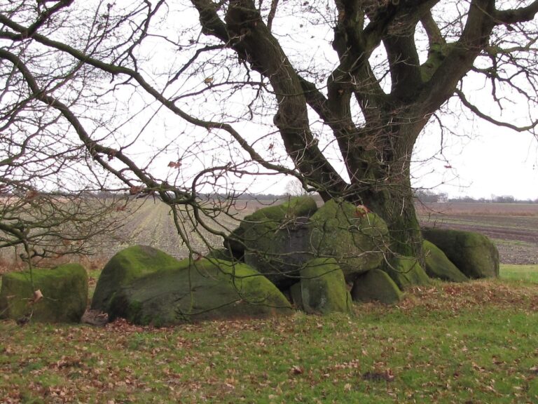
Dolmen D31 is a Neolithic passage grave, a burial chamber reached through a passage, in the Hunzebos south of Exloo in the Netherlands. It is attributed to the western group of the Funnel Beaker culture and dates to about 3470–2760 BCE. This Neolithic archaeological tradition takes its name from its distinctive funnel-shaped pottery; its western group was a regional subdivision.
Early interpretations and records
In the seventeenth century, Dutch minister and antiquarian Johan Picardt associated nearby Celtic fields, small prehistoric field systems, with Hunsow, the antiquarian name for a supposed ancient settlement in Drenthe. R. Boelken first mentioned D31 in 1818, and the tomb was excavated around 1820.
Nineteenth-century surveys and ownership
The Province of Drenthe acquired the tomb in 1847 from members of Exloo’s local communal landholding association. That year, Leonhardt Johannes Friedrich Janssen, curator of Dutch antiquities at Leiden’s National Museum of Antiquities, visited the site and included it in a general survey of Dutch megalithic tombs published in 1848. In 1874, archaeologist Willem Pleyte and photographer Jan Goedeljee made the first systematic photographs of Drenthe’s surviving megalithic tombs, including D31.
In 1878, British antiquarians William Collings Lukis and Henry Dryden surveyed the tomb at the request of the Society of Antiquaries of London, a learned society devoted to antiquities and history. Their work took place amid concern that restoration could change the monuments’ original appearance. The survey was published in 2015 by Drenthe archaeologist Wijnand van der Sanden, after having remained unpublished for many years.
Twentieth-century preservation and recording
Albert Egges van Giffen included D31 in his atlas in 1918, and the tomb was restored in 1952. It became a Dutch National Monument in 2004. In 2017, photographs were used in photogrammetry, a process for producing measurements and three-dimensional models from photographs, for a 3D atlas project involving the Province of Drenthe, the University of Groningen, and the Gratama Foundation.
Remains
Mound and chamber
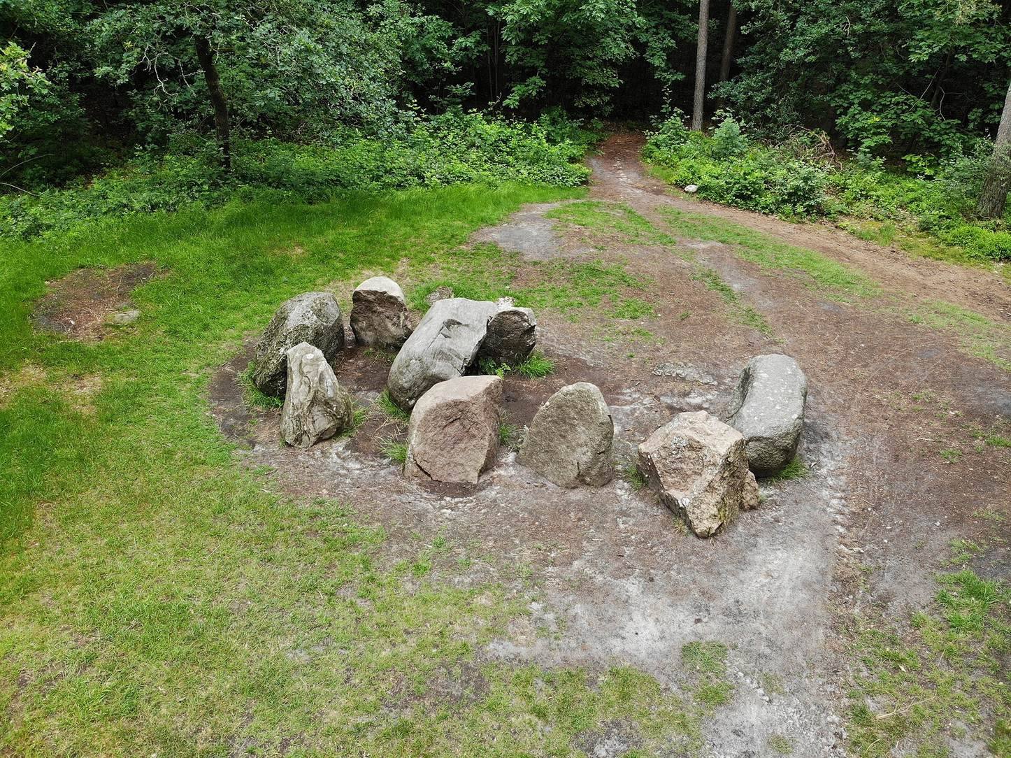
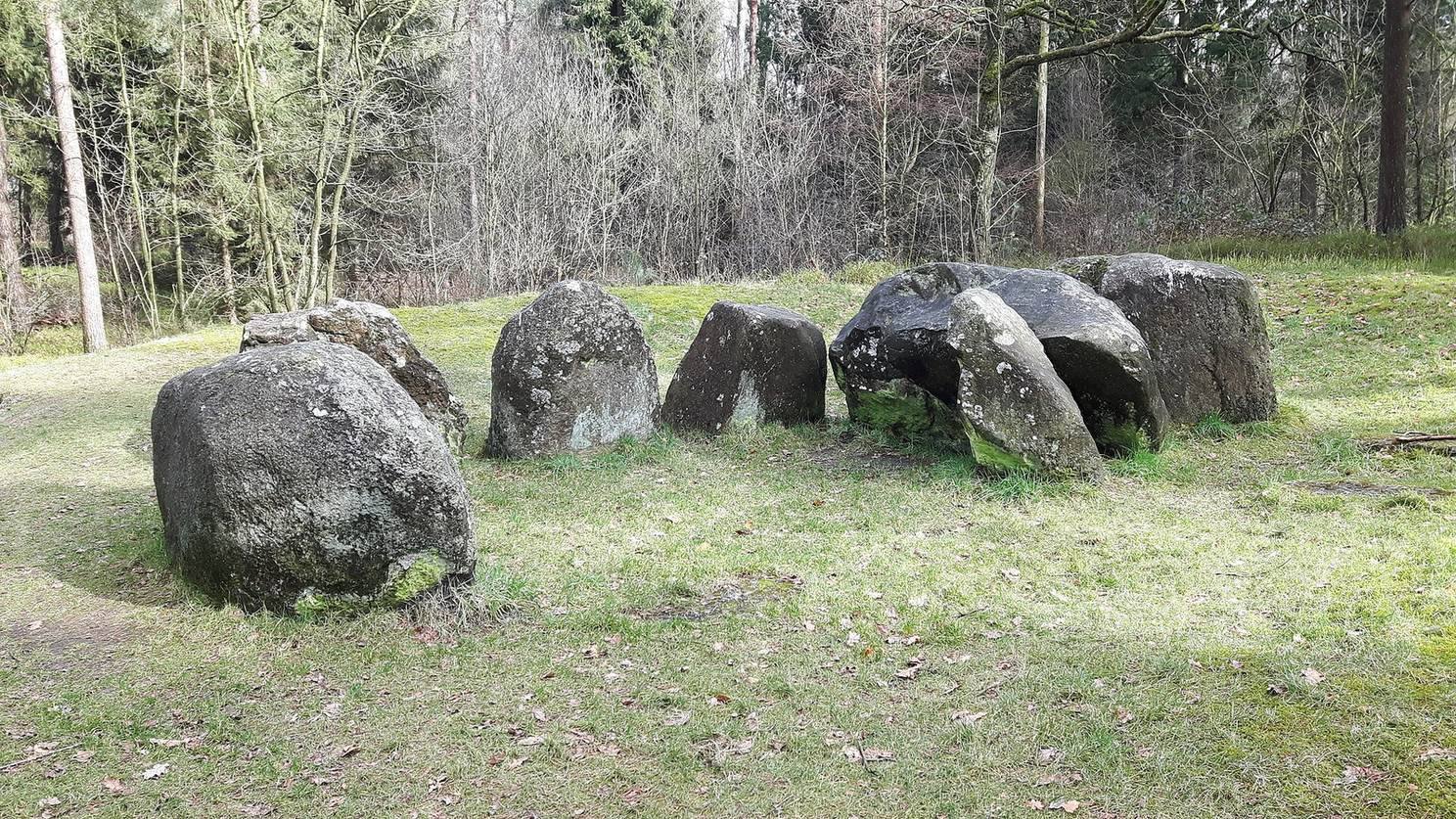
The tomb is oriented roughly east–west. Its oval mound remains recognizable on a natural hill, and a 1878 measurement put its width at about 23 m. The chamber measures 7 m long by 3.3 m wide. Four pairs of stones formed its long sides, with an end stone closing each short end. Both end stones and six side stones survive. Five roof stones were in place in 1822; one remains, lying inside the chamber rather than resting on its supports.
Entrance and passage
The entrance was at the eastern end of the south side, between the first and second side stones. A passage made from two stones led to it. Concrete-filled setting marks show where stones in the chamber and passage were placed.
Recorded condition
When Lukis and Dryden surveyed D31 in 1878, one end stone and two side stones stood upright, with a tilted roof stone between them. Five other stones, probably side stones, lay scattered nearby. Van Giffen described the tomb in 1918 as severely deteriorated and difficult to recognize, and noted little change in its condition since 1878.
Landscape and nearby sites
A nearby burial mound is associated with the Corded Ware culture, a prehistoric tradition linked to pottery decorated with cord impressions. Drenthe’s oldest trade route passes D31 and the locations of D33, D34, D35, and the Eppiesbargie burial mound; the Valtherzandweg still forms part of its course. Other nearby megalithic tombs are Odoorn (D32), 2.4 km west-southwest; Valthe-West (D34), 2.8 km south; and Exloo-Noord (D30), 3.1 km north-northwest.