Coffin Stone: A Possible Neolithic Burial Monument near Aylesford
Site at a Glance
- Popularity
- Medium
- Country
- United Kingdom
- Primary era
- Early Modern
- Eras represented
- Medieval, Early Modern, Modern
- Civilizations
- British, English
- Site type
- Civic
- Remains
- Monument
On this page8 sections
History
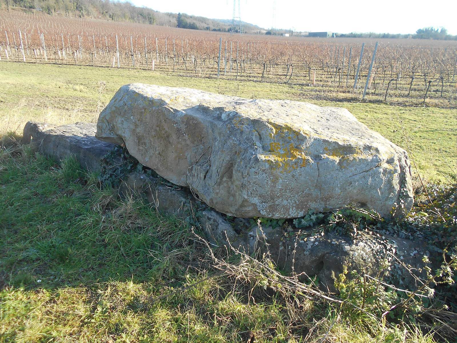
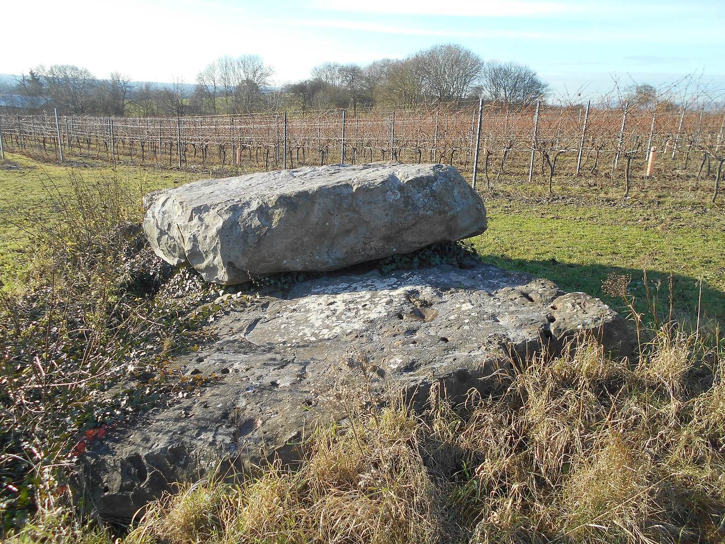
The Coffin Stone is a large sarsen slab at Aylesford, Kent, in the United Kingdom. It has been proposed as the remains of a chambered long barrow, a long burial mound with a chamber often used for collective burial, dating to the fourth millennium BCE in Britain’s Early Neolithic, when farming became established. If it was a tomb, pastoral communities may have built it soon after agriculture arrived in Britain from continental Europe.
Proposed Neolithic origins
In the nineteenth century, human remains reportedly found near the stone helped support the burial-monument interpretation. John H. Evans regarded the discovery as strong evidence that the slab belonged to a destroyed tomb, and Ronald F. Jessup also considered this explanation likely.
Work led by Paul Garwood in 2008–09, as part of the Medway Valley Prehistoric Landscapes Project, identified prehistoric activity near the stone. The activity could not be dated precisely. The investigators concluded that the slab had been moved to its present position sometime between 1450 and 1600.
Antiquarian records
Hercules Ayleway alerted his friend William Stukeley to the stone in 1722. Stukeley visited the area and made an illustration, which appeared in his account published after his death in 1776. John Thorpe later visited and included two illustrations in his 1788 account. Thorpe thought Stukeley had given the stone its ‘Coffin’ name.
Beale Poste visited around 1840 and sketched the site. He associated it with human remains said to have been recovered nearby in 1838 or 1839. In 1871, E. H. W. Dunkin described the stone as a possible burial monument or standing stone and recorded remains reportedly uncovered during hedge removal in 1836. Dunkin also noted that local farmers had moved more than fifty sarsen blocks to the nearby springhead. James Fergusson referred in 1872 to two obelisks locally called ‘coffin-stones’.
Later records and interpretations
George Payne recorded ‘General’s Stone’ as another local name in 1893. Paul Ashbee later suggested that Payne had confused the Coffin Stone with a separate megalith several hundred metres away, in the same field as Kit’s Coty House. O. G. S. Crawford included the stone among the Medway Megaliths in 1924, and William Coles Finch published its first photograph in 1927.
In 1946, Evans noted a local tradition linking the Coffin Stone and other megaliths to burials after the fifth-century Battle of Aylesford. Early modern antiquaries had advanced this connection before it became part of local folklore. A 1989 visit described the stone as being in good condition at the edge of a ploughed field, while leaving open whether it was natural or placed by people. In 2005, English Heritage declined to consider legal protection after regarding the stone as a natural feature.
Remains
Slab and immediate setting
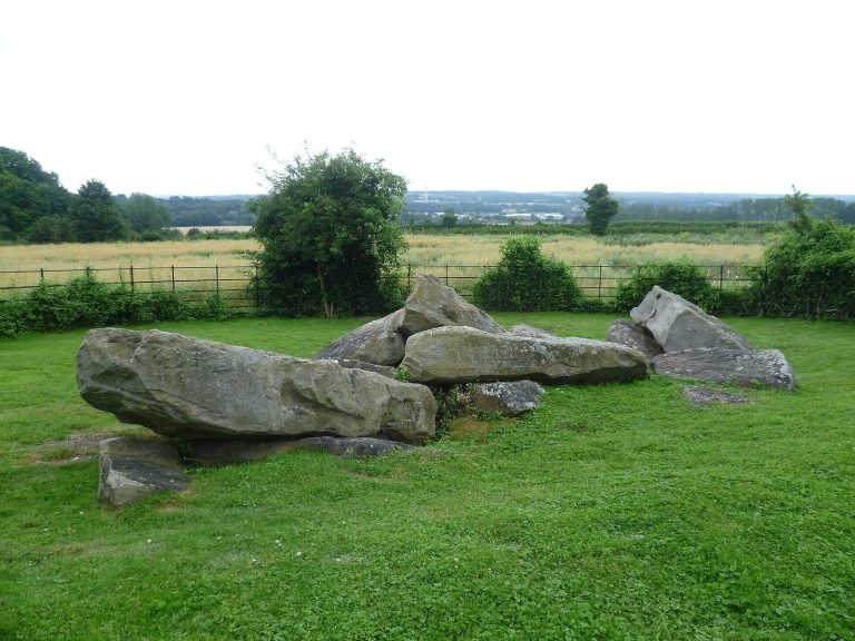
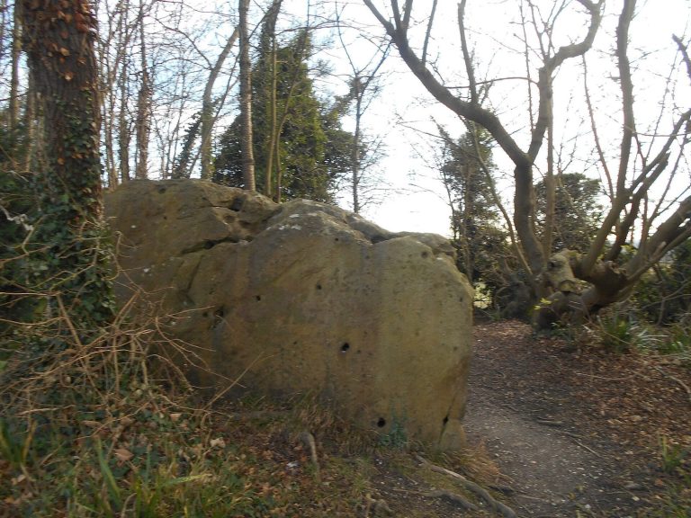
The Coffin Stone is a rectangular slab of sarsen, a hard sandstone that occurs naturally in Kent. It lies horizontally at the foot of Blue Bell Hill, on the eastern side of the River Medway, and may once have stood upright nearby. Two smaller stones lie close by, while a second large slab rests on top of the main stone. A farmer placed this upper slab sometime in the twentieth century. Measurements from the 1870s give the main slab a length of 4.42 metres, a breadth of 2.59 metres and a thickness of about 0.61 metres. In 2006, with the upper slab affecting measurement, its dimensions were estimated at about 4.40 by 2.80 metres and at least 0.50 metres thick.
The stone stands at Great Tottington Farm, now a vineyard, about 400 metres northwest of Little Kit’s Coty House and a short distance north of Tottington springhead. Kit’s Coty House and the now-destroyed Smythe’s Megalith are also on the river’s eastern side. The Coldrum, Addington and Chestnuts long barrows lie west of the river. These monuments belong to the Medway Megaliths, a regional group of prehistoric monuments along the River Medway.
Possible burial structure
If the slab formed part of a burial chamber, the chamber may have reached 3.75 metres in height, which would make it the largest known among the Medway Megaliths. A stone front may have stood before it, and stones at the western springhead at Tottington have been suggested as possible parts of that structure. Nearby stones may have edged a mound, with ditches along its sides. A reduced mound remained visible into the 1950s and was only faintly traceable later, although a trace could still be seen in 2007.
Other archaeological traces
A large hollow in nearby chalk has been interpreted as a quarry hollow, a depression left by removing material, and possibly the place where the slab once stood upright. Two skulls and other bones may have been found near the stone in the 1830s, perhaps with charcoal; Roman pottery fragments may also have come from the vicinity. Finch’s 1927 photograph showed broken sarsen fragments piled at the monument’s eastern end, and he noted damage and breakage caused by ploughing.