City Walls of Valkenburg: Defensive Fortifications in the Netherlands


Site at a Glance
- Rating
- 3.7
- Popularity
- Very Low
- Country
- Netherlands
- Primary era
- Medieval
- Eras represented
- Medieval
- Civilizations
- Duchy of Brabant, Holy Roman Empire
- Site type
- Military
- Remains
- Wall
On this page19 sections
History
The city walls of Valkenburg are defensive works around the historic center of Valkenburg in the Netherlands. Their earliest fortifications and the date when the town received the right to fortify itself remain uncertain, with 1312 and 1452 among the dates proposed for the latter. The defenses developed in connection with Valkenburg Castle, whose oldest traces date to the beginning of the twelfth century.
Early defenses and medieval conflict
A settlement is thought to have grown at the foot of the hill castle soon after the castle’s development. It was enclosed relatively early by an earth rampart and a wooden palisade. Castle, rampart, and palisade were destroyed several times by besiegers, including during attacks in 1122 and 1141.
In 1329, Duke John III of Brabant besieged Valkenburg for eleven weeks. Lord Reinoud of Valkenburg and his sons defended the castle and the surrounding fortifications, but Reinoud’s son Walram II was killed. After Brabantine forces captured Valkenburg, the castle and defenses were partly demolished.
Rebuilding and strengthened defenses
Dirk IV used a large compensation payment to begin extensive repairs and renewal around the castle and fortifications. The rebuilding also altered the town’s layout for defensive purposes. The Geul riverbed was shifted slightly northward, while a stone wall with bulwarks, towers, and gates was constructed around the town center. This system was connected to the rebuilt Valkenburg Castle on the Heunsberg.
In 1465, bailiff Dirk van Palland prepared the fortifications for an attack by forces from Liege. A bailiff was a regional judicial and administrative official who could also have military responsibilities. Town accounts describe extensive work, particularly along the northern wall beside the Geul.
War, demolition, and later use
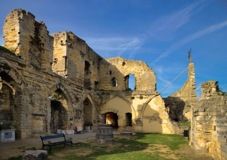
During the Eighty Years’ War, the long conflict between the Dutch provinces and Habsburg Spain, Spanish forces captured and devastated Valkenburg in 1578. Dutch State troops, meaning forces of the governing bodies of the Dutch Republic, partly dismantled the castle and walls in 1644.
At the beginning of the Franco-Dutch War, a conflict that began in 1672 between the Dutch Republic and France and their opposing allies, Stadtholder William III ordered the castle to be blown up. A stadtholder was a high-ranking provincial governor and military-political officeholder in the Dutch Republic; William III later also became king of England. Parts of the fortifications were destroyed at the same time. The Grendelpoort and Berkelpoort were largely spared, as were sections of the Den Halder bulwark and a small stretch of city wall.
The Berkelpoort was closed every day until 1830, and the Grendelpoort was probably treated in the same way. At the Geulpoort, the Geul itself formed a natural barrier along the northern side of the defenses.
Archaeology and reconstruction
Visible remains and underground foundations continue to shape the townscape. Work along the Geul embankments exposed sections of the northern city wall, including relieving arches and several semicircular towers, in 1989-90, 2004-05, and again in 2008. Relieving arches are built into walls to distribute masonry weight above openings or weaker points.
The Berkelpoort was restored in 2007. Its gate building was raised with marl blocks, a soft, lime-rich stone, and given a roof. Plans presented by the municipality in 2010 proposed rebuilding part of the wall beside the Berkelpoort and another section along the Geul at Walramplein.
In 2013, the municipal council decided to rebuild the demolished Geulpoort and restore the Grendelpoort, including the replacement of its tower spires. The works were completed in 2015, while the Geulpoort itself was rebuilt in 2014. Except for the modern reconstruction of the Geulpoort, the visible remains of the Valkenburg fortifications are designated as national heritage monuments.
Remains
Layout and defensive corners
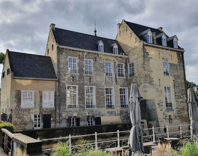
The fortification occupied a defensive position around the historic town center in a triangular or shield-shaped plan. Each corner was strengthened. Valkenburg Castle formed the southern corner, the Den Halder bulwark occupied the northwestern corner, and another bulwark stood at the eastern corner. A bulwark is a projecting defensive work used to reinforce a corner or wall.
The city wall linked the castle with the two bulwarks. A moat surrounded the fortification except at the southern castle corner, while the Geul served as a natural moat on the northern side. The eastern bulwark stood at present-day Walramplein. The house Palanka occupied the location in the eighteenth century, and Hotel Walram now stands there. A small gate has been reconstructed at the site of the former bulwark.
Fortified corners
Den Halder
Den Halder developed into an urban castle during the seventeenth century. It formed the northwestern corner of the defensive plan and was connected to the city wall and the other fortified parts of Valkenburg.
Valkenburg Castle
The southern corner consisted of Valkenburg’s powerful hill castle, a castle built on elevated ground for defense and control of the surrounding area. The castle was connected directly to the city fortification system and formed its elevated southern strongpoint.
Gateways
Geulpoort
The Geulpoort, also called the Molenpoort, was the northern entrance. It led toward Heerlen, Sittard, and Julich. The rebuilt gate is flanked by reconstructed sections of the adjoining city wall, and parts of the western moat were re-excavated in 2014.
Grendelpoort
The western entrance was the Grendelpoort, also known as the Maastrichterpoort or Bergerpoort. Its routes led toward Maastricht, Liege, and Dalhem. The restored structure includes reinstalled tower spires.
Berkelpoort
The Berkelpoort formed the eastern entrance and led toward Aachen and Cologne. Its restored gate building was raised with marl blocks and provided with a roof.
Smaller passages
Several smaller openings supplemented the main gates. The Nieuwpoort probably stood near Sint Pieterstraat. The Drenckpoort was either a side gate of the Geulpoort or a passage at the surviving western wall, while the Oliepoort and Meipoort provided additional access through the city wall.
Walls, towers, and earlier defenses
Wall sections and towers
Defensive towers interrupted the wall at regular intervals. Repairs to the Geul embankments revealed the foundations of five semicircular towers, or rondels, which are rounded towers projecting from a fortification wall. Their locations are marked by semicircular wooden viewing platforms. Reconstructed wall sections stand between the Geulpoort and Den Halder, and further rebuilt sections adjoin the Geulpoort.
Northern wall
The northern city wall included relieving arches. Its exposed remains and the foundations of the semicircular towers are associated with the Geul embankments, where several phases of investigation revealed the surviving defensive fabric.
Oak palisade
Near the Geulpoort, dozens of oak-post fragments measuring approximately three meters in height belonged to a double palisade. The palisade ran along the Geul and formed part of the earlier defenses before the stone wall system was built.