Château Saint-Louis: A French Colonial Fort and Government Residence in Quebec City
Site at a Glance
- Popularity
- High
- Country
- Canada
- Primary era
- Early Modern
- Eras represented
- Early Modern, Modern
- Civilizations
- British, French
- Site type
- Civic
- Remains
- Palace
On this page20 sections
History
French fort and colonial residence
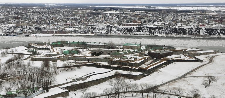
Château Saint-Louis was a French colonial fort and later government residence on Cape Diamond in Quebec City, Canada, with its first wooden fort built in 1620. Samuel de Champlain ordered the fort to defend the settlement below. It was named for Louis XIII, king of France from 1610 to 1643, and a larger replacement was built in 1626.
The forts formed part of Quebec’s defenses. In 1636, Governor Charles Jacques Huault de Montmagny replaced the palisades with a stone fortification wall, followed by construction of another fort. Governor Louis d’Ailleboust de Coulonge added four defensive projections called bastions in 1643 and replaced a wooden palisade with a thick stone wall.
The fort became the official residence of the government of New France, France’s colonial territory in North America, in 1646. The first Château Saint-Louis was built under Montmagny in 1647–48, with construction attributed to Zacharie Cloutier and other settlers. It was enlarged in the early 1680s. From the establishment of the Sovereign Council, New France’s governing body with judicial authority, until the British conquest in 1760, successive forts and châteaux also served as the council’s meeting place. Colonial administration passed from the Company of Rouen (1614–1620) to the Company of Montmorency (1621–1627), then to the Company of the Hundred Associates (1627–1663). These French chartered companies helped administer the colony, while expansions at the site also required support from the French court. In the seventeenth century, Quebec City’s Rue du Fort took its name in honour of the fort and château.
Frontenac’s expansion and rebuilding
After the Battle of Quebec in 1690, Governor-General Louis de Buade de Frontenac ordered a major expansion of the fort. Its area grew to four times its former size, and its defenses followed a plan associated with Vauban, the French military engineer. This bastioned design used projecting defenses to give guns overlapping fields of fire. Seventeen cannons were positioned south of the site. The fort’s configuration remained unchanged after this work.
Frontenac also ordered the fort and château rebuilt during the 1690s. A replacement château was begun in 1694, and Frontenac died there in 1698. Financial problems delayed completion until 1723, under the Marquis de Vaudreuil. From 1719 to 1723, a new pavilion and two wings were added by Gaspard-Joseph Chaussegros de Léry.
British rule, alteration, and fire
Artillery severely damaged the château during the 1759 Siege of Quebec and the Battle of the Plains of Abraham; its northern pavilion had to be demolished. After the British conquest of New France in 1760, the remaining buildings were repaired by British military forces, with work finished by 1768. They became a meeting place for British authorities in the Province of Quebec as Quebec City became the capital of the British Empire in North America. The château later housed British governors of Quebec, the Governor-General of British North America, and the Lieutenant-Governor of Lower Canada.
In the 1780s, Château Haldimand, built nearby during that decade, took over the château’s administrative and defensive functions. Saint-Louis was considered too cramped, although both residences were used at the same time for a period. Governor James Henry Craig returned to Château Saint-Louis as a resident in the early nineteenth century. Between 1808 and 1811, he had it renovated, raised by one storey, and remodelled in the Palladian style, based on the principles of the Italian architect Andrea Palladio.
Fire destroyed the château in 1834. A wooden platform called Durham Terrace was built over the remains in 1838. The terrace was extended in 1854 and renamed Dufferin Terrace in 1878.
Archaeology and interpretation
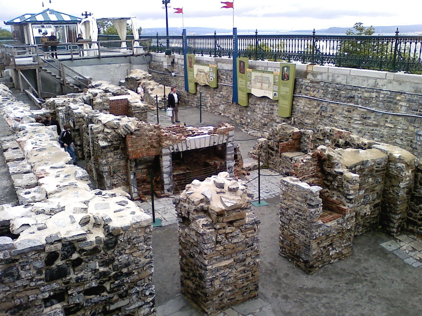
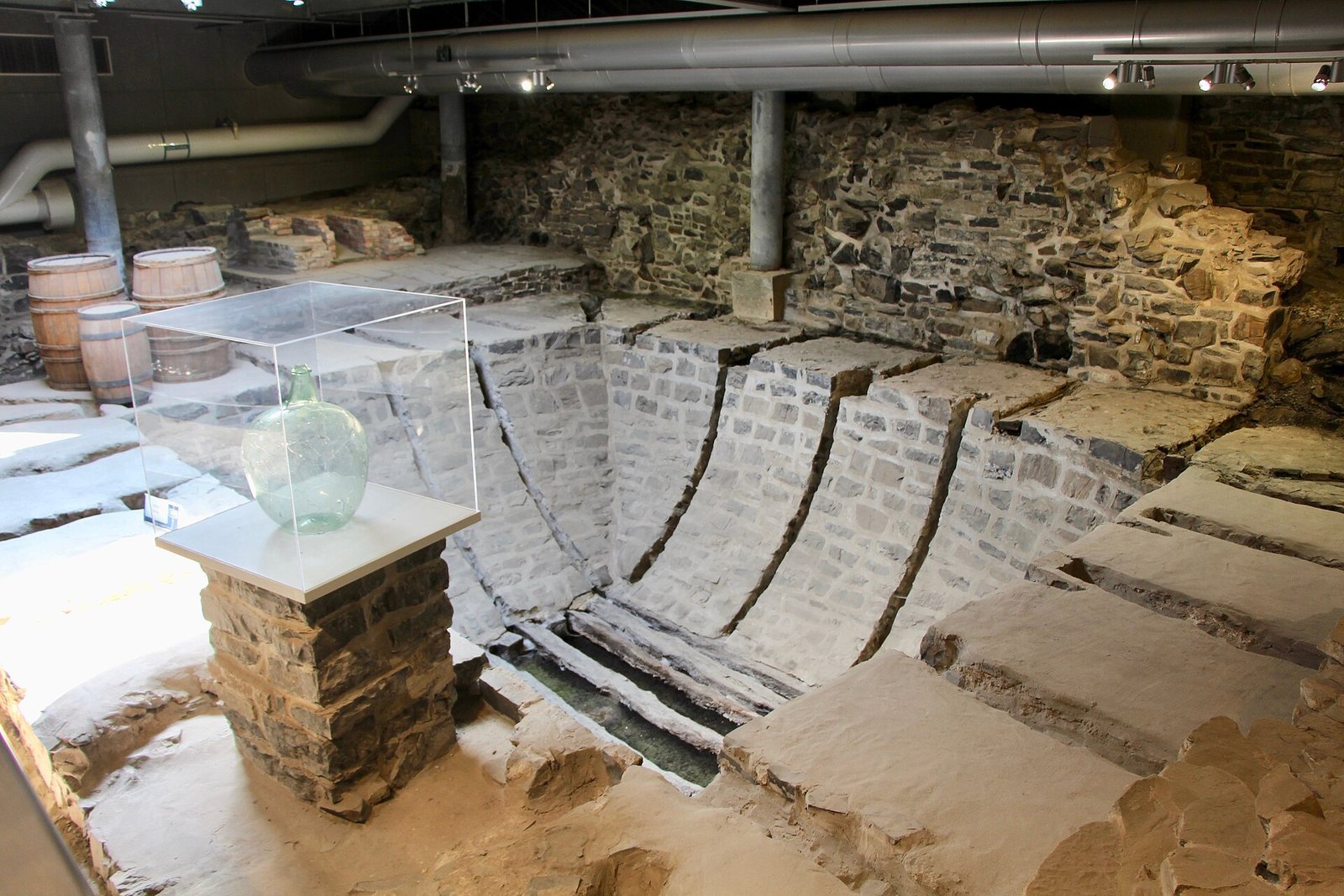
The archaeological site became a National Historic Site of Canada in the early 2000s and is also part of the Quebec Fortifications National Historic Site. Parks Canada undertook excavations during structural work on the north part of Dufferin Terrace from 2005 to 2007. The remains opened as a historic site in 2008. In the winter of 2010–11, an archaeological crypt was built beneath the terrace to shelter the remains from weather while allowing them to be viewed.
In 2021, Parks Canada and the Huron-Wendat Nation, an Indigenous people and nation, expanded the site’s exhibition to present Huron-Wendat perspectives on diplomacy and relations with First Nations. The additions included Wendat-language material and six stations exploring values such as pride, honour, and respect.
Remains
The archaeological area lies beneath and around Dufferin Terrace on the upper town’s cliff edge at Cape Diamond, overlooking Quebec City’s lower town. It extends within an area bounded by the present Governor’s Garden, Wolfe’s Battery, the Château Frontenac, and the terrace. The surviving remains include successive defensive works, residences, service areas, courtyards, drainage systems, and military features. The excavations yielded more than 500 architectural remains and over 500,000 artefacts.
Fortifications and military works
The first and second forts
The 1620 fort was built of wood, with stone facing added to its earthen embankments. Its surviving remains include a masonry projection. The replacement fort, built between 1626 and 1635, had a stone main building. Its remains include a stone stairway and a wooden platform for a cannon.
The later forts and batteries
The third fort, dating from 1636 to 1690, and the fourth, built between 1691 and 1834, are represented by a redoubt, an enclosed defensive work, and sections of stone perimeter wall. Eight platforms for cannon survive from the château’s 1691 gun battery. Some defensive works bear traces of the 1759 bombardment, and artillery projectiles were recovered from the site. Repairs made by British military forces after 1760 can be seen in the perimeter walls.
Château buildings and interiors
The first château
The first château was a stone building measuring 26 by 7 metres, with a shingled roof. Parts of it were incorporated into the later château.
The later château
Begun in 1694, the replacement château had two storeys and measured 36 metres in length. Its excavated foundations and other remains form part of the archaeological area beneath the terrace.
Basement rooms and the culinary complex
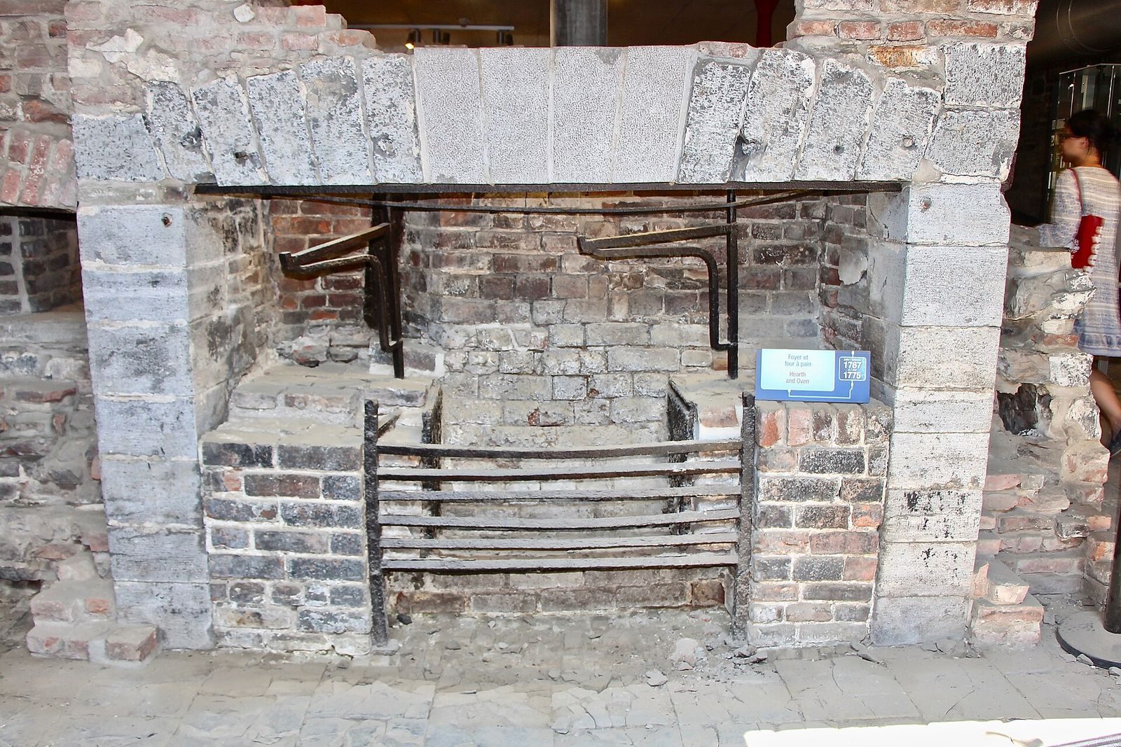
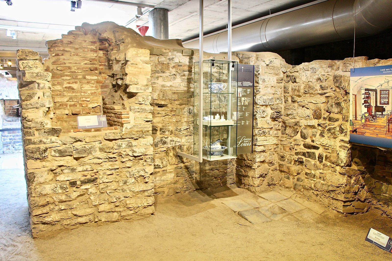
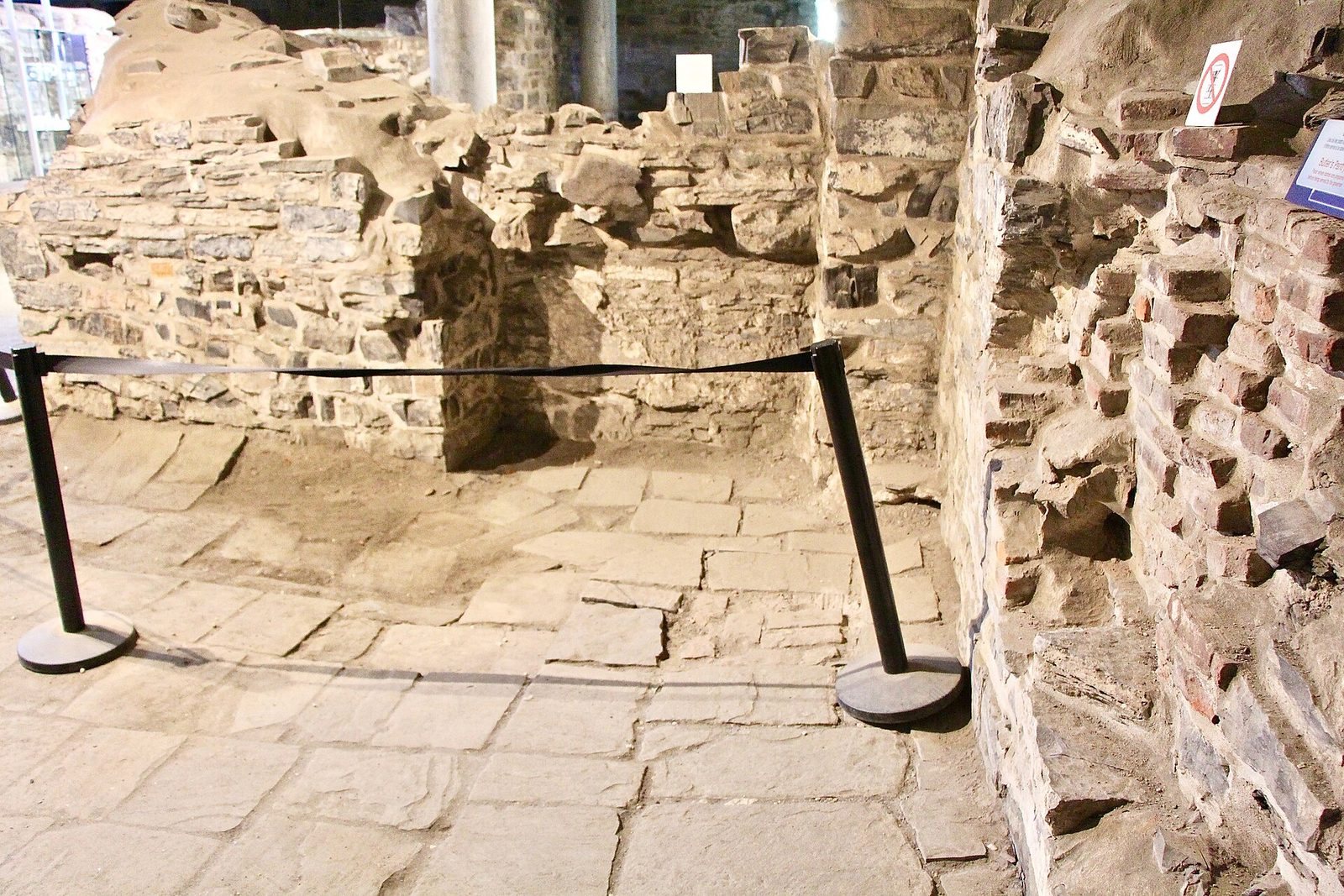
Excavated basement rooms associated with the château’s culinary complex include a kitchen, serving room, and pantry. Their remains include a bread oven, a hearth, and a fireplace. The rooms also preserve flooring from both periods of colonial rule: limestone paving and wooden floors associated with the French regime, and sandstone paving from the British regime.
Latrine wings
Two latrine wings stood at the north and southwest ends of the château. Three pits associated with them contained artefacts connected with the daily lives of French and British governors.
The 1808–1811 enlargement
Remains of Craig’s enlargement include foundations for a staircase shaft, a grand entrance hall, two passages used by servants, and walls from the expanded southwest wing.
Service buildings
French-period service area
Service buildings surrounded the governor’s residence. In the front courtyard, remains from the French regime include a bakery.
British-period service area
The south courtyard contains remains from the British regime of a woodshed, carriage shed, stable, icehouse, greenhouses, covered passage, and kitchen. The English icehouse dates to 1771.
Drainage systems
The château’s position beside a cliff and the natural convergence of runoff made water management a continuing concern. Remains include successive systems for carrying wastewater away from the Saint-Louis and Haldimand châteaux and channeling rainwater.
Terrace remains and preservation
A small section of the retaining wall of the first Durham Terrace survives south of the château. Two masonry walls in the former south courtyard mark the terrace’s 1854 extension. The archaeological crypt beneath Dufferin Terrace protects the excavated remains from the weather while keeping them viewable.