Château de Bonrepos: Pierre-Paul Riquet’s Canal-Engineering Estate


Site at a Glance
- Rating
- 4.5
- Popularity
- Low
- Country
- France
- Primary era
- Early Modern
- External website
- Open
- Eras represented
- Early Modern
- Civilizations
- French
- Site type
- Domestic
- Remains
- Castle
On this page9 sections
History
Château de Bonrepos is a seventeenth-century château in France, built under Pierre-Paul Riquet from 1651 and reconstructed between 1654 and 1666 as a country residence and hydraulic research site. Riquet acquired the Bonrepos seigneury, a territorial lordship, together with a château and a park of about 150 hectares. He selected the estate to investigate how water could be supplied to his proposed Canal Royal de Languedoc, now generally known as the Canal du Midi.
From fortified site to country residence
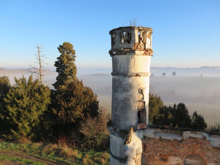
Before Riquet’s arrival, Bonrepos was a fortified site. Its donjon, the principal tower of a stronghold, had lost its military purpose after a royal order of 31 July 1626 called for the dismantling of fortresses. Riquet built his new residence on the former bastion, a projecting defensive fortification, while retaining elements of the earlier stronghold.
The locality had previously shared the name of its parish, Saint-Jean-de-Montagne, which belonged to the barony of Verfeil until the end of the sixteenth century. After Huguenots, French Protestants associated with the Reformation and the Wars of Religion, burned the parish church between 1570 and 1593, the name of the Bonrepos seigneury became established. Riquet transformed the deteriorated fortified residence into an austere seventeenth-century country house, while later generations added an orangery, an icehouse, and a tree labyrinth.
Riquet’s hydraulic experiments
Riquet developed the estate as a practical laboratory for the canal project. He established a brickyard and a forge nearby, and between 1655 and 1662 he used the Garène valley as an experimental worksite for a navigable canal. The experiments addressed the problem of supplying water to a waterway intended to link the Garonne basin near Toulouse with the Mediterranean.
In 1662, Riquet demonstrated his hydraulic work to distinguished visitors, including Charles-François d’Anglure de Bourlemont, archbishop of Toulouse. The demonstration helped convince the archbishop that the canal project was feasible. On 15 December 1662, Riquet presented the project to Jean-Baptiste Colbert, finance minister under Louis XIV. The Crown later authorized construction through a royal edict issued in October 1666.
Riquet regained his noble status in 1666 and became lord of Bonrepos. He died in October 1680 before the canal works were finished. His sons, Jean-Mathias, Baron of Bonrepos, and Pierre-Paul, Count of Caraman, completed the project, which was officially inaugurated on 19 May 1681. Jean-Mathias also completed construction work at the château. He had served as a councillor of the Parliament of Toulouse, the French monarchy’s high court for the region, from 1664, became president of one of its chambers in 1683, and died on 30 April 1714.
The Riquet and Cambon succession
After Jean-Mathias’s death, the estate passed to his son Jean Gabriel Amable de Riquet, born from his second marriage to Madeleine de Broglie. Jean Gabriel Amable became a councillor of the Parliament of Toulouse and prosecutor-general in 1752. His daughter Dorothée married Jean Louis de Cambon, first president of the Parliament of Toulouse and a maintainer of the Floral Games Academy, a literary society devoted to poetry.
Their son Jean François, Marquis of Cambon, became a deputy and mayor of Bonrepos in 1824. Following a complicated succession, his granddaughter Charlotte Adélaïde de Tauriac inherited the estate in 1836. Because she was a minor, Bonrepos was sold at auction that same year. Count Joseph Falentin de Saintenac bought the château and sold it in 1853 to Henri and Paul Courtois, Toulouse bankers who founded the Courtois Bank. The brothers sold it again in 1867 to Count de Bertier and his wife, née Tauriac, returning the estate to a descendant of Pierre-Paul Riquet.
Twentieth-century preservation
The Bertiers lived at the château. The countess died in 1888, and her husband died shortly after 1900. Their son François, Count de Bertier, received the estate in a division with his sister and died at Bonrepos in 1916, leaving her as sole heir.
In 1931, François de Bertier’s sister, then widowed, sold the château and about 100 hectares of land to a woman from Béziers. She soon married Dr Henri Marceillac of Verfeil. During the Second World War, Waffen-SS forces, the armed branch of Nazi Germany’s SS, and members of the French Resistance successively occupied or used the château and estate. The circumstances of these wartime events remain partly unclear.
After Dr Marceillac’s death in 1953, his family sold the estate to Colonel Fournier. Serious roof damage later led regional cultural authorities to secure the registration of the château and the 30 hectares around it in the supplementary heritage inventory by prefectural order dated 3 February 1999. A local heritage-preservation association worked for more than three years toward the estate’s protection. The château and its surrounding historical perimeter received classification as historic monuments through a decision of April 2007, confirmed by prefectural order on 31 July 2008.
On 27 December 2007, Colonel Fournier’s descendants sold the château, gardens, park, and about 50 hectares of agricultural land to SAFER Gascogne-Haut-Languedoc, a French public-interest agency involved in rural land transfers. The agency sold the roughly 30-hectare historical part to the municipality of Bonrepos-Riquet on 28 December 2007. The municipality has officially used the name Bonrepos-Riquet since 1921, commemorating the connection with Pierre-Paul Riquet. The château also serves as the town hall. A request was submitted in December 2006 to associate the estate with the Canal du Midi, a UNESCO World Heritage monument.
Remains
The château stands on a former fortified platform surrounded by ditches crossed by two bridges. It occupies a hill overlooking the valleys of the Conné and Girou, with distant views of the Pyrenees in clear weather. The surviving historic fabric includes the residence, service buildings, gardens, park, orangery, and hydraulic installations connected with Riquet’s experiments.
Château and fortified platform
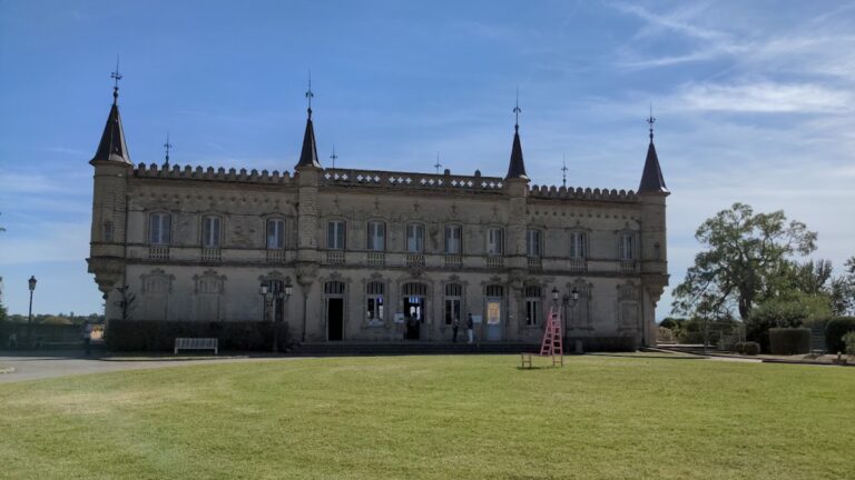
The main residence is a rectangular corps de logis, the principal residential block, with two large square towers on its western side and two round pepper-pot turrets on the rear façade. A pepper-pot turret is a small round tower capped by a conical roof. The residential and service buildings enclose two courtyards and open southward onto a terrace. The former dry ditches were reshaped as formal garden beds, while the area within them became the cour d’honneur, the principal entrance court. The western area was cleared of its earlier walls to create an open view of the residence.
Several military features survive from the earlier fortified house, including the dry ditches, the enclosed inner court, and the fortified western part of the residence. The buildings that once enclosed the inner space were later demolished. The façades originally used bands of brick for articulation, but these were altered in the eighteenth century, when the doors and windows were also modernized in contemporary styles.
Gardens and estate features
The estate retains the arrangement of a park with formal French gardens. Its associated features include a central avenue, the west and east façades, the south terrace, the former ornamental garden, a cooling grotto, the former orangery, and an icehouse. An icehouse, also called a glacière, stored ice for later use. The former orangery was described as one of the largest in southern France. A tree labyrinth formed another later addition to the grounds.
Hydraulic works in the Garène valley
Riquet’s experimental hydraulic works survive in the park’s Garène valley. Beginning with an earlier fishpond, he had three stepped basins excavated: a discharge basin, a reservoir basin, and a canal basin. Two channels and seasonal water supplied the basins, creating a hydraulic machine that anticipated equipment later used for the Canal du Midi. These preserved installations provide the physical remains of the experiments that shaped the canal project.
The château, service buildings, orangery, gardens, park, and hydraulic installations together form the protected historic estate. The ornamental garden is also included in the preliminary inventory of remarkable gardens.
Nearby sites