Castro de Romariz: An Iron Age and Roman Hill Settlement in Portugal
Site at a Glance
- Rating
- 4.7
- Popularity
- Very Low
- Country
- Portugal
- Primary era
- Iron Age
- External website
- Open
- Eras represented
- Iron Age, Classical
- Civilizations
- Roman
- Site type
- Military
- Remains
- Fortified Town
On this page14 sections
History
Castro de Romariz is an Iron Age and Roman-period hill settlement in Portugal, at Romariz, associated with the Castro culture of northwestern Iberia. Activity on the plateau began by the Late Bronze Age, around 900–700 BC, and the settlement developed through prehistoric and Roman phases before its abandonment around the end of the first century AD or the beginning of the second.
Early occupation and the Castro settlement
Granite cup-marks, engraved lines, and a small group of finds point to activity on the plateau during the Late Bronze Age. More substantial occupation began by the fifth century BC, during the Early Iron Age, when the community participated in the wider Castro culture, a tradition of fortified hilltop settlements with stone defenses and circular or rectangular buildings.
Castro de Romariz lay in the southern part of the territory associated with the Callaici, an ancient population whose lands extended across northern Portugal, Galicia, western Asturias, and western León. Imported pottery shows that the settlement was connected to wider Mediterranean exchange networks during the pre-Roman Iron Age.
A fortification wall was built between the third and second centuries BC. During the second century BC, buildings changed from timber construction to stone construction, reflecting a major transformation in the settlement’s physical form. These developments took place as communities in northwestern Iberia maintained local traditions while engaging increasingly with Mediterranean contacts.
Roman incorporation and abandonment
Northwestern Iberia nominally formed part of the Roman province of Hispania Citerior from 197 BC, and Rome had severely defeated the Callaici in 136 BC. Roman authority became firmly established only after the Cantabrian War of 29–19 BC, fought under Augustus, the first Roman emperor. The foundation of Bracara Augusta and Lucus Augusti then supported the Roman consolidation and Romanization of the region.
During the Roman imperial period, Castro de Romariz underwent qualitative changes. Buildings received tiled roofs, walls and floors were plastered, and the roads were built more firmly. These alterations formed part of the settlement’s Roman phase, although its occupation ended for reasons that remain unknown toward the end of the first century AD or at the beginning of the second century AD.
Excavation and protection
The first excavations were carried out by the municipality of Santa Maria da Feira under Mayor José Correia between 1843 and 1846. Sixteen building plans were identified during this campaign. Investigation resumed between 1940 and 1946 under Manuel Fernandes dos Santos, the parish priest of Romariz, who published the results in a monograph.
Following the excavations, the site received legal protection in 1945 as an Imóvel de Interesse Público, a Portuguese designation for a property of public cultural interest. Since 1980, Armando Coelho and Rui Centeno of the University of Porto have led further campaigns, examining the relationships between layers, finds, and structures and clarifying the settlement’s origins and prehistoric and Roman phases.
Castro de Romariz is also known as Castro do Monte do Castro, Castro do Monte do Crasto, Povoado Fortificado de Romariz, and Povoado Fortificado no Monte do Crasto.
Remains
Plateau and defenses
Castro de Romariz occupies an oval plateau on Monte de Castro, also called Monte de Crasto, at approximately 370 metres above sea level. The plateau measures about 160 by 80 metres. The investigated northern area covers approximately 5,000 square metres, while the southern part forms part of the wider plateau associated with the settlement.
The ground falls steeply to the north, east, and south. On the more gently sloping western side, an artificial ditch deepened the natural slope, and a granite wall formed the principal fortification. The settlement’s position is also linked to the regional transport landscape, since it lies within sight of the Roman roads connecting Bracara Augusta with Asturica Augusta and Porto with Viseu. It stands approximately 7.5 kilometres northeast of Santa Maria da Feira and about 10 kilometres south of the Douro.
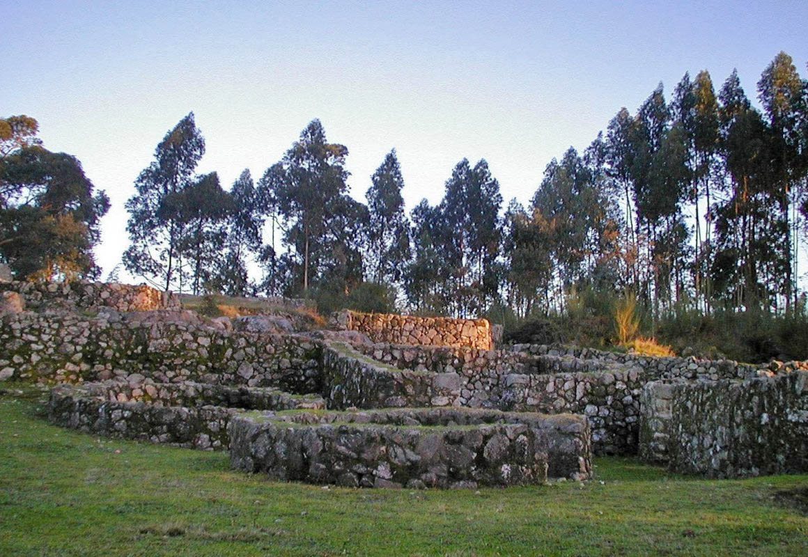
The settlement was relatively small within the Castro tradition. Its occupied area is estimated at approximately 5 ares, or about 10 ares if the entire plateau was used. Granite-paved streets and paths followed the positions of existing buildings and the boundary walls of building groups, creating partly angular routes across the settlement.
Buildings and residential areas
Circular buildings
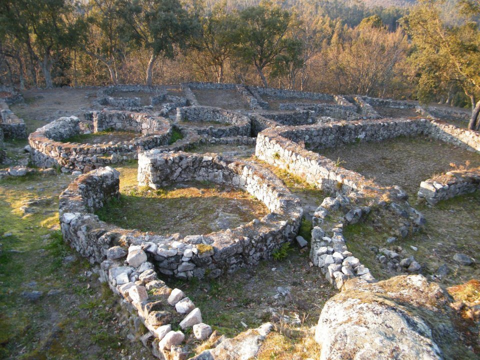
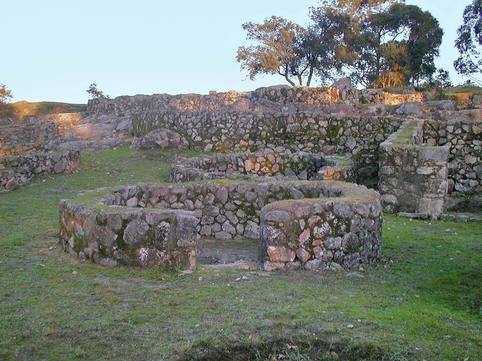
Excavations uncovered more than 50 prehistoric and Roman building plans, including circular structures characteristic of the Castro culture. Circular buildings reached diameters of up to approximately 5 metres, and some had semicircular or pincer-shaped vestibules. Their continued use into the Roman period shows that local building traditions persisted alongside Roman changes to roofs, surfaces, and roads.
Rectangular buildings
Elongated rectangular buildings formed another important part of the settlement. Some measured about 13.5 by 5 metres, and neighboring structures sometimes shared a partition wall. Walls enclosing residential areas were frequently incorporated into the rear and side walls of buildings, linking individual structures to larger built groups.
Quarters and paved courtyards
Several buildings and streets were arranged into defined quarters or neighborhoods measuring up to approximately 385 square metres. Courtyard areas outside the buildings also had paved surfaces. The dense occupation developed through several phases, although the limited overlap between building plans prevents a secure reconstruction of the sequence in which individual structures were built. A general movement from circular to rectangular plans may have occurred, but both forms remained in use during the Roman period.
Objects and material remains
The Romariz Treasure
The Romariz Treasure was recovered in 1843. It consists of a silver vessel containing 103 Roman Republican denarii, silver coins dated to 157–156 BC, together with a gold ring and another unidentified silver object. Two pieces of a gold necklace were also found during the first excavation campaign.
Imported goods
Objects from the pre-Roman phases show connections beyond the immediate settlement. Punic amphorae from the fifth century BC, Greek and Campanian pottery from the fourth century BC, and blue glass beads indicate contact with Mediterranean production and exchange networks. Punic goods were associated with Carthage and its western Mediterranean sphere.
Roman construction materials and pottery
Roman roof tiles form a large part of the later material assemblage. The tiles include tegulae, flat tiles, and imbrices, curved tiles laid over their joints. Locally produced utilitarian pottery also makes up much of the Roman-period material. Finds from Castro de Romariz are distributed among the museums of the Institute of Archaeology of the Faculty of Letters of the University of Porto, the Museum of Sacred Art of Porto, and the Lóios Convent Museum in Santa Maria da Feira.