Castle of Vilella: An Almohad Fortress in Valencia


Site at a Glance
- Rating
- 4.8
- Popularity
- Very Low
- Country
- Spain
- Primary era
- Medieval
- Eras represented
- Medieval
- Civilizations
- Almohad
- Site type
- Military
- Remains
- Castle
On this page10 sections
History
Castle of Vilella is an Almohad fortress in Spain, near Almiserà in Valencia, probably built in the late twelfth or early thirteenth century. The Almohad period was the era of Almohad rule in the western Islamic world, including al-Andalus, the Muslim-ruled territory of the Iberian Peninsula. The castle was a late construction contemporary with the neighboring Castle of Xiu and served as a refuge stronghold in the late Andalusi period.
Almohad origins and the Aragonese conquest
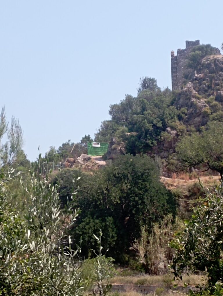
The fortress is also known locally as the Castle of the Sierra and, alternatively, as the Castle of Almiserà. Its position on a rounded rocky outcrop above the Llautó pass gave it control of a route between the Vall d’Albaida and the Safor. Although the castle is now in the Safor comarca, its historical and geographical setting belonged to the Vall d’Albaida, and it stands close to the boundary of Llutxent.
When James I of Aragon entered the Bairén valley during the Aragonese conquest, Vilella had a garrison dependent on Castle of Bairén. James I, the thirteenth-century king whose conquests brought Valencia and surrounding territories under the Crown of Aragon, mentioned Vilella in the Book of Deeds in spring 1243. He listed it among the large, strongly positioned rock castles whose commanders or inhabitants negotiated with him after the fall of Valencia the previous year. The same account connects the castle with Bairén.
Vilella continued to function during the Mudéjar revolt led by Al-Azraq. Mudéjars were Muslims who remained under Christian rule after the conquest, and this revolt was a resistance movement in the newly conquered Valencian territories. The castle’s role as a refuge remained relevant during this period, when Al-Azraq was a prominent Muslim leader opposing Aragonese rule in the region.
Feudal reorganization and abandonment
After the territory was pacified, Vilella lay between the seigneurial domains of Llutxent and Palma. It was incorporated into the defensive network of Benicadell, also called Penacadell, a mountain region whose fortifications protected this area. Its strategic importance gradually declined after the first phase of the feudal conquest.
The fortress was still used during the Wars of the Union with Castile in the mid-fourteenth century. It was definitively abandoned after that period. The nearby depopulated settlement of Vilella, in the municipality of Llutxent, preserves remains of earlier buildings and is thought to have been an alqueria, a rural settlement or farmstead in the Islamic Iberian world, dependent on the castle. The settlement may also have preserved the name from which the fortress took its name.
Castle of Vilella was declared an Asset of Cultural Interest in Spain on 17 December 2002, under reference RI-51-0010948. This designation recognizes the surviving fortress as part of the historical heritage of the area.
Remains
The castle occupies a rocky outcrop about 142 metres above sea level, approximately two kilometres northwest of Almiserà, between the Benicadell and Cufa mountain ranges. Steep sides surround the rock, which overlooks the Llautó pass. The enclosure covers 2,038 square metres and follows an elongated plan on a mainly east-west axis. Rectilinear wall sections enclose the interior, while a substantial wall reaches about seven metres in height at some points.
Entrance and defensive works
Northern entrance tower
The northern entrance stands on the slope and is formed by a rectangular tower about four metres high. Two doorways face in opposite directions within the tower, an arrangement intended to make access more difficult. The structure was built mainly from rammed earth, a technique in which earth or other aggregate is compacted inside forms. Lime mortar was used in these walls.
The outside wall of the entrance tower has a thick lower section that probably supported a wooden platform. Above it, a thinner wall formed a defensive walkway around the entrance. The arrangement combined controlled access with a position from which the approach could be defended.
Perimeter walls
Large rammed-earth walls, approximately 1.20 metres thick, define the northwestern side of the fortification and continue toward the entrance tower. Toward the east, the wall runs for only a few metres. Much of its course has disappeared in the eastern and southeastern sectors, where the rocky outcrop becomes higher and more precipitous.
Western access structure
A rectangular structure is attached to the perimeter wall at the western end of the enclosure. It has one doorway facing south, another facing east, and two loopholes opening westward. Because anyone entering the castle had to pass through it, the structure may have served as a defensive tower controlling access.
Interior remains
Habitation spaces
The interior contains masonry wall bases and fragments of brick. These remains indicate that habitation spaces existed within the enclosure, although they were probably few and modest in scale. Together with the perimeter walls and entrance works, they preserve the basic arrangement of a small refuge fortress organized around a defended enclosure.