Castle of Penamacor: A Medieval Fortress and Frontier Stronghold in Portugal


Site at a Glance
- Rating
- 4.3
- Popularity
- Low
- Country
- Portugal
- Primary era
- Medieval
- External website
- Open
- Eras represented
- Medieval, Early Modern
- Civilizations
- Portuguese
- Site type
- Military
- Remains
- Castle
On this page12 sections
History
The Castle of Penamacor is a medieval fortress in Penamacor, Portugal, whose origins are associated with the reign of King Sancho I around 1189. The surrounding territory had been conquered and donated to the Knights Templar, a medieval military-religious order that operated fortifications and supported Christian territorial expansion in the Iberian Peninsula, through its Portuguese master, Gualdim Pais. A fortification was established on a rocky hill that already contained a settlement or castro, although archaeological work has not confirmed an earlier occupation.
Foundation and medieval expansion
Sancho I granted Penamacor a municipal charter in 1199, and the charter was ratified in 1209. The privileges probably encouraged the repopulation of the settlement and may have helped initiate the castle’s construction. Its exact starting date remains uncertain, since construction may belong either to the period around 1189 or to the phase following the charter of 1199.
In 1262, King Afonso III established an annual fair at Penamacor. Around 1300, during the reign of his son, King Denis, the castle was enlarged with a second line of walls and the enclosure of the town. Work on the principal fortified tower, or keep, also began during this period. A territorial jurisdiction known as a couto, a medieval area with defined legal or fiscal privileges, was instituted at Penamacor in 1379.
Late medieval defenses and government
A barbican, an advanced defensive enclosure protecting an entrance or wall, was begun during the reign of King Ferdinand I and completed under King John I. During the political crisis of 1383 to 1385, which followed the disputed succession to the Portuguese throne, Penamacor and its castle supported the Master of Avis, the future King John I.
In the fifteenth century, Afonso V created the County of Penamacor and granted it to Lopo de Albuquerque. Population records show the continuing importance of the fortified settlement. An inquiry of 1496 counted 389 inhabitants, while an ecclesiastical survey in 1527 recorded 864 inhabitants in the castle. In 1500, a civil registry office was destroyed by fire.
Manueline rebuilding and civic administration
During the early sixteenth century, Penamacor and its defenses were remodeled. Drawings made by Duarte de Armas in 1509 and 1510 show the state of the fortifications during this phase and indicate that the principal keep was not yet complete. The tower was eventually constructed during the reign of King Manuel I. It was later misidentified as a lookout tower, an interpretation repeated by subsequent writers.
The castle also accommodated municipal government. In 1568, the municipal chamber could be reached from the gate facing the town and contained two halls, one for municipal sessions and another for scribes. The municipal house was built over the Gate of the Vila near the town pillory, a civic monument representing local judicial and administrative authority. The complex also included a clock tower and other civic buildings.
Frontier artillery defenses
Penamacor regained strategic importance during the Portuguese Restoration Wars, the mid-seventeenth-century conflict in which Portugal fought to restore its independence from the Spanish monarchy. King John IV’s War Council ordered the modernization of the defenses so that they could accommodate advances in artillery. Under the direction of the Marquis of Castelo Melhor, Governor of the Beiras, the town walls were strengthened with six bastions and three half-bastions. A bastion was a projecting artillery platform designed to reinforce a defensive wall against cannon fire.
Manuel Pinto Vilalobos undertook repairs to the castle in 1719. In 1739, the keep, then being used as a gunpowder magazine, was destroyed by an explosion. Several buildings in the courtyard were also damaged, and an infantry regiment was stationed at the castle at the time. A parish memorandum from 1758 described the complex as royal property and listed a southern tower, a royal palace on the eastern side, a municipal hall, a jail, a clock tower, six bastions, and two gates, the Gate of Carros to the east and the Gate of Santo António to the west. A later description mentioned walls damaged by a storm and by the fire connected with the explosion, along with a triangular square and a gate niche containing an image of Senhora do Pé da Cruz. Further damage occurred in 1762.
Decline, reuse, and preservation
Five bastions were still operational in the nineteenth century. The principal entrance was then the Gate of Santo António, while the defensive circuit extended past the clock tower, the former municipal hall, the Poço de El-Rei, the Gate of Carros, the Cavalaria position, and the Gate of Monturo dos Negros.
The military garrison was withdrawn in 1834. Afterward, the walls deteriorated progressively as their stone was reused in local construction. The Gate of Santo António was demolished in 1867, stone was removed from a bastion in 1874, and material from the Gate of Monturo dos Negros was resold and reused for a town avenue and its sidewalks in 1886.
Efforts to catalogue the remains began in 1853 under Joaquim António Dias, an engineer and captain. At the beginning of the twentieth century, Lieutenant-Colonel Júlio Rodrigues da Silva prepared descriptions of the bastions. The municipality filled in the castle cistern, known as the Poço de El-Rei, in 1933. In 1943, the former municipal house became the Municipal Museum on the initiative of municipal secretary Mário Pires Bento, beginning a change from military and civic use toward museum and heritage use.
The castle was proposed for classification as a national monument in May 1973, and state support for its reclassification was indicated that August. A decision published on 31 October 2012 recognized it as a National Monument. Archaeological excavations around the perimeter took place in September 2003 and again from July to September 2006 under Silvina Silvério and André Teixeira of Arqueonova. Later surveys in the historic town and around the castle supported efforts to enhance its heritage.
The false Sebastian of Penamacor
Penamacor is also associated with the sixteenth-century legend of a false Sebastian. King Sebastian I disappeared after the 1578 Battle of Alcácer Quibir, and Sebastianism became the belief that he would return to restore Portugal. In 1584, an impostor claiming to be the returned king was welcomed by local inhabitants and established a small court with two accomplices. One claimed to be the Bishop of Braga, while the other used the name Francisco de Távora. Royal authorities arrested the group and took them to Lisbon. The impostor received a sentence of perpetual galley service, and his accomplices were executed.
Remains
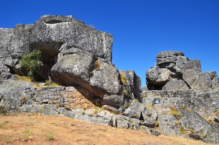
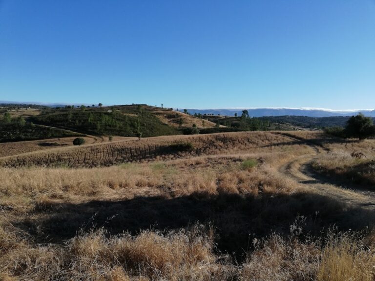
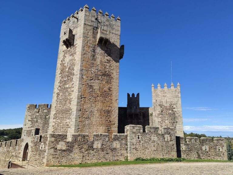
The castle stands about 573 metres above sea level on a rocky hill between the Ribeira de Ceife and Ribeira de Taliscas, tributaries of the Ponsul River, which flows into the Tagus. From this position, the fortress overlooks much of the frontier toward the Serra da Estrela and the Castle of Monsanto. The fortified settlement followed the contours of the terrain in an irregular, roughly oval enclosure. Fragments of its perimeter survive, including a wall line without merlons between the municipal house and the keep and a section of the southern wall.
Castle enclosure and defensive works
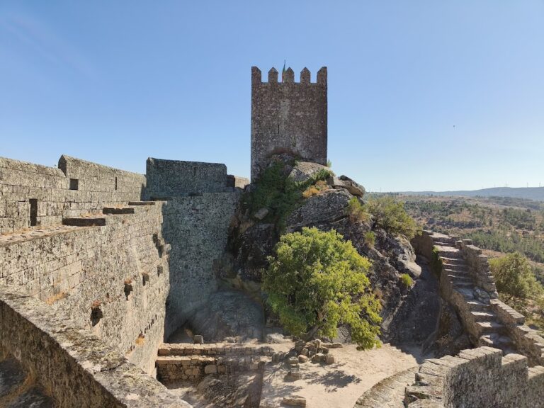
The medieval castle occupied the eastern end of the settlement and projected beyond the surrounding urban walls. Its defenses included an outer barbican, wall-top passages used for defense, and battlements with raised merlons. Artillery positions at the northwestern and northeastern angles had cruciform openings and cylindrical supports. Entry was through an arched doorway in the western wall.
Several later defensive structures remain along the escarpments. One bastion adjoins the municipal house and has steep curtain walls, the main stretches of wall joining defensive positions, with two gun openings. Another bastion is partly incorporated into a rocky outcrop south of the former Convent of Santo António. The surviving works also include the Redoubt of the Cavalaria at the former Fiscal Guard barracks and the Redoubt of Outeiro beside Rua do Outeiro to the west. Other sections of the seventeenth-century bastion curtains follow the shape of the slopes.
Keep and clock tower
The keep, which also functions as the clock tower, is attached externally to the surviving urban wall. It has a regular rectangular or approximately square plan and rises through three horizontal registers, or architectural levels. Its entrance is placed high above ground and reached by a staircase. Inside, two timber-floored levels divide the tower. The walls contain embrasures, openings for observation or weapons, blind registers, and a partly blocked or broken arch on the western side.
The eastern elevation has blind first and third registers and a second-level doorway with a curved lintel above an inscription that can no longer be read. The northern elevation has a high stepped and chamfered base, royal arms flanked by armillary spheres, and a rectangular upper frame. An armillary sphere, a model of the celestial sphere, was an important Portuguese emblem during the age of maritime expansion. The western elevation contains an embrasure and a straight-linteled window, while the southern elevation is partly built against rocky outcrops incorporated into the structure.
The keep’s wall walk is finished with pentagonal merlons. On the southern side, machicolations, projecting openings used to defend the base of a wall, rest on three-part corbels, or projecting supports. At the northeastern angle, the wall walk incorporates a square bell and clock structure with four round-arched openings and a pyramidal roof. Its clock face is oriented north.
Municipal house and civic features
The municipal house, or Domus Municipalis, forms part of the urban enclosure and was built over the Gate of the Vila near the pillory. The two-storey rectangular building has cornices and a four-sided tiled roof. Its northern facade contains an arched entrance and two decorated windows framed by stone friezes. The decoration includes the arms of Penamacor, armillary spheres, a Portuguese shield, and the date 1568.
On the southern facade, a double-arched doorway and staircase lead to the upper floor. There, a straight-linteled door and window are flanked by the municipal arms, while cornice moldings support the roof. The clock-tower section has a quadrangular plan, a chamfered base, two blind registers, and a partly blocked pointed-arched doorway on the western elevation. A bas-relief of a knight is placed above the doorway, and a straight-linteled window stands beside two cannon gargoyles.
Archaeological evidence
Excavations in and around the castle perimeter recovered bones, human skeletons, a fifteenth-century dish, and a false doorway. These finds contribute to the interpretation of the fortified settlement and its changing use. The Poço de El-Rei, once the castle’s cistern, was also a physical element of the complex before it was filled in by the municipality in 1933.