Castle of Ouguela: A Portuguese Frontier Fortress


Site at a Glance
- Rating
- 4.2
- Popularity
- Low
- Country
- Portugal
- Primary era
- Medieval
- Eras represented
- Medieval, Early Modern
- Civilizations
- Portuguese
- Site type
- Military
- Remains
- Castle
On this page14 sections
History
Castle of Ouguela is a Portuguese frontier fortress in Portugal, developed on the site of a pre-Roman hillfort through Islamic, medieval, and early-modern phases. It stands near the Spanish border and formed part of Portugal’s defensive system in the Alentejo. Its history reflects the changing control of the frontier, repeated efforts to attract inhabitants, and the modernization of its defenses during conflicts with Spain.
Early occupation and Christian conquest
The hill was occupied before Roman rule. During the Roman conquest of the Iberian Peninsula, the settlement was known as Budua. The Visigoths called it Niguela, while Muslim forces occupied the site and apparently fortified it from the eighth century onward.
Castilian and Leonese forces definitively conquered Ouguela after 1230 during the Christian Reconquista, the expansion of Christian powers across territories ruled by Muslims. On 28 May 1255, the civic leaders of Badajoz donated Ouguela and other localities to the Chapter and Bishop of Badajoz.
Transfer to Portugal and medieval development
The Treaty of Alcañices, a 1297 agreement that transferred several frontier territories to Portugal, placed Ouguela and its castle under the Portuguese Crown on 12 September 1297. On 5 January 1298, King Denis I granted the settlement a foral, a royal charter defining its rights and administrative arrangements. The charter offered extensive privileges to encourage settlement and defense, while Denis ordered the fortifications to be rebuilt.
Construction of a new town enclosure began during the reign of Ferdinand I and continued under King John I. On 7 December 1420, John I granted Ouguela the privilege of a couto de homiziados, a protected settlement status intended to attract inhabitants, including certain fugitives. This measure supported the settlement’s population and its role in defending the frontier.
In 1475, during the conflict associated with the Battle of Toro, João da Silva, governor of Ouguela, fought João Fernandes Galindo, governor of the neighboring Spanish town of Alburquerque, near Ouguela. Both men died from their wounds. Galindo died immediately, while da Silva survived for another twenty-eight days. In 1551, da Silva’s grandson, Diogo da Silva, ordered a cross to be erected at the place of the combat. The cross is now in the Museum of Elvas.
Cartography and the Manueline period
During the reign of King Manuel I, Duarte de Armas depicted Ouguela and its castle in the Book of Fortresses, produced around 1509. Manuel I granted the settlement a new charter on 1 June 1512. At that time, the Cunhas, lords of Tábua, served as Ouguela’s governors.
War and the modernization of the fortress
Ouguela formed part of Portugal’s first Alentejo defensive line, together with Campo Maior, Elvas, Olivenza, and Juromenha. During the Portuguese Restoration of Independence, the seventeenth-century movement that ended the Iberian Union and renewed Portugal’s frontier defenses, the War Council of King John IV ordered the modernization of Ouguela. The new fortified lines were designed by the French architect Nicolau de Langres.
In 1644, a Spanish force from Badajoz attacked Ouguela under Carlo Andrea Caracciolo, Marquis of Torrecuso. The force consisted of 1,500 cavalry and 1,000 infantry. João Rodrigues de Oliveira, a former Portuguese officer who had distinguished himself in Brazil during the period of the Philippine Dynasty, had defected to Spain and received the rank of field master and the governorship of Vilar de Rei.
Rodrigues de Oliveira led 600 cavalry and an equal number of selected infantry against Ouguela on the night of 9 April. Four soldiers from the garrison at Campo Maior detected the movement, hid among the rear of the Spanish column, learned the attack plan, and reached Ouguela by shortcuts two hours before the attackers. Their warning allowed the governor, Captain Pascoal da Costa, to organize a hurried defense at dawn.
Da Costa commanded 45 men and the inhabitants of the settlement. Isabel Pereira fought in the trenches and distributed gunpowder and ammunition. After being wounded and briefly rendered unconscious, she returned to the fighting when she found that her wound was not serious. The defenders resisted an attempt to blow up the castle gates, assaults on the walls, and Rodrigues de Oliveira’s promises and threats. After three hours, the Spanish force withdrew, leaving ladders against the walls, twenty dead, and dozens of wounded.
During the eighteenth century, the defenses were strengthened with a bastion, a projecting work that allowed fire along the walls, a demi-bastion, and a ravelin, an advanced triangular work protecting a gate or wall. These additions were built in 1755. Under the command of cavalry captain Brás de Carvalho, the strengthened fortress resisted another Spanish invasion in 1762.
A plan and profile dating from 1755 to 1803 shows further defensive works, including a watchtower, ditches, and palisades. In 1803, the lunets of Cabeço da Forca and Mártir were built under the command of the Marquis of la Reine by Senior Engineer-Major Maximiano José da Serra. Proposed works included the recovery of one of the southern towers in 1828 and the construction of a demi-lune to protect the eastern approach in 1829.
Demilitarization and conservation
The fortress was demilitarized in 1840. Its western sector, defined by the bastioned structures, then became the settlement’s cemetery. Circular brick sentry boxes remained visible at the angles of the second defensive line in the early twentieth century.
The castle and fortifications were classified as a Property of Public Interest by a decree published on 18 August 1943. Public conservation campaigns in 1976, 1987, 1991, and 1994 consolidated, repaired, and restored the castle, its bastions, and its internal and access areas. Architects Miguel Pedroso de Lima and José Filipe Cardoso later developed a safeguarding and enhancement project linking the recovery and revitalization of Ouguela and Alburquerque. The project proposed a museum area, a research and documentation center, and equestrian and pedestrian routes with a scenic connection to Alburquerque.
Remains
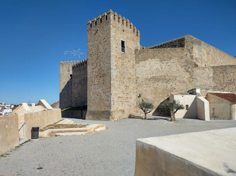
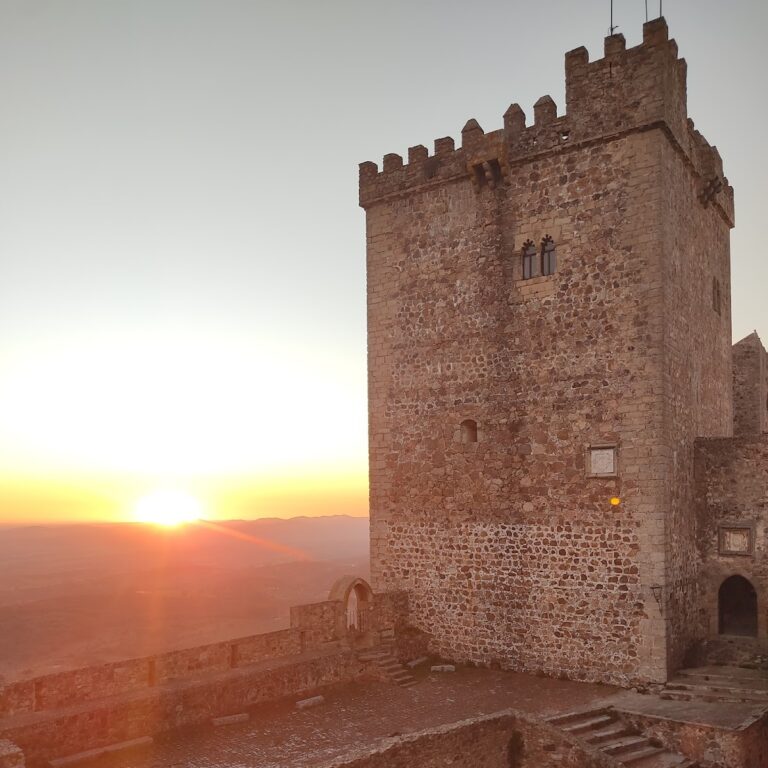
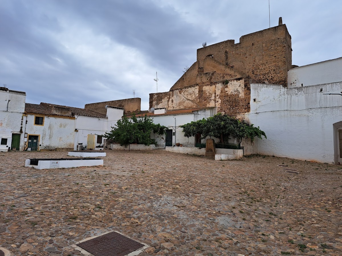
Castle of Ouguela occupies an escarpment approximately 259 meters above sea level, near the Xévora River and the Spanish border. The Spanish fortification of Alburquerque is visible from its walls. The fortress has an irregular hexagonal plan, with walls built of granite and schist. Medieval walls and towers stand alongside early-modern bastions, scarps, parapets, and ravelins, forming a defensive complex shaped by successive periods of military construction.
Medieval enclosure and principal entrance
Northern entrance
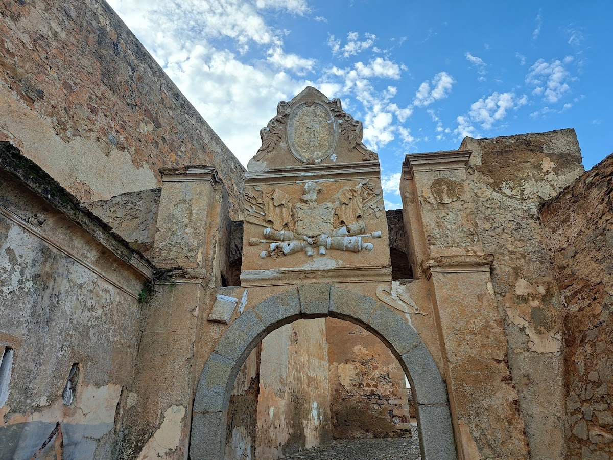
The northern entrance is formed by two paired towers and a semicircular arch. It also includes a pointed-arch doorway, a small opening, and a portcullis system. A demi-bastion protects the approach, with four gun ports, a raised firing platform known as a barbette, and a projecting right-hand ear designed to protect the fortress doorway. Heraldic arms decorate the gate, while a casemate, a protected chamber for weapons, contains seven loopholes.
Walls and wall-walk
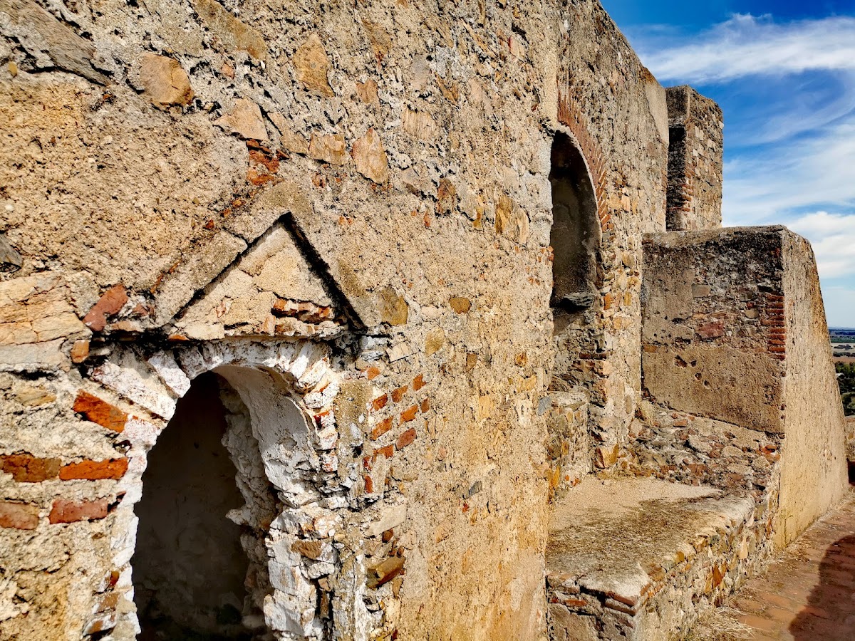
The medieval wall-walk remains complete and has low protective walls on both sides. The original crenellations of the towers and walls were replaced by barbettes and gun ports as the fortress was adapted for firearms. Gun ports are specifically recorded in the keep, linking the medieval defensive core with the later military system.
Bastioned perimeter and advanced works
Ditch and outer defenses
A ditch surrounds the bastioned perimeter. Its defensive arrangements include a tenaille-shaped rampart and a patrol path. These works belong to the later defensive organization that added projecting positions and covered approaches around the older walls.
Lunets of Cabeço da Forca and Mártir
The fortress also included advanced works detached from the principal enclosure. The lunet of Cabeço da Forca lies to the southeast, while the lunet of Mártir lies to the northwest. Both formed part of the expanded defensive system associated with the eighteenth- and early nineteenth-century strengthening of Ouguela.
Western bastioned sector
The western bastioned sector was later adapted as the settlement’s cemetery. Circular brick sentry boxes belonging to the second defensive line remained observable at its angles in the early twentieth century, preserving evidence of the fortress’s later defensive arrangements.