Castle of Olhain: A Medieval Water Fortress in France
Site at a Glance
- Rating
- 4.2
- Popularity
- Low
- Country
- France
- Primary era
- Medieval
- External website
- Open
- Eras represented
- Medieval, Modern
- Civilizations
- Duchy of Burgundy, French, Merovingian
- Site type
- Military
- Remains
- Castle
On this page17 sections
History
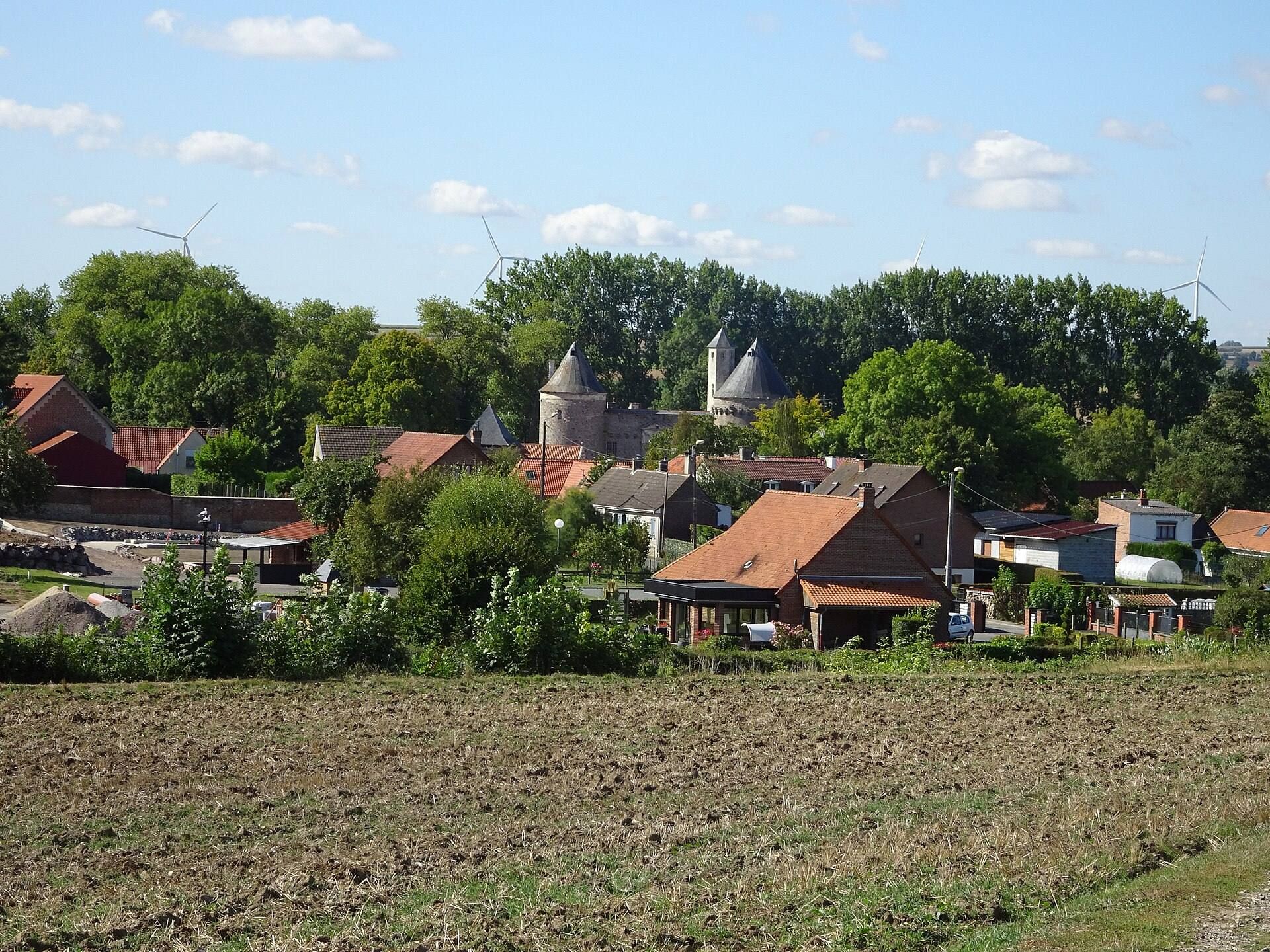
Castle of Olhain is a medieval fortress in France, near Fresnicourt-le-Dolmen, in the historic region of Artois. Its present complex is largely a fifteenth-century water fortress, built on artificial islands in the valley of the Lawe River. It is regarded as one of the best examples of medieval fortification in Artois and the former Nord–Pas-de-Calais region.
The Olhain Family and the Early Castle
The Olhain family is recorded in Artois from 1179. Hugues d’Olhain, son of Simon, appears in charters between 1179 and 1213 and is traditionally credited with founding and building an early castle at Olhain. Very little of that first structure survives in the present complex.
Hugues was also one of the captains of the Fourth Crusade, a thirteenth-century military expedition that diverted to Constantinople. The crusaders captured the city in 1204 and established the Latin Empire. In 1239, Hugues’s son Jean d’Olhain founded the castle chapel.
Construction of the Present Fortress
Olhain passed to the Nielles family when Marie d’Olhain married Jean de Nielles in 1387. Jean was a favourite of John the Fearless, duke of Burgundy from 1404 to 1419. In 1407, the duke authorized his chamberlain to take oak from Wault forest near Houdain, to a value of up to 60 gold écus, for construction work at Olhain. This document gives a precise date for the beginning of the present castle’s construction.
In 1409, Alix de Nielles, lady of Olhain, married Jean I de Berghes, Grand Veneur of France and governor of Abbeville. The estate consequently passed to the house of Berghes-Saint-Winock, which retained it until 1900.
Religious and Political Upheavals
During the sixteenth century, the lords of Olhain converted to Protestantism while Artois remained connected politically to the Spanish crown. Charles de Berghes later returned to Catholicism and, on 3 June 1628, obtained the restoration of his Artois citizenship from Philip IV of Spain, the Habsburg king whose rule included the Spanish Netherlands. This allowed him to reside in Artois, although members of the Berghes family spent little time at the castle.
On 6 April 1641, during Louis XIII’s conquest of Artois, the Champagne Regiment took Castle of Olhain. Louis XIII’s campaigns brought the territory under French control. During the siege of Arras, Spanish forces occupied the castle and blew up two of its towers.
Olhain suffered further damage in 1710 during the War of the Spanish Succession, a European conflict over the succession to the Spanish monarchy. Allied forces led principally by the Dutch besieged and occupied Béthune, after which Dutch troops occupied Olhain. The castle had already been seriously damaged by siege artillery.
Residence, Hunting Estate, and Restoration
In the first third of the eighteenth century, the Berghes-Saint-Winock family rebuilt its residence at Boubers-sur-Canche and made it the administrative center of the principality of Râches. Olhain ceased to be a principal residence, but it continued to serve as a hunting residence and remained in regular repair.
After Eustache Joseph de Berghes, Viscount of Arleux, died in 1757, the Boubers and Olhain estates were divided between his sons. Philippe Adrien Joseph Guislain de Berghes inherited Boubers, while François Désiré Marie Guislain de Berghes inherited Olhain. François’s descendants kept the estate until 1900.
The Berghes-Saint-Winock family lived at Olhain during the first half of the nineteenth century and carried out work there, including the refurbishment of the chapel. After 1870, the family preferred to live at the Château de Rânes in Normandy, and the family line ended in 1907.
During the twentieth century, the castle passed to the Dutoit family. The family undertook its preservation and promoted the cultural heritage of the region, using the property as a residence during part of the year. In November 1915, the castle temporarily served as the headquarters of the commander of the French 25th Infantry Brigade and his staff. During the Second World War, Canadian and British troops requisitioned it, but the complex escaped the major physical consequences of the 1940 French Campaign and the 1944 Allied landings in Normandy.
Gradual restoration began in the 1950s and eventually brought the buildings into good condition. Castle of Olhain has been protected as a French historic monument since 12 April 1989. It remains privately owned and functions as a historical and cultural site.
The Woodland Discovery
In 2021, LiDAR mapping for flood-control work in the Lys river basin unexpectedly revealed a fortified Neolithic circular site in the Olhain woodland. LiDAR uses laser measurements to map ground surfaces, including earthworks beneath woodland. The discovery led to proposals for archaeological excavation and protective designation in cooperation with the National Forestry Office.
Remains
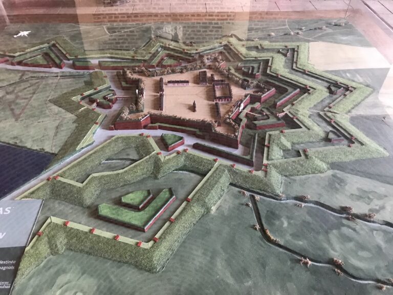
Castle of Olhain is arranged across two artificial islands surrounded by water within an artificial lake. The smaller island lies almost centrally in the lake and contains the principal fortress, or citadel, together with the buildings of the aristocratic residence. The larger island formed the bailey, an enclosed outer courtyard for service, storage, and administrative buildings. Drawbridges connected the two islands and linked the complex to its approaches.
The Fortress Island
Citadel and Entrance Towers
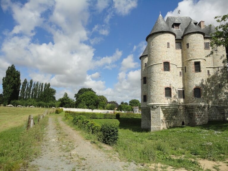
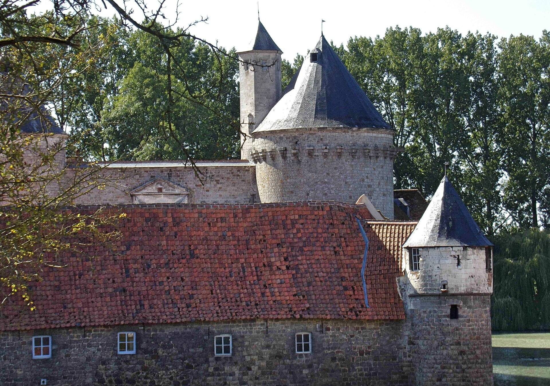
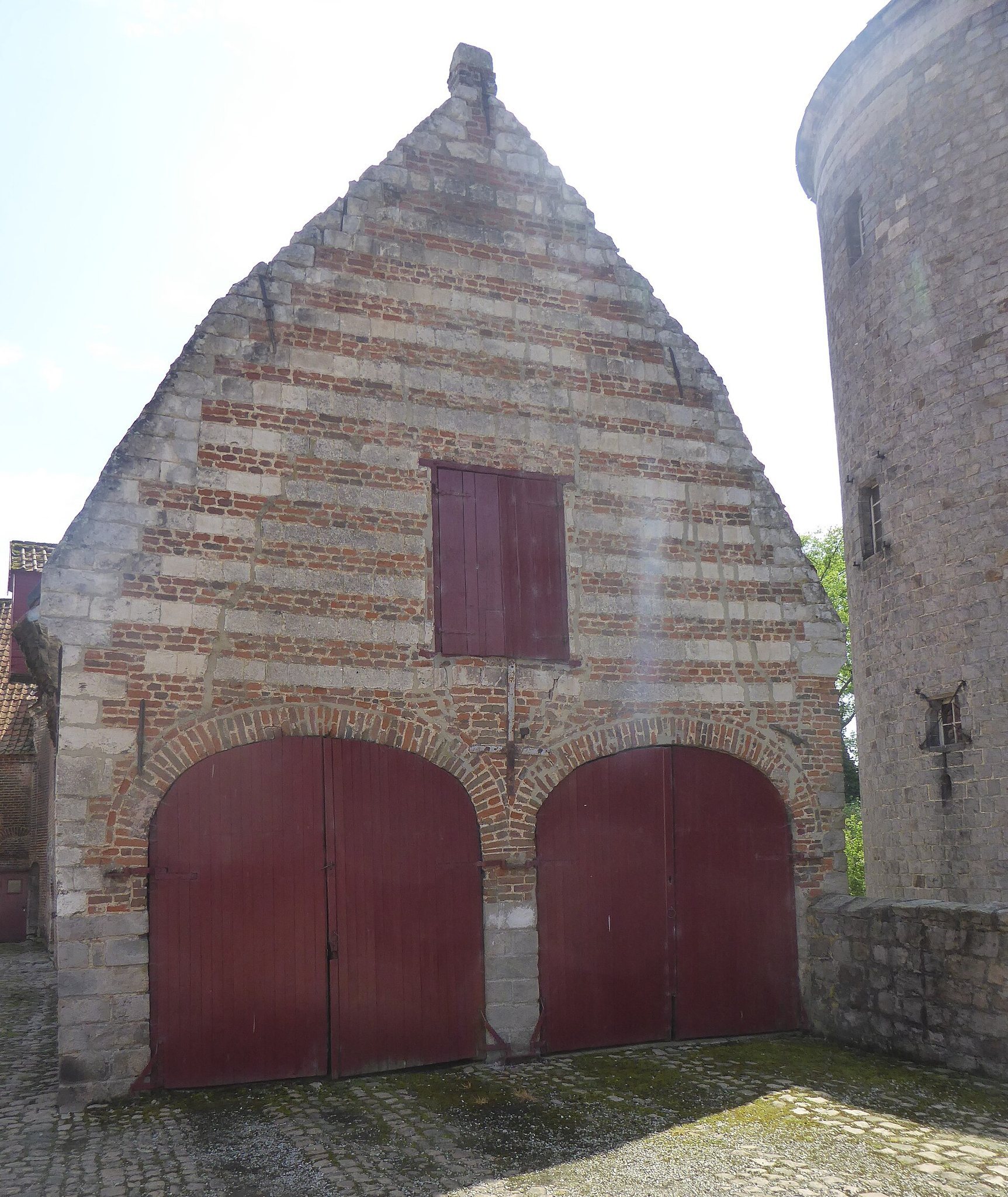
The citadel has a single eastern entrance protected by two substantial round defensive towers. Both towers carry conical tiled roofs. Deeper inside the complex, the highest tower rises more than 30 metres and functions as a stair tower. Its upper viewing platform overlooks the surrounding landscape.
Residential Buildings
A residential building once closed the inner courtyard on the western side. One wing facing the broadest part of the moat, which measures approximately 80 metres across, was demolished. The surviving complex also includes a nineteenth-century chapel, reflecting the later history of the residence and its refurbishment under the Berghes-Saint-Winock family.
The Bailey and Water Defenses
Outer Courtyard
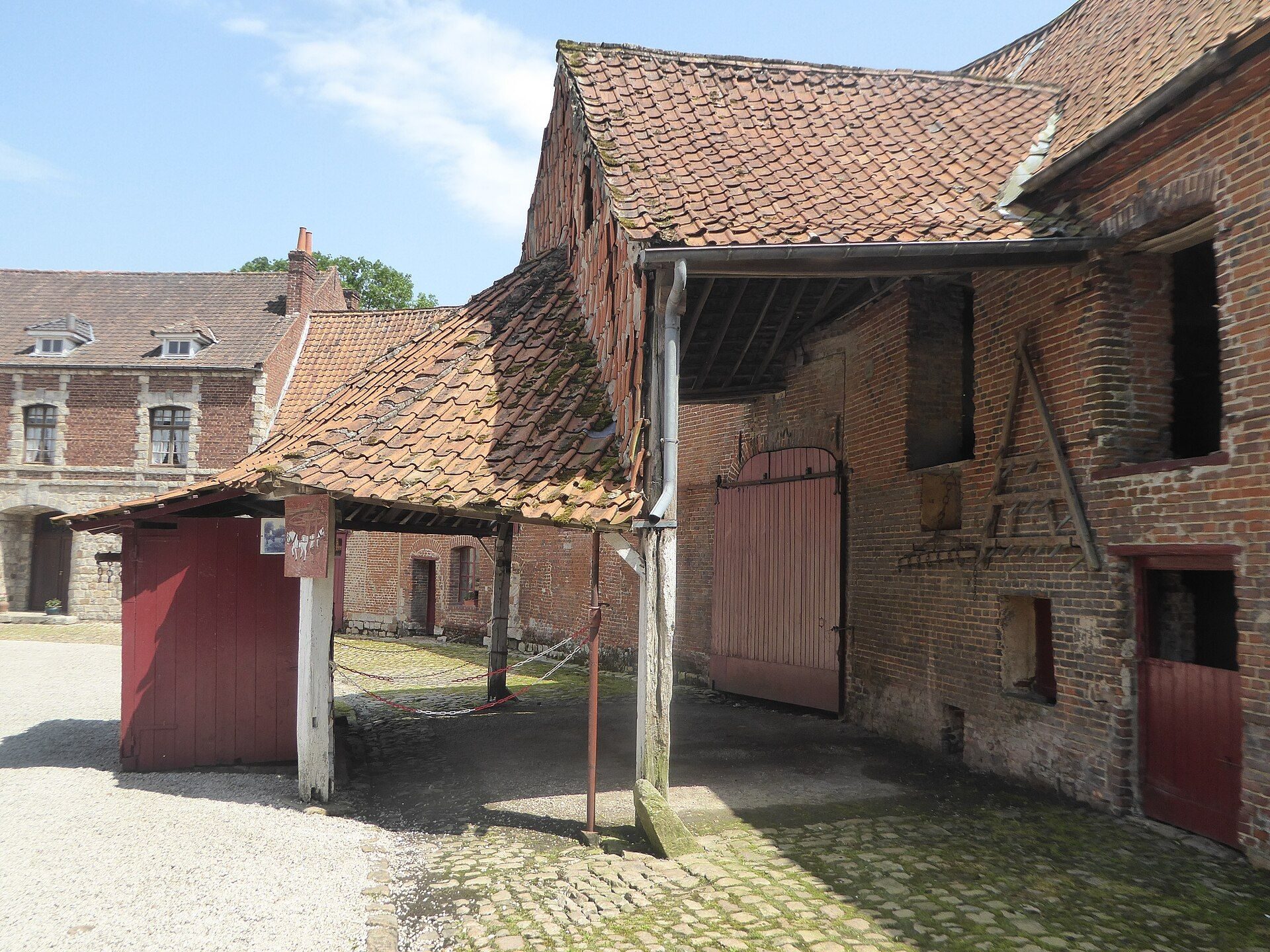
The larger artificial island is enclosed by a stone curtain wall, a defensive wall linking fortified structures, and contains a spacious courtyard. Its working buildings included storage buildings, a forge, a bakery, stables, and numerous service structures. A gatehouse, or fortified entrance complex, preceded the bridge connecting the bailey to the fortress.
Moats and Bridges
The water defenses were created for a fortress in the flat terrain of Artois, where natural high ground was scarce. One drawbridge led to the bailey, while another joined the bailey to the citadel. The surrounding moats are partly water-filled and partly infilled, and sections around the bailey have been filled.
Interior and Defensive Features
Service Areas
The complex contains a bread oven and a guard room. In the guard room, a large sandstone fireplace bears the arms of the Berghes-Saint-Winock family, including a lion. Kitchens in the cellars are built between walls dating to the Merovingian period, the Frankish ruling dynasty and cultural era of the fifth to eighth centuries.
Early Artillery
Culverins associated with the castle date from the period of the Spanish incursions. A culverin was a relatively long-barrelled early gun used in siege and defensive warfare, providing a material connection to the conflicts that damaged the fortress.
The Neolithic Earthwork
The fortified Neolithic site in the Olhain woodland forms a circular earthwork about 500 metres in diameter and covers approximately 25 hectares. Three embankments surround its center, with each bank separated from the next by a ditch about four to five metres wide. The earthworks are exceptionally well preserved.