Castle of Noudar: A Medieval Frontier Fortress in Portugal


Site at a Glance
- Rating
- 4.4
- Popularity
- Low
- Country
- Portugal
- Primary era
- Medieval
- External website
- Open
- Eras represented
- Medieval
- Civilizations
- Portuguese
- Site type
- Military
- Remains
- Castle
On this page15 sections
History
Castle of Noudar is a medieval frontier fortress in Portugal, built and developed through successive Roman, Visigothic, Islamic, and Christian phases on a hill between the Ardila River and the Múrtega stream. Its present form was established mainly in the early fourteenth century under King Denis of Portugal and the Order of Avis, a Portuguese military-religious order responsible for frontier defense and settlement. The castle controlled a route linking Beja, Moura, and Jerez de los Caballeros and remained involved in the shifting political and military history of the Portuguese-Castilian border.
Earlier occupation and Christian conquest
Human occupation of the site began in the Chalcolithic period. Later communities associated with Rome, the Visigothic kingdoms, and Islamic rule successively used the hill. During the tenth or eleventh century, Islamic occupants probably established a small rammed-earth tower or castle there to control the road towards Beja. Rammed earth was made by compacting earth inside temporary forms to create solid walls.
The settlement was known in earlier records as Nodar or Noudall. It was founded in 1167 and taken from Muslim forces by Gonçalo Mendes da Maia during the Reconquista, the long medieval expansion of Christian kingdoms into territories ruled by Muslim polities in the Iberian Peninsula. Noudar then became part of the frontier zone in which the Order of Avis operated.
On 6 December 1253, Alfonso X of Castile granted Noudar a foral, a charter defining a settlement’s rights, duties, privileges, and administrative arrangements. Noudar later formed part of the dowry of Alfonso X’s daughter Beatriz when she married Afonso III of Portugal. The marriage arrangements linked the territory to Portugal while providing for its eventual return to Beatriz’s heirs.
The fourteenth-century fortress
After a peace agreement in 1295 between Denis of Portugal and Ferdinand IV of Castile, Noudar returned to the Portuguese Crown. Denis issued a new charter on 16 December 1295 and transferred the lands to the Order of Avis in 1303. The order was required to encourage settlement and rebuild or construct the castle, walls, and fortress.
Denis ordered Lourenço Afonso, master of Avis, to establish the castle and town. Construction and related settlement work took place during the early fourteenth century and was completed by 1308. On 16 January of that year, the king promoted settlement by exempting local residences from debts, granting privileges to the masters of Avis for agricultural assistance and support of their vassals, and placing the settlement under royal protection for five years.
Aires Afonso, commander of the Order of Avis from 3 March 1307 to 11 April 1311, directed further work at the castle. In 1319, Denis cancelled debts incurred in constructing the castles of Noudar, Veiros, and Alandroal. In 1322, he granted the castle and its associated land revenues to Vasco Afonso, master of Avis, to facilitate its construction.
Border warfare and changing control
The castle’s position exposed it to repeated conflict. In 1339, Diego Fernandez, a Castilian nobleman of the Order of Santiago, besieged Noudar. The fortress returned to Portugal in 1372 during the marriage of Ferdinand of Portugal and Leonor Teles, but Castile regained it in 1385. Under the Treaty of Monção in 1386, Noudar and several other castles and territories were exchanged for Olivenza and Tui.
King John renewed the settlement’s protected charter in 1406 to reinforce the frontier population. During the reign of Manuel I, Noudar received another charter in 1513. A letter from 1510 had already referred to work on the castles of Portel, Moura, and Mourão, placing Noudar within a continuing programme of frontier repair and administration.
By 1532, Noudar was a parish and a commandery associated with the Order of Avis, the Marquis of Torres Novas, and the alcalde Luís Dantas. A commandery was an administrative and economic unit entrusted to a commander, often within a military-religious order. The parish area had six residents, while nearby Barrancos had 73 people, including nine widows and two clergymen. Bartolomeu Rodrigues, recorded on 29 November 1557, was the oldest known parish prior.
In 1577, the Noudar and Barrancos commandery was controlled by Jorge, Duke of Aveiro. Its privileges passed to the House of Linhares on 17 April 1590 and to the House of Cadaval in 1610. During the seventeenth century, the town had about 400 residents, a Misericórdia, a hospital, and three hermitages. A Misericórdia was a Portuguese charitable brotherhood that commonly operated welfare institutions such as hospitals.
War, decline, and abandonment
The castle suffered heavy damage during the Portuguese Restoration Wars and related succession conflicts. Spanish troops captured it in 1644 and again in 1707. Noudar and its castle remained in Spanish hands from the Restoration War period until the War of the Spanish Succession, a European conflict over the succession to the Spanish monarchy. Portugal recovered the settlement under Article V of the Second Treaty of Utrecht on 6 February 1715.
The parish church was first dedicated to Nossa Senhora de Entre Ambas as Águas, a name referring to Noudar’s position between the Múrtega and Ardila waterways. It was probably rededicated to Nossa Senhora do Desterro at the beginning of the eighteenth century under the prior of Avis. By 1740, after the Restoration conflicts, the population had fallen to about 200. Friar Ignácio da Costa Inverno was prior in 1769.
Noudar remained a municipal seat until the eighteenth century, but warfare and depopulation led to the transfer of municipal administration to Barrancos. The village was extinguished in 1825, and its population abandoned it during the nineteenth century. A 1755 plan by Miguel Luiz Jacob proposed a star-shaped redoubt along the southeastern São Gens wall, with curtains and other defenses. The redoubt was never built. Further military drawings were prepared in 1758 and 1795 by João António Infante and Lourenço Homem da Cunha de Eça.
Ownership, preservation, and archaeological investigation
In 1879, José Bonifácio Garcia Barroso requested that the ruined castle be placed under the Finance Ministry for sale by public auction. It was sold in 1893 to João Barroso Domingues, later resold to José Augusto Fialho e Castro, and subsequently inherited by Maria das Dores Blanco Fialho Garcia.
Gustavo de Matos Sequeira recorded two inscriptions associated with the keep in 1909. One commemorated the castle’s foundation and the settlement of the town by Lourenço Afonso for Denis. The other referred to work undertaken during the commandery of Aires Afonso. The inscriptions were later transferred to the Municipal Museum of Barrancos, although the present whereabouts of the first inscription became uncertain.
The ruins were declared a National Monument by decree on 23 June 1910. Twentieth-century work by the Directorate-General for Buildings and National Monuments demolished later walls, consolidated older structures, reconstructed vaulted roofs, and retiled the roofs. Further consolidation took place in 1979. In 1981, work recovered ruined walls, restored the chapel, reconstructed the church and two other buildings using traditional techniques, and supported archaeological investigation directed by Cláudio Torres.
Archaeological research in the 1980s and later investigations revealed evidence of Islamic occupation. The municipality of Barrancos acquired the monument in 1997 through a purchase process involving the former private owners and EDIA. In 2000, a professional training school was established within the castle by the municipal council and a southern construction-training centre, with support from the national monuments authority and the European Social Fund. Recovery of Monte da Coitadinha began between 2000 and 2001 as part of the Noudar Nature Park project. In 2021, the municipality launched the first phase of a programme to rehabilitate the eastern and northern sections of the castle walls.
Remains
Hilltop enclosure and outer defenses
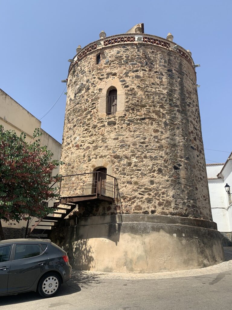
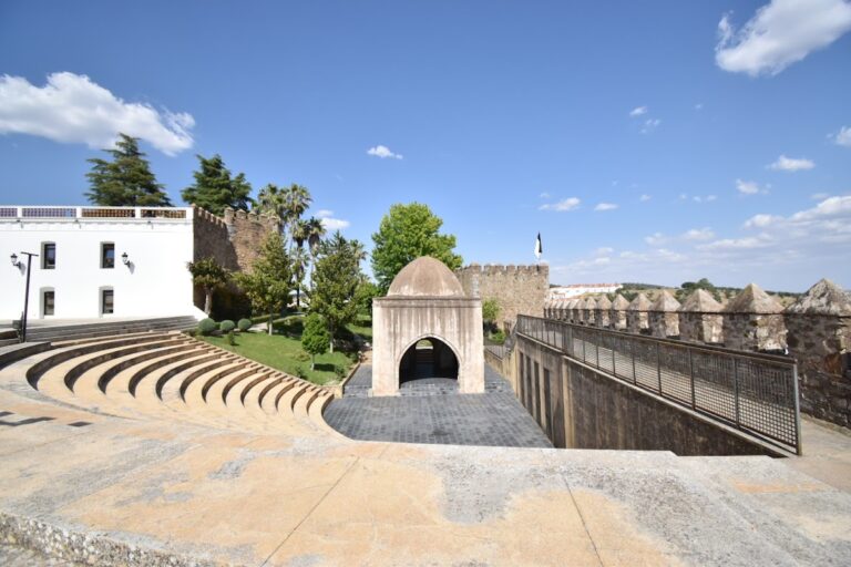
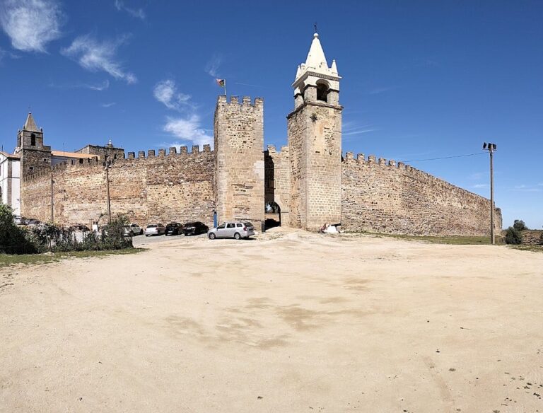
Castle of Noudar occupies an isolated rural position on a schist platform crowning a hill about 275 metres high. The hill lies between the Ardila River and the Múrtega stream, approximately 2 kilometres from their confluence and about 0.5 kilometre from the Spanish border. The fortress incorporates the enclosure of the former village and surviving sections of its southeastern and southern walls. Its irregular plan, also described as hexagonal, follows a longitudinal northwest-southeast axis and is divided into the alcazaba and the walled village enclosure. An alcazaba is a fortified inner citadel containing principal defensive and residential buildings.
The castle forms part of a landscape associated with the historic route between Beja, Moura, and Jerez de los Caballeros and with the Via da Prata, described as an important ancient western roadway. The Church of Nossa Senhora do Desterro stands within the former village enclosure, while the Atalaia da Forca is approximately 200 metres from the castle.
Barbican
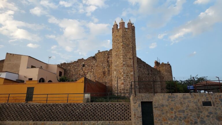
An irregular barbican adjoined and was partly integrated with the southeastern village wall. A barbican is an outer defensive work protecting an entrance or wall. Historical drawings show a double line of barbican walls on the northeast, two rectangular towers on the southwest, a square tower at the eastern corner, and another tower to the north. Semicylindrical corbels stood on the southeast, while damaged or ruined merlons formed parts of the defenses. Some barbican sections were tiled.
Walls and gates
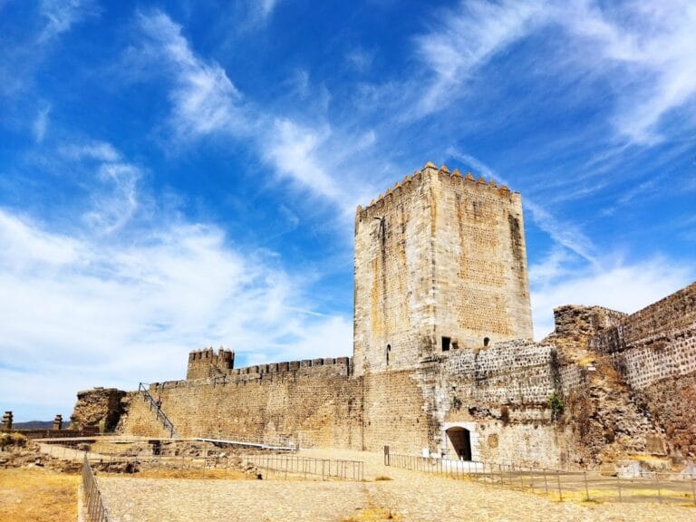
The castle walls and battlements follow a wall walk, a passage along the top of a defensive wall, and are reinforced by twelve rectangular or square corbels. Two gates, on the east and west, were protected by small rectangular towers. The southeastern wall used rammed earth strengthened with schist masonry, combining compacted earth construction with stonework made from layered metamorphic rock.
Keep
The rectangular keep stands in the northwestern wall and rises approximately 17.5 to 18 metres. A keep is the principal fortified tower of a castle, generally serving as a strong defensive and residential structure. The tower has one entrance at ground level and another on the second floor of the northwestern wall, reached by an exterior stone staircase. Pyramidal merlons crown its roofline. The keep was vaulted and contained a cistern, a tank for collecting and storing water. An early sixteenth-century representation by Duarte d’Armas also showed an additional upper room.
Citadel and former village
Military square and alcazaba
Two further cisterns occupied the central military square, a longitudinal courtyard beside the keep. The courtyard was part of the former alcazaba, whose residential and service buildings retain visible traces of murals. A later plan recorded a watchtower used to store gunpowder, a warehouse in the southwest that was demolished, and ruined barracks in the northwest.
The military square had a double entrance beside the keep. Its defenses included the village wall, curtain walls, corbels, towers, and projected redoubts. A curtain is a section of wall between defensive towers, while a redoubt is a small enclosed or detached fortification. These elements formed the defensive system around the inner courtyard and the former settlement.
Church and associated buildings
The Church of Nossa Senhora do Desterro stands inside the former village enclosure. It was restored in the 1980s, together with two other buildings within the castle complex. Their reconstruction used traditional techniques, and the work formed part of the wider recovery of the ruined settlement.
Inscriptions and surrounding landscape
Two inscriptions came from the keep. The first was a Gothic-lettered commemorative stone dated 1 April 1308. It recorded Lourenço Afonso’s foundation of the castle and settlement for King Denis. The second was carved in ashlar and commemorated work during the commandery of Aires Afonso. It included a flourishing cross of the Order of Avis, two birds, two fruits, a scallop, and an old Portuguese shield. The lower portion was damaged and difficult to read. The limestone inscription measured 23.5 by 27 centimetres and was set on a base measuring 65.5 by 28 by 19 centimetres. Both inscriptions were eventually transferred to the Municipal Museum of Barrancos.
Circular structures associated with pastoralism surround the castle. They use dry-stone walls and false-dome roofs, formed by progressively projecting courses of masonry rather than by a true arch or dome. The wider Herdade da Coitadinha contains riparian and wild vegetation, including oleanders, evergreen oak, holm oak, and cork oak. Dolmens, Chalcolithic settlements, watermills, and huts also form part of the archaeological and ethnographic landscape associated with Castle of Noudar.