Castle of Aljezur: A Medieval Islamic Fortress in Portugal

Site at a Glance
- Rating
- 4
- Popularity
- Medium
- Country
- Portugal
- Primary era
- Medieval
- External website
- Open
- Eras represented
- Medieval
- Civilizations
- Almohad, Order of Santiago, Portuguese, Umayyad
- Site type
- Military
- Remains
- Castle
On this page15 sections
History
The Castle of Aljezur is a medieval fortress in Portugal, developed during the Islamic period on a hill above the settlement of Aljezur. The castle was probably founded in the tenth century, while its later fortifications were likely built between the twelfth and thirteenth centuries under the Almohad Caliphate, a medieval Islamic state that ruled parts of North Africa and the Iberian Peninsula. Its position gave it control over the Ribeira de Aljezur, its plain, part of the coast, and the route through the D. Sancho valley toward the ocean.
Early occupation
People used the hill long before the castle was built. Excavations directed by the archaeologist Carlos Tavares da Silva identified Bronze Age remains dating to about 3,000 years ago, followed by occupation from the second Iron Age through the Roman Republican period, approximately the fourth to first centuries BC. During the Roman period, the hill may have held a Lusitanian hillfort, a fortified settlement associated with the pre-Roman peoples of western Iberia. The Romans probably established a watch post there, and this surveillance role may have continued during the Visigothic period between the seventh and eighth centuries.
The archaeological material reflects connections beyond the immediate area. Bronze Age finds include ceramic vessels, such as carinated bowls and containers comparable to material from the Cerradinha site at Santiago do Cacém. Iron Age and Roman layers contain amphora fragments and fine black and Campanian ceramics. Some objects were made locally or regionally, while Campanian fine wares and wine amphorae of the second and first centuries BC probably came from the Italian Peninsula or elsewhere in the Mediterranean.
Islamic foundation and fortification
The settlement of Aljezur was established during the medieval Islamic period, and the castle probably originated in the tenth century. Its Islamic occupation had at least two phases. The earlier phase was residential, with buildings whose walls were capped with compacted earth and whose floors included surfaces paved with stone slabs. A later phase transformed the hilltop into a fortified enclosure.
The later defenses were probably constructed at the beginning of the second period of the Almohad Caliphate, during the twelfth or thirteenth century. The castle formed part of the defensive system of the region governed from Silves. That zone extended from Aljezur and the southern Alentejo coast toward the areas of present-day Lagoa and Albufeira. The castle probably accommodated a garrison and also served as a storage facility, as shown by two silos cut into the rock.
Christian conquest and changing control
Tradition places the Christian capture of Aljezur on 16 June, in either 1242 or 1246. The attacking force belonged to the Order of Santiago, a Christian military order involved in the conquest and administration of territories in the Iberian Peninsula, and was commanded by Paio Peres Correia. After the conquest, King Afonso III granted Aljezur and other localities to the order and probably ordered work at the castle, possibly including compartments built along the walls. The fortress may then have served chiefly a military function.
The Treaty of Badajoz, signed on 16 February 1267, included Aljezur among the Algarve castles that Afonso X of León and Castile undertook to deliver to Afonso III of Portugal. On 12 November 1280, King Dinis issued Aljezur’s charter at Estremoz. On 1 December 1297, Dinis exchanged Almada and the Alfeite estate for the castles of Monchique and Aljezur and the towns of Almodôvar and Ourique. These places passed to the Order of Santiago as part of the order’s separation from the masters of Castile.
Decline and abandonment
The Ribeira de Aljezur remained navigable until the sixteenth century and provided a communication route between the Alentejo coast and the western Algarve. As silting reduced navigation, the castle’s defensive value declined, and Aljezur became less strategic in relation to other Algarve positions. The fortress was probably abandoned between the end of the fifteenth century and the beginning of the sixteenth. Ceramics from the upper part of a fill used as a rubbish deposit belong to this transitional period.
A visitation of the Order of Santiago in the fifteenth century, dated either 1448 or 1482, described the western wall as ruined and the gates as damaged and without locks. It prohibited the removal of stone for other buildings, ordered the rebuilding of ruined wall sections, and required the cistern to be cleaned after it had been used for rubble. These works did not proceed, despite renewed support from King Manuel I. The castle consequently deteriorated through the sixteenth to nineteenth centuries, while chief castellans continued to be associated first with the Counts of Vila Verde and later with the Marquises of Angeja.
The earthquake of 1755 severely damaged the castle’s structures and interior buildings after devastating the town. A description published between 1747 and 1751 had already noted the remains and a nearly filled cistern. Another description, from 1876, referred to the octagonal ruins, two towers, the cistern, and the foundations of small barracks.
Archaeology and conservation
The first major interventions after the long period of abandonment took place in 1940 and 1941 during national commemorations of Prince Henry the Navigator. The work concentrated on the walls, although several sections were substantially modified. Additional wall restoration and a retaining wall followed in the 1980s, with urgent conservation carried out in 1985.
Archaeological prospecting took place in 1988 during a survey of Aljezur and Monchique. Investigations in the 1990s by the Archaeology Unit of the Southwest Alentejo and Vicentine Coast Natural Park, in cooperation with Aljezur Municipal Council, brought together evidence for Bronze Age, Iron Age, Roman, and Islamic occupation. In 2004, work to identify the former wall line found the lower edge of the wall beside the southern tower. It also showed that a wall restored in the 1980s had been moved outward from the medieval alignment and did not follow the earlier plans and construction methods.
Archaeological monitoring accompanied stabilization and retaining work beneath the wall foundations in 2005. Investigators found a possible pavement outside the walls, a dwelling interior with a hearth containing two silver dirhams, and a possible collapse layer of mortared blocks that may belong to the final phase of Muslim rule before the Christian conquest. The entrance area was investigated and treated in 2008 to clarify its successive occupation phases. Between 2007 and 2008, the archaeological structures were protected and the castle was consolidated. The castle was classified as a Property of Public Interest in Portugal in 1977, and administrative responsibility was assigned to the Portuguese Institute for Architectural Heritage in 1992.
Remains
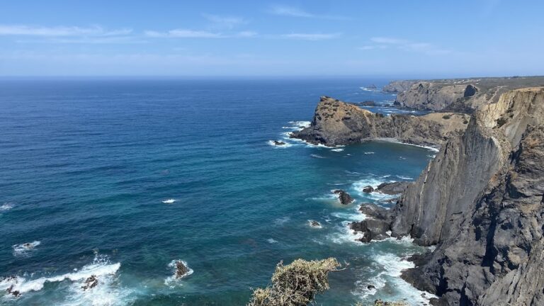
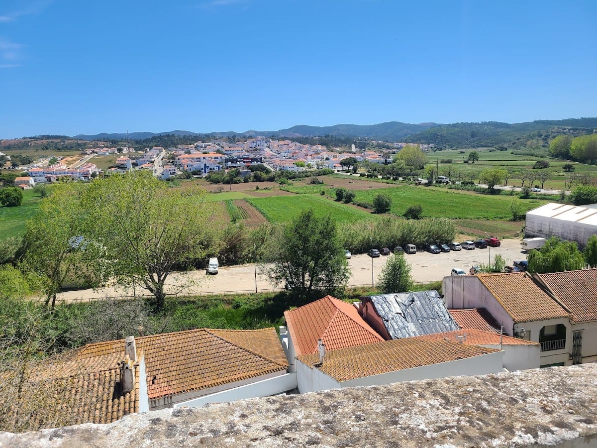
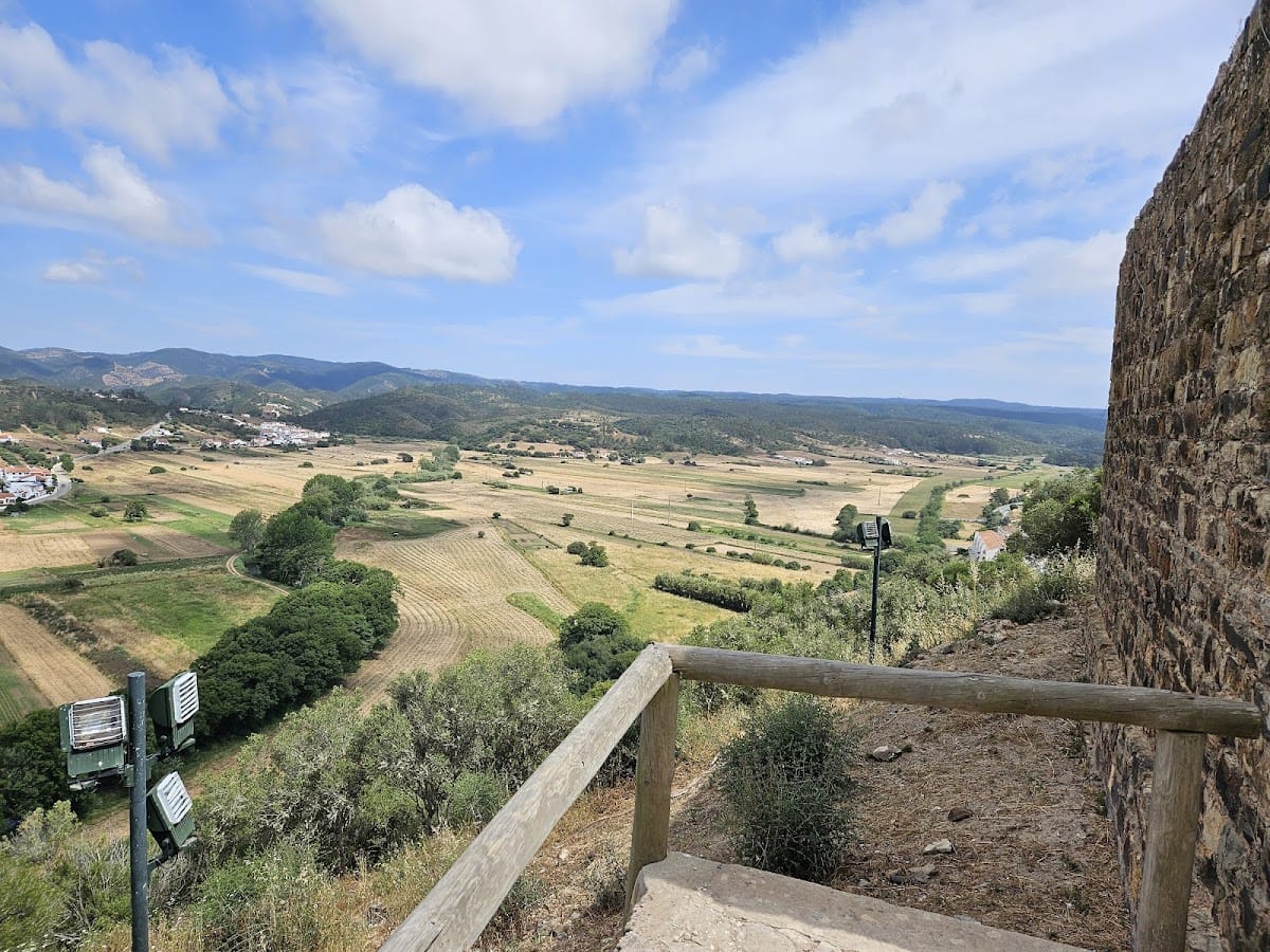
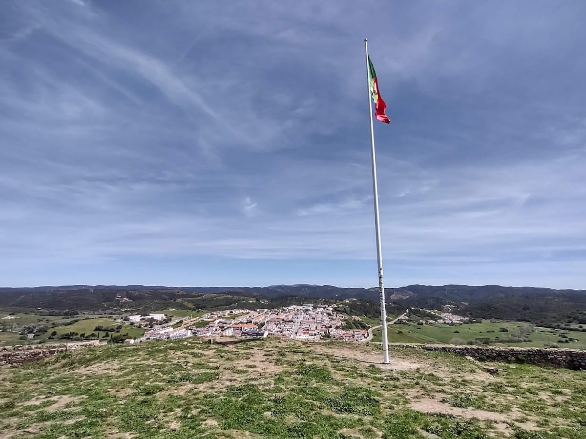
The fortress occupies the summit of an isolated hill about 88 metres high, overlooking Aljezur’s older quarter to the east. A 93-metre hill lies to the south. The elevated position overlooks the Ribeira de Aljezur, its plain, part of the coast, and the route through the D. Sancho valley to the ocean near Amoreira Beach. Remains of a river port were found in Aljezur, helping explain the strategic value of the hilltop during the period when the river served as a navigable communication route.
Fortifications and towers
Enclosure walls
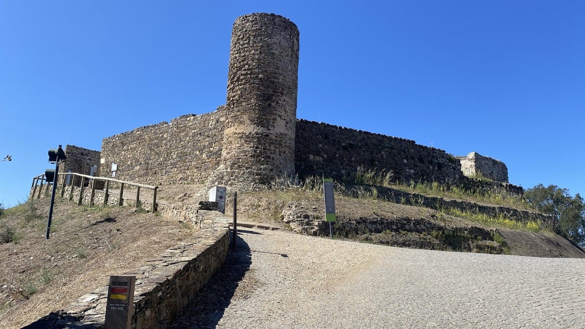
The castle has an irregular polygonal plan, approximately octagonal, shaped by the contours of the hill. Its straight walls are about 1.5 metres thick and between 3 and 5 metres high. The walls and towers may originally have carried battlements, with wooden stairs giving access to the tower tops. On the northwestern slope, remains of a barbican, an outer defensive work protecting an entrance or approach, survive at less than one metre high. Wall outcrops also remain on the western side.
Northern tower
The northern tower is circular, about 5 metres in diameter and 9 metres high on its exterior. It protected the entrance zone on the northeastern side of the enclosure. The entrance area was examined and treated in 2008, and a stone plaque beside it commemorates the national centenary celebrations and the works undertaken at that time.
Southern tower
The southern tower is quadrangular, measuring approximately 4.98 by 4.40 metres. Its height and foundation level are similar to those of the circular northern tower. Investigations in 2004 identified the lower edge of the wall beside this tower, while planned later work included consolidation of the southern tower.
Interior structures and storage
Cistern
The parade ground contains a roughly cubic cistern in the northwestern corner. A cistern is a tank used to collect and store water. This one has a vault and an arched doorway. Descriptions from the eighteenth and nineteenth centuries provide contrasting details about its condition, noting at one stage that it was nearly filled and at another that it remained in good condition.
Compartments and silos
Trapezoidal and rectangular compartments were built against the walls. They may have served as barracks or other military spaces, consistent with a fortress intended to house a garrison. Two silos were cut into the rock and indicate collective storage, perhaps for grain or other supplies. Exposed rock remains across the interior, and in places the interior surface stands higher than the wall level.
Archaeological deposits and finds
The earliest Bronze Age deposits are sparse, discontinuous, and thin, lying directly above the rocky substrate. Bronze Age material includes ceramic vessels, while Iron Age and Roman remains include amphora fragments and fine black and Campanian wares. These objects preserve evidence of local and regional production alongside contact with the Italian Peninsula and other Mediterranean areas.
Islamic-period finds include two coins, metal objects, and fragments of jars, cups, basins, enameled and glazed bowls, cooking pots, pitchers, and large storage vessels. Food remains include fish, domestic and wild mammals such as deer, and numerous estuarine and marine mollusc shells. Together they point to fishing, farming, livestock raising, hunting, and shellfish gathering. Iron-smelting slag also indicates iron working during the occupation.
At Várzea da Misericórdia, on one slope of the castle hill, remains of a possible Bronze Age settlement were found. A bronze helmet from that context is preserved in the Municipal Museum of Lagos. The 2005 investigations additionally revealed a possible pavement outside the walls, a dwelling interior with a hearth, and a possible collapse deposit of mortared blocks. The two silver dirhams recovered from the hearth provide material evidence for Islamic-period occupation.