Castillo de Sibirana: A Mountain Frontier Castle in Spain
Site at a Glance
- Rating
- 4.7
- Popularity
- Very Low
- Country
- Spain
- Primary era
- Medieval
- Eras represented
- Medieval
- Civilizations
- Crown of Aragon, Kingdom of Navarre
- Site type
- Military
- Remains
- Castle
On this page7 sections
History
Castillo de Sibirana is a depopulated settlement in Spain, in the municipality of Uncastillo, centered on a castle and the Chapel of Santa Quiteria in the Aragonese Romanesque style. The site formed part of a fortified frontier system developed during the early tenth century to protect the eastern territories of Sancho Garcés I of Pamplona and to control routes through the surrounding valleys.
The early frontier system
In the early tenth century, Sancho Garcés I sought to secure the lands around Sangüesa, the Roncal and Onsella valleys, and parts of the Aragón valley. Fortified positions on high ground helped block possible Muslim incursions, restrict the expansion of the County of Aragón, and increase pressure on Huesca. Between 905 and 925, castles were established along a defensive line extending from Vadoluengo near Sangüesa. Sibirana belonged to this network, which also included Royta, Uncastillo, Luesia, Biel, and Castiliscar, together with fortified towers at other locations.
Another reconstruction places the conquest of Sibirana by Sancho Garcés I in 921. In that interpretation, the surviving castle replaced an Islamic tower associated with the Banu Qasi, a powerful Muslim lineage that controlled territories and fortified settlements in the Ebro and western Pyrenean region. The date of the present castle is otherwise placed broadly between the eleventh and fifteenth centuries.
Medieval references and changing ownership
The first known documentary reference to Sibirana dates from 1063, when the place appeared under the forms Sibrana and Siurana. In 1086, the castle and the settlement below it formed part of the dowry given to Felicia of Roucy at her marriage to Sancho Ramírez of Aragón. Sancho Ramírez was an Aragonese king whose reign connected the monarchy with the wider political world of the eleventh-century Pyrenees.
A charter granted by Alfonso I of Aragón, also known as Alfonso the Battler, referred to the river Sibrana. Between 1159 and 1162, Sibirana was held by Pedro López de Luna. The castle therefore belonged to a medieval system in which fortified territories could be administered by a holder on behalf of a superior authority.
Abandonment and protection
The settlement was probably abandoned between the seventeenth and eighteenth centuries. Its isolated mountain setting, harsh climate, and limited agricultural conditions made permanent occupation difficult. Epidemics during the late Middle Ages and early modern period appear to have reduced the population, and the community was not subsequently repopulated. A baptismal register from Petilla de Aragón shows that people still lived at Sibirana at the end of the eighteenth century.
The castle is protected by the Government of Aragón as an Asset of Cultural Interest. The castle and the estate on which it stands are privately owned.
Remains
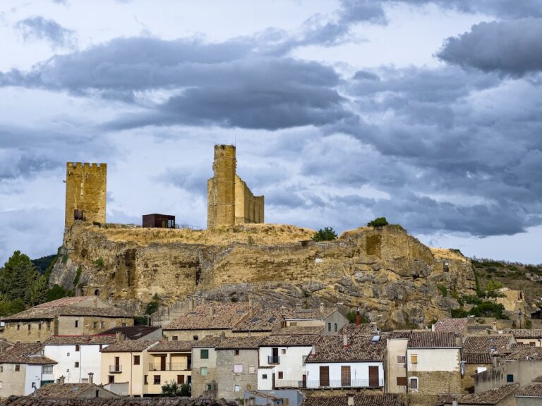
The remains occupy a small valley beside the Sibirana ravine, a right-bank tributary of the Arba de Luesia River. The castle stands on the summit of a steep rocky outcrop directly above the route linking Uncastillo and Luesia with the Onsella valley and, through it, Sos, Sangüesa, and the Aragón valley. Its position allowed the route to be blocked when necessary. Beneath the outcrop, the settlement survives in fragmentary form, together with the Chapel of Santa Quiteria.
The twin towers
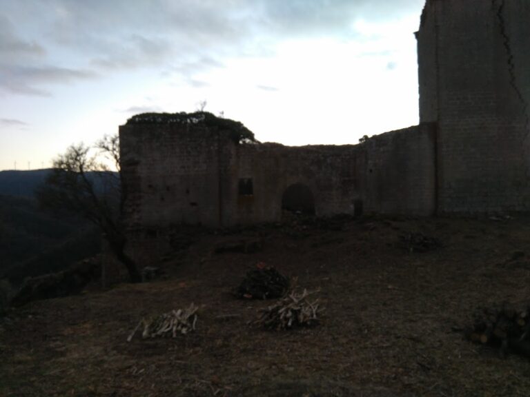
The castle consists of two square towers built on the rocky summit. Each measures about four metres across and rises approximately twenty-five metres. The towers had three wooden floors and retained their battlements, while their exteriors remained in very good condition until the 2010s. The southern side of the outcrop is inaccessible. Access was provided from the north by a wooden staircase that has disappeared, although holes cut into the rock still mark the positions of its supporting timbers.
Neither tower has openings or arrow slits on its north side. This arrangement reduced exposure to the cold north wind, known as the cierzo, and strengthened the more accessible northern approach. Water was drawn from the ravine below, while the surrounding lands supplied food, with livestock raising particularly important to the settlement’s subsistence.
The settlement and chapel
The remains of ten or twelve houses survive beneath the rocky outcrop on the south side of the castle. Together with the castle, the Chapel of Santa Quiteria represents the surviving core of the former settlement. The chapel is identified, like the castle, with Aragonese Romanesque architecture.
Nearby sites