Castelo de Ourique: A Medieval Fortress in Portugal


Site at a Glance
- Rating
- 4.4
- Popularity
- Very Low
- Country
- Portugal
- Primary era
- Modern
- Eras represented
- Modern
- Civilizations
- Unclassified
- Site type
- Civic
On this page10 sections
History
Castelo de Ourique is a former military monument in Ourique, Portugal, built during the period of Muslim rule in the Iberian Peninsula, possibly as early as the ninth century. It occupied a strategic position above the Alentejo settlement and helped control the route between the Algarve and the Sado River valley. Earlier occupation by a castro, a fortified settlement associated with pre-Roman communities, followed by Romanization has been proposed, although this possibility remains unconfirmed at the castle itself.
Muslim Foundations and the Reconquista
The fortress may have formed part of the rural defensive network established during the emirate-caliphate period. It has sometimes been associated with Al-Riqa, a place-name mentioned in tenth-century Arabic writings, but the identification with Ourique and the location of Al-Riqa remain uncertain.
During the Reconquista, the long Christian expansion into territories ruled by Muslim states in the Iberian Peninsula, Castelo de Ourique belonged to a defensive system north of the Algarve mountain range. This system extended between Odemira and Mértola and protected a route that was important for both commerce and military movement. Castelo de Cola probably served as an advanced guard for Ourique.
The fortress was probably captured and recaptured several times during the conflicts of the twelfth and thirteenth centuries. It may have been connected with the legendary Battle of Ourique, traditionally dated to 25 July 1139, although the actual location of that battle remains uncertain. The castle was definitively taken by Christian forces in the thirteenth century and was later incorporated into the Order of Santiago, a military-religious order with territorial, defensive, and administrative responsibilities in medieval Iberia.
Charters and Royal Reconstruction
On 8 January 1290, the castle and settlement received a foral, or charter defining a community’s rights, duties, and administrative status. King Denis ordered the reconstruction of the castle between the thirteenth and fourteenth centuries, during the period associated with this grant. Afterward, it functioned as a state fortress whose principal purpose was to defend Ourique, a role it probably retained until the fifteenth century.
Its wider military importance declined rapidly after the Reconquista. Inland strongholds became less central as coastal ports and the frontier with Spain assumed greater strategic importance. Castelo de Ourique consequently served mainly as a local defense for the settlement. A second charter was issued by King Manuel I in 1510, confirming the continuing administrative history of Ourique even as the castle’s military role had diminished.
Demolition and Archaeological Investigation
The remaining sections of the citadel were demolished during the 1960s. A viewpoint, garden, and water reservoir were then created on the hilltop, using some former wall lines or support structures as a platform. A classification procedure begun in 1973 was ultimately archived in 2012 after the surviving structures could not be securely identified as parts of the medieval citadel. Castelo de Ourique is therefore recorded as heritage without legal protection.
In 2018, the ORIK association, supported by the municipality and private partners, carried out the first archaeological investigations at the former citadel. Coordinated by archaeologist Jorge Vilhena with Nuno Inácio and Helena Soares, the project examined the hilltop, its slopes, and an area extending approximately two kilometres around the place known as the Castle. The work sought to clarify the history of the fortress and the origins of Ourique, as well as to investigate the possible location of the Battle of Ourique.
Few ancient remains were found on the castle hill, while the historic center produced richer archaeological evidence. Numerous medieval storage silos were identified there, with some probably belonging to the Muslim period, although their exact dates remain uncertain. Ceramics recovered from material salvaged by Manuel Maia in 1995 indicate settlement at Ourique from the early medieval and modern periods through the eighteenth century.
Remains
The castle originally consisted of two principal elements, a fortification wall enclosing the settlement and a separate citadel. The citadel stood on the summit of a hill approximately 245 meters above sea level, north of the settlement and near the parish church. Its position overlooked the plain of Campo de Ourique and lay between the Castanheiros and Cotovio ravines. The surviving physical evidence has been heavily altered, so the original arrangement cannot be reconstructed securely.
Citadel and Enclosure
Viewpoint and Former Enclosure
The hilltop is now occupied by the Miradouro de Ourique, also known as Parque Frederico Ulrich or Miradouro Ramiro Sobral. Part of the former enclosure was reused as the support or boundary of the viewpoint. This structure is faced with recent stone and topped by a concrete wall carrying a frieze associated with public works of Portugal’s Second Republic, the authoritarian regime that governed from 1926 to 1974.
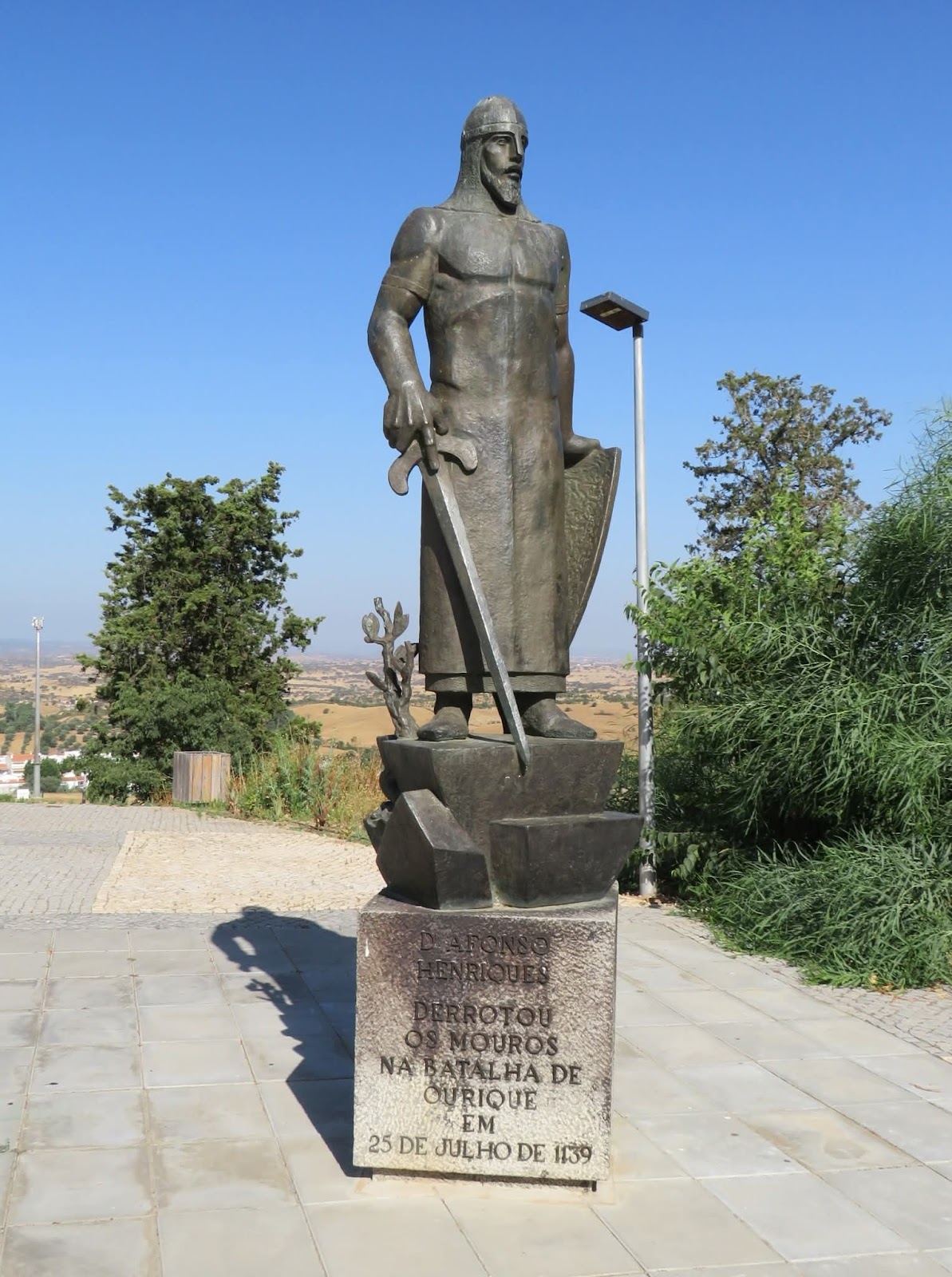
The viewpoint is entered through a small pointed arch installed during twentieth-century works. Its shape may echo the medieval entrance, but it is a modern construction rather than a surviving castle gate. A statue of Afonso Henriques, the first king of Portugal, stands at the viewpoint and commemorates his traditional command of the Christian forces at the Battle of Ourique in 1139.
Water Reservoir
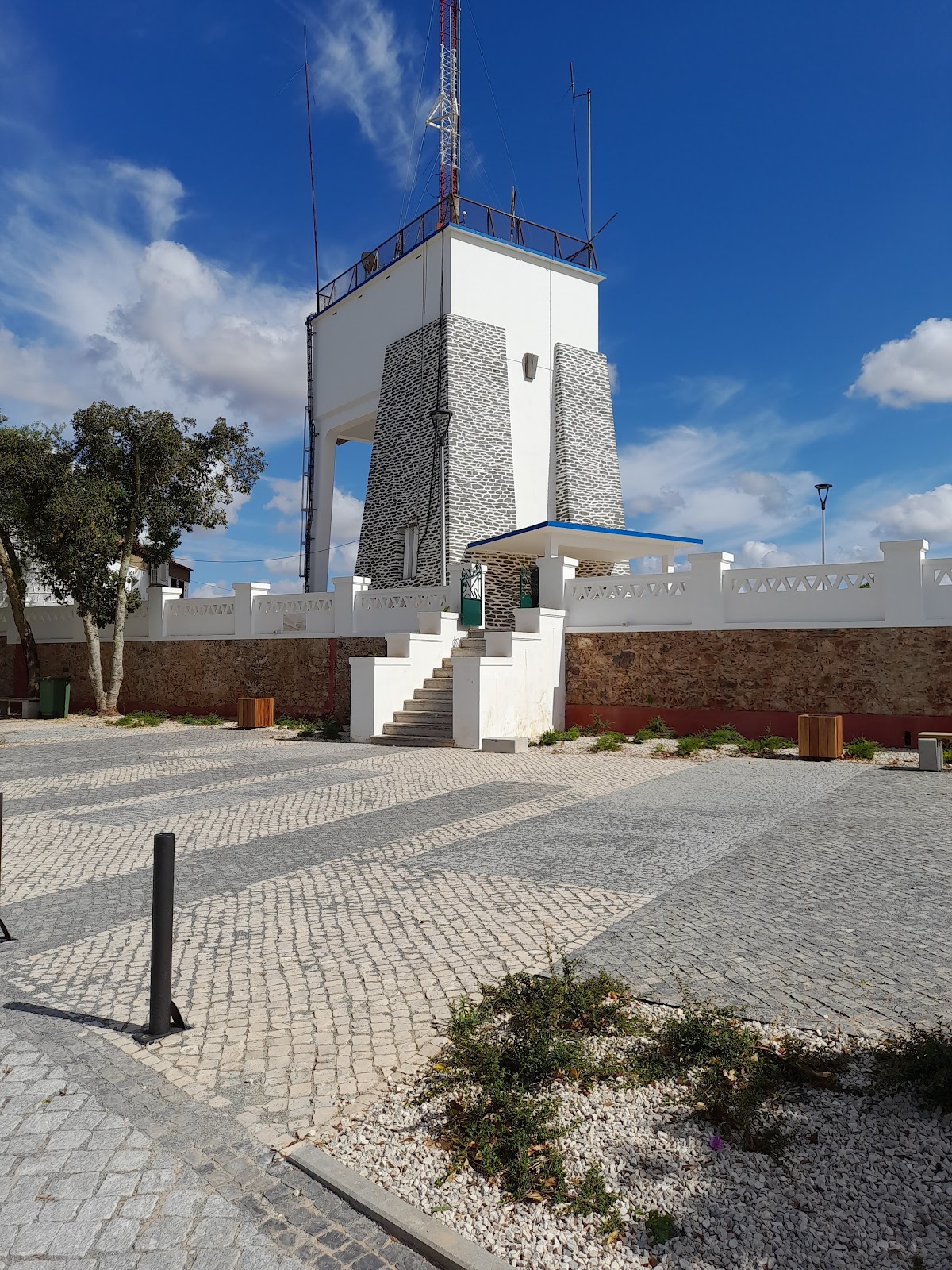
A modern quadrangular water reservoir occupies the approximate position where a medieval tower may once have stood. The reservoir is a tank for storing water and belongs to the twentieth-century transformation of the hilltop. The relationship between the modern structure and the earlier tower remains hypothetical, as does the precise form of the medieval citadel.
If the citadel followed common Gothic fortress models after its medieval reconstruction, it may have had an oval plan. In that possible arrangement, a keep, the principal fortified tower of a castle, would have been attached to the enclosing wall beside the main entrance. This proposed layout cannot be treated as a secure reconstruction of Castelo de Ourique.
Retaining Wall and Archaeological Evidence
Northern Slope Wall
Archaeological investigation uncovered a retaining wall approximately three metres high on the northern side of the hill’s slope. It was built in taipa, or rammed earth formed by compacting successive layers of earth inside temporary formwork. Objects from the sixteenth and seventeenth centuries were found around the wall. Beneath it were fifteenth-century ceramic fragments and a sixteenth-century coin that may have been issued during the reign of Manuel I.
The wall provides physical evidence for the later use and reshaping of the hill, while the material beneath it helps place activity in the period after the castle’s principal medieval military role. Its surviving fabric forms part of the altered landscape now occupied by the viewpoint and cannot by itself establish the complete construction history of the earlier fortress.