Castell de Verdera: Medieval Fortress and Monastic Stronghold in Spain


Site at a Glance
- Rating
- 4.7
- Popularity
- Low
- Country
- Spain
- Primary era
- Medieval
- Eras represented
- Medieval
- Civilizations
- Crown of Aragon
- Site type
- Military
- Remains
- Castle
On this page13 sections
History
Castell de Verdera is a medieval fortress in Spain, rising on the summit of Sant Salvador Saverdera in the Serra de Rodes. Its earliest recorded mention dates to 904, while archaeological evidence indicates that the ridge had been fortified earlier, possibly before the ninth century. The first major phase, from the ninth century to the late thirteenth century, created a mainly Romanesque stronghold, a medieval style associated with thick masonry, semicircular arches, and basilical church plans. The fortress was first a comital possession, meaning one associated with a count, and later came under monastic control. A second phase began in the last quarter of the thirteenth century, when the Counts of Empúries enlarged and strengthened it. From this period, it was widely known as Castell de Sant Salvador after its church.
Comital foundation and monastic rule
In 974, Count Gausfred I of Empúries-Roussillon gave the fortress and its surrounding properties to the monastery of Sant Pere de Rodes, a Benedictine monastery that played an important role in the administration and ownership of the castle. The transfer was confirmed by papal bulls in 974 and 990 and by a royal charter issued by the Frankish king Lothair in 982.
Gausfred’s successor, Count Hugh I of Empúries, later occupied properties belonging to the monastery, including the castle. Pope Benedict VIII ordered him to restore the seized lands and threatened severe spiritual penalties if he refused. Hugh appears to have returned the domains after reconciling with the monastery in 1022, and later donations confirmed the arrangement.
The territory controlled from Castell de Verdera extended to the nearby fortress of Bufalaranya, then called Roca Negra. This military network helped defend Sant Pere de Rodes and preserve the monastery’s autonomy, making the castle one of its most valuable possessions. The church of Sant Salvador probably originated during this period and remained under the monastery’s ecclesiastical authority.
The Empúries rebuilding
Disputes between the Counts of Empúries and the abbot revived in the late thirteenth century. Shortly before 1283, Count Ponç Hug IV seized the fortress while attempting to recover comital power. His policy also brought him into serious conflict with the bishop and with King James II.
An agreement of 27 February 1283 required Ponç Hug IV to confirm Gausfred’s donations, while allowing the counts to occupy the castle in wartime. In July of that year, the approaching war with France, which arose from the Sicilian question, prompted the count to rebuild the old fortress and renew its defenses. The resulting arrangement functioned as a condominium, a jointly held lordship or jurisdiction. The counts occupied the castle permanently, while the monastery retained legal authority.
French forces captured the fortress in June 1285 during the crusade against the Crown of Aragon. They held it for about six months before being expelled, after which Sant Salvador returned to Ponç Hug. The struggle over possession continued. In 1299, the abbey brought the dispute before the episcopal courts of the bishop of Girona. A judgment issued in 1301 condemned the count and threatened excommunication. An agreement of 1303 required him to renounce his seizures, except for Sant Salvador, which remained under tacit joint jurisdiction and comital control. In his 1309 testament, Ponç Hug compensated the monastery for occupying the castle and promised guarantees of non-aggression.
Later counts and changing ownership
Ponç Hug V, known as Malgaulí, later transferred the castle’s castellany, the office and jurisdiction responsible for administering a castle, to the Satrilla family. They retained it until 1374, when Count John I of Empúries recovered full control. John I had a particular attachment to Sant Salvador and built a personal residence there, probably within the keep, the fortress’s principal strong tower, which could also contain residential rooms.
After the second dynasty of the Counts of Empúries ended in 1402, the county passed to the Crown and was later pledged to the Diputació del General, the representative governing body of the Catalan principality. By 1474, the castle appears as a possession of the monastery. By the late seventeenth century, however, ownership had returned to the holders of the County of Empúries, then the Dukes of Medinaceli.
Lookout, destruction, and preservation
During the late medieval and early modern periods, the fortress served as a lookout against piracy, including attacks by Barbary pirates. Its strategic value declined as firearms and military methods developed, although it continued to function as a lookout until at least the sixteenth century.
In 1708, during the War of the Spanish Succession, the conflict over the Spanish monarchy, the castle was destroyed or made unusable for military purposes. Much of its construction was demolished. Tradition attributes the action to the French marshal, the Duke of Noailles, during his expedition against Sant Pere de Rodes. The purpose may have been either to disable the fortress or to prevent its capture by French forces.
By the nineteenth century, Castell de Verdera was uninhabitable and had no military use. The monastery held it when its community was removed during the exclaustration of 1835. After the confiscation and redistribution of monastic property, the castle was claimed and recognized as belonging to the Medinaceli family, which retained it until a recent period. The ruins now mark the boundary between El Port de la Selva, Palau-saverdera, and La Selva de Mar.
Castell de Verdera is protected under Spanish historical-heritage provisions enacted in 1949 and 1988. Catalan cultural-heritage legislation of 1993 lists it as a Cultural Asset of National Interest, and it is also recorded as a Spanish Asset of Cultural Interest.
Traditions and legendary associations
Several traditions surround the fortress and its landscape. One legend says that Charlemagne granted the Count of Empúries the exceptional right to use the formula “by the grace of God” after the count successfully resisted a siege. The Salt de la Reina precipice is linked to several different stories about a noblewoman or Moorish queen who plunged into the ravine on horseback. Another version connects the place with a count’s daughter, a shepherd, and a child later associated with the founders of Sant Pere de Rodes.
Other legends tell of a sinful Countess of Empúries and connect the mountain with the Holy Grail cycle, the body of medieval and later stories about the sacred vessel associated in Christian tradition with the life and Passion of Jesus. In these interpretations, Sant Salvador becomes Montsalvat, the legendary Grail castle, while Quermançó is identified with Klingsor, a magician in some versions of the Grail tradition. These stories, together with the area’s modern reputation for paranormal phenomena, belong to the site’s later tradition rather than establishing the events they describe as history.
Remains
The ruins occupy the narrow summit of Sant Salvador Saverdera at approximately 670 metres above sea level, the highest point of the Serra de Rodes. The fortress follows an approximately rectangular plan oriented from northwest to southeast, but its walls adapt closely to the summit’s pronounced rocky irregularities. Defensive works occupy the accessible northwest, north, east, and south sides. On the southwest, the castle was built directly against the cliff, with the natural terrace called the Salt de la Reina in this sector.
The Romanesque church
The church of Sant Salvador de Verdera is the principal surviving building from the earlier fortress phase. It dates to the first half of the eleventh century, although its relationship to any earlier church remains uncertain. A document from 1279 also mentions it. The church stands on the highest point of the site, on a small platform at the southern end of the fortified enclosure.
It is a small but monumental-looking basilica, a longitudinal church organized around a central nave and side aisles. The building has three aisles, three semicircular apses, and a portico, or covered entrance porch. The portico connected with the keep, while another entrance opened through the north wall. Substantial sections of the side walls, facade, and portico survive, and the portico’s vault remains standing. The masonry consists mainly of small, poorly finished rectangular ashlar blocks, meaning regularly shaped stone blocks, with more carefully finished work at the corners.
Entrance and western defenses
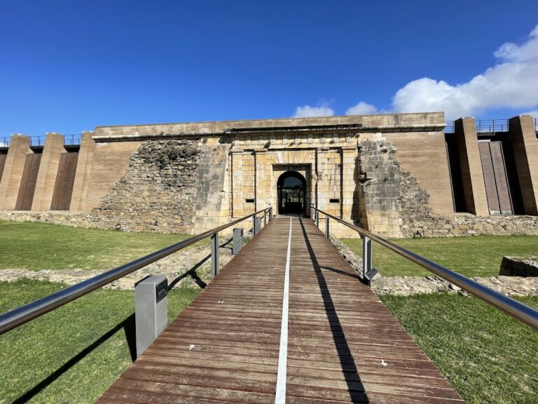
Most of the other identifiable remains belong to the rebuilding and strengthening carried out in 1283. The entrance is on the north side, set within a recess in the wall. A large square tower protected it, while taller semicircular and triangular towers stood farther west, attached to the curtain wall, the main enclosing wall joining defensive towers, and adjusted to the rocky ground.
The gateway retains a double arch and formerly held a portcullis. Until the first half of the nineteenth century, a commemorative stone above the entrance recorded the rebuilding of 1283 and the expulsion of the French crusaders. It displayed the heraldry of Rodes and Empúries. The stone’s present location is unknown, but a drawing and transcription of its inscription survive.
Eastern curtain wall
The eastern defenses preserve a still-imposing curtain wall with three semicircular projecting towers and three irregular rectangular towers arranged alternately. Another rectangular tower stands at the southeastern end. A postern, or small secondary gate, lies beyond the second rectangular tower. The walls and towers contain long arrow slits, narrow openings that allowed defenders to shoot while limiting their exposure.
The eastern wall has a notably regular height, a feature interpreted as evidence that the complex was deliberately destroyed. A section that once connected this side of the fortress with the keep has almost disappeared. The pattern of the 1283 rebuilding has also been associated with the adoption of military architecture of eastern influence that entered western Europe during the Crusades.
Keep and interior enclosure
The keep stood at the southwestern end of the fortress on the cliff edge, adjoining the church facade. Only low wall remains survive. The personal residence built for Count John I of Empúries probably occupied this strong tower, linking the defensive and residential functions of the site.
Inside the enclosure, the ground is broad but highly irregular because of the underlying topography. Sparse structural remains survive among the uneven interior surfaces, and their arrangement is difficult to interpret. The surviving evidence nevertheless places the church, keep, entrance, and perimeter defenses within a compact summit fortress whose plan was shaped by the ridge rather than by a regular level platform.
Water systems and outlying defenses
Northeast of the entrance, outside the main enclosure, is a large cistern covered by a pointed vault. Beside it are remains of an additional defensive work, possibly a palisade, together with a water conduit that carried water toward Sant Pere de Rodes. These features extend the fortress’s physical infrastructure beyond its principal walls.
South of the fortress, on Sant Genís, also called Eagle Hill, stand the remains of a separate round outlying tower. This detached defensive tower lies beyond the surviving main site plan and formed part of the wider system of observation and protection associated with the summit.
Summit and Salt de la Reina
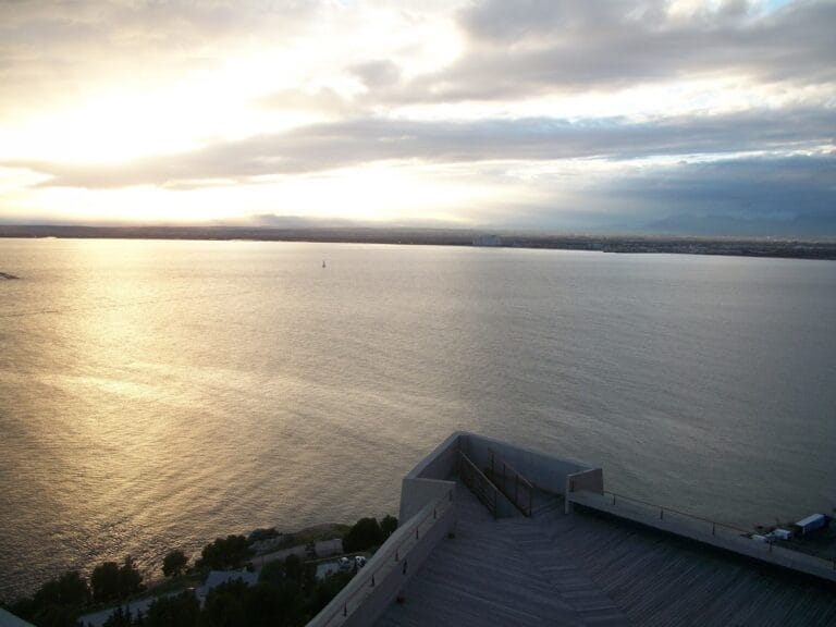
The Salt de la Reina is a natural terrace on the southern side of the castle, opening over the precipice. Its physical setting gave rise to the local stories of a queen or noblewoman who supposedly leapt into the ravine on horseback. The summit also commands extensive views over the Empordà plain, the Gulf of Roses, the Montgrí Massif, the Medes Islands, the eastern Pyrenees, the Albera range, the Roussillon plain, and the Cap de Creus peninsula. In exceptionally clear conditions, the view extends toward the Montseny range, Provence, and Mallorca.