Cartal: A Multi-Period Settlement and Roman Fort in Ukraine
Site at a Glance
- Popularity
- Very Low
- Country
- Ukraine
- Primary era
- Classical
- Eras represented
- Classical
- Civilizations
- Roman
- Site type
- Military
- Remains
- Fortified Town
On this page18 sections
History
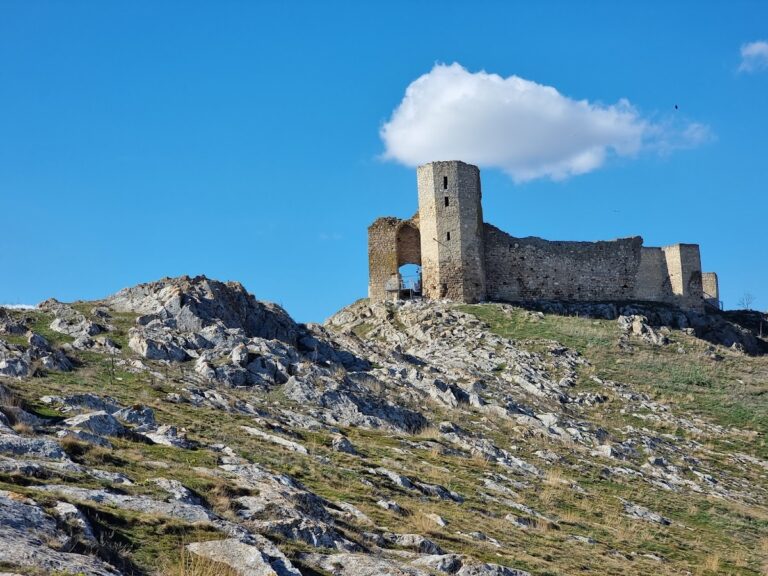
Cartal is an archaeological settlement and Roman fort on Stone Hill near Orlivka, in Ukraine. Its layers include Eneolithic (Copper Age) activity from the fifth to fourth millennia BCE and a settlement broadly dated to the eighth through sixth centuries BCE. Later phases include Middle Hallstatt, an early Iron Age culture, Getic activity in the fourth century BCE, and Roman-Dacian occupation in the second and third centuries CE. Together, these remains represent activity over nearly six millennia, though not necessarily continuous settlement.
Early settlement and cultural phases
Evidence from Cartal spans the Bronze Age and early Iron Age as well as its more clearly defined cultural phases. The Getae and Dacians were ancient peoples of the lower Danube and neighboring regions. For many years, the site was understood chiefly as the location of the Roman fort called Aliobrix. Its identification with either of two Roman posts assigned to the left bank of the lower Danube remains uncertain.
Getic defenses and Roman presence
From the first century BCE, Cartal formed part of a defensive network associated with Geto-Dacian groups and intended to protect local inhabitants from Roman raids. The site has also been viewed as a bridgehead in a Roman-built line of defenses along the Danube, designed to protect the empire.
The fort’s garrison included detachments of the First Italic and Fifth Macedonian legions, major units of the Roman army. Ships belonging to the Flavian Moesian Fleet, a Roman naval force linked to the province of Moesia along the lower Danube, were stationed nearby. Inscribed fragments of household objects found in the nineteenth century refer to the Fifth Macedonian Legion, which guarded a Danube crossing toward the Black Sea coast.
End of occupation and archaeological investigation
Cartal had ceased to exist as a settlement by about the third century CE. The Roman governor Tiberius Plautius Silvanus Aelianus may have captured and destroyed the fort during a campaign. Traces of a major fire at the site are consistent with this possibility.
Modern study of the area began in the 1960s, after a hoard of electrum coins associated with the Greek city of Cyzicus was accidentally found at Orlivka in 1967. The coins, made from an alloy of gold and silver, were inside a bronze wine-pouring jug and date from the early fifth to late fourth century BCE. Small-scale excavations on Stone Hill began in the early 2000s through the Odesa Archaeological Museum of the National Academy of Sciences of Ukraine. Recognition of the deeper sequence of settlements and burials led to more extensive, regular excavations under archaeologist Ihor Bruyako, the museum’s director.
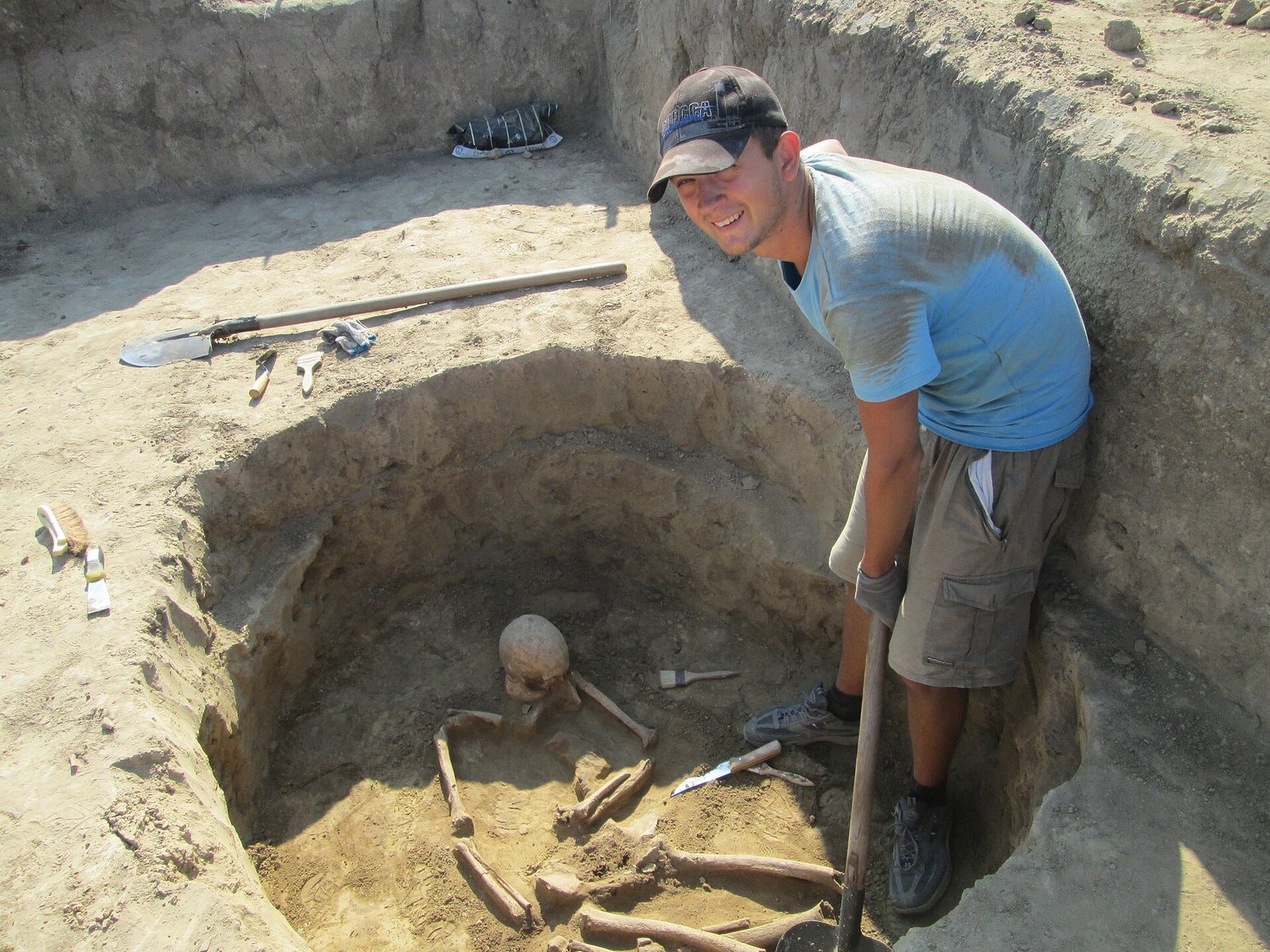
Excavations in 2015 uncovered several skeletons in the nearby Cartal Thracian cemetery. Students from Izmail State University of Humanities joined research in 2016. A month-long expedition in August 2019 brought together that university, the University of Lower Danube in Romania, Ion Creangă State Pedagogical University in Moldova, and the Odesa Archaeological Museum. Cartal is designated an archaeological monument of national importance and is also described as a historical monument. Stone-quarrying has substantially damaged the site.
Remains
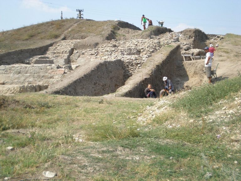
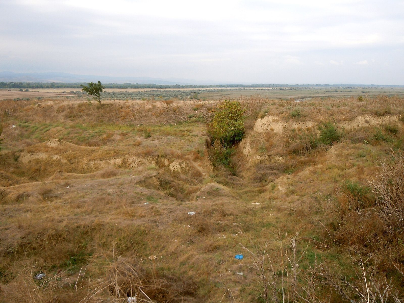
The archaeological complex covers just under two hectares on Stone Hill, about 1.5 kilometres from Orlivka. The hill is bordered on three sides by the Danube and Cahul rivers, their channels, and Lake Kartal. The surviving evidence includes defenses and residential areas, along with burials and finds from several periods.
Fortified settlement
Ditch and defensive wall
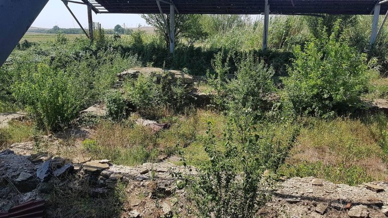
A substantial ditch that once encircled the fortified settlement is still discernible. In the northwestern part of Stone Hill, a wall was built with two stone outer faces and clay packing between them. A defensive tower apparently stood in this area.
Residential remains
Residential remains occur in the northern and northwestern parts of the site. Builders laid unfired or lightly fired bricks directly on the ground, without foundations, and used slate-stone courses at the base of the walls. The roofs were tiled, and the walls received rudimentary plaster. In some areas, tightly compacted floors were coated with light-colored clay. Rods, poles, and other building materials point to the presence of structures made using a different construction method as well.
Pottery and other finds
Vessels
Pottery includes one-handled cups, bowls, and pots associated with Getic and Roman cultures. These vessels were generally wheel-made from grey clay, and almost all bore wavy linear decoration. Imported finds include large transport jars and fine red-coated vessels dating from the first to third centuries CE.
Tools, coins, and relief
Excavated objects include bronze and iron tools, fragments of millstones used to grind grain, and remains of a whetstone used for sharpening. Copper and silver Roman coins have also been recovered, including coins made in the early first century CE. A fragment of a relief depicts Diana, the Roman goddess associated with hunting.
Burials and surrounding archaeological sites
Elongated pit
One pit was nearly oval and extended along a north-south axis, with walls that widened toward the bottom. It measured 1.85 by 2.05 metres and was one metre deep from the modern surface; its outline had been recorded half a metre below that surface. Human bones lay mainly beside the pit walls, and the animal remains included an incomplete dog skeleton.
Tiered collective burial
A collective burial occupied a shallow pit of ordinary utilitarian form. At a depth of 0.7 to 0.75 metres, one skeleton lay on its left side, strongly turned face-down, with arms and legs bent. Two more lay beneath it, one above the other. The lowest was on its back, knees bent and legs directed to the right. At 0.9 metres, another person lay face-down, arms bent under the body and legs flexed; the fibulae lay to the skeleton’s left, toward the south.
A dog skeleton rested on its right side on a ledge at 1.2 metres, its muzzle pointing south. Bones and dog skulls from at least six individuals occurred in different parts of the pit, along its floor and walls; stones filled the northern sector. Thin-walled, burnished tableware fragments lay at the level of the skeletons. Beneath them and in the bottom fill, Middle Hallstatt pottery predominated, including black-burnished vessels and cooking pots.
Burial 183
Burial 183 contained three anatomically complete skeletons, found just above the bottom of a pit at about 1.8 metres. They lay without a discernible arrangement and were probably thrown into the pit.
Paired burial of children
A pair of children was buried in the northeastern part of a pit, 1.15 to 1.2 metres below its edge. The older child lay farther west, crouched on the left side and turned strongly onto the stomach. Its head pointed north with a slight turn east; the other child’s head also pointed north, but with a slight turn west.
Burial provisionally assigned to the Cimmerian period
A burial uncovered in 2026 was provisionally assigned to the Cimmerian period. The Cimmerians were an ancient people associated with the Black Sea region. The grave contained horse harness with bronze and iron components, along with other grave goods.
Nearby cemetery and settlement remains
A Thracian flat-grave cemetery lies near the complex. In a flat-grave cemetery, burials are placed in the ground rather than beneath raised mounds. Between Cartal and Orlivka, archaeologists also identified an unfortified settlement, several small barrows, or burial mounds, and another flat-grave cemetery.