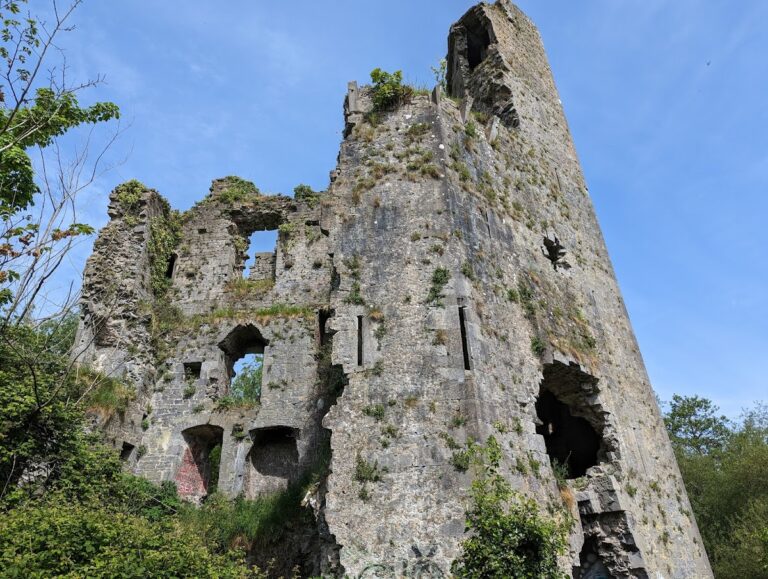
Carrigogunnell: A Medieval Irish Castle on the River Shannon


Site at a Glance
- Rating
- 4.5
- Popularity
- Low
- Country
- Ireland
- Primary era
- Medieval
- External website
- Open
- Eras represented
- Medieval, Early Modern
- Civilizations
- Irish
- Site type
- Military
- Remains
- Castle
On this page15 sections
History
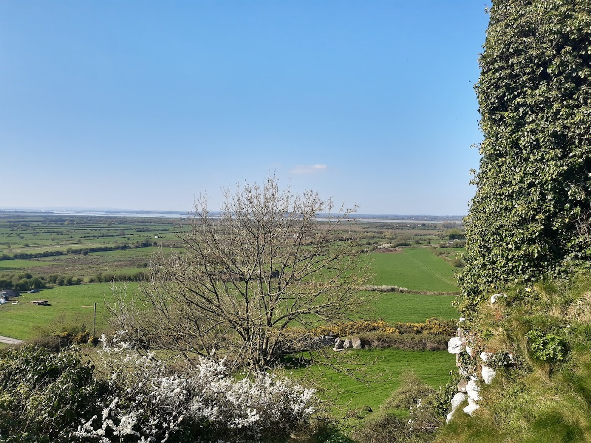
Carrigogunnell is a medieval Irish castle in County Limerick, Ireland, occupying a high rock above the River Shannon and the surrounding lowlands. The fortification dates from at least the early thirteenth century and was later associated with Gaelic lordship, Tudor conquest, and the Williamite War in Ireland.
Early references and O’Brien control
The site and its surrounding territory appear in the Annals of Innisfallen under the name “Carraic Ui gConaing” in 1209. That year, King John, the English king who ruled from 1199 to 1216, confirmed the property to Donnchad Cairbreach O’Brien, King of Thomond. Thomond was a medieval and early-modern lordship and kingdom in north Munster ruled by the O’Brien dynasty. Donnchad was also an ally of the English king’s Norman interests.
Carrigogunnell then disappears from the historical record for more than a century. A branch of the O’Brien family appears to have crossed the Shannon and settled in the district around 1336, although the date when its members obtained the castle is uncertain. The descendants of Tadhg na Glenore O’Brien, King of Thomond in 1426, probably did not acquire the site or substantially build the castle before about 1450.
Later tradition claimed that the Knights Templar, a medieval Catholic military-religious order, had built or garrisoned Carrigogunnell. That attribution is unsubstantiated. The Irish antiquarian Thomas Westropp instead connected the castle with the Gaelic Dalcassians, a dynastic group particularly associated with Thomond. He judged its defenses more suitable for a fortified residence than for a fortress intended to withstand a major assault or siege.
The Tudor conquest and the events of 1536
Carrigogunnell became prominent in the historical record in 1536, when Leonard Grey, 1st Viscount Grane and Lord Deputy of Ireland, marched against it. The Lord Deputy was the chief representative of the English Crown in Ireland. Grey described Carrigogunnell as a very strong castle on a high rock and “the key of all the county.”
During the attack, Mahon “Mat” O’Byrne surrendered the castle on the condition that the government would hold it itself. That undertaking was broken. Government forces attacked, captured a tower on the night of 22 August, and compelled the keep to surrender the following morning. Edmond Cahill, the warder, and the garrison were taken to Limerick, tried, and hanged.
Grey was preparing to give Carrigogunnell to Donough O’Brien, apparently disregarding his promise to hold it for the government. A plot attributed by their enemies to Edmond Sexton and his wife returned the castle to Mahon O’Byrne’s warder. The Crown argued that the O’Briens held the property from Richard de Clare, known as Lord Clare, and that it had therefore reverted to the Crown. Donough O’Brien was later deprived of the castle for extortion, while his son Brian Duff was confirmed in possession of it and of much of the district that later formed the barony of Pubblebrian.
The campaign also made Carrigogunnell the setting for a massacre. Grey’s own report acknowledged that women and children were among those killed. The episode illustrates how the Tudor conquest of Ireland could treat the killing of non-combatants as a military achievement.
Later occupants and destruction
A later historical account identifies members of the O’Connell family as occupants before the Fitzgeralds obtained the castle. Carrigogunnell was not used during the Wars of the Three Kingdoms, the series of conflicts fought in Britain and Ireland from 1640 to 1651.
The castle’s last owner, Donough Brien, prudently sold it to Michael Boyle, who later became Archbishop of Dublin. Captain Wilson then took possession and built a stable at the site. By this period the property included the castle, a bawn, or enclosed defensive courtyard, several thatched huts, and a salmon fishery. The complex had fallen into a neglected condition.
Carrigogunnell returned to military use during the second siege of Limerick in the Williamite War, the conflict between supporters of the deposed Catholic king James II and supporters of William III and Mary II. In August 1691, 150 men supporting James II occupied the castle. The Dutch general Godert de Ginckell, who commanded Williamite forces in Ireland, sent Lieutenant-General Scravemore against it with a strong force and four guns. The garrison surrendered and was taken as prisoners of war to Clonmel.
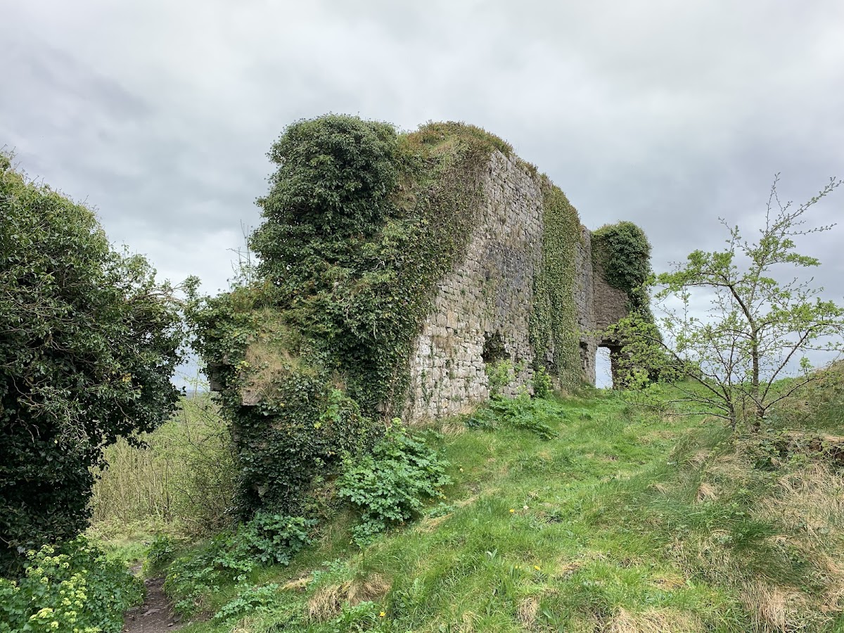
In September 1691, de Ginckell ordered the castle to be slighted, meaning deliberately damaged so that it could no longer serve effectively as a stronghold. Carrigogunnell was blown up and has remained a ruin since that destruction.
Name and legend
The name appears in several historical forms. It was written as “Carekogunyel” during the reign of Henry VIII, as “Carrig Gunning” on maps made around 1570–1580, and as “Carykgonyn” in Mercator atlases published in 1606 and 1636. John Speed and other English cartographers used forms such as “Cargonin” and “Cargonian.” The form “Carrigogunnell” is recorded from 1536.
The name has traditionally been associated with the Irish expression meaning “rock of the candle.” Other proposed derivations connect it with the ancient local tribe Ui Chonail Gabhra, also associated with Ui Fidgenti, with the Ui Chonaing, or with “Carrig-O-Gloinneal,” interpreted as “Rock of the O’Connells.” These tribal explanations remain uncertain because there is no clear evidence that the relevant groups controlled the land around the castle.
Local tradition tells of a gigantic and frightening hag named Grana who lived on the rock before the castle was built. Each night she supposedly lit an enchanted candle on the summit, and anyone who saw it was believed to die before sunrise. In one version, Regan, one of Finn’s men, escaped the curse with a magic cap given by the magician Luno of Lochlin. The hag then supposedly threw a large erratic stone, called Clough-a-Regaun or Cloghregan, at him. Other versions attribute the deed to Saint Patrick, and place the story variously in the third or fifth century.
Remains
Carrigogunnell occupies an outcrop of volcanic trap rock above the lowlands of County Limerick and the River Shannon. Its outer ward covered approximately 1 acre, or 0.40 hectares, and had an approximately harp-shaped plan. The castle buildings were made from well-cut local limestone rather than from the volcanic rock forming the outcrop. Within the outer enclosure, the upper ward was set into the northwestern corner.
Outer ward and entrances
Outer enclosure
A tower stood at the southwestern corner of the outer ward. Much of the western wall had been removed by about 1908. The outer defenses had walls under 5 feet, or 1.5 metres, thick, with no towers at the junctions of the walls. Their irregular arrangement contributed to Westropp’s interpretation of Carrigogunnell as a fortified residence rather than a purpose-built fortress for resisting assault or siege.
Gateway and sally port
The principal gateway was on the south side, approached by a shallow slope. It had no flanking towers and served as the only main exit. A sally port, a small exit used by defenders, led westward toward the crags of the rock formation.
Northeastern building
A large two-storey building occupied the northeastern corner of the outer ward. It has been suggested that this was a chapel, although the surviving evidence does not clearly establish that function.
Upper ward and residential buildings
Western range
A range of two-storey buildings extended about 100 feet, or 30 metres, along the western wall of the inner ward. The buildings display at least two construction phases, indicating that this part of the castle developed over time.
Keep
The keep stood in the northwestern corner of the inner ward. It rose more than 50 feet, or 15 metres, and contained five storeys and a spiral staircase. Its architectural features indicate a fourteenth- or fifteenth-century date. By about 1908, only the outer wall and parts of the southern wall remained.
Residential building
Accommodation lay immediately east of the keep, while a tower and staircase stood on the south side of the inner ward. East of the keep was a three-storey residential building, probably constructed in the sixteenth century.
Seventeenth-century complex
By the seventeenth century, the property extended beyond the principal castle buildings to include a bawn, several small thatched huts, Captain Wilson’s stable, and a salmon fishery. These elements formed part of the occupied estate before the castle’s military destruction in 1691, after which the surviving remains continued as a ruin.