Camber Castle: A Tudor Coastal Artillery Fort in England
Site at a Glance
- Rating
- 4.3
- Popularity
- Low
- Country
- United Kingdom
- Primary era
- Early Modern
- External website
- Open
- Eras represented
- Early Modern
- Civilizations
- English
- Site type
- Military
- Remains
- Fort
On this page13 sections
History
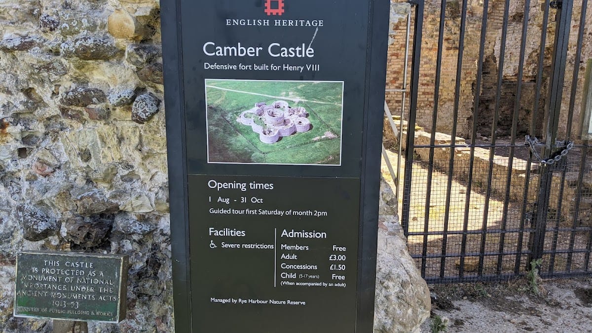
Camber Castle is a Tudor coastal artillery fortification in England, near Rye, built to protect the Sussex coast against threatened French attack. Its main development took place between 1512 and 1544, during the period when Henry VIII commissioned coastal forts known as Device Forts to defend England against invasion and naval attack. The castle stood near the Camber, at the mouths of the Brede, Rother, and Tillingham rivers, and was approximately 1.5 kilometres from both Rye and Winchelsea.
Origins and Tudor expansion
Rye and Winchelsea belonged to the Cinque Ports, a medieval confederation of south-eastern English ports that supplied ships and crews for royal service. Their harbours formed part of the strategic setting for the castle, although Winchelsea Harbour had already silted up by the sixteenth century and silting increasingly affected Rye and the Camber anchorage.
A first fortification may have been built shortly after 1486 by Sir Richard Guldeford, Master of the Ordnance. Henry VII had reportedly granted him the manor of Higham in return for constructing a tower to protect the anchorage. The tower’s construction is not confirmed by surviving evidence. In 1512, however, Henry VIII ordered an artillery tower and a new bridge at Camber as tensions with France increased. Edward Guldeford, Richard’s son, carried out the work between 1512 and 1514 at a cost of £1,309.
In 1539, fears of invasion from France and Spain prompted Henry VIII to strengthen England’s coastal defences. Camber Castle was substantially enlarged under this programme. The first expansion lasted from 1539 until autumn 1540 and was directed by the Moravian engineer Stefan von Haschenperg. Philip Chute, John Fletcher, and William Oxenbridge acted as commissioners, with Oxenbridge serving as paymaster. Chute became captain, and the garrison numbered 17 men by the end of 1540.
This first design proved unsatisfactory. The defensive arrangement limited the guns’ ability to fire on ships, the entrance obstructed part of the field of fire, and the high water table probably created damp problems. The design also differed markedly from other regional Device Forts, and the work may have been hurried by pressure from Henry VIII. Rebuilding began in summer 1542 and continued until August 1543, probably on the king’s orders. Oxenbridge remained paymaster and apparently became master of the works, while von Haschenperg continued as engineer almost until completion. This phase cost approximately £10,000.
Military use and declining importance
By its completion, the fort was already militarily outdated because European fortification design had shifted from circular forms towards acute-angled bastions, projecting fortified positions designed to hold artillery and cover surrounding walls. Camber Castle nevertheless remained an operational artillery fort through much of the sixteenth century. Its garrison numbered 24 men under Chute in 1540 and 28 men with a captain after 1542. The castle initially held between 26 and 28 artillery pieces, although its usual armament had fallen to approximately nine or ten guns after 1568.
In 1568 the castle also held 140 longbows and 560 arrows, probably for the local militia, together with substantial numbers of polearms. By 1614, 46 arquebuses and muskets had replaced the declining use of longbows. The castle may have seen action during the French attack on the Sussex coast in July 1545, but its military value soon diminished. Silting blocked the Camber and surrounding harbours, the coastline moved seaward, and the fort eventually stood well inland. Marsh reclamation and ballast dumped by ships accelerated these changes.
The decline of Winchelsea and Rye, peace with France in 1558, and the redirection of English military attention towards the Spanish threat further reduced the castle’s strategic importance. From 1553 its garrison remained between 26 and 27 men, including 17 gunners. Thomas Wilford was captain by 1570. Maintenance became increasingly difficult. The gun platforms were in severe decay in 1568, Elizabeth I authorised £171 for repairs in 1584 amid renewed invasion fears, and a survey in 1594 estimated that a further £95 was required.
In 1588, Father Darbysher and the Spanish-paid spy Roger Walton planned to surrender the fort to invading French and Spanish forces. The conspiracy failed. In 1610 Peter Temple became captain, and between 1610 and 1614 the garrison was reduced to 14 soldiers, including four gunners. The north and south bastions were filled to form solid gun platforms around 1613 and 1615, while an earthwork called the Rampire was built against the southern corner. Sir John Temple became captain in 1615 and had been replaced by Robert Bacon by 1618.
Closure, destruction, and later history
By the early seventeenth century, the fort was obsolete and approximately 3.2 kilometres from the sea. Closure was proposed in 1623, and Charles I ordered its demolition in 1636. The garrison, commanded by Captain Thomas Porter, left in 1637, followed by the artillery.
When the English Civil War began in 1642, the conflict between supporters of the monarchy and Parliament, the incompletely closed castle was still being used as a royal munitions store. Parliamentary forces removed its weapons and stores to Rye. In 1643 they dismantled much of the fortification by stripping the roof, blocking the gunports, and destroying the living quarters. The castle was consequently not used by Royalist forces during the Second Civil War in 1648.
A royal survey after the Restoration, the return of Charles II to the throne in 1660, described the castle as a ruin. During the eighteenth and nineteenth centuries, the ruins became a popular place for picnics and were depicted by J. M. W. Turner. Francis Grose attributed the fort’s decline to changes in the local harbours and the strength of the Royal Navy.
In 1804, Lieutenant Colonel John Brown examined whether the keep could be converted into a Martello tower during the threat from Napoleonic France. The proposal was not implemented, although the surrounding coastline was substantially strengthened. A proposal in 1931 to turn the keep into a golf clubhouse was also abandoned, and the clubhouse was built at nearby Castle Farm instead.
The castle remained privately owned and open to visitors in the early twentieth century. A Victoria County History research team surveyed it in 1935, producing an early historical and structural analysis published in 1937. During the Second World War, the British Army used the castle, probably as an early-warning post equipped with anti-aircraft searchlights. Starfish and Naval decoy sites were established north of the castle to divert German bombers from Rye. Trenches were dug in the north bastion, and military training may have taken place around the site.
Post-war archaeological interest led to a Ministry of Works research programme on Device Forts from 1951. Martin Biddle carried out an exploratory survey in 1962, and the ruins were closed in 1963 for more extensive excavations. Further excavations took place during the 1970s and early 1980s. The state took the castle into guardianship in 1967, and conservation from 1968 concentrated on protecting the internal brick walls and the cores of the walls. The Department of National Heritage bought the property from its private owners in 1977, and English Heritage took over its management in 1984.
A final assessment of the archaeological work formed part of a reopening programme in 1993. The castle reopened in 1994 after an extensive conservation programme carried out between 1968 and 1994. It remains an unusual example of an unmodified Device Fort and is protected under English law as a Grade I listed building, a structure of exceptional historical or architectural interest.
Remains
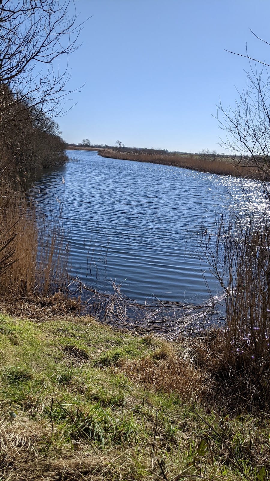
Camber Castle lies on the Brede Level, a broad reclaimed plain between Rye and Winchelsea, about 1.5 kilometres from the sea. The surrounding pasture is flat and only slightly above sea level, with ridges formed by the retreating coastline. Castle Water lies to the east, occupying a large twentieth-century gravel pit that later flooded to form a wetland nature reserve. A defensive earthwork approximately 1.8 metres high runs along the southern and eastern sides. It probably once carried a stone wall and was intended to protect the fort when the sea was much closer.
Overall form and materials
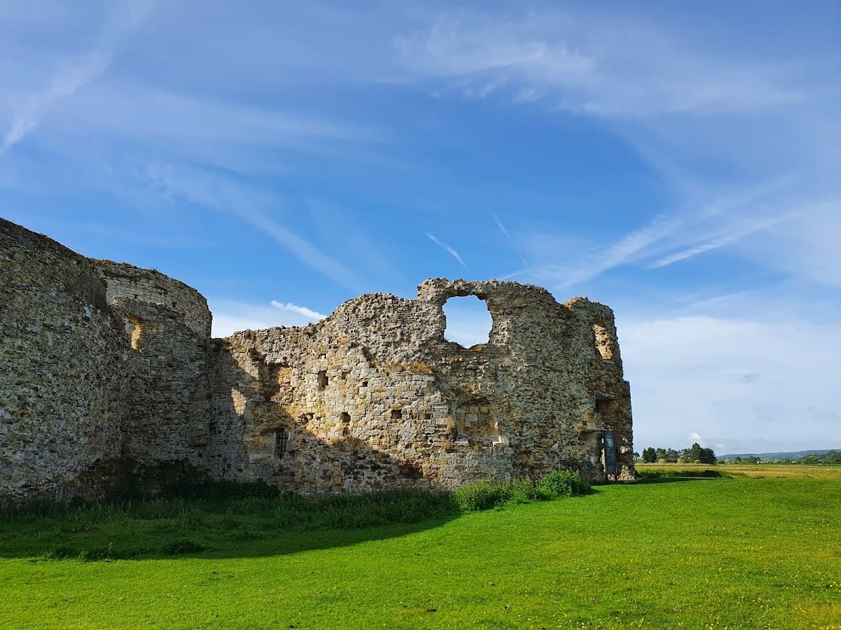
The three-storey castle has changed little since its completion in 1544 and incorporates elements of the three principal building phases of 1512–1514, 1539–1540, and 1543–1544. It is roofless but still rises to approximately 18 metres and covers about 3,000 square metres. The earliest tower was built from fine-grained yellow sandstone. The later expansion used yellow and grey sandstone, with imported Caen stone for finer details. Ironstone, siltstone, and brown sandstone rubble and boulders formed the wall cores, with some material coming from local cliffs.
The outer defences formed an octagonal wall linking four stirrup towers, distinctive towers with flat fronts and curved backs, and four later bastions. The wall was built during the second phase and reinforced during the final phase with an additional exterior facing 2.4 metres thick. It originally carried gun embrasures and parapets. A two-storey gallery ran around the inner side of the outer wall and provided relatively spacious barrack accommodation. Only its ground floor survives, with windows opening onto the courtyard.
Entrance and central keep
Entrance bastion
The entrance was formed by an entrance bastion. Its core was built during the second phase as a square, single-storey structure measuring 15 by 10.5 metres. It was later extended forward by 9 metres to create a circular bastion and gained another storey during the third phase. Most internal walls have been destroyed. The ground-floor chambers served administrative purposes and may also have housed the deputy captain. The first floor contained higher-status rooms for the captain, with large windows, open fireplaces, and a private garderobe, a latrine built into the castle wall. Much of this storey is lost.
A German cocklestove, a tiled stove used to heat interior rooms, was probably installed in Philip Chute’s living quarters. It was decorated with images of Landsknecht soldiers and Protestant German military leaders, of which only fragments survive. A raised causeway extends a short distance southwest from the outer earthwork before disappearing into the sand. Marks from pits dug in the early seventeenth century to obtain material for filling the bastions survive around the outer parts of the castle.
Central keep
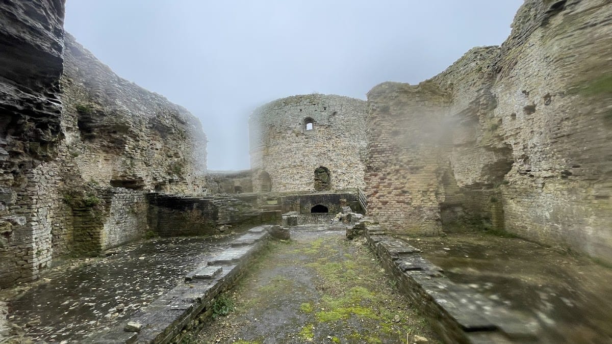
The central keep developed from the original round tower, incorporating 6.7 metres of its earlier walls. That first tower had ten ground-floor gunports within walls 3.05 metres thick, and the gunports were blocked during the second building phase. The keep originally had a parapet and flat roof for artillery. During the third phase, the roof was changed to a pitched or ridged form and the guns were moved to the outer bastions.
The brick-built ground floor contains a brick- and stone-lined well. Two small fireplaces were not intended for cooking, and the final keep was probably never used as living accommodation. Windows were added to the first floor during the final phase. They were not gunports, but had bars and shutters that could be secured during an attack.
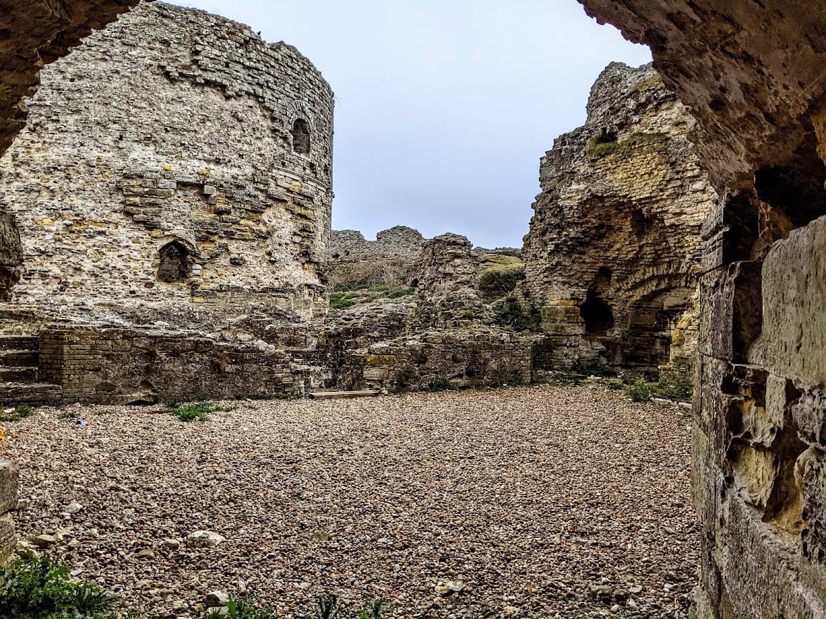
A vaulted underground ring passage, only 1.9 metres high, ran around the outside of the keep. Covered radial passages connected it with each bastion, although these passages are now ruined. Other underground passages led from the entrance bastion beneath the castle walls to the exterior, possibly providing an emergency escape route or allowing attacks against besiegers. A cobbled courtyard surrounded the keep and separated it from the outer defences. It contained a well in its northwestern corner.
Stirrup towers, bastions, and earthworks
Stirrup towers
The four stirrup towers are two storeys high and measure approximately 6 by 6.2 metres internally. Their walls are 0.8 metres thick, with flat fronts and curved backs. They originally carried gun platforms and had inward-facing gunloops through which defenders could fire into the courtyard when necessary.
Outer bastions
The four later bastions were built around the stirrup towers during the third phase. Each is approximately 19 metres wide internally, projects 12 metres beyond its associated stirrup tower, and has walls 3.6 metres thick. Most contained a single internal gun room with a strong gun platform above. The western bastion instead served as a kitchen and contained two circular ovens and other cooking facilities. The bastions were formerly connected by a wall-walk and parapets.
Rampire earthwork
The early seventeenth-century Rampire earthwork crosses the southern and southeastern defences. Where earth was piled against the inner face of the castle, the gunports were blocked with stone. The southern stirrup tower and its bastion are partly buried by the earthwork. Together with the surviving outer bank and raised causeway, it preserves evidence of the fort’s changing defensive arrangements as the shoreline moved away from the castle.