Ancient Byblos: A Phoenician Coastal City and Maritime Center in Lebanon

Site at a Glance
- Rating
- 4.8
- Popularity
- Very Low
- Country
- Lebanon
- Primary era
- Bronze Age
- External website
- Open
- Eras represented
- Stone Age, Bronze Age, Iron Age, Classical, Medieval
- Civilizations
- Achaemenid, Canaanite, County of Tripoli, Crusader, Egyptian, Fatimid, Phoenician, Roman
- Site type
- City
On this page25 sections
History
Ancient Byblos is a long-inhabited archaeological city-site in Lebanon, occupied from the early Neolithic and transformed into an urban center during the third millennium BCE. It became a city-state during the Early Bronze Age and later a kingdom, developing into a major commercial and maritime center between Egypt, Mesopotamia, Anatolia, Cyprus, Crete, and the wider Mediterranean. Its history extends through Canaanite, Phoenician, Egyptian, Assyrian, Babylonian, Persian, Hellenistic, Roman, Byzantine, Arab, Crusader, Mamluk, and Ottoman periods.
Neolithic settlement and Bronze Age urbanism
Early settlement at Byblos dates approximately to 8800–7000 BCE, while continuous habitation is dated from about 5000 BCE. The community grew through the Chalcolithic, or Copper Age, when copper objects appeared alongside established stone technologies. Urbanization began in the third millennium BCE, and the enclosed settlement eventually covered approximately 5–7 hectares, with an estimated 200 houses and about 2,000 inhabitants.
Byblos’s position beside the Mediterranean and near the Lebanese mountains connected maritime routes with inland corridors. Its economy rested on seaborne trade, cedar procurement, agriculture, animal husbandry, craft production, and metalworking. Trade with Egypt began by the early Egyptian dynasties and included cedar and other timber, resins, wine, olive oil, metals, textiles, and crafted goods. Egyptian rulers sent gifts and ritual objects to Byblos, while the city maintained a continuing maritime connection with the Nile Valley.
Relations with Mesopotamian centers also began during the third millennium BCE. Byblos exchanged goods and gifts with Ur, Ebla, Mari, and other cities, importing metals and textiles while producing and exporting worked goods. The ruler Ibdati appears in texts associated with Ur, and Yantin-Ammu, also called Inten, maintained relations with Mari. Disruption associated with Amorite expansion occurred around the end of the third or beginning of the second millennium BCE, but trade and urban prosperity later resumed under a new royal dynasty that included Abi-Shemu and Ipy-Shemu-Abi.
Egyptian connections and royal rule
During the Middle Bronze Age, approximately 2000–1550 BCE, Byblos underwent renewed construction, royal-tomb building, and extensive commercial activity. Its rulers retained local authority while adopting Egyptian titles, customs, and artistic forms. Egyptian influence was accompanied by continuing Mesopotamian connections and by trade across the eastern Mediterranean.
Egyptian records refer to Byblos for nearly two millennia, with inscriptions from the Old Kingdom, Middle Kingdom, New Kingdom, and later periods. Expeditions associated with Sneferu, Hatshepsut, Thutmose III, Seti I, and Ramesses II connected the city with Egyptian royal policy. During the New Kingdom, approximately 1550–1300 BCE, Byblos was an Egyptian vassal city-state with its own king. Egyptian administration, military activity, taxation, and trade were closely tied to the city and its harbor.
Thutmose III’s military activity in the Levant was connected with Byblos, where an Egyptian administrative presence and a chapel associated with the Temple of the Obelisks were established. The chapel was later dismantled or replaced under Ramesses II. Fourteenth-century BCE correspondence preserved in the Amarna Letters records repeated appeals by Rib-Hadda for Egyptian military assistance against the Habiru and the rulers of Amurru. After political conflict, authority in Byblos temporarily passed from the king to a civic council and then to another member of the royal family.
Byblos prospered during the Late Bronze Age through its relations with Egypt and the eastern Mediterranean. The peace associated with the treaty of Qadesh between Ramesses II and the Hittite king Hattusili III coincided with renewed diplomatic and commercial activity. The city was also associated with the development of the Byblos syllabic script, a second-millennium BCE writing system whose signs represented syllables. About ten inscriptions were reported, but the script remains undeciphered.
Phoenician independence and the Iron Age
After Egyptian power declined in the eleventh century BCE, Byblos became an independent Phoenician city. Its rulers controlled timber procurement and international trade, while councils of elders, magistrates, aristocratic families, merchants, and officials exercised substantial political influence. The Ahiram sarcophagus bears the earliest known Phoenician alphabetic inscription from Byblos and one of the earliest known long Phoenician inscriptions. The Phoenician alphabet used 22 consonantal signs and later influenced the Greek alphabet.
Relations with Egypt continued during the Iron Age. Royal inscriptions and objects connect Byblos with Abibaal, Elibaal, Shiptibaal, Yehawmelek, and other rulers, while Egyptian statues, vessels, and inscriptions continued to reach the city. Byblos paid tribute to Assyria but retained varying degrees of autonomy. Shiptibaal II appears in the tribute lists of Tiglath-Pileser III, Urumilki paid tribute to Sennacherib, and Milkiasaph supplied tribute and naval assistance to Ashurbanipal during his campaign against Egypt.
Persian and Hellenistic rule
During the Persian, or Achaemenid, period, approximately 539–332 BCE, Byblos was one of four Phoenician vassal kingdoms. Its local kings continued to govern under Persian authority, and the city flourished economically and administratively. Byblos began minting coins during this period, becoming one of the earliest Phoenician cities to do so. The coins record local rulers and display ships, royal titles, and religious or civic symbols.
King Yehawmelek is associated with a prosperous fifth-century BCE phase and with work at the Temple of Baalat-Gebal, the city’s principal female deity and patroness. An inscription records payments to builders, decorators, and temple officials. King Aynel, the last known Phoenician king of Byblos, opened the city to Alexander the Great during the Macedonian conquest.
Under Hellenistic rule, beginning after Alexander’s conquests, Byblos entered Ptolemaic and later Seleucid administration. Greek political, artistic, and cultural forms spread through the eastern Mediterranean, while the city remained active in maritime commerce. Its royal institution disappeared after the early Hellenistic period. Byblos also became an important center of the cult of Adonis, and stamped amphora handles indicate extensive commercial activity.
Roman, Byzantine, and medieval transformations
Gnaeus Pompey Magnus brought Byblos into the Roman sphere in 64 BCE. The city formed part of the Roman province of Phoenicia and expanded with roads, baths, temples, water installations, and a theater, although its commercial importance declined relative to Tyre and Sidon. Under Hadrian, officials surveyed and regulated forests within an imperial estate, reflecting the continuing value of the region’s timber resources. Christianity later brought a bishopric to Byblos.
During the Byzantine period, approximately 395–636 CE, the city remained extensive but gradually lost importance. Arab forces took Byblos in 636 CE, after which long-distance trade with Europe diminished and settlement became concentrated south of the ancient city around a fishing harbor. The city passed through Tulunid and Ikhshidid phases, followed by Fatimid, Byzantine, and Seljuk control. Fatimid authorities strengthened the coastal settlement and built a citadel using material from a former Roman temple.
During the Crusader period, Byblos became part of the County of Tripoli and was known in Western records as Gibelet or Giblet. The Genoese Embriaco family first governed it on behalf of Genoa and later held it as hereditary lords. Saladin captured the city in 1187 or 1188, and the Crusaders recovered it in 1197. The Mamluk sultan Baybars conquered Byblos in 1266 and restored its fortifications. The city remained under Mamluk control until the Ottoman conquest in 1516.
Modern archaeology and preservation
Byblos remained within the Ottoman Empire until the end of the First World War, then formed part of the French Mandate in Lebanon until Lebanese independence in 1943. Ernest Renan conducted the first recorded modern archaeological investigation in 1860. Pierre Montet excavated the site in four campaigns between 1921 and 1924, and Maurice Dunand continued the work from 1925 into the 1950s.
The excavations covered approximately five and a half hectares, reached the underlying soil, and identified 36 archaeological strata. Measured horizontal layers and a site-wide grid preserved relationships between structures and deposits. Walls were not dismantled until their foundations had been reached, and some were later reassembled elsewhere to preserve the architectural record. Ancient Byblos was inscribed as a UNESCO World Heritage cultural site in 1984 under criteria iii, iv, and vi. During the 2006 Lebanon War, an oil spill affected parts of the harbor and city walls, and the coastal area was subsequently cleaned.
Remains
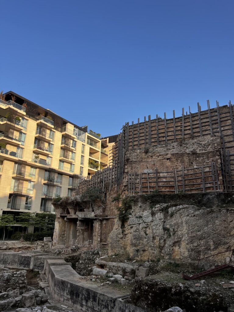
The archaeological site occupies a coastal promontory and plateau beside the Mediterranean. It covers approximately 14 hectares, has a perimeter of about 1,500 meters, and includes a natural spring cut into rock in a central depression. The surviving remains bring together prehistoric settlement, Bronze Age sanctuaries and defenses, royal tombs, maritime installations, Roman public buildings, Persian structures, and medieval fortifications.
Settlement and defensive works
A defensive wall enclosed the settlement from at least the fourth millennium BCE. It was repeatedly rebuilt and reinforced from the beginning of the third millennium BCE through the Bronze and Iron Ages. The principal entrances were an eastern land gate and a northern port gate, which connected the enclosed city with the mainland and the sea during portions of the Middle Bronze Age.
Bronze Age defenses included a northern buttress, an earthen glacis, stone revetment, and later retaining walls. A glacis, a sloping defensive embankment placed against a fortification, reached an angle of approximately 40 degrees in the Early Bronze Age and about 60 degrees after Middle Bronze Age reinforcement. It was rebuilt several times, while the eastern wall was strengthened again during the Persian period.
The earliest dwellings were circular or oval structures made from pebbles and small stones. Later houses were rectangular, with plastered or earthen floors, internal partitions, and shared courtyards. Early Bronze Age homes often centered on courtyards and included storage, food-processing, weaving, metalworking, and other production spaces. Some had partial upper stories supported by wooden columns, with narrow corridors and ladders leading to upper rooms or storage areas.
Sanctuaries
Sacred Precincts
The Sacred Precincts date to the Early Bronze IA, around 3300 BCE. A curving masonry wall enclosed the complex, which probably incorporated the natural spring. Its features included a rectangular chamber, a stone-paved courtyard, gravel and white-mortar floors, and circular open-air platforms. The precinct continued in use through the third and second millennia BCE, preserving a connection between Chalcolithic religious architecture and the religious buildings of the Early Bronze Age.
Temple of Baalat-Gebal
The Temple of Baalat-Gebal, or Temple of the Lady of Byblos, was founded during the third millennium BCE, with dates ranging approximately from 3000 to 2700 BCE, and remained in use into the Roman period. Its Egyptian and Phoenician sections included the Temple of the Colossi, and the two parts were connected by a large courtyard containing an altar. An eastern entrance led toward the central courtyard, while worshippers entered the large courtyard from the north. The eastern route was associated with the king and priests.
The temple complex stood on a raised platform and used a bent-axis entrance. Its remains extend for approximately 45 meters and are about 10–15 meters wide. Roughly dressed stone blocks formed a plan containing storage rooms, a large hall with column bases, administrative or staff rooms, and a later long hall that may have become an open court. The complex also included an inner court, an altar, a stepped shrine or plinth, circular brick basins for ablutions, benches, and paved areas of large stone slabs.
L-shaped Temple
The L-shaped Temple had foundations dating to the early third millennium BCE and remained one of Byblos’s longest-lived religious complexes. It probably served the cult of Baal or Baalat-Gebal. The complex included a sacred precinct, forecourt, three central chapels, and auxiliary areas to the northeast and west. Four terracotta basins in the northeastern unit were used for ritual activities involving purification or libation. Two large betyls, sacred standing stones representing deities, stood within the temple.
Temple of the Obelisks
The Temple of the Obelisks was built over the L-shaped Temple during the early second millennium BCE and was dedicated to Reshef, a Levantine deity associated with warfare. It contained 26 standing stones ranging from slightly more than 50 centimeters to slightly less than 2 meters in height, together with a large rectangular betyl. The complex consisted of a broad courtyard, a central cella, or principal sacred chamber, measuring approximately 5 by 5 meters, an eastern ante-cella, an antechamber, an annexed chapel, and utilitarian eastern rooms.
Access was from the east through a short staircase and narrow passage. The antechamber may have had a cultic function, while the annexed chapel contained a small stone bench and two offering tables. A chapel associated with Ramesses II occupied part of the eastern side and replaced or reused an earlier chapel connected with Thutmose III. The temple was dismantled and moved nearby during the French excavations.
Royal and other burials
Royal necropolis
The royal necropolis contained nine tombs and was used for approximately 700 years. Tombs I–IV belong primarily to the Middle Bronze Age, while Tombs V–IX are later and had been looted in antiquity. The tombs were cut into bedrock, with vertical shafts leading to lateral chambers for sarcophagi. The sarcophagi were carved from single blocks of stone and covered by large lids, some with ridge-shaped profiles.
Tombs I–IV contained Egyptian imports and locally made objects in Egyptianizing styles, including vessels, jewelry, bronze objects, and other valuable goods. The tomb of Ahiram may date to the Late Bronze Age II, around the time of Ramesses II, although its chronology remains uncertain. Its sarcophagus carries processions, mourning women, lotus buds and flowers, lion-headed supports, and an inscription running along the side of the lid.
Necropolis K
Necropolis K lies east of the archaeological area and outside the city walls. Dating to approximately 1750–1550 BCE, it consists of interconnected underground rooms entered through a well. The burials contained numerous Middle Bronze Age Mycenaean and Cypriot vessels, together with Egyptian scarabs associated with the Hyksos period, Thutmose III, and Amenhotep III.
Palace and maritime installations
Royal palace
The royal palace stood on the upper hill of the acropolis behind the Temple of Baalat-Gebal and dates at least to the Early Bronze Age III. Its east, west, and north wings served different royal and administrative purposes. The west wing contained two long rooms and smaller rooms, while the west and north wings probably accommodated the royal family and dignitaries and provided storage and production areas.
The east wing was the royal section, carved deeply into bedrock. Its central throne room was flanked by three irregular rooms probably used for service or storage. A broad vestibule in the north wing faced the Temple of Baalat-Gebal, whose rear entrance led toward the palace. The throne room was used for royal transactions and business records, and the palace stood near the edge of the promontory, where stairs may have descended toward the shore and main port.
Tower Temple and harbor
The Tower Temple stood near the southern edge of the site above the bay where an ancient harbor may have been located. Dating to the end of the third millennium BCE, it had thick walls, an imposing staircase, and stone anchors incorporated into its masonry. It may have risen to a ceiling about 6 meters high and perhaps served as a coastal landmark or lighthouse.
Maritime installations extended below the archaeological site from the medieval port in the north toward southern rocky islets and the beach. Phoenician engineers flattened rocky outcrops to create working surfaces, landing places, and docking areas. The remains include rocky platforms, shallow inlets, quays, jetties, loading areas, and possible lifting mechanisms. Holes in the rock may have held wooden masts or lifting devices, while nails and rope-worn copper-rich fittings point to shipbuilding or cargo handling. A deep basin north of the southern rocky islet, together with an adjacent basin buried under sand, may have formed a mooring area containing numerous anchor weights.
Persian, Roman, and medieval buildings
Persian complex
The Persian complex included a monumental podium, two preserved towers, eight additional defensive towers, a ramp, a retaining wall, and a temple. The complex dates broadly from the seventh to the fourth centuries BCE, while the podium and temple were built approximately at the end of the sixth century BCE. The podium measured about 70 by 40 meters and stood approximately 16 meters high.
The temple measured approximately 42 by 21 meters. Its main hall was about 15 meters wide and contained two rows of five square pillars. A seven-meter-wide, two-chambered entrance opened westward. The building also had a projecting eastern chamber, a broad staircase, and a paved ramp.
Roman public buildings
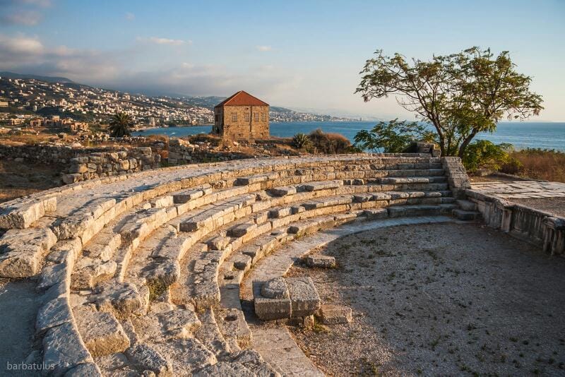
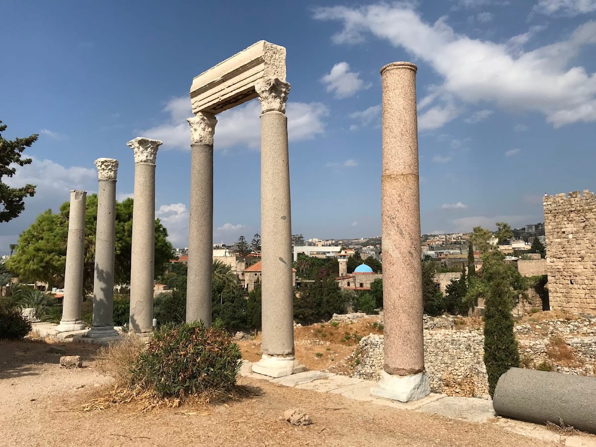
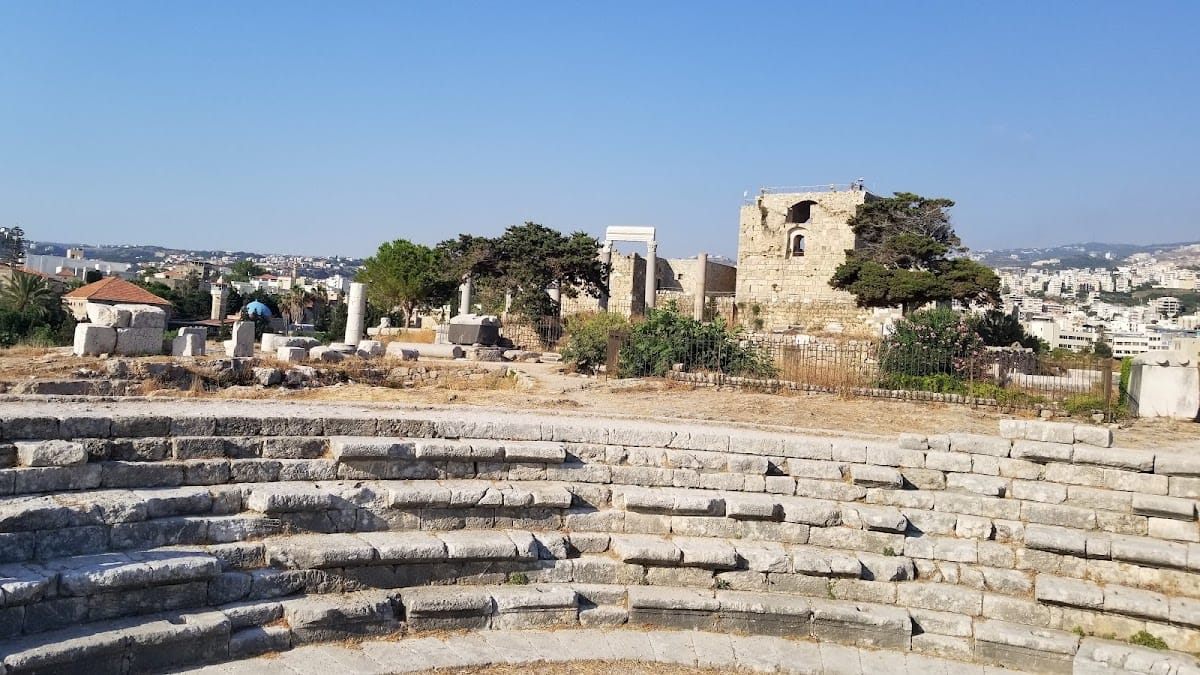
Roman structures occupied both the acropolis and lower city. At least three temples stood on the acropolis, including the Temple of the Lady of Byblos, the Temple of the Colossi, and a Great Roman Temple built above the earlier Temple of the Obelisks. A theater was constructed on the northeastern side of the acropolis, probably in the early third century CE, and was later displaced from its original position.
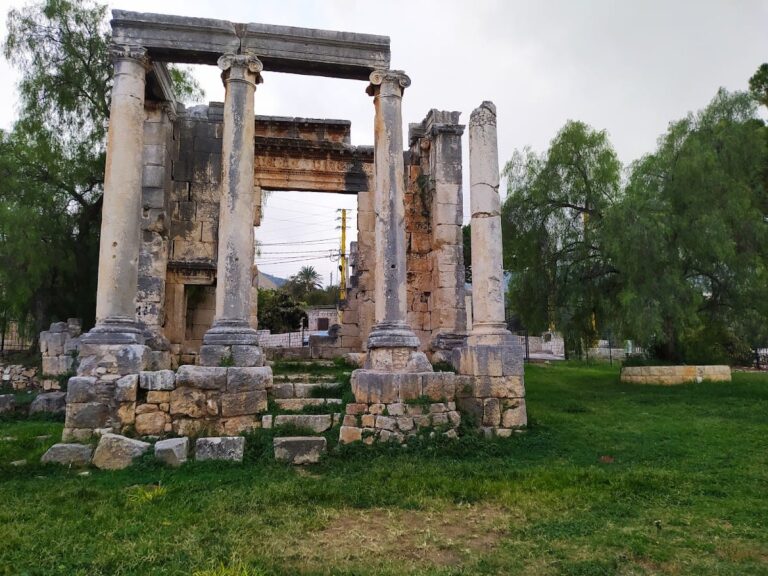
The Roman baths occupied the northern part of the site. Their surviving remains extend for more than 80 meters and include a caldarium, a heated bathing room, a tepidarium, a warm room, and a water reservoir serving the heated rooms. A Roman nymphaeum, a monumental fountain or water shrine, stood in the northeastern area. It dates to the late second or early third century CE and formed part of a wider water system that included an aqueduct, reservoirs, pipes, wells, and distribution channels. A major colonnaded road crossed the city for more than 720 meters, with approximately 85 meters preserved within the archaeological site.
Crusader Castle
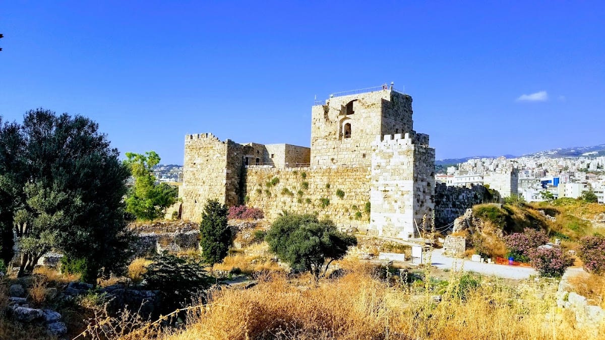
The Crusader Castle occupies the northern part of the site near the harbor. Built mainly of limestone in the twelfth century, it has a roughly square plan, enclosing walls, five towers, a central keep and courtyard, and a northern moat crossed by a bridge. Saladin damaged or destroyed parts of its walls around 1190. After the Crusaders recovered the city in 1197, the fortifications were restored, leaving the castle as the most substantially preserved monumental structure within the ruins.
Burials, offerings, and craft production
The Chalcolithic necropolis contained approximately 2,059 burial jars and 3,652 grave goods, with an average of about three objects per burial. Burials occurred inside or near dwellings. The ovoid, globular, and elongated jars carried chevrons, horizontal bands, herringbone incisions, relief ropes, and impressed signs or animal motifs. Grave goods included ceramics, copper daggers and hooks, stone and flint tools, obsidian, ivory, seals, figurines, beads, pendants, bracelets, rings, and necklaces made from materials including silver, gold, carnelian, limestone, bone, and shell.
At least 49 intentional offering or foundation deposits were found, most dating to approximately 2250–1750 BCE. They were placed in ceramic jars, courtyards, sacred chambers, wall recesses, niches, and beneath paving. Twenty-two deposits formed the Field of Offerings in the cella and courtyard of a poorly preserved temple in the south-central area. Deposit F in the Temple of the Obelisks contained 262 faience animal figurines representing 11 species, probably imported from Egypt and dated approximately to 1750–1650 BCE.
More than 600 scarabs were found, most of them Egyptian imports. Approximately 63 percent belong to Egypt’s Middle Kingdom, around 2030–1650 BCE, and nearly half were associated with sacred areas. One jar from the Temple of Baalat-Gebal contained 98 scarabs. Unfinished green jasper scarabs show that some were produced locally in the early Middle Bronze Age, using Egyptianizing imagery that circulated through the Levant, Cyprus, Crete, Tunisia, and Tell el-Dab’a.
Byblos produced large quantities of metal weapons from the Chalcolithic through the Iron Age. Nearly 900 weapons were found, with the principal group dating to the Middle Bronze Age I, approximately 2000–1750 BCE. Stone and bivalve molds demonstrate local production of daggers, crescentic axes, narrow-bladed axes, and D-shaped fenestrated axes. Other finds include spears, spearheads, triangular daggers, swords up to approximately 60 centimeters long, axes, and blades, some retaining traces of wooden or bone handles.
Houses and workshops used stone foundations and lower walls, timber framing, and mud-brick upper walls. The site preserves evidence of metalworking, ivory carving, glassmaking, faience production, textile manufacture, jewelry production, pottery, and stone carving. Pottery included dishes, bowls, lamps, amphorae, jugs, bottles, kraters, cups, and tripod vessels, often decorated with geometric designs, zigzags, wavy lines, chequers, lozenges, networks, concentric circles, and spirals. Beads and ornaments were made from minerals including carnelian, amethyst, jasper, agate, turquoise, lapis lazuli, obsidian, and malachite. Spindle whorls, furniture remains, and evidence for stools, chairs, tables, beds, and storage fittings further illustrate the city’s domestic and craft activities.