Burcht Jonckholt: A Medieval Moated Residence and Sixteenth-Century Fortification
Site at a Glance
- Rating
- 4.2
- Popularity
- Very Low
- Country
- Belgium
- Primary era
- Early Modern
- Eras represented
- Medieval, Early Modern
- Civilizations
- Spanish
- Site type
- Military
- Remains
- Castle
On this page9 sections
History
Burcht Jonckholt is a medieval castle site near Hoelbeek in Belgium, originating in the thirteenth century as a moated wooden residence of local major landowners who held their estate as a fief, land granted by a superior lord in return for allegiance and service, from the Count of Loon. The site later became a sixteenth-century military fortification during the Eighty Years’ War, the prolonged revolt of the Netherlands against Habsburg Spanish rule.
From allodial estate to feudal lordship
Jonckholt was probably first an allodial estate, meaning land held independently rather than as a fief. During the eleventh or twelfth century, it was incorporated into the County of Loon, a medieval territorial principality in the region of present-day Belgian Limburg, and granted to the lords of Jonckholt. From the fourteenth century, their fief also included Hoelbeek and Groenendaal.
The lords of Jonckholt were related to the Hamal family of ‘s Herenelderen. The family first appears in the historical record in 1288, through Johan van Jochout. In 1390, when the male line of succession ended, the estate was divided between two daughters. Jonckholt and Hoelbeek passed to the elder daughter, who was married to Hendrik van Guigoven, castellan of Kolmont, an official responsible for a castle district.
The lordship subsequently passed to the Van Rijkel-Gelinden family in 1414, the Van den Bosch de Mopertingen family in 1436, and the De Merode de Houffalize family in 1494. In 1639, Anne François de Merode de Houffalize sold the estate to Karel Egidius Vaes, lord of Schalkhoven. Through marriage, it later came to the Van Eyll family, which retained it until 1819.
Administrative role and military transformation
By the late fourteenth century, Jonckholt had probably ceased to be the residence of its owners. Marriages had connected them with families possessing other castles that were better situated and more comfortable. Jonckholt nevertheless continued to serve as a feudal court and rent court, handling obligations connected with fief-holding as well as rents and other dues from the estate. Villagers leased the land, while a steward conducted the local administration for the lords.
Around 1565 to 1568, as the Eighty Years’ War approached, Jonckholt acquired strategic importance in the defence of the route from Germany through Maastricht into the Spanish Netherlands. Troops led by William of Orange, a leading figure in the Dutch revolt, sought to enter the Spanish Netherlands along this route. The fortification was intended to discourage their advance.
At this time, the site belonged to the De Merode family, several of whose members served in the Spanish military administration and army. During the sixteenth century, Jonckholt was therefore developed from a feudal estate centre into a military fortification. Around 1600, however, it lost its military importance as the war shifted farther toward Germany. Its marshy location was also economically disadvantageous, and the site declined into a ruin. The buildings were dismantled to ground level, leaving the earthworks and ditches visible in the landscape.
Excavation and conservation
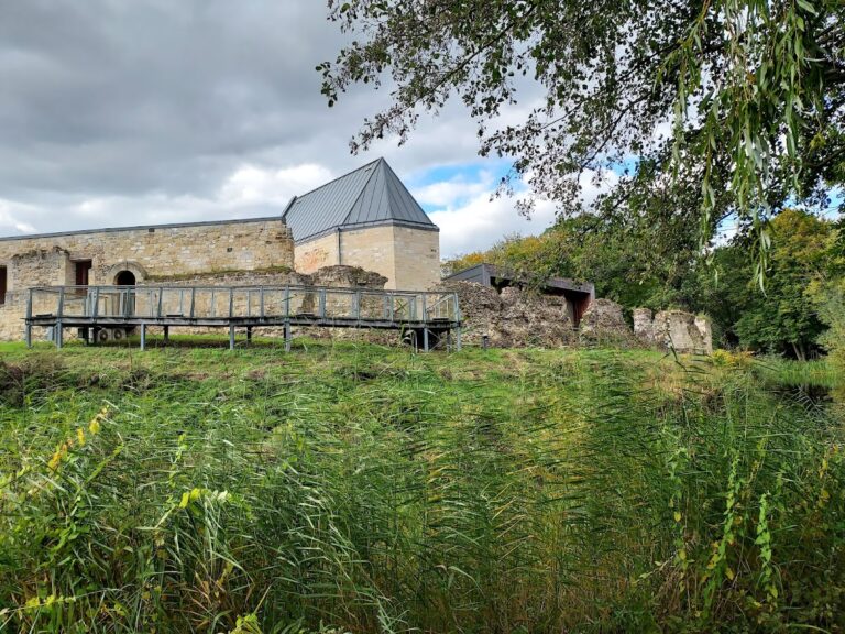
Archaeological excavations from 1985 to 1987 exposed the castle foundations. Since then, archaeologists and historians have reinterpreted the successive phases of Jonckholt’s fortifications. After the excavations, the marlstone foundations of the walls and corner towers were conserved, and the site was made accessible. The castle was not marked on the Ferraris maps of the late eighteenth century, although a 1744 map by Eugène-Henri Fricx still showed remains, chiefly the earthen ramparts.
Remains
The medieval moated enclosure
Jonckholt’s earliest physical form was created around 1200, when approximately 40 by 40 metres of marshland was raised by about one metre to make an island surrounded by a ditch. This stage is known as the curtis phase. A curtis was a manorial estate centre that combined the lord’s residence with facilities for managing dependent land.
The island contained a fortified gate and about five wooden buildings. Together they formed an enclosed farmstead for the local lord, whose authority extended beyond the residence to a substantial portion of local government on behalf of the Count of Loon.
The sixteenth-century fortress
Stone enclosure and timber interior
During the military rebuilding of around 1565 to 1568, the original moated plateau was enlarged. A brick curtain wall, a continuous defensive wall enclosing the site, was built around it and faced with marlstone. A second ditch surrounded the enlarged enclosure.
The fortress had an approximately square plan measuring 52 by 40 metres. Each corner held a tower with loopholes, small openings through which firearms could be used. Although the enclosure walls and corner towers were built in brick and marlstone, the buildings inside remained wooden. The result was a stone water castle with a timber interior. The excavated foundations of the walls and towers survive as conserved remains.
Outer ramparts and bastions
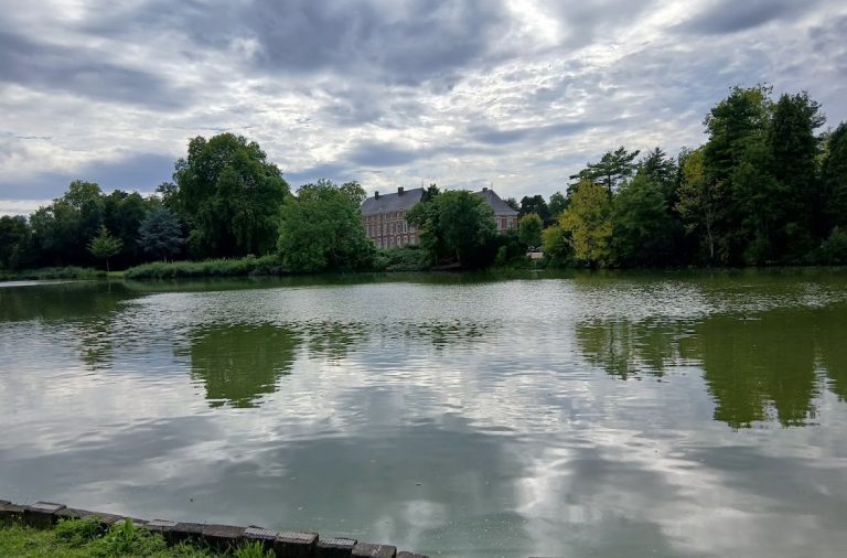
Additional earthen ramparts and ditches were constructed beyond the stone castle. A circular bastion, a projecting fortification designed to support defensive fire along adjoining walls, occupied each corner of the outer earthworks. These earthworks helped prevent emerging artillery from firing directly against the stone walls.
After the castle buildings were dismantled, the earthen ramparts and ditches remained visible across the site. Their survival, together with the conserved marlstone foundations, preserves the change from a raised medieval manorial enclosure to a sixteenth-century fortified complex.