Brimstone Hill Fortress National Park: A British Military Fortress in the Caribbean
Site at a Glance
- Country
- Saint Kitts and Nevis
- Primary era
- Early Modern
- Eras represented
- Early Modern
- Civilizations
- British, English
- Site type
- Military
- Remains
- Fort
On this page11 sections
History
Brimstone Hill Fortress National Park is a British military complex on a steep hill on Saint Kitts’s western Caribbean coast, in Saint Kitts and Nevis. British military engineers designed it, and enslaved Africans built and maintained it from 1690 through intermittent construction lasting about a century. The fortress was intended to protect Sandy Point and its harbor, about two miles away, support nearby Fort Charles, and shelter influential planters and merchants during wartime. Its exceptional preservation makes it an important example of seventeenth- and eighteenth-century Caribbean military architecture and a witness to European colonialism, the African slave trade, and the development of Caribbean societies.
Colonial rivalry and construction
England and France shared control of Saint Kitts from 1625 to 1713, using the island as a base for Caribbean expansion and commerce. In 1689, during the Nine Years’ War, a major conflict between England and France fought from 1688 to 1697, French forces placed cannon on Brimstone Hill and used them to capture English-held Fort Charles. English forces under Sir Christopher Codrington retook the fort in 1690. The English then established a fortress on the hill and installed guns designed to fire 24-pound projectiles.
The Treaty of Utrecht, agreements in 1713 that ended major parts of the War of the Spanish Succession, awarded the whole island to Britain. Lightning destroyed the fortress’s powder magazine in 1711 and again in 1731. By 1736, the fortress had 49 guns. In 1795, 40 enslaved men served there in the St. Christopher Corps of Embodied Slaves, a military unit whose members were armed with pikes and cutlasses.
The siege and British recovery
By 1780, Brimstone Hill was considered impregnable and had acquired the nickname Caribbean Gibraltar. Its strategic position also attracted United States attention. While Saint Kitts remained a profitable British colony, the United States encouraged France to attack British control and capture the fortress. On 11 January 1782, French forces led by Admiral François Joseph Paul de Grasse and General François Claude Amour, marquis de Bouillé, began a siege. Nevis surrendered during the campaign, and guns from Fort Charles and other small forts were brought to Saint Kitts to fire on Brimstone Hill. After a month, the isolated British garrison surrendered. The French force numbered 8,000 troops and had 62 guns, while the defenders numbered 1,000. British Admiral Hood was unable to dislodge de Grasse.
The Treaty of Paris of 1783, which ended the American Revolutionary War and settled territorial arrangements, returned Saint Kitts, Brimstone Hill, and Nevis to British rule. Britain enlarged and strengthened the fortifications over about 15 years. The fortress was never again captured by an enemy force, and a French naval attempt to take it in 1806 failed. In 1805, however, French Admiral Édouard Thomas Burgues de Missiessy raided Saint Kitts and blew up the powder magazine.
Abandonment and preservation
After the Napoleonic Wars, the conflicts between Napoleonic France and its opponents from 1803 to 1815, local militias across the Caribbean were disbanded in 1838. Britain abandoned the fortress in 1853, and local militias were disbanded in 1854. As British and French economic priorities shifted toward Asia and Africa, the fortress’s inventory and buildings were auctioned.
Interest in Brimstone Hill had revived by 1900, and government-funded stabilization and restoration began in the early twentieth century. Extensive cleanup and rehabilitation followed in the 1930s and 1940s. The Brimstone Hill Restoration Society was founded in April 1965 at the initiative of the fortress administrator, Lieutenant Colonel H. A. C. Howard. D. L. Matheson led the society from 1967 for about 20 years, and in 1985 the Brimstone Hill Fortress National Park Society became its official successor. Prince Charles reopened the first fully restored area, the Prince of Wales Bastion, in 1973. Queen Elizabeth II unveiled a plaque identifying Brimstone Hill as a national park in 1985, and legislation formally established the park in 1987. In 1999, UNESCO inscribed it as a World Heritage Site under criteria (iii) and (iv), recognizing its preserved military architecture and its testimony to colonialism, the slave trade, and the emergence of Caribbean societies.
Remains
Hilltop setting and construction
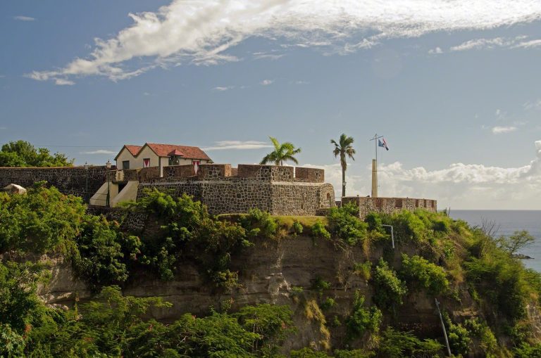
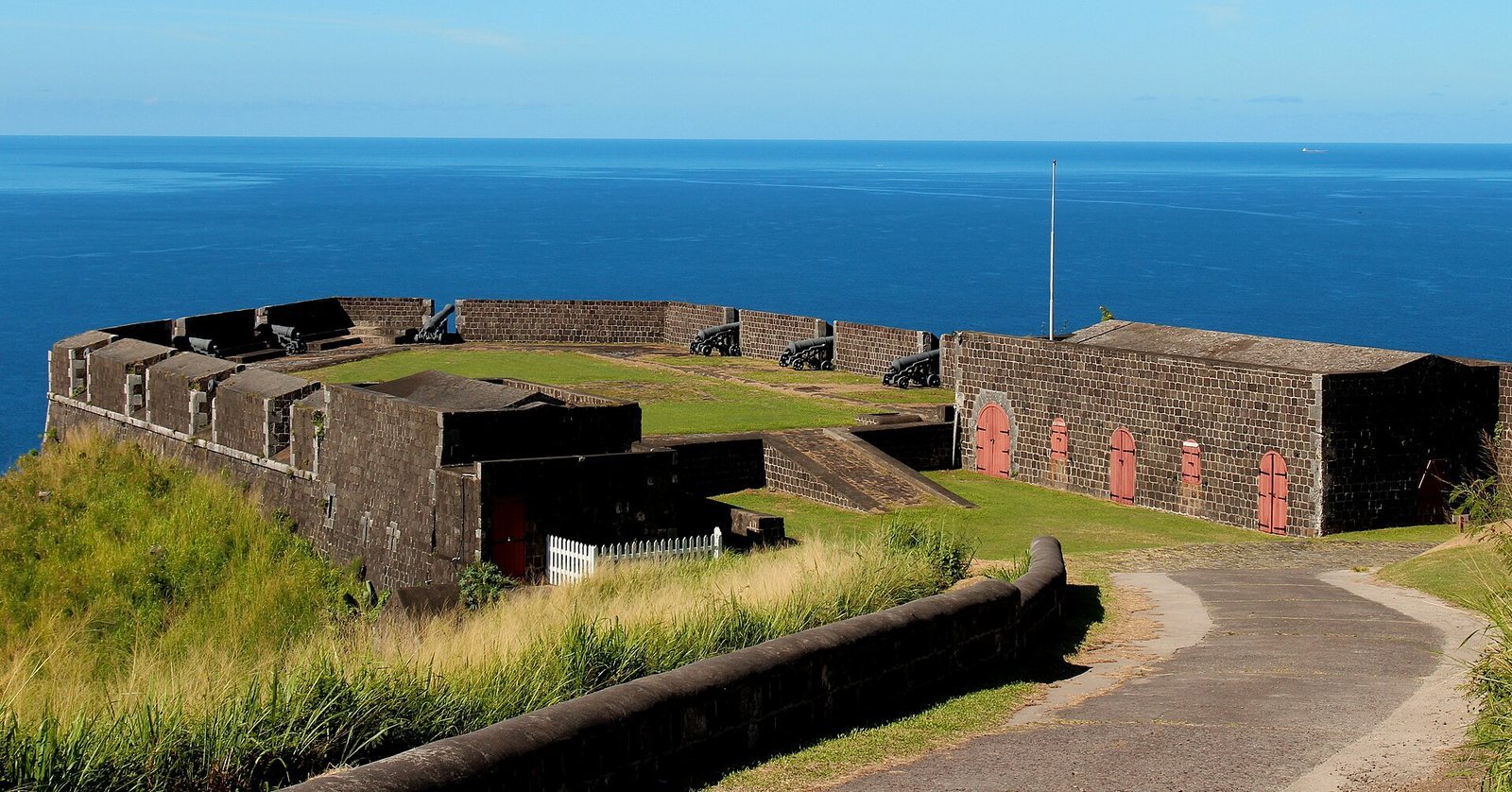
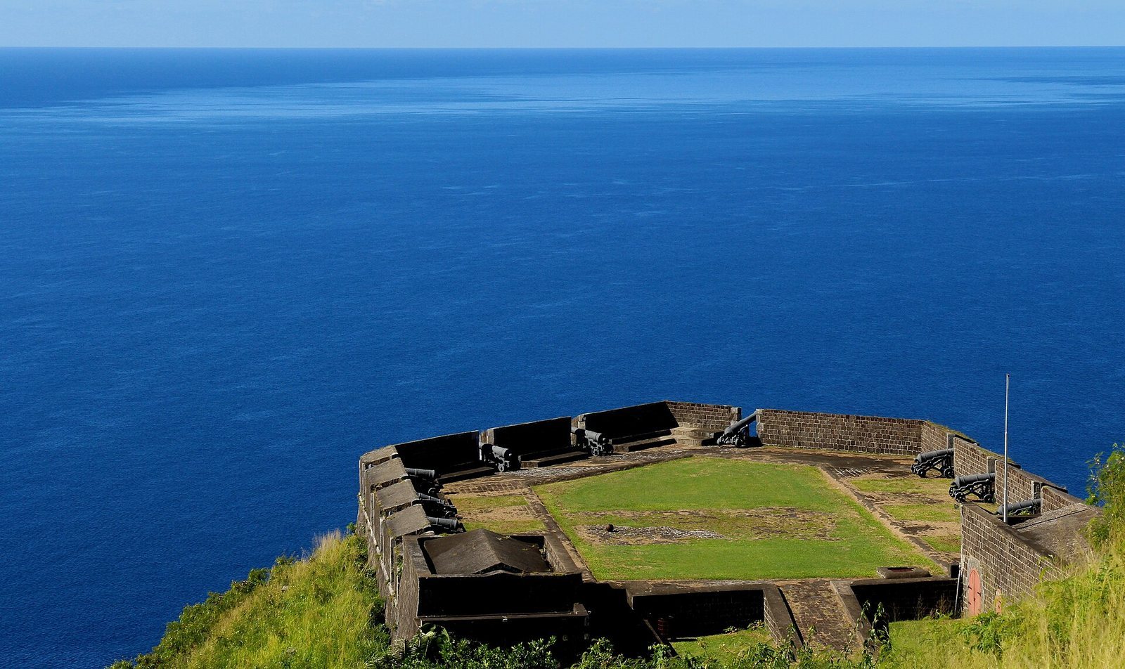
The surviving fortress occupies a steep hill near the sea on Saint Kitts’s western coast. The hill rises 972 feet, and the World Heritage property covers 15.37 hectares. The large military complex includes a projecting citadel, barracks, other buildings, and a water-management system adapted to the sloping ground. The citadel follows a polygonal plan, a layout formed by several angled sides, an early example of this fortification form.
The hill’s foundation is volcanic andesite, a hard rock formed from cooled lava during volcanic activity about 6,000 years ago. Rising lava displaced limestone beneath the ocean floor, leaving the hill surrounded by a limestone rim. The name Brimstone Hill is associated with a strong sulfurous smell rising from underwater eruption channels. Stone blocks cut from the hill’s hard rock were used in the upper levels of the fortress, while limestone served as mortar.
Fortifications
Fort George Citadel
The projecting citadel is named Fort George and contains the Fort George Museum. A citadel is a fortified stronghold within a larger defensive complex.
Places of Arms
The complex includes Western and Eastern Places of Arms. A Place of Arms is an open area within a fortification used for assembling troops.
Bastions
The Prince of Wales Bastion is among the named defensive sections of the fortress. The Magazine Bastion was breached by French forces during the 1782 siege. The site also includes the Orillon Bastion, an orillon being a rounded projection that protects the flank of a bastion.
Buildings and other features
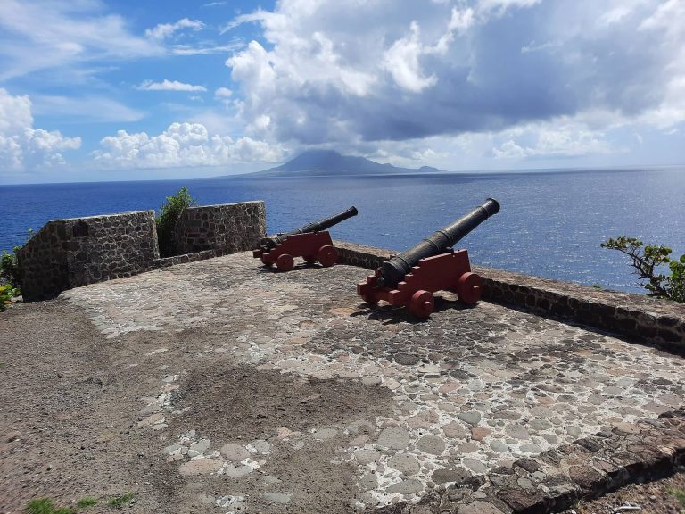
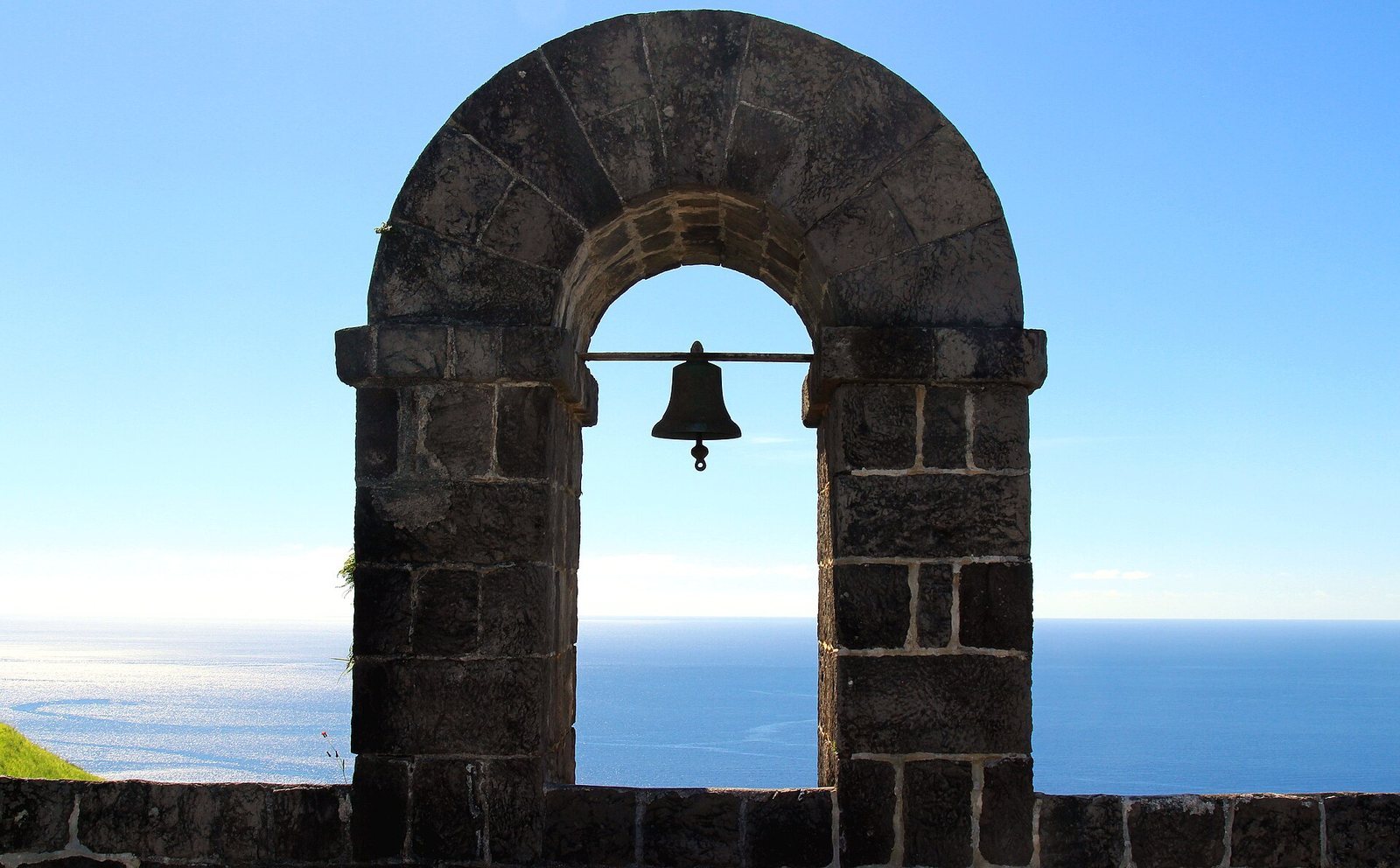
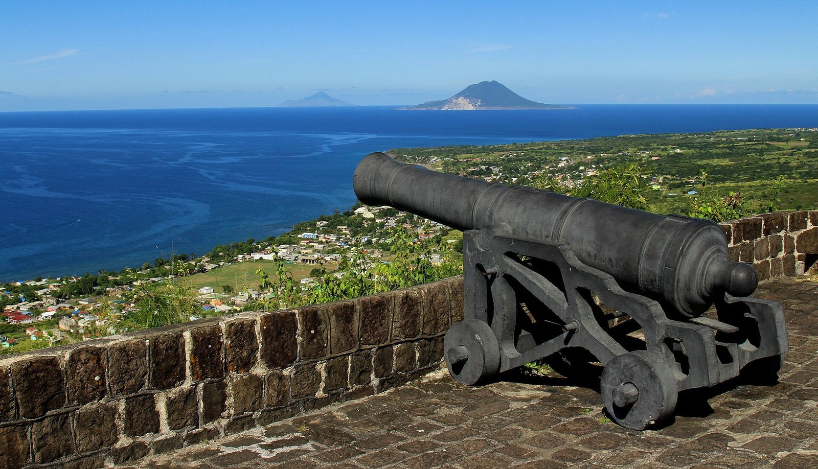
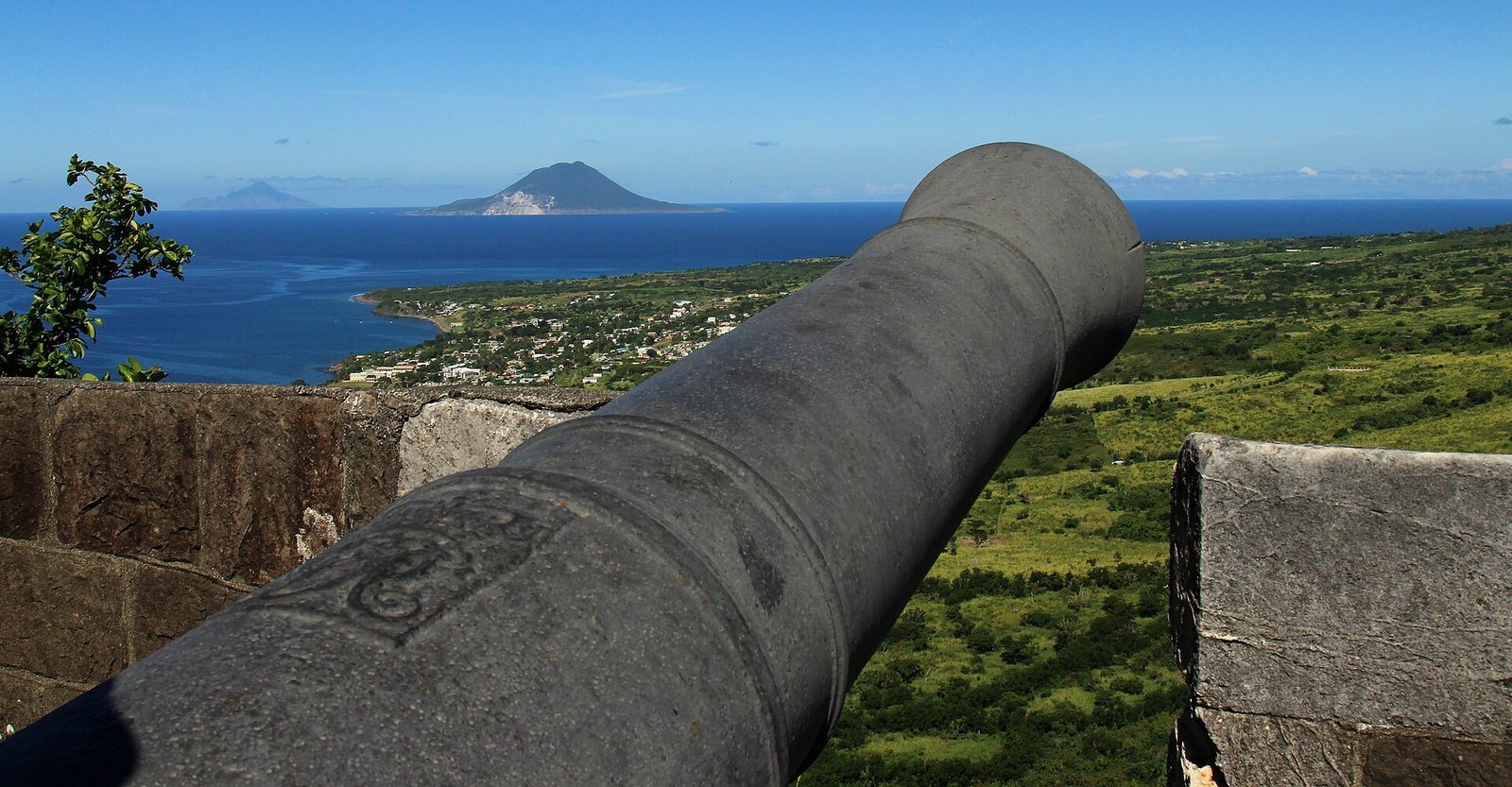
The ruins of the Royal Engineers’ Quarters and the Artillery Officers’ Quarters survive alongside the Infantry Officers’ Quarters. Other features include a cannon and a building associated with the orientation centre. A view from the fortress includes the island of Sint Eustatius.