Fort Oranje: Historic Fortress of Sint Eustatius


Site at a Glance
- Rating
- 4.8
- Popularity
- Very Low
- Country
- Netherlands
- Primary era
- Early Modern
- Eras represented
- Early Modern
- Civilizations
- Dutch, English, French
- Site type
- Military
- Remains
- Fort
On this page7 sections
History
Fort Oranje is a historic Dutch fortress in Oranjestad, Sint Eustatius, in the Caribbean Netherlands, part of the Netherlands. It was built in 1636 at the site of a small French fort from 1629 and became a defensive stronghold overlooking Oranje Bay. Its best-known event occurred in 1776, when its cannons saluted an American colonial flag in what became known as the First Salute.
French beginnings and Dutch construction
A small wooden French fort occupied the site in 1629. The French abandoned both the fort and the island after several years because the area lacked adequate drinking water. Dutch settlers from Zeeland took possession of the unoccupied island in 1636. Acting under commission from the Dutch West India Company, a chartered company that organized Dutch Atlantic trade, settlement, and military activity, they built a new fort over the remains of the earlier French position.
The new fortress was named after the House of Oranje, the Dutch royal family. It was also known as Old Fort and Fort George. Its purpose was to protect the Upper Town and Lower Town from pirates and foreign powers. Control of Sint Eustatius changed repeatedly among the Dutch, English, and French, and each power altered the fort. The French strengthened it in 1689, while earlier fighting had already led to major rebuilding. The Dutch burned the fort in 1673, and the English rebuilt it later that year. From 1737, the Dutch carried out further renovations using the labor of enslaved Africans.
The First Salute and later military use
On November 16, 1776, Governor Johannes de Graaff ordered the fort’s cannons to fire an 11-shot return salute at the USS Andrew Doria. The ship was flying the Grand Union Flag, an early flag used by the thirteen American colonies during their revolt against Britain. The exchange became known as the First Salute. In American historical interpretation, it was treated as an early foreign acknowledgment of American independence.
The event was among the causes associated with the Fourth Anglo-Dutch War. During that conflict, the English took control of Sint Eustatius and Fort Oranje. The French captured them from the English in 1781 and returned them to the Dutch in 1784. Fort Oranje remained a military post until 1846, serving as a garrison for army infantry and artillery. A garrison was a body of troops stationed at a fortified place.
Administrative reuse and preservation
After a long period of vacancy, the fort was refurbished as an administrative center. Its later uses included the lieutenant governor’s office, government services, and a prison. A fire partially destroyed the complex in 1990, followed by restoration in the late 1990s. The restored complex subsequently accommodated the public prosecutor’s office, the planning department, the tourist office, and other government functions. Art exhibitions and island-information services were also held there.
Fort Oranje is among Sint Eustatius’s protected historic buildings and is one of the island’s sixteen surviving defensive works. Between February 2019 and May 2020, a stabilization project addressed erosion and instability beneath the fort’s cliff. In 2026, the Dutch Real Estate Agency transferred the fort to Sint Eustatius, carrying out a 2022 motion by the island council that requested the transfer of historic heritage to local government.
Remains
Fortifications and cliff setting
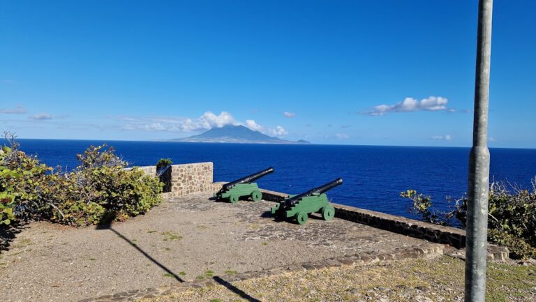
Fort Oranje occupies a steep cliff above Oranje Bay. Its position was intended to defend both the Upper Town and Lower Town, although the unstable cliff made this defensive arrangement poorly conceived. The original fort had a square plan with a courtyard, four bastions, and sixteen mounted cannons. A bastion is a projecting part of a fortification that allows defenders to fire along the outer walls. Later accounts describe the fortress as having three bastions.
The French reinforced the fort with doubled palisades and added a dry moat, a defensive ditch without water. The cliff beneath the complex later required extensive stabilization. The works used 2,800 anchors, 7,400 square meters of canvas, and more than 15,000 square meters of mesh to address erosion and instability.
Administrative buildings and surviving uses
The complex incorporates several later components and uses, including the former prison, the lieutenant governor’s residence, government offices, and the tourist office. These elements reflect the fort’s transformation from a military garrison into an administrative center while retaining its place within the historic defensive site.