Big Island Settlement Mound in Durankulak: A Multiperiod Settlement Site
Site at a Glance
- Popularity
- Medium
- Country
- Bulgaria
- Primary era
- Medieval
- Eras represented
- Stone Age, Bronze Age, Classical, Medieval
- Civilizations
- Ancient Greek, First Bulgarian Empire
- Site type
- City
On this page25 sections
History
The Big Island Settlement Mound in Durankulak is an archaeological settlement site on a peninsula in Lake Durankulak, Bulgaria. Occupied from the early fifth millennium BCE to the early eleventh century CE, it preserves evidence of prehistoric, ancient, and early medieval communities.
Early Eneolithic settlement
Settlement began in the early fifth millennium BCE, during the Hamangia III–IV phases of the Early Eneolithic, also known as the Copper Age. The Hamangia phases belong to a prehistoric archaeological tradition of southeastern Europe. At that time, a river ran through the area and the present lake had not yet formed. The settlement may have served as a political and administrative center, as well as a place where the exchange of valuable raw materials could be controlled.
A severe earthquake, estimated at intensity IX on the MSK-64 scale, which measures the effects of an earthquake, brought the Hamangia IV settlement to an abrupt end. Early tremors may have started a fire that forced residents to leave, although many belongings appear to have been taken away. Later shocks destroyed buildings, and the settlement was not rebuilt in its earlier form. A clay platform used for rituals was subsequently placed over the destruction deposits, on the remains of Building 8.
Varna and later prehistoric occupation
After an interval, a substantial settlement associated with the Varna culture developed around 4450/4400–4250/4150 BCE. Its residents reused stone from the destroyed Hamangia buildings, sometimes keeping parts of older walls. This allowed aspects of the earlier settlement’s arrangement to carry forward. Occupation later ended abruptly near the close of the Varna settlement. Climatic change, drought, and rising Black Sea levels have been suggested as possible causes, but none is established as the explanation.
Other prehistoric activity included ritual pits and a sacrificial fire associated with the Cernavoda I and III cultures. Toward the end of the twelfth century BCE, a settlement linked to the Coslogeni cultural complex was built on the southern slope. Its inhabitants have been tentatively associated with people arriving from the north and described as possibly Proto-Thracian.
Cybele sanctuary
Greek colonists from Callatis, an ancient Greek colony on the western Black Sea coast, established a cave sanctuary to Cybele at the end of the fourth century BCE. Cybele was a mother goddess worshipped in the ancient Greek world. The sanctuary was used most intensively in the first half of the third century BCE and remained active until the first quarter of the second century BCE. It was probably abandoned after an earthquake caused much of the cave roof to collapse.
Amphora stamps from the sanctuary and nearby necropolis point to renewed trade between Callatis and cities in the Aegean and Black Sea regions after Lysimachus withdrew. Lysimachus was one of Alexander the Great’s successors and ruled Thrace. The stamps include examples from several Greek cities, and one from Sinope dates to 320–210 BCE.
Late Antiquity
In the sixth century CE, a small community settled beneath the part of the cave roof that remained. A destructive accidental fire ended this occupation. Erosion and further collapse then filled the cave.
Early medieval settlement
A large settlement arose on the island in the mid-ninth century and lasted until the beginning of the eleventh. Its history spans the Christianization of the Bulgarians and the reigns of Boris I, Simeon, and Peter. The settlers are thought to have come from the northern Black Sea region. Some may have been Christian before reaching the island, perhaps in an earlier homeland near Crimea. Burials and other excavated evidence point to Christian customs and few pagan elements.
The southward movement of some Proto-Bulgarian groups has been linked to conflict with the Khazars, a power north of the Black Sea. A defensive wall indicates concern about attack from outside. Byzantine pressure, from the eastern continuation of the Roman Empire, is identified as the principal destructive force in the settlement’s history. The community continued for a time after the fall of the First Bulgarian state, before Byzantine rule became firmly established in the area.
Archaeological investigation
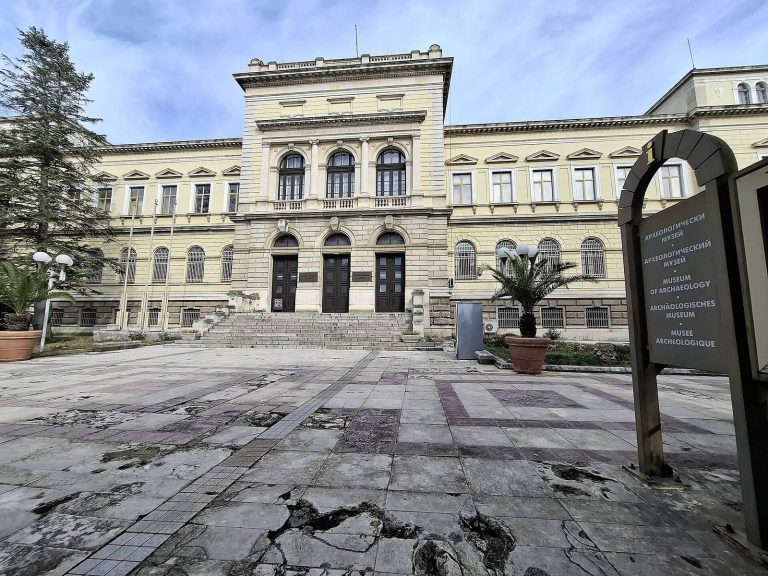
Investigations began in 1974 under Bulgarian archaeologist Henrieta Todorova, and the early medieval settlement was excavated in full between 1976 and 1980. Work continued intermittently under Todorova and, after her death in 2015, under archaeologists Ivan Vajsov and Vladimir Slavchev. Conservation and display projects were developed and partly carried out from 1980 to 1984. Finds from Great Island are held by museums and archaeological institutions in Dobrich and Sofia, and some have been shown in temporary local exhibitions.
Remains
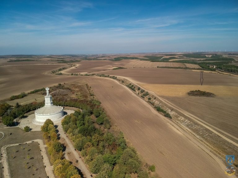
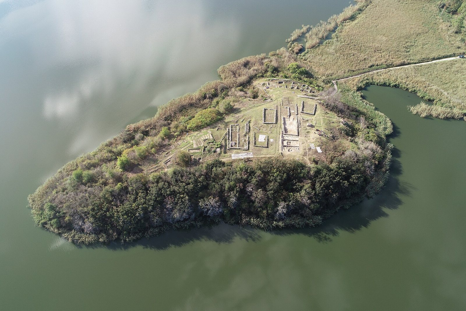
The site occupies a naturally raised rock formation in the western part of freshwater Lake Durankulak. Though commonly called an island, it is a peninsula linked to the lake’s western shore by a narrow strip of land. It covers about 25,390 square metres, with occupation from different periods extending across roughly 19,953 square metres. The peninsula rises to 12.4 metres above sea level; its probable limestone base reaches about six metres above the present lake. The prehistoric mound lies near the centre and covers approximately 1,400–1,500 square metres.
The eastern and southern slopes are steep, while the northern and western sides are more gradual. Stone for Eneolithic building foundations came from the high central area. Before construction, builders spread a leveling layer of finely crushed reddish rock mixed with grey marsh clay over the uneven ground. Straight streets, up to 1.50 metres wide, connected larger representative buildings with utility buildings. The structures stood in north–south rows and were grouped into representative and economic areas.
The mound contains seven distinct archaeological layers, six of them fully investigated, with cultural deposits measuring 3.20–3.50 metres thick. Six Early Eneolithic buildings have been identified: Buildings 5, 8, 12, 13, 24, and 25. Five are displayed in place, with their original stone foundations preserved. The surrounding landscape changed over time: an ancient river once ran beside the settlement, and later changes in sea level transformed the river valley into a lake and flooded parts of the earlier landscape.
Early Eneolithic buildings
The buildings reflect repeated construction and rebuilding during the Hamangia III–IV phases. Their foundations used stone slabs, while clay served to level floors and coat surfaces. Buildings 5, 8, 24, and 25 preserve evidence of different plans and uses.
Building 5
Building 5 had two principal phases. The earlier Hamangia III structure was a single room measuring 8.50 by 4.90 metres, with a floor area of 41 square metres. It stood directly on the reddish leveling layer and had substantial foundations made from large slabs. Its best-preserved eastern wall was incorporated into the later structure as support for an upper-floor platform. A hearth and platform stood beside this wall, and part of the earlier building was covered by the new construction.
The later Hamangia IV building had a slightly trapezoidal plan, a north–south orientation, and a built area of 283 square metres, including 203 square metres of usable interior space. A lengthwise internal wall divided it into eastern and western rooms, and the entrance was on the south. Some foundations rested on the earlier walls and others directly on the leveling layer. Additional double-faced stone walls, set a short distance outside the main walls, may have supported a raised terrace on three sides. The walls survive in places to 0.60 metres high, while the western and northern foundations were badly damaged in the earthquake that ended the settlement.
Inside, stone-slab platforms against the outer walls were coated with yellow clay, also used in repeated floor coatings. Several large heating installations were present. In the entrance area of the eastern room, a square installation measuring 3.00 by 2.50 metres was divided into equal compartments by low intersecting walls. It held a large quantity of charred, cleaned grain, interpreted as seed intended for sowing. The building had a gabled roof.
Building 8
The first phase of Building 8, assigned to Hamangia III, was a timber structure measuring 9.0 by 8.5 metres, with about 80 square metres of covered space. Four rows of six substantial wooden supports carried the building along its north–south axis. A roof covered with marsh plants, probably reeds, has been proposed. Beside the western wall was a low mud platform with a small hearth at its southern end; another hearth lay in the eastern part. The structure may have provided temporary accommodation for builders. Its posts were later removed and reused in the roof of the next building.
The Hamangia IV successor measured 25.0 by 9.5 metres and had 237 square metres of covered space. Its broad walls rested on foundations of nine to eleven courses of double-faced stonework, with upright slabs reinforcing the outside of the western wall. It had no interior dividing walls. Two small chambers flanked the southern entrance; one held a group of ceramic vessels, while the western chamber had a paved floor. A large oven with a stepped threshold stood near the eastern wall. Yellow clay leveled the main floor and coated the inside faces of the stone foundations. The roof was gabled.
Building 24
Building 24 stood east of Building 25, with a 1.50-metre-wide street between them that was repeatedly leveled with grey marsh clay. The building began as a single room and later gained a large open forecourt on its southern side. In the first phase, builders leveled the area with yellow clay, marked proposed wall lines with small stones, then placed the foundations about 20 centimetres away. Further clay was laid inside, followed by successive thin floor coatings.
In the later phase, the north wall was 8.50 metres long, the east wall 18.80 metres, and the west wall 17.50 metres. The north wall came first; the east and west walls were later extended south by about five to six metres. This arrangement created a large room and an open forecourt measuring 6.70 by 4.20 metres. Two stone projections separated the spaces, leaving an opening 2.80 metres wide. The interior entrance was paved with medium-sized slabs repeatedly coated in yellow clay.
A raised platform of close-set stone slabs occupied the northwest corner. In the southeast corner were a large hearth and a clay storage feature containing einkorn and emmer wheat, barley, millet, grass pea, and vetch. The building covered 148 square metres, of which 70 were usable interior space; its roof probably sloped westward from a single ridge. Finds included a large storage jar, smaller vessels, a ceramic model of bread, freshwater mussel shells, charred matting, and bone tools. These tools included awls, spatulas, and a stamping implement used to make impressed patterns on Hamangia pottery.
Building 25
Building 25 served a practical role and may have been used to prepare food centrally for the settlement. Its first structure was nearly square, measuring 6.5 by 6.0 metres. Double-faced foundations made from five or six courses of medium-sized slabs survive best beneath the western wall, reaching 0.70 metres high. Above them, walls of purified yellow clay were 45–50 centimetres thick. Openings in the floor mark positions for wooden roof supports; stones stabilized their bases, suggesting that the roof frame was raised before the walls.
Solid walls enclosed the north, east, and west sides, while a thin clay partition partly divided the south. The interior measured 5.5 by 4.0 metres. A half-domed heating feature stood in the northeast corner, and low clay platforms lined parts of the walls. Five successive coatings of yellow and yellow-brown clay formed the floor. A later southern annex measured 4.5 by 5.5 metres and may have been a covered ground-level terrace. It contained a domed oven and a long clay feature whose function is uncertain. A raised clay platform supported two mud-built silos for unprocessed grain.
In the Hamangia IV phase, probably after the first earthquake, the building was extensively altered. The partitions were removed to form one room measuring 10.0 by 4.5 metres, and a fresh layer of yellow clay leveled the floor. A new domed oven occupied the northwest corner; a large mud grain store replaced the earlier heating feature. A low platform of small slabs coated with clay, along with signs of repairs and renewed flooring, also belonged to this phase. A large hand-operated grain mill was installed where the earlier heating feature had stood. The southern side was open, with a timber colonnade, and the entrance and adjoining streets were paved with stone. The roof was gabled.
Varna settlement
Settlement layout
The Late Eneolithic settlement was arranged in three parallel east–west rows, separated by narrow streets and larger open spaces. Many buildings had north–south long axes, though some followed different alignments. Rectangular houses usually had one main room, with a hearth near the centre and an oven against the eastern wall. A clay partition often separated an entrance vestibule from the living area, and entrances were generally on the south. Rebuilding, perhaps after local earthquakes or fires, resulted in buildings with changed orientations. Larger structures, including Building 9, have been interpreted as having public or sacred functions.
Building 9
Building 9, the only Late Eneolithic building displayed in place, was occupied from the fourth to the third construction horizon, in the second half of the fifth to the beginning of the fourth millennium BCE. Its earlier phase had double-faced stone foundations reinforced inside by upright slabs, particularly visible at the northwest corner. A hearth paved with small slabs stood against the eastern wall, and the floor was repeatedly coated with yellow and yellow-brown clay.
In a later phase, some of the original walls were removed, leaving shallow foundation trenches. The building then had a trapezoidal north–south plan covering 184 square metres. Three rooms occupied the interior, with the smallest at the southern entrance end. The best-preserved eastern wall, built of five courses of double-faced slabs, stands up to 0.60 metres high. A rectangular trough-like feature in the central room had slab walls and a stone floor. Ash, animal bones, and pottery nearby indicate domestic use. The roof was gabled.
Late Bronze Age settlement
The Late Bronze Age settlement occupied terraces on the southern and western slopes. Its upper terrace was built up artificially, and a substantial stone wall above it protected the settlement from the north. The settlement had two phases, A and B. Its small buildings had rounded ends and stood on foundations made from several courses of stone slabs.
Cybele sanctuary and associated facilities
Cave sanctuary
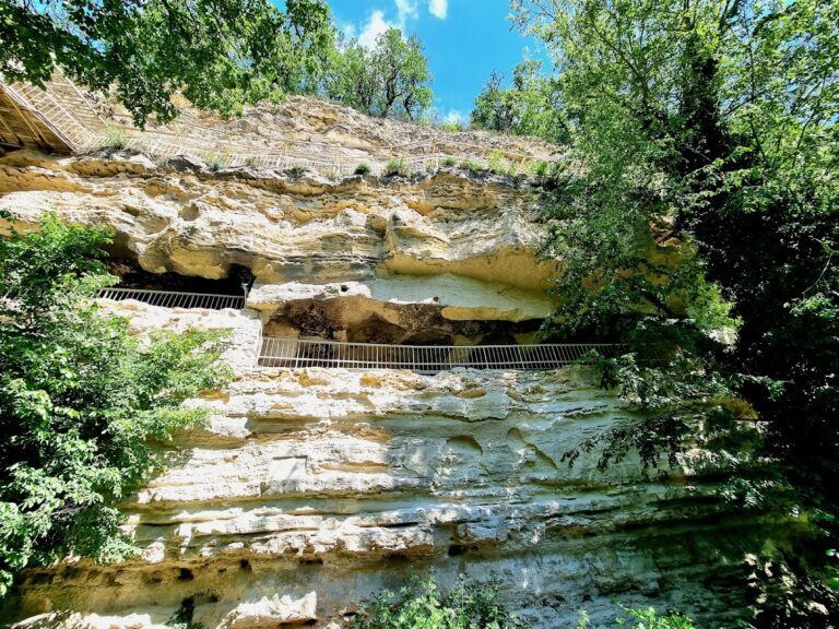
The sanctuary lies on the southern slope among a series of terraces. Its upper terrace had been artificially formed during the Late Bronze Age, while the lower one developed naturally in the fourth millennium BCE. Water and erosion had formed the cave, the largest on the island’s slopes, and stone-working marks remain on its walls. The sanctuary extends 25 metres into the rock and is 6.40–8.15 metres wide.
Its layout included an open ritual area before the entrance, a vestibule with a stone pediment, a cut corridor, and central rooms divided by a wall. The eastern room ended in a rounded apse where Cybele’s throne was placed. The western room held a sacrificial altar and channels for draining blood; a channel in the altar led to a deep collecting basin. Orange clay-and-lime plaster coated the walls, and fragments were found on the floor. Terracotta figures and ceramic fragments were also recovered. A relief plaque of Cybele was built into a nearby building’s wall and may have been taken from the sanctuary ruins by early medieval inhabitants.
Well and service areas
A deep drinking-water well lay below the southern slope, separate from the sanctuary. It contained many broken amphorae, including examples stamped at Sinope, Thasos, and other Greek cities. The well formed part of a service and economic complex. A similar complex was found at the foot of the southwestern slope.
Early medieval settlement
Quarters, buildings, and defenses
The early medieval settlement comprised 240 buildings arranged in 15 quarters. A broad paved street divided its northern and southern parts and provided passage throughout the year. Most houses were small, rectangular stone buildings set partly below ground, usually by 50–80 centimetres. Stone ovens and hearths were common, alongside round and oval buildings resembling yurts. Several round buildings, or rotundas, stood in the southern area and may have served public or religious purposes.
A defensive wall crossed above the former sanctuary vestibule. Builders incorporated large, dressed Hellenistic stone blocks and parts of the sanctuary’s pediment into the fortification. The entrance cut through the wall opposite the narrow land connection to the western shore.
Church and burials
Building 58 was converted into a church. Christian graves surrounded it, with burial pits lined and covered by substantial stone slabs. The graves form part of the evidence for Christian burial customs in the settlement.
Grain mills
Hand-operated grain mills were found in 69 buildings, usually alongside a domed or rectangular stone oven. Each mill had two upright trapezoidal stones set about 26 centimetres apart, with more than half their depth below the floor for stability. Grooves across their upper ends held an axle for a wooden lever. A circular pit, about 50 centimetres deep, stood roughly 30–40 centimetres in front of the supports. It held a stone base with a hollow for the upright spindle that supported the iron axle of the upper millstone.
The floor around each pit formed a shallow, rimmed working area about 70–75 centimetres across. Millstones averaged about 45 centimetres in diameter, with an active grinding surface about 34 centimetres wide; grain entered through a funnel-shaped opening in the upper stone. A wooden lever and connecting rod moved the upper stone back and forth. Some installations had additional spindle holes, 75 and 150 centimetres from the supports, suggesting that one connecting rod could operate two mills at once.
Preservation
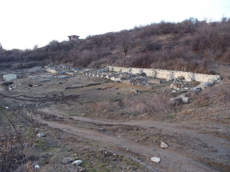
The settlement is presented as an open-air archaeological site, with conserved and partly reconstructed structures. Some early medieval stone walls were rebuilt using cement mortar, while the prehistoric stone foundations remain largely in their original condition.