Barysaŭ Castle: A Defensive Stronghold on the Berezina

Site at a Glance
- Rating
- 4.1
- Popularity
- Low
- Country
- Belarus
- Primary era
- Medieval
- Eras represented
- Medieval, Early Modern, Modern
- Civilizations
- Grand Duchy of Lithuania, Russian
- Site type
- Military
- Remains
- Castle
On this page12 sections
History
Barysaŭ Castle is a defensive stronghold in Belarus, in the town of Barysaw, that developed between the thirteenth and eighteenth centuries within the historical lands of the Grand Duchy of Lithuania. It was established after Barysaŭ was moved about 4 kilometres downstream along the Berezina from the earlier settlement at Starabarysaŭ. The castle occupied a strategic position where a river route linking the Baltic and Black seas met an overland route leading into the interior of the state.
Origins and the Grand Duchy of Lithuania
The earliest surviving written mention of the castle at its later location dates to 1432, when it appeared in a list of towns associated with Grand Duke Sviadryhailo. In 1542, King Sigismund Augustus granted the castle and the Barysaŭ volost, a smaller territorial and administrative unit, to Jan Glebovich, the voivode of Vilnius. From 1563, Barysaŭ became the centre of a starostvo, an administrative district governed by a starosta.
Russian forces appeared near Barysaŭ in 1507 and occupied the surrounding area. In 1514, Russian voivodes, high-ranking military and administrative commanders, besieged the town and castle but failed to take them. Further attempts also proved unsuccessful. During the Livonian War, a conflict from 1558 to 1583 over control of Livonia and territories around the eastern Baltic, the castle permanently housed a military garrison.
Wars, Reconstruction, and Supply
Wars between the Polish-Lithuanian Commonwealth and the Muscovite state repeatedly brought changes of control, damage, rebuilding, and alterations to the fortifications. During the Russo-Polish War of 1654 to 1667, the Muscovite voivode Yury Baratynsky approached Barysaŭ with 700 soldiers and dragoons to seize the town and castle and defeat K. Paklonski’s force. The garrison repelled repeated attacks, but troops led by the voivode B. M. Khitrovo captured and burned the castle after a prolonged battle on 19 June 1655. The surviving defenders withdrew to the right bank of the Berezina and burned the bridge behind them.
Tsar Alexei Mikhailovich ordered the castle rebuilt, using peasants brought from nearby villages to speed the work. As the war continued, the defences were strengthened more substantially. The castle changed hands twice in 1658 and suffered severe damage, then was rebuilt again by Muscovite forces in the following year. It also served as a storage and transfer base for weapons, ammunition, armour, and food. Supplies included rusks, malt, grain, peas, flour, rye, oats, wheat, beans, gunpowder, cannon shot, and bullets. By the end of 1660, 73 cannons, 252 poods of gunpowder, and 290 poods of lead and musket bullets had been sent from Barysaŭ to Smolensk and Moscow. Craftsmen from Lithuanian towns, together with carts carrying armour and edged weapons, were also moved from the castle.
In June 1661, forces of the Grand Duchy of Lithuania began a continuous siege. The small Muscovite garrison could not defend the full perimeter, and two-thirds of the fortifications were burned. The castle nevertheless resisted for a year, supported by its stores of weapons and food, against forces commanded by Stefan Czarniecki, V. Valovich, A. Rusetsky, and the infantry regiment of P. Sapieha. On 9 July 1662, the exhausted garrison abandoned the castle and withdrew eastward.
Decline and Later Uses
The castle was put in order toward the end of the seventeenth century. By 1697, its wooden walls had decayed and only the earthworks remained, although the fortifications continued to be described as being in good condition until the end of the eighteenth century. In 1810, Russian engineers prepared a plan to convert the site into a bastioned fortress, with projecting fortified platforms designed to provide flanking fire along adjoining walls. The plan was not implemented. The fortress continued to appear on Barysaŭ’s general plans, including those of 1810 and the 1830s.
After the 1831 uprising, the castle’s ramparts were levelled. A two-storey prison castle was built on the site in 1861 and operated until the 1950s. During the Polish-Soviet War in 1920, the building was heavily damaged by shelling along the Berezina front. The prison site was abandoned after the Second World War, and its buildings were dismantled for their bricks. Barysaŭ Castle is included in the State List of Historical and Cultural Values of the Republic of Belarus under code 613B000001.
Remains
Barysaŭ Castle occupied about 2 hectares on an island along the left bank of the Berezina. Old channels of the river formed the island, while the Prilya, also called Aleska, a Berezina branch, helped supply the surrounding moat with water. The castle was a wooden-and-earth fortification, with high earth ramparts carrying wooden walls and towers and surrounded by deep, water-filled moats. These defences were enlarged and rebuilt through successive phases.
Island Fortifications
Enclosure and Fore-Fortification
A description from 1581 presents the castle as rectangular and following the island’s outline. By the second half of the seventeenth century, its plan was described as oval. The southern wall incorporated a redan, a projecting angular section of a fortification wall, while an eastern fore-fortification stood beyond a water-filled moat. The eastern enclosure contained an Orthodox church. In the sixteenth century, the walls and towers were wooden, and one description records four layers of log-cell construction packed with earth and stone. During the first half of the seventeenth century, the castle was reconstructed as a five-bastion fortress, with an additional fortified enclosure to the east.
Ramparts and Water Defences
A report from 1657 describes the rebuilt castle as having four walls with sand packed between them. Its water supply included a concealed passage to the Berezina and a well. In the 1659 reconstruction, pine-log structures with double walls were installed on the rampart. The walls rose more than 3.5 arshins, approximately 2.5 metres, and contained loopholes with a wide field of fire. The 1817 plan still showed the fortifications, including damage to the northern wall and a redan on the southern wall. Some former moats survive, and several sections remain filled with water. The northern moat was almost completely filled during construction of a pedestrian bridge and a residential building.
Interior Buildings and Approaches
Castle Buildings and Bridge
Residential and utility buildings were erected inside the enclosure, chiefly granaries. A bridge across the Berezina passed west of the fortress and appeared on a plan from the middle of the seventeenth century. In January 1593, Trifan Karabeynikov described a wooden bridge towards Minsk as 200 sazhens long. In August of the same year, the imperial envoy Nikolai Vorkach described the castle as a fairly large structure built entirely of wood.
Later Plans and Reconstruction
A plan from the late eighteenth century no longer showed the fortress walls and depicted only buildings within the castle. The walls were also absent from a map of the mid-1860s. A local-history museum model represents the earlier castle as an island enclosed by a wooden wall with towers and an entrance gate set on an earth rampart. It shows an oval enclosure without redans.
Nineteenth-Century Prison Castle
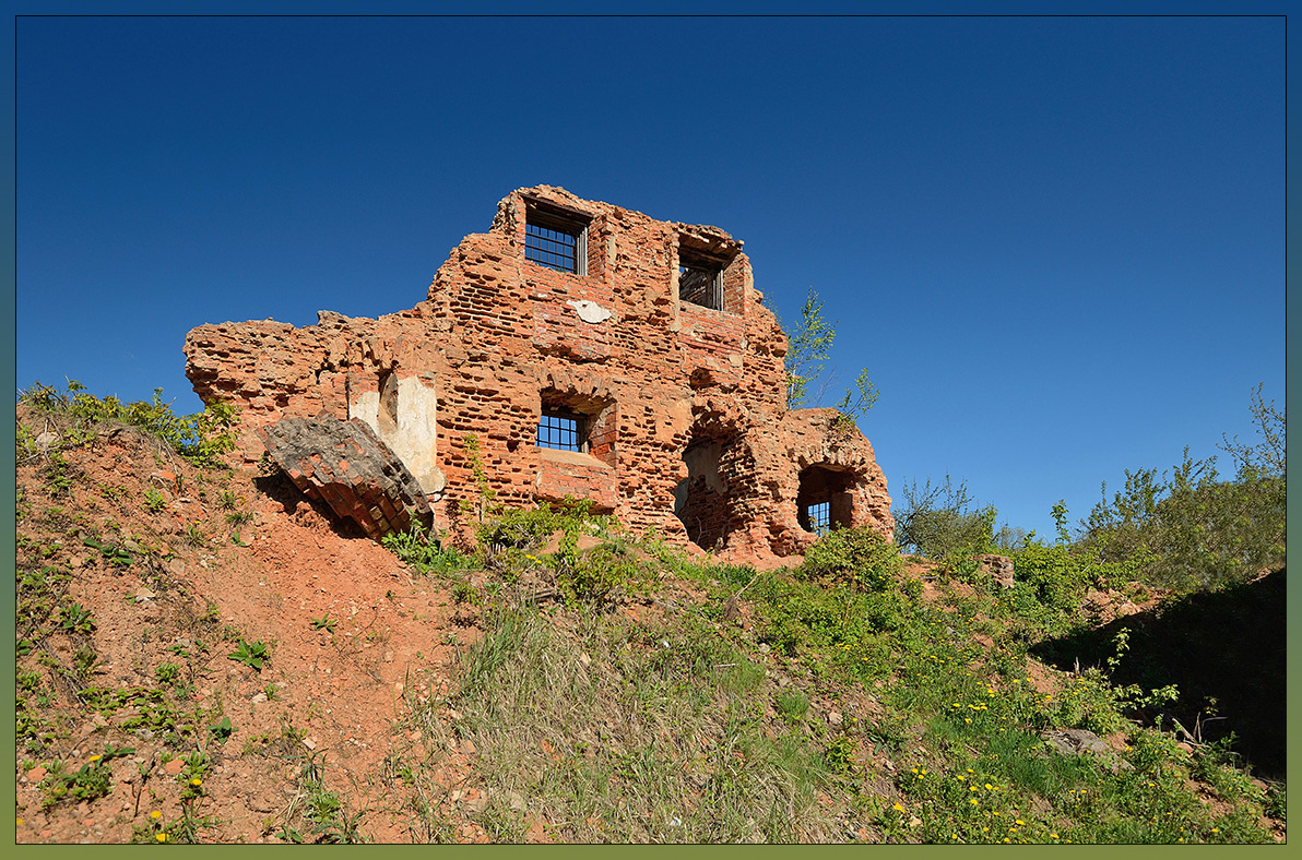
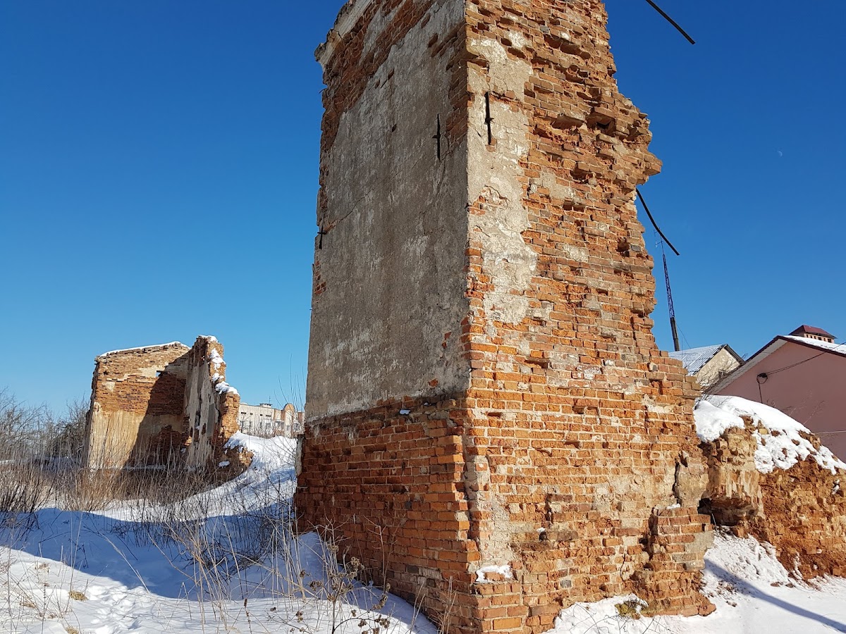
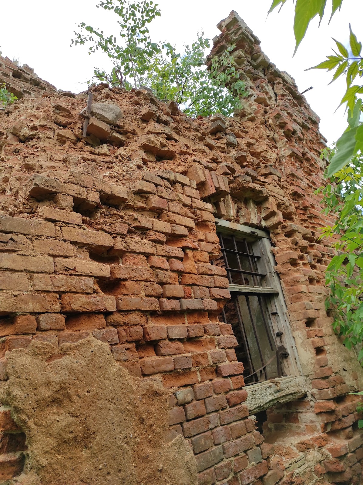
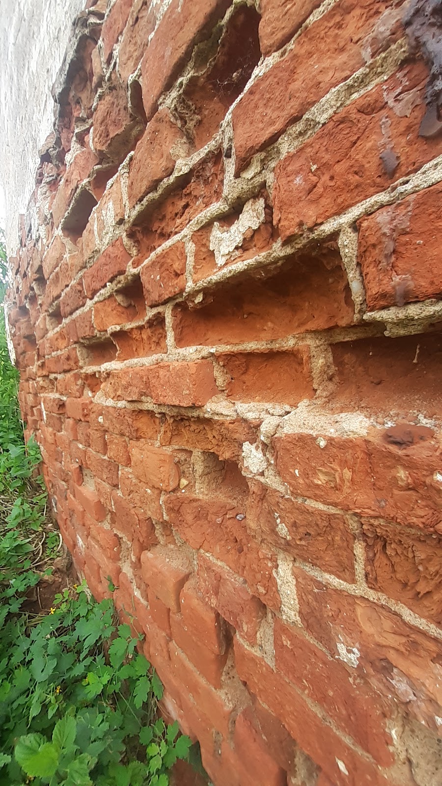
The prison castle built in 1861 was a two-storey red-brick building surrounded by a stone wall. Part of the prison structure and part of its brick enclosure survive on the former castle site. These remains stand alongside sections of the earlier moats and earthworks, preserving elements of both the fortress landscape and its later institutional use.