Arditurri: A Roman and Industrial Mining Complex in Spain
Site at a Glance
- Popularity
- Medium
- Country
- Spain
- Primary era
- Classical
- Eras represented
- Classical, Modern
- Civilizations
- Roman, Spanish
- Site type
- Economic
- Remains
- Mine
On this page16 sections
History
Arditurri is a mining complex in Spain where Roman miners expanded workings that had begun before Roman rule, especially during the first century AD. Its earliest mining evidence dates to the Iron Age, when iron became a principal material for tools and weapons. The Romans extracted silver-bearing lead ore and developed drainage systems to keep water out of the mines.
Roman and earlier mining
Arditurri belonged to the mining district of Oiasso, a Roman city at present-day Irun. Oiasso had a port through which ore could be shipped, and it stood on the Roman road between Asturica Augusta, now Astorga, and Burdigala, now Bordeaux. Ore also travelled overland along this route. After Oiasso’s port was abandoned, shipments went instead through nearby Pasajes, eventually by a railway built for mineral transport.
Medieval iron production
Iron extraction became important during the Middle Ages, supplying ironworks in the surrounding area. Local iron ore, water, and timber supported this industry. In 1328, Alfonso XI, king of Castile, granted an ironworks charter to workers in Irun-Uranzu and Oiartzun.
Renewed mining in the eighteenth and nineteenth centuries
Mining interest revived in 1798, when Oiartzun resident Juan Antonio Sein pursued silver and lead extraction. His family’s venture brought in the German engineer Juan Guillermo Thalacker, commissioned by Carlos IV, king of Spain. In an 1804 assessment, Thalacker considered Arditurri comparable in importance to the mines of Cartagena, León, and Rio Tinto.
Nineteenth-century operators reopened Roman galleries and reused slag rich in silver. In 1830, the Guipuzcoan Mining Company extracted lead, silver, and iron. Its expansion of earlier workings damaged Roman remains.
Industrial expansion and railway
In 1898, the Royal Asturian Mining Company leased the Arditurri, La Oportuna, and Echolachuri lands from Salustiano Olazabal and others. Chavarri Brothers acquired rights to the concessions in 1900 and pursued a railway connection to Pasajes. Construction began in 1902, and the first section, which included five tunnels, was completed that May. The railway entered service in 1905. Chavarri Brothers also began iron extraction between 1902 and 1904.
The railway and mining rights changed hands, and the line was later acquired by Sociedad Minera de Oyarzun. Mining and rail operations stopped during the First World War, a conflict fought from 1914 to 1918. Afterward, the Royal Asturian Mining Company renewed its interest in the mines and considered an aerial ore-transport line. It later modernized the railway, which remained in use until trucks took over mineral transport in 1966.
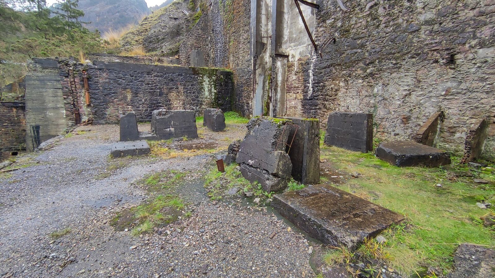
The Royal Asturian Mining Company operated the mines under a concession that expired in 1985. Its production included lead and silver, followed later by fluorite and sphalerite, a zinc ore. The company also built a zinc-rolling pavilion and used a former Capuchin convent as its base. The convent had been destroyed during the First Carlist War, a Spanish civil war fought from 1833 to 1840. Open-pit mining began in the 1960s. The last concessionaire stopped work on 13 November 1984.
Archaeology and recovery
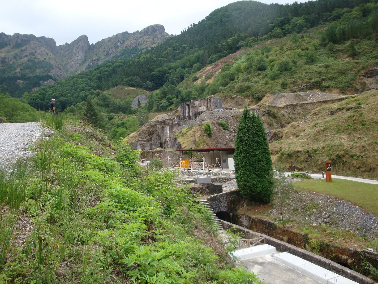
Archaeological investigation began in 1983, while mining was still underway. Oiartzun municipality bought the land in 1988 and began planning its recovery. From 2001 to 2006, studies addressed mining-related environmental problems, including heavy metals in water and unstable waste heaps at Arditurri and the Otsamantegi mines. The mining area became part of Aiako Harria Natural Park in 2004, and a recovery and interpretation plan was approved in 2007.
In 2012, archaeologist Mertxe Urteaga found the entrance to the Santa Bárbara mine, also known as Arditurri 3. Its workings had not been used since Roman times. Following archaeological study, the mine was prepared for public access.
Remains
The Arditurri complex occupies a mineral-rich part of the Aiako Harria granite massif. The granite formed as magma cooled slowly about 300 to 250 million years ago, then reached the surface. Its body runs roughly north-northeast to south-southwest, dips steeply toward the south-southeast, and is reported to be about 3 to 13 metres thick or more. Siliceous-clayey schist surrounds it. Minerals in the area include iron ores such as goethite and siderite, along with galena, fluorite, sphalerite, and orthoclase. Across the complex, galleries opened in different periods extend for about 15 kilometres, alongside open pits, waste heaps, sloping workings, and levelled ground. Forty-four Roman mining units are catalogued at Arditurri.
Roman underground workings
Galleries and drainage
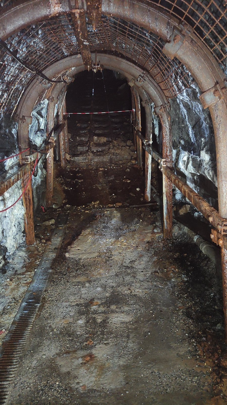
Roman workings across the massif include prospecting, passage, and ore-extraction galleries, as well as shafts, chimneys, sloping planes, and water controls. At Arditurri, the galleries are narrow and vaulted, with marks left by pick-cutting and regularly spaced niches for lamps. Their floors are smooth or stepped. Drainage channels helped control flooding, including an underground water conduit known as a cuniculus. A section of this conduit and its beginning can be seen in the accessible mine area.
Prospecting and ore processing
Roman miners sought ore veins partly by observing vegetation, then sank steep test shafts through the rock. Where they found ore, they opened horizontal extraction galleries and used heat to crack the stone. They crushed the extracted material, selected the richer particles, and settled them in water-filled basins before smelting, which separates metal from ore by heating. The first smelt produced a mixture of lead and silver; cupellation, a furnace process, then separated the silver from the lead.
Accessible mines
Mina Grande
The adapted 800-metre section belongs to Arditurri 20, also called Mina Grande. This mine has eight levels. Five levels below the third are flooded, while the third level was worked by Roman miners and had drainage. Roman galleries do not form part of the accessible route, although a section of Roman workings and the beginning of the cuniculus are visible.
Santa Bárbara
Santa Bárbara, or Arditurri 3, contains a steeply descending prospecting gallery that joins a horizontal access gallery. Both are narrow, oval in cross-section, and have numerous niches for oil lamps. Pick marks remain on the gallery walls.
Former mining railway
Route and engineering
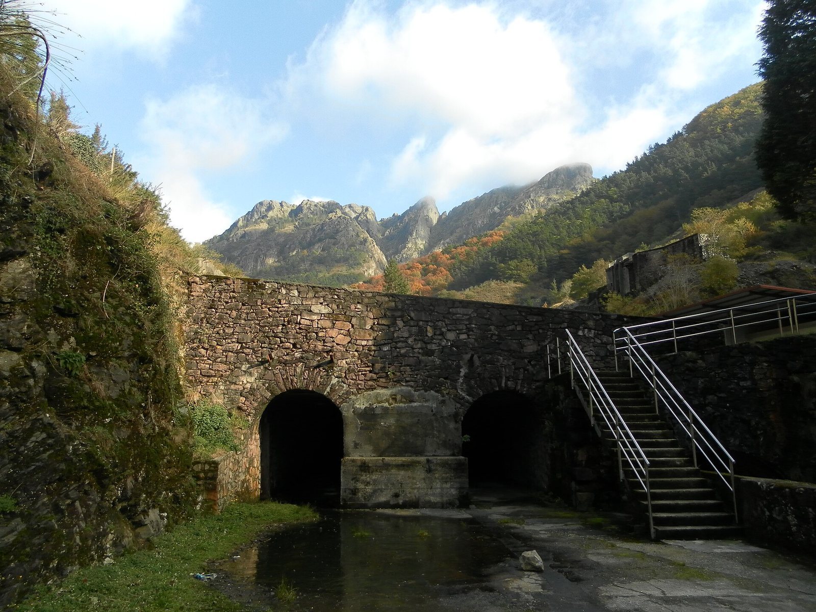
The railway ran from Arditurri, at an elevation of 832 metres, broadly alongside the Oyarzun River toward Pasajes. Its two sections measured 5,049 metres from the mines to Altzibar and 6,321 metres from Altzibar toward the Capuchin factory and port, giving a total length of 11,370 metres. The line reached the urban area of Pasajes at kilometre 10.8 and connected at Renteria with the broad-gauge railway of the Compañía de los Caminos de Hierro del Norte de España. The track gauge was 750 millimetres, and the track bed was 3.5 metres wide. The line included eight tunnels, with a combined length of 670 metres; individual tunnels ranged from 30 to 225 metres and included fully lined, partly lined, and unlined sections.
Bridges and ore handling
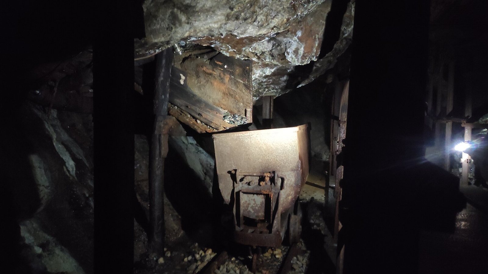
Fourteen metal bridges carried the railway across streams, roads, footpaths, and other rail lines. The longest was the 43.2-metre bridge over the Oyarzun River, supported by two intermediate piers and formed of three metal spans. Smaller crossings included bridges of six and seven metres. At Pasajes, a loading wharf and a cantilever ore loader, a projecting structure supported at one end, handled shipments. Lead and zinc-rolling factories stood nearby, while ore-distillation furnaces were located eight kilometres from the mines. Within the mine, a separate 600-millimetre-gauge track used battery-powered electric locomotives. Wooden-sided ore tubs, each holding 1.33 cubic metres, ran on that track. The abandoned railway route was later converted into a greenway for walking and cycling.