Anastasian Wall: An Eastern Roman Frontier Fortification in Türkiye
Site at a Glance
- Popularity
- High
- Country
- Turkey
- Primary era
- Medieval
- Eras represented
- Medieval
- Civilizations
- Byzantine
- Site type
- Military
- Remains
- Wall
On this page11 sections
History
The Anastasian Wall was an Eastern Roman (Byzantine) frontier fortification near Akören, in the Silivri area of Türkiye. Built in the late fifth and early sixth centuries, it was intended to protect Constantinople and the province of Europa from attacks approaching from the west. It also formed an outer defensive line for Rhegion and Selymbria.
Origins and purpose
The wall takes its name from Emperor Anastasius I, who ruled from 491 to 518 and probably completed and strengthened it. Defensive works may have begun under Leo I around 469 or under Zeno around 478. A seventh-century chronicle gives 507 as the foundation date, but that date is considered unreliable. Anastasius renewed the fortification between 507 and 512, and the surviving structure is associated with his reign.
Late fifth-century references to a Long Wall may describe this barrier, but could instead refer to an older defense across the Thracian Chersonese, the Gallipoli peninsula. That earlier wall may have been built under Miltiades the Elder in the late sixth century BC; the historian Malchus may have meant an earthwork that preceded it. Defensive remains at Salmydessos point to links among the city’s defenses, the Chersonese barrier, and the Anastasian Wall.
The fortification was designed to resist incursions by Huns and Avars, nomadic confederations, as well as Slavs and Proto-Bulgars, a steppe people associated with Bulgaria’s early history. It reflected a shift away from forward defense: the Danube frontier no longer provided dependable protection, so the empire concentrated on holding its remaining territories. The wall could not protect Constantinople’s main aqueducts, which lay too far west. Centuries later, the historian Edward Gibbon described barriers of this kind as a last frontier.
Administration and military crises
Anastasius also reorganized the territory between the wall and Constantinople. He dissolved the Diocese of Thrace, a civil district made up of provinces, and placed the area under two vicarii, or civil administrators, who answered to the Praetorian Prefect of the East, the empire’s leading civilian official. Military affairs went to the magister militum praesentalis, a senior military commander. In 535, Justinian I restored the Diocese of Thrace and established the province of Europa, governed by an official called the praetor Iustinianus in Thracia.
The historian Procopius noted that the wall was difficult to garrison because of its length. Justinian strengthened its guard, but incursions by Proto-Bulgars and Kutrigurs breached it in 540 and again in 558 or 559. An earthquake in 557 had already damaged the fortification, while a shortage of trained soldiers further weakened its defenses. During the crisis of 558, the general Belisarius used his strategic skill to avert a major defeat. Justinian then went to Selymbria to oversee rebuilding.
Avars and Slavs were repelled in attacks between 577 and 619. In October 610, Emperor Phocas ordered a commander to defend the wall against Heraclius, his rival, who later succeeded him. In 626, the Avars overran the barrier while much of the Eastern Roman army was campaigning against Persia under Heraclius. They went on to besiege Constantinople but were driven back.
Abandonment and modern investigation
The wall appears to have remained in use for a time, but was abandoned during the seventh century. Its length made it difficult to defend, and the empire lacked the people and resources needed to maintain it. Local residents later reused its stone, hastening the structure’s decay.
Road building repeatedly threatened the remains in modern times. From 1994 to 2000, a research project led by James Crow of the University of Newcastle upon Tyne investigated the wall.
Remains
The wall extended for about 56 km across the Thracian peninsula, roughly 65 km west of Constantinople, from the Black Sea to the Sea of Marmara. It began at Evcik Iskelesi on the Black Sea coast and ended at Karınca Burnu, about 6 km west of Silivri. From Evcik, its course ran west to Hisar Hill, then south past the Karacaköy River, Kuskaya Hill, Hırsız Hill, Kurfallı, Fenerköy, Alipaşa, Parpat Hill, and Sancaktepe. Kuskaya Tepe, at about 378 m, was the wall’s highest point; in clear weather, views from there reached both the Black Sea and the Sea of Marmara.
Wall line and construction
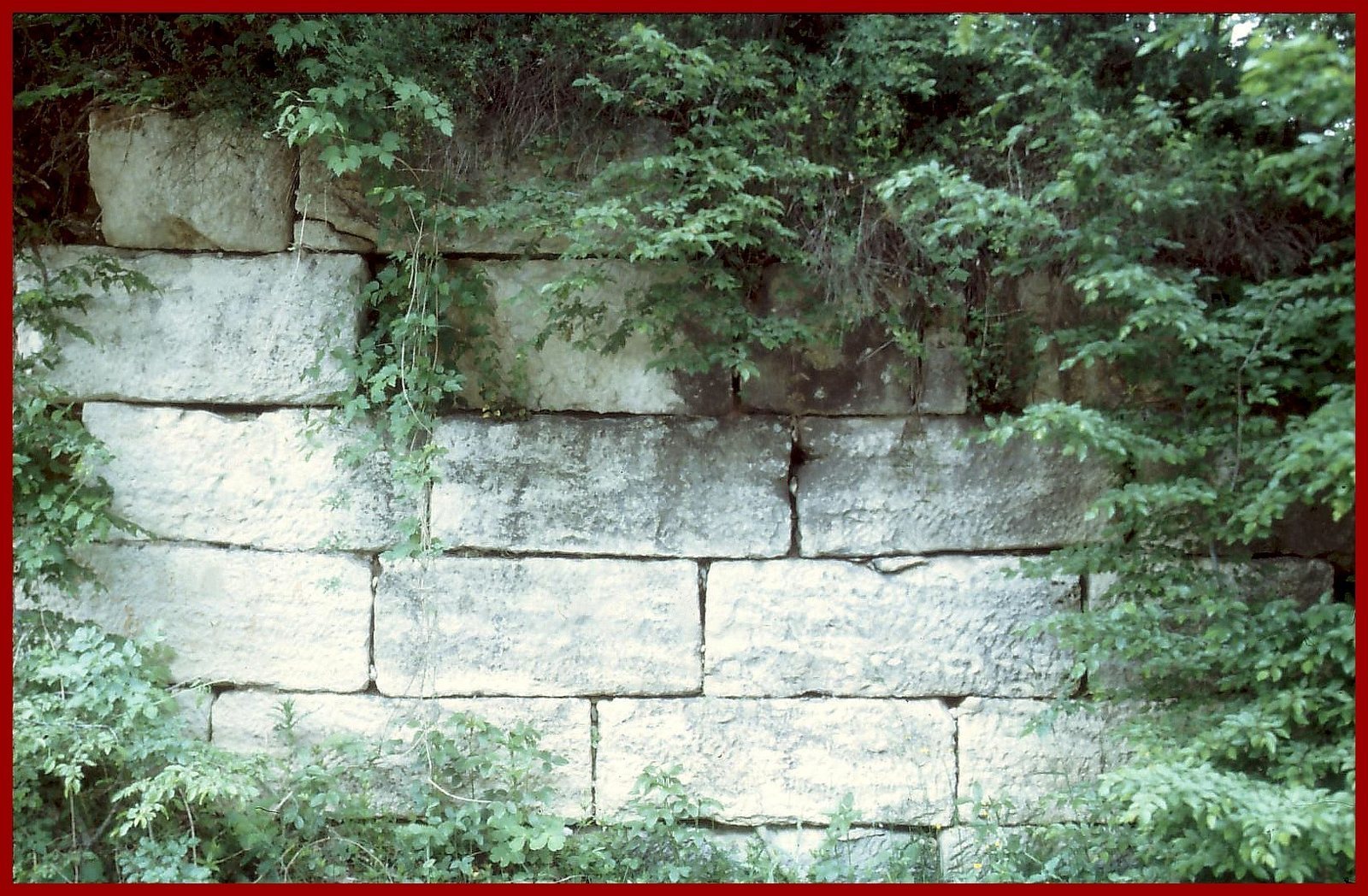
The original wall was about 3.3 m thick and around 5 m high. Described as a stone-and-turf fortification, it was built in regular courses of brick and stone. In surviving northern stretches, the inner face consists of regularly cut stone blocks, while the core contains rubble set in mortar. A continuous walkway ran along the top, protected on both sides by low defensive walls with alternating raised sections and openings. A ditch on the side facing potential attackers hindered an approach, and gates, forts, and a military road formed part of the defensive line.
Towers and strongholds
Towers
About 450 towers were built along the wall for observation and signaling. Larger pentagonal towers stood at exposed points and where the line changed direction; smaller square towers stood between them. Their spacing varied from about 45 m at Cilingir Tepe to 120–160 m near Dervis Kapi. Towers were closer together in the south, along the well-connected Via Egnatia, a major Roman road across the Balkans toward Constantinople. Stairways inside the towers probably provided access to the walkway.
Gates and forts
The main passage north of Dervis Kapi was defended by two small forts, Kucuk Bedesten and Büyük Bedesten, each surrounded by a defensive ditch. A separate hexagonal tower stood near this passage. Smaller forts, spaced about 3.5 km apart, housed guards.
Central stronghold
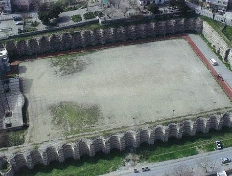
A rectangular fortified stronghold measuring 250 by 300 m occupied the central sector. It formed one element in the wall’s network of defenses, which also included the towers, guarded passages, and smaller forts.
Surviving sections
Less than half of the wall’s original fabric survives, and stone from more than half its length was reused in local buildings. The northern sector is best preserved, with some sections reaching about 4 m high. Remains can be seen at the Gümüşpınar junction in Karacaköy, at Hisartepe in Yalıköy, at Pınarca in İhsaniye, and near Kurfallı village. Few parts of the southern sector remain visible, while isolated ditches, gates, and forts also survive.