Altenburg Castle: An Iron Age Hillfort in Germany


Site at a Glance
- Rating
- 4.4
- Popularity
- Very Low
- Country
- Germany
- Primary era
- Iron Age
- Eras represented
- Iron Age
- Civilizations
- Unclassified
- Site type
- Military
- Remains
- Fortified Town
On this page7 sections
History
Altenburg Castle is a large Iron Age hillfort in Germany, near Bad Zwesten, occupying the summit of the 432.7-metre Altenburg. The fortified hill settlement developed through the European Iron Age, with occupation beginning around 750 BC and continuing into the Middle La Tène period, around 150 BC. It extends across parts of Niederurff, Arnsbach, and Römersberg, and is also known as Altenburg near Römersberg and the Altenburg ringwall near Niederurff.
Early settlement and the Iron Age
The earliest signs of human activity are isolated Neolithic finds, including stone axes linked to the Michelsberg culture, a central European farming culture of the fifth millennium BC, approximately 4400–3500 BC. Permanent settlement during this early period is considered unlikely. The hill was visited more often and occupied for longer periods from the beginning of the Hallstatt period, an early phase of the European Iron Age, around 750 BC. It was probably fortified by that time.
Archaeological material represents several cultural phases through the Middle La Tène period, a later phase of the European Iron Age, around 150 BC. The settlement was used during both the older and younger pre-Roman Iron Age, while the fortification was certainly established by the later Iron Age. The ethnic identity of the inhabitants cannot be securely defined. The La Tène population of Lower Hesse, a historical region in northern Hesse, is currently understood to have been neither Germanic nor Celtic.
Rediscovery and archaeological investigation
In the mid-nineteenth century, the archivist and historian Georg Landau identified the Altenburg ringwall as an Iron Age complex. A major excavation by the Hessian State Office for Monument Preservation, the state agency responsible for protecting archaeological and historic monuments in Hesse, took place in 1984. It recovered weapons, pottery, tools, and horse harness, including fittings used to control or attach horses. The excavation also revealed a probable cult or sacrificial place, where 77 iron objects had been deliberately made unusable. This deposit, which included swords, spearheads, and arrowheads, may represent ritual activity, although its precise purpose remains uncertain.
Further evidence came to light in 1963, when numerous pottery sherds were found during construction of a wooden observation tower on the summit. Repeated looting excavations have damaged some archaeological material. The site is protected as an archaeological monument under the Hessian Monument Protection Act, and investigations, deliberate collecting, and the treatment of chance finds are subject to the requirements of the monument authorities. Since 2006, an archaeological walking trail has interpreted the hillfort and archaeological features in the surrounding landscape, including the medieval deserted village of Blankenhain and a modern water-supply installation.
Remains
Hilltop layout and outer defenses
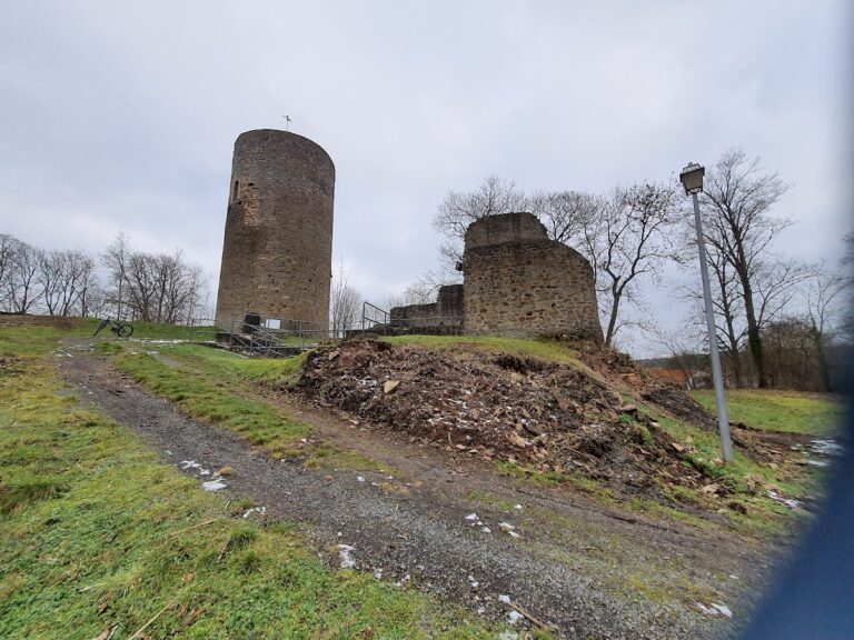
The ringwall and fortified settlement occupy approximately 8.3 hectares around the summit. Three defensive rings enclose the site, with ramparts reaching up to 4 metres high. The outer defensive line surrounds an irregular area measuring about 500 by 200 metres. On the steep western and eastern slopes, the natural ground was artificially steepened rather than reinforced with a full rampart. In flatter sections, a ditch ran in front of the rampart in places. Excavation showed that the southern part of this outer defense used a timber-and-earth construction. The settlement buildings were probably made from wood, straw, and clay.
Middle and inner fortifications
The middle defensive line survives as a rampart on the southern side, where the ground rises more gently. The plateau behind it served as settlement space. Its defensive strength was increased by steepened slopes, or scarps, reaching up to 12 metres high. These earthworks also protected the former main approach from the south.
The innermost fortification has a triangular plan and encloses approximately 1.5 hectares. Its rampart survives to about 2 metres high, with gate openings on the south and northeast sides. Ditches formerly stood before the rampart on level ground, while palisades probably strengthened the steep sides. Together, these features formed the most enclosed part of the hillfort.
Water sources and archaeological finds
Several springs supplied water in prehistoric times. Some were incorporated into the defensive system, including an annex spring, a slope spring, and a rampart spring. These sources now yield only small amounts of water in unusually wet years. Finds from the 1984 excavation include pottery, weapons, tools, horse harness, and 77 deliberately damaged iron objects. The swords, spearheads, and arrowheads from the probable ritual area provide material evidence for cult activity at the settlement.
Nearby sites