Alignement de Lagatjar: A Probable Late Neolithic Stone Alignment in Brittany
Site at a Glance
- Popularity
- High
- Country
- France
- Primary era
- Stone Age
- Eras represented
- Stone Age
- Civilizations
- Unclassified
- Site type
- Civic
- Remains
- Megalithic Monument
On this page8 sections
History
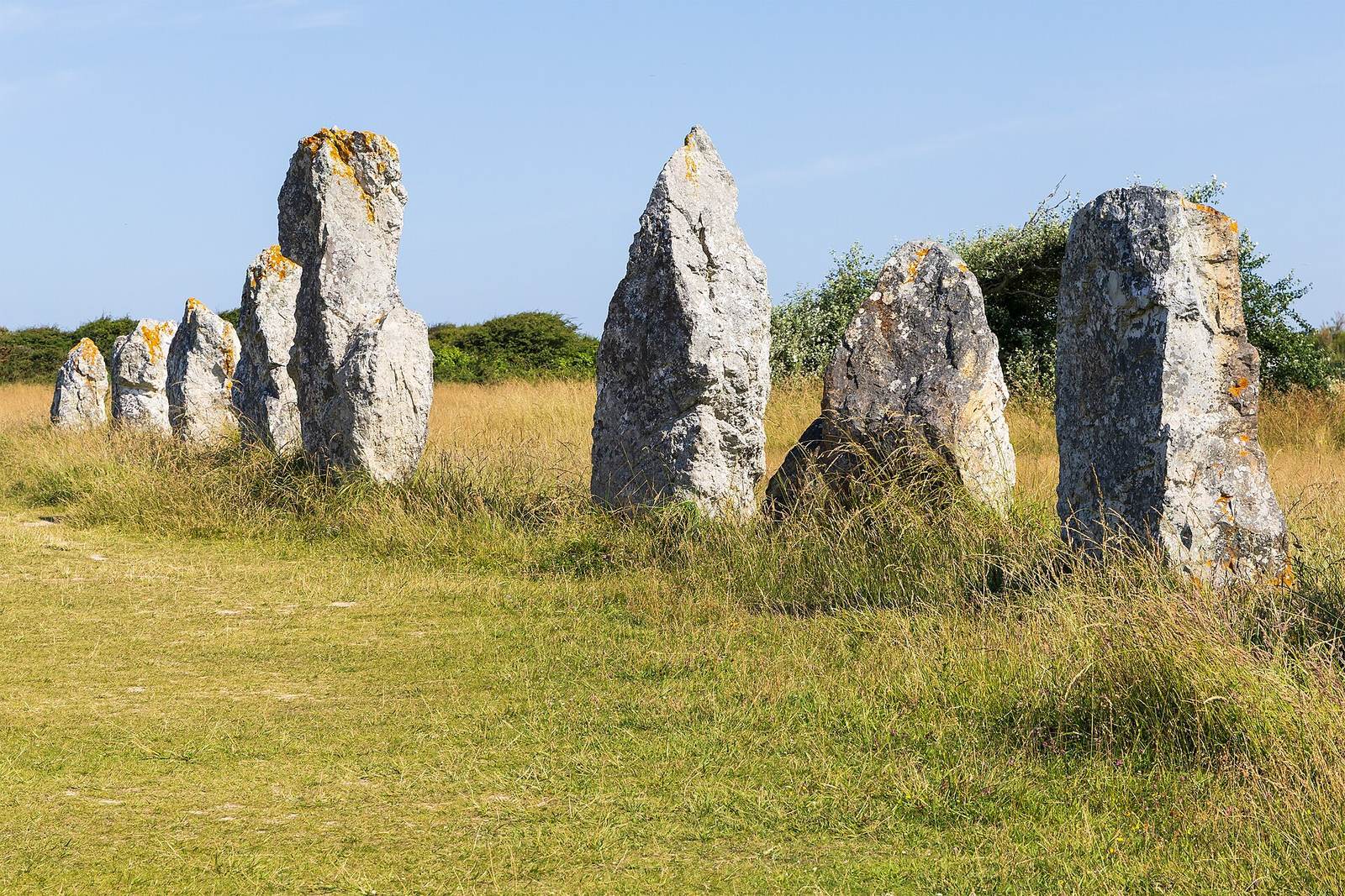
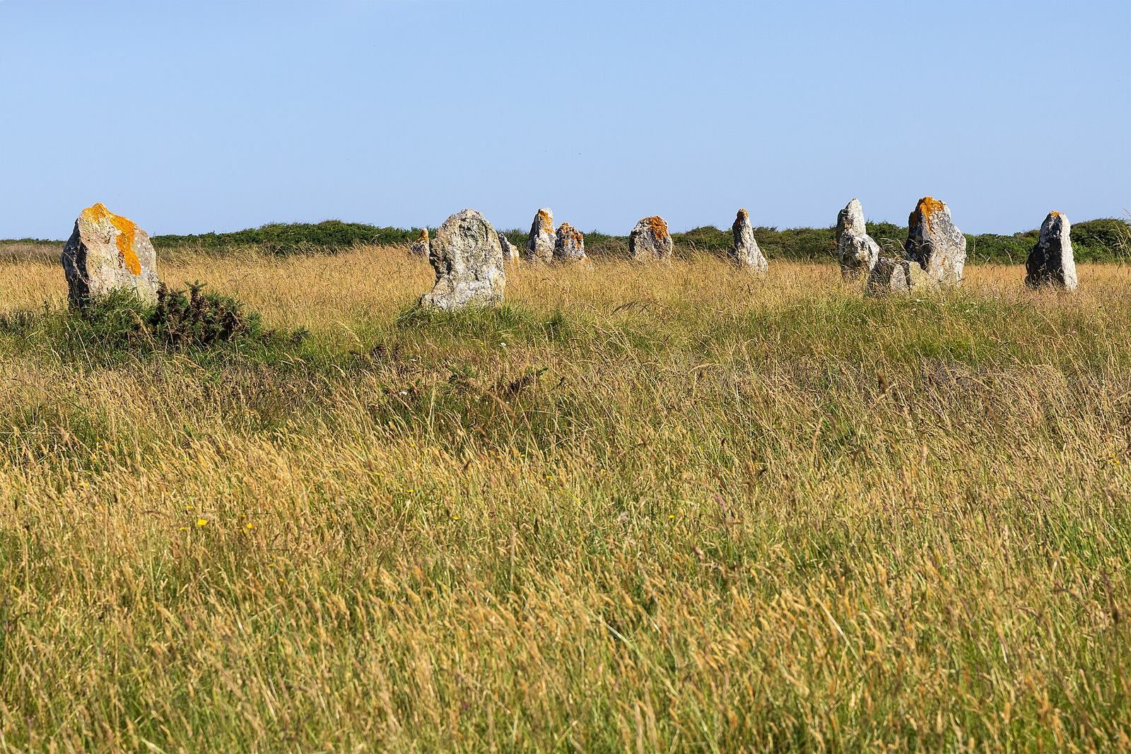
The Alignement de Lagatjar is a prehistoric stone alignment, a group of large upright stones arranged in rows, at Camaret-sur-Mer in Brittany, France. It probably dates to the Late Neolithic, the final phase of the New Stone Age before the Bronze Age, although its precise date is uncertain.
Early records and changing interpretations
The earliest known description comes from Admiral Thévenard in 1799. In 1805, Cambry described rows of stones extending 1,800 feet. Brousmiche called the monument a “Druidic temple” in 1830, invoking Druids, religious specialists among ancient Celtic peoples. That was an interpretation, not an established explanation of the site’s purpose. The Chevalier de Fréminville described 67 stones in 1835 and 1844. Vallin, Le Men and Flagelle added or repeated descriptions in 1859, 1876 and 1878, and the archaeologist Paul du Châtellier drew a plan after visiting in 1882.
Stone totals have varied according to what observers counted. Thévenard counted 84 menhirs, or large upright stones, around 1800; de Fréminville counted 67 in 1835; Alfred Devoir recorded 87 in 1908; Bénard Le Pontois counted 93 in 1929; and Giot counted 140 in 1961 and 65 in 1979. Small blocks and stones used to secure larger ones may have affected the totals. The original number is uncertain, with estimates reaching 400. A traditional claim of 600 menhirs may have confused the number of stones with the alignments’ total length. In 1908, Devoir proposed that two directions corresponded to the summer and winter solstices, when the Sun reaches its northernmost or southernmost apparent position in the sky. Toudouze later suggested a link with the Pleiades, a star cluster in Taurus. Neither astronomical interpretation establishes the monument’s purpose.
Several proposed reconstructions extend the alignments beyond their surviving length. Devoir considered a length exceeding 600 metres plausible and thought scattered blocks toward Kerbonn and the southwest, including two low stones on the cliff west of Penhir, might point to a continuation of more than a kilometre. Toudouze proposed a northern extension toward Styvel and two dolmens near the Lannic mill. A dolmen is a structure of upright stones supporting a capstone. This proposal would make the distance from Lannic to Kerbonn about 1.5 kilometres. Le Pontois also suggested that the longest row might have connected Lagatjar with remains near the Tas de Pois. Three dolmens were once reported northeast of the alignments. Two near the Lannic mill were destroyed in the early twentieth century; the supposed third was a mistaken identification of two leaning menhirs, which were raised separately during the 1928 restoration.
Protection and restoration
The alignments received historic-monument classification in 1883. In 1903, after du Châtellier warned the prefect that soil was being removed near the site, the mayor prohibited extraction in the surrounding area. Quarrying nevertheless continued, and du Châtellier noted deterioration in 1907. Devoir surveyed the monument in 1910.
The monument was restored in 1927–28 under Le Pontois and the historic-monuments architect Gaston Chabal. The 1928 work recorded 87 menhirs and 11 packing stones, which help hold larger stones in place. The arrangement visible today reflects this restoration.
Remains
Layout
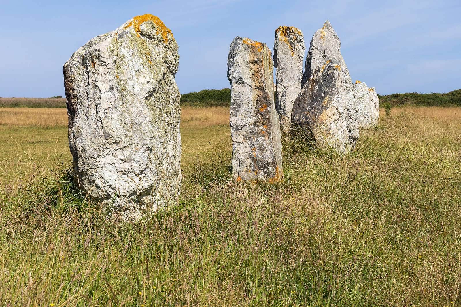
The surviving rows form an upside-down pi shape and extend for more than 200 metres. The principal row runs northeast to southwest and measures about 200–210 metres. A row roughly 40 metres long crosses it about 30 metres from its northeastern end and includes the largest menhir. A third row, about 50 metres long, runs parallel to the second, roughly 40 metres farther southwest. The rows contain 42, 13 and 17 stones respectively. Southeast of the main group are three isolated menhirs, two of them aligned.
Stone materials and finds
Materials and dimensions
The stones are chiefly local quartzitic sandstone, generally white quartzite, a hard rock rich in quartz. The underlying rock extends from Pointe du Grand Gouin to Pointe de Penhir, so transport may have been limited to about 100 metres. Packing stones were described as red, iron-rich sandstone, distinct from the menhirs, though quartz and reddish colouring were also noted at one menhir’s base. Most blocks are modest in size. Du Châtellier recorded one stone at 4 metres high, and some were described as 3–4 metres long before they were raised.
Recovered objects and deposits
A bronze axe, broken into two pieces, was reportedly found at the base of a fallen and broken menhir. A sandstone polishing stone and charcoal were recovered during the 1928 restoration, although the dating methods then available could not establish the charcoal’s age. A shell midden, a deposit of discarded shells, found on the summit of the Lagatjar dune in 1916 contained pottery fragments described as Neolithic.