Aléria: An Ancient Greek-Associated and Roman City in France




Site at a Glance
- Rating
- 4.2
- Popularity
- Medium
- Country
- France
- Primary era
- Classical
- External website
- Open
- Eras represented
- Iron Age, Classical, Medieval
- Civilizations
- Ancient Greek, Etruscan, Genoese, Roman
- Site type
- City
On this page22 sections
History
Aléria is an ancient archaeological site in France whose Roman city, Aleria, developed after earlier Greek-associated settlement. Occupation on the plateau extends back to the sixth millennium BC, while the site later became a Roman military, administrative, commercial, and religious centre in Corsica for approximately seven centuries.
Prehistoric communities and the rise of Alalia
The Aléria plateau supported Neolithic and Iron Age communities that cultivated crops, kept animals, fished in the neighbouring lagoons, extracted local resources, and practiced metallurgy. At nearby Terrina, copper production was established during the Chalcolithic period, approximately 3500–3000 BC. These activities place the later urban site within a long-established landscape of settlement and resource use.
Greek settlers from Phocaea in Ionia are traditionally credited with founding Alalia at Aléria around 565–566 BC. The foundation remains archaeologically unconfirmed because pottery securely dated to that period has not been found at the site, although Mediterranean contacts through trade are certain. Alalia became an emporium, or trading centre, associated first with Greek settlers and later with Etruscan and Carthaginian populations.
In 538 BC, a combined Etruscan and Carthaginian fleet fought the Phocaeans in the Battle of Alalia. The conflict weakened the Phocaean position, and the Etruscans subsequently took control of the city and its surrounding district. The Etruscan necropolis at Casabianda was used mainly from the sixth to the third centuries BC. Excavations uncovered 179 tombs during work in the 1960s and 1970s, followed by a further 130 tombs during excavations begun in 2018.
Roman conquest and urban development
Rome captured Alalia in 259 BC during the First Punic War, the long conflict between Rome and Carthage over control of the western Mediterranean. The city was almost completely destroyed and rebuilt as Aleria. Roman colonization followed in several phases associated with Sulla around 81 BC, Caesar in 46 BC, and Octavian around 32 BC. The precise roles of these phases were not identical, but together they formed the basis of Roman reconstruction.
Sulla, the Roman dictator and military commander, established a legionary fort or colony for veterans. Augustus, Rome’s first emperor, later promoted Aleria to colonial and provincial-capital status. An imperial procurator, an official responsible for administering imperial interests, resided there in a palace. The consul Lucius Cornelius Scipio recognized the settlement’s strategic value as a base from which troops could reach the interior and other coastal cities.
During the Roman period, Aleria became a major military, administrative, commercial, and religious centre. It helped drive the Romanization of Corsica and exported granite, minerals, oil, and cork. A military harbour, probably on the coast or at the Étang de Diane, served the Roman presence and has been identified with the ancient Diana Harbor. A commercial harbour stood near the mouth of the Tavignano, south of the river and approximately 150–200 metres from the present sea. The ancient shoreline was therefore considerably closer to the settlement than it is today.
Late Antiquity and Christian Aleria
Aleria underwent gradual decline from the fourth century AD while continuing to be occupied. A major fire occurred around 410, and the Vandals destroyed or sacked the city in the fifth century. The deterioration of drainage contributed to the formation of marshes and the spread of malaria. The plain remained sparsely populated and difficult to cultivate for centuries, although Aleria continued as a Christian centre.
Christian activity probably developed from Aleria during the fourth century. The settlement became associated with the church of San Marcellu, traditionally regarded as the first cathedral of Corsica, and remained one of the island’s five bishoprics until the French period. A letter from Pope Gregory the Great confirms the existence of a bishopric at Aleria at the end of the sixth century. From 1578, its bishops resided at Cervione; the diocese was suppressed in 1801 when the diocese of Ajaccio was extended over Corsica.
Medieval disruption and Genoese rule
Medieval attacks caused further disruption. A raid traditionally dated to Holy Saturday in 809 reportedly led to the capture of Aléria’s population, apart from the bishop and several elderly people. Inhabitants then sought refuge in Serra, Alesani, and Campoloro. By 935, Aléria had become a major Saracen stronghold. Remains found inside the amphitheatre arena may point to medieval occupation or reuse, although their date and interpretation remain uncertain.
In the early eleventh century, Tuscan or Genoese forces, aided by Christian communities, expelled Muslims from Aléria and other Corsican territories. The territory later came under papal suzerainty and, from 1091, was granted as a fief to the bishop of Pisa. In 1359, the territory between Brando, Aléria, Corte, and the sea allied itself with Genoa. The Genoese Republic, a maritime city-state that controlled much of Corsica during the medieval and early-modern periods, subsequently shaped the settlement’s military history.
Genoese authorities attempted to revive Aléria during the fifteenth century and built a fort on the northern promontory. The Matra family commanded it until the eighteenth century. In 1736, Francesco Saverio Matra, who was leading insurgents against Genoa, received Theodore of Neuhoff at the fort. The Matra family later used the stronghold as a base in opposition to the government of Pasquale Paoli.
The ancient ruins were exploited as a source of building stone and lime, apparently from the fourteenth century until the nineteenth century. Architectural elements were burned to produce lime or reused in nearby buildings. This long period of reuse altered the surviving fabric of the ancient city while also incorporating Roman material into later structures.
Rediscovery and archaeological protection
Prosper Mérimée described the ancient ruins after inspecting Corsica in 1839, paying particular attention to the western arch and the remains of the rectangular building beside it. Major excavations began in 1955 under Jean Jehasse and Jean-Paul Boucher. By 1958, the excavators had exposed the forum of the Roman city, and work between 1955 and 1960 revealed associated administrative, commercial, and religious quarters.
Jean and Laurence Jehasse directed excavations at the ancient city and the pre-Roman necropolis. Laurence Jehasse also directed the Aléria museum from 1967 to 1978. Support from Jérôme Carcopino, a Corsican-born French historian and statesman, helped revive archaeological study and protection at the site. Research since 2010 has examined Aléria and its maritime territory. A campaign in 2011–2013 reassessed the standing remains, while geophysical surveys in 2016–2017 investigated the limits, configuration, and density of the urban area inside the walls.
The ancient site is owned by the Collectivity of Corsica and has been designated a Historic Monument since 18 December 1990. The pre-Roman necropolis at Mattonata, Casabianda, and Lavandagio received designation in 1972, while the privately owned Santa Laurina remains were designated in 2007. Fort Matra has housed the Jérôme-Carcopino Museum of Archaeology since 1978. The museum preserves finds from Aléria, especially material from the Casabianda necropolis, and holds the status of a French Museum.
After the Second World War, malaria control and drainage carried out chiefly by the American army made repopulation and renewed agricultural use of the plain possible. The creation of SOMIVAC in 1957 promoted agricultural redevelopment in the eastern plain, including vineyards around Aléria. On 21–22 August 1975, Corsican regionalist militants led by Edmond and Max Simeoni occupied the Depeille wine farm. The confrontation with French security forces caused deaths and injuries, the dissolution of the Action régionaliste corse, and the subsequent radicalization of contemporary Corsican nationalism. A glass commemorative stele was inaugurated near the assault site on 22 August 2014.
Remains
The urban enclosure and public centre
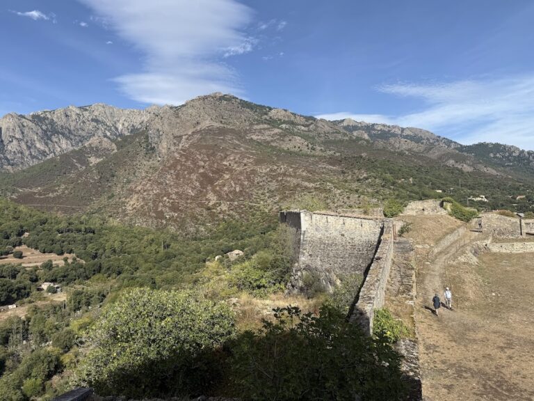
The ancient city occupied approximately 11 hectares on a promontory above the Tavignano. A surviving rampart defines part of the south-eastern boundary, while steep natural slopes protect the west and north. Gates have been identified or inferred in the southern, western, and north-eastern sections of the circuit. The archaeological complex brings together the Greek-period defensive wall, the pre-Roman necropolis, the Roman city, and a partially excavated Roman villa. Foundations and foundation walls preserve the main administrative, commercial, religious, and residential sectors, although the excavated area represents only a small part of the ancient city.
The forum lay south of the entrance and formed the centre of public life, including popular assemblies. Its trapezoidal plan measured approximately 92 metres in length, with bases of 24 and 39 metres. Porticoes bounded its northern and southern sides. Their cylindrical columns were built of unplastered brick, and a brick-paved gutter collected rainwater from the roofs.
Principal temple
The principal temple stood on the eastern side of the forum. Fine limestone formed the building, while its foundations used dressed rubble collected from the bed of the Tavignano. An inscription suggests that the temple was dedicated to the imperial cult of Rome and Augustus, the Roman practice of honouring emperors and members of the imperial household. A stone bearing a Christogram, a Christian monogram formed from letters representing Christ’s name, shows that the building was later used as a Christian chapel.
Domus with Dolium
North of the temple are the remains of the house known as the Domus with Dolium. Its name refers to a large earthenware storage jar, or dolium, set in the centre of a room on a brick floor. The house level stands 50 centimetres higher than the temple area and dates to the end of the first century AD. Five large square columns belonged to its central peristyle, an enclosed courtyard surrounded by porticoes.
The domus was oriented east–west. Service or work rooms occupied its southern part, while a septic installation in the east discharged into a large cesspit made of shell limestone. Finds include a small, well-preserved grain mill, a lava-stone salt mill, coins dating from the reign of Tiberius to that of Trajan, bronze objects, bones, pottery, and inscriptions. One inscription records the relationship between fifteen Corsican communities and the patron or leader of the colony of Aleria, providing evidence for the island’s third-century economy.
Shops and southern approach
Foundations of Roman shops survive south of the forum, behind the portico. Farther west stood a southern gate, from which a road led approximately 200 metres to the amphitheatre. The building immediately east of the southern gate may have been a magistrate’s office, although its function remains uncertain.
Administrative and bathing complex
Praetorium
The Praetorium stood west of the forum. A praetorium was an official administrative and judicial headquarters, and this complex served as the seat of the governor. It was arranged as a shaded precinct with water basins and fountains. The sole entrance passed through a northern arch, and the trapezoidal complex had porticoes on three sides. Their roofs sloped toward the open centre, directing rainwater into reservoirs.
A square building against the eastern side of the Praetorium has been almost completely destroyed. It may have been a large Capitolium, or capitol temple, reached from the forum by a monumental staircase. Traces of columns indicate a cella, the principal enclosed chamber of a temple, surrounded by columns. The southern portico had columns approximately one metre thick, connected by limestone slabs and supporting an oak roof. Stairs led down to storage rooms beneath it.
The central water basins date to the third century AD and supplied channels along the western wall and the adjacent balneum, a Roman bathing complex. Enclosed rooms in the north-west corner probably served as armouries and treasuries. The Praetorium was repeatedly altered and enlarged through the fifth century AD.
Balneum
The balneum lay north of the Praetorium and contained reservoirs, bathing and changing rooms, heated rooms, and underground drainage. Two reservoirs occupied the centre of the complex in an arrangement resembling an impluvium, a basin designed to receive rainwater. The larger eastern cistern appears to have been divided internally and had a red-brick floor; the smaller western cistern was made from a coarse and unusual stone material. Sixteen brick column remnants supported the roof.
A five-metre-wide corridor surrounded the central part of the baths. Four rooms to the north had mosaic floors, and one contained oil containers fixed in cement. Small water basins survived along the western side. The heated rooms, or caldaria, occupied the south-west corner. Broken floors reveal a hypocaust, an underfloor heating system in which small pillars allowed hot air to circulate beneath the pavement.
Three heated rooms formerly had blue-and-white checkerboard mosaics. A fourth contained a polychrome mosaic with triangles, squares, interlace, and foliage motifs characteristic of third-century design. A semicircular basin in the southern heated room was warmed by a furnace, with three cold-water reservoirs behind it. The balneum dates to the period of Sulla, its halls to the Augustan period, and its interior construction to the beginning of the fifth century AD. Its arrangement may have served the governor and his residential quarters, although that function remains uncertain.
Industrial quarter, roads, and amphitheatre
The industrial quarter west of the balneum contained large quantities of oyster shells, indicating the processing of preserved shellfish, crustaceans, and fish. Parts of the buildings date to the first century AD. Shops, offices, and kitchens associated with the Praetorium also occupied this area. A passage at the south-west corner of the balneum led to a road used to transport fuel wood for heating the baths.
The decumanus maximus, the principal east–west road, met the road between the industrial quarter and the balneum in a semicircular area near the western city gate. A rampart ran through this area, with a mausoleum beneath it associated with a prominent individual.
Amphitheatre
The amphitheatre lies approximately 200 metres south of the excavated urban centre. Its small dimensions have prompted an estimate of no more than about 2,000 spectators, but the date and interpretation of the structure remain uncertain. Archaeological remains found inside the arena may indicate medieval reuse.
Necropolises and Roman villa
The Casabianda necropolis lies south of the Roman city, approximately 500 metres from the ancient urban area. Its rock-cut tombs contained jewellery, weapons, metalwork, bronze and ceramic vessels, rhyta, kraters, and other grave goods, including fine Greek and Etruscan works. The cemetery was abandoned when the Roman city and its northern cemetery were established.
The archaeological complex also includes a partially excavated Roman villa and a cemetery near the modern excavations. Numerous furnishings, ceramics, coins, sculptures, and bronzes recovered from the site are preserved in the Jérôme-Carcopino Museum rather than remaining in place.
Fortifications and later buildings
Fort Matra
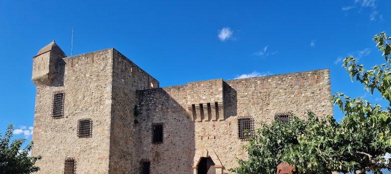
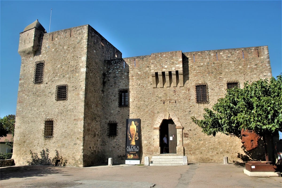
Fort Matra stands on a rocky spur north of the Aléria plateau, overlooking the Tavignano and the surrounding plain. Built by the Genoese during their rule, it functioned as a garrison, a surveillance post for the coast and lagoons, and a Genoese arms depot. Its construction date is uncertain. The fort now contains the archaeological museum and preserves finds from the ancient city and the Casabianda necropolis. A marble lion stands at its entrance.
The museum’s collections include prehistoric material, Greek, Etruscan, and Roman ceramics, jewellery, weapons, utilitarian objects, bronzes, sculptures, coins, and other archaeological remains. Notable displayed objects include a small marble bust of Jupiter-Amon and drinking vessels shaped as a horse’s head and a dog’s head.
Diana Tower
The surviving remains of the Diana Tower stand between the coast and the Étang de Diane. This former Genoese tower protected the entrance to the lagoon and has been partly restored.
Church of San Marcellu
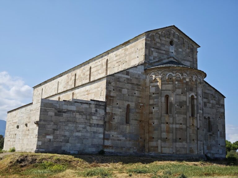
The church of San Marcellu stands near Fort Matra. Probably built during the fourth or fifth century AD, it is traditionally regarded as the first cathedral of Corsica. The church was destroyed and rebuilt several times, with stones from the Roman city reused in its construction. Its seventeenth-century oil painting Saint Marcel between Two Martyrs is protected separately as a cultural object.
Santa Laurina baths
The Santa Laurina Roman baths, dated to the second century AD, form another part of the Aléria archaeological complex. They may originally have been a mansio, an officially maintained stopping place beside a Roman road. Another interpretation identifies part of the remains as a Paleo-Christian basilica. Jean Jehasse directed their excavation.