Abritus: A Roman Fort and City in Bulgaria
Site at a Glance
- Popularity
- High
- Country
- Bulgaria
- Primary era
- Classical
- Eras represented
- Iron Age, Classical, Medieval
- Civilizations
- Byzantine, First Bulgarian Empire, Roman, Thracian
- Site type
- City
On this page21 sections
History
Thracian settlement and Roman occupation
Abritus is an ancient settlement and Roman fort at Chisarlik in Razgrad, Bulgaria, with a late-antique fortress built in the late third or early fourth century. The site grew from an earlier Thracian settlement into a military and urban center that helped protect the Roman frontier and routes in the lower Danube region.
Human activity at Chisarlik reaches back to the Upper Paleolithic, the later phase of the Old Stone Age. A cultural layer from the second half of the fifth century BC and a Thracian settlement dating broadly to the fourth and third centuries BC mark a later phase of occupation. The settlement was probably a center of Rysiké, a Thracian administrative district, under the last Thracian kings.
Roman occupation expanded the earlier settlement in the late first or early second century AD. By the late first century, soldiers’ families and other civilians had established a settlement connected to the garrison. Roman auxiliary troops were present by AD 78. In the second century, the Cohors II Lucensium, an auxiliary military unit, was stationed at Abritus in association with Legio XI Claudia, a Roman legion based at Durostorum, modern Silistra.
Roman fort and city
Lower Moesia became a Roman province in AD 45. After the provincial division of AD 86, Abritus lay in Moesia Inferior, and during Late Antiquity it belonged to Moesia Secunda. A stone fort may have been started under Marcus Aurelius or his successor Commodus, though that dating is uncertain. A later fort was built in the late third or early fourth century, and its major defenses were constructed or enlarged around AD 320-330 under Constantine the Great.
The fort guarded the empire’s rear defensive line, helping secure the Danube frontier and roads linking Odessus, Marcianopolis, and Sexaginta Prista. The fertile surrounding countryside supported farming, vineyards, and livestock, supplying nearby settlements and military posts. The civilian city flourished especially from the second to the fourth century. After regular troops withdrew, the fort served as a defended civilian center. Its residents included Roman veterans, Thracians, Greek merchants and craftspeople, Sarmatians, Goths, and migrants from western Asia Minor. By its final period, the built-up area extended to about 300 hectares.
In AD 251, during the Gothic invasions, a major battle took place about 15 kilometres northwest of Abritus. Roman Emperor Decius and his son and co-ruler Herennius Etruscus were killed, and the Roman army suffered a severe defeat. The fort apparently escaped destruction in the battle and was strengthened afterward.
Late Roman and Byzantine phases
Abritus was destroyed and rebuilt during the Roman-Gothic fighting of AD 376 to 378, the Hun attack of AD 447, and further Gothic assaults in the 480s. Despite these blows, it remained one of the province’s largest cities in the fifth and sixth centuries. As Christianity became the Roman Empire’s official religion, Abritus also developed into a church center. A bishop named Marcian is associated with the city by about AD 458. Under Justinian, Abritus was a bishop’s seat within the church province of Marcianopolis, an ecclesiastical region comprising several dioceses. The historic bishopric also gave rise to the titular see of Abrittum, a title preserving a former bishopric without an active local diocese.
Abandonment and medieval reuse
Attacks by Avars, a steppe people, and Slavic peoples severely damaged Abritus around AD 586, after which the fort was abandoned. A Bulgarian settlement later occupied the ruins and continued into the tenth century. Bulgarians refortified the site in the late ninth or early tenth century. In the mid-eleventh century, Pechenegs, another steppe people, burned the Bulgarian fortress during a war involving Sviatoslav I, prince of the Kievan Rus, a medieval East Slavic polity.
Identification and archaeological investigation
Ananie Yavashov began exploring the area in 1869 by excavating a mound near the fortress, and more substantial investigations at Abritus began in 1887. In 1893, Yavashov uncovered a sixth-century church about 60 metres east of the west gate and probably part of the south gate. He first took the church for a temple of Apollo because an ancient inscription had been reused in its construction. The northeast fan-shaped tower was excavated in 1928, and Yavashov published findings from Chisarlik in 1930. Teofil Ivanov excavated further parts of the church in 1953. An inscribed altar found in 1954 confirmed the identification of the site as Abritus.
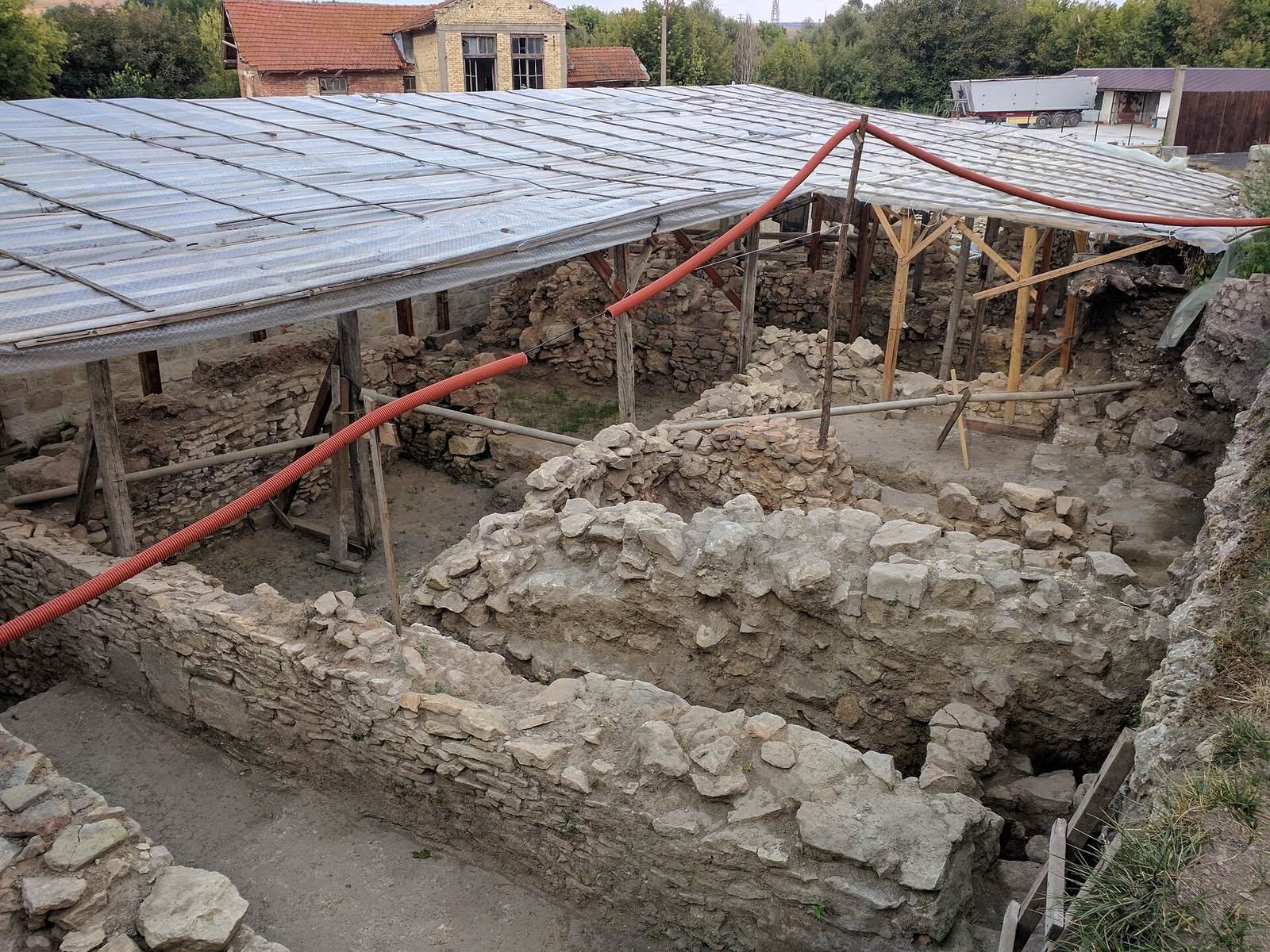
Systematic excavations by the Bulgarian Academy of Sciences’ Archaeological Institute and the Razgrad History Museum ran from 1955 to 1976. They established the positions of the gates and towers, allowing Ivanov to reconstruct the fort’s plan. Work paused in 1972 when a pharmaceutical factory occupied parts of the site, especially its central and western areas, and resumed in the 1990s farther from the factory. Abritus became one of the most thoroughly investigated Roman sites in southeastern Europe and the first Roman fortification in Bulgaria to be almost completely excavated and conserved.
Remains
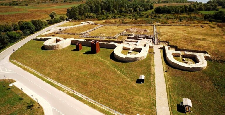
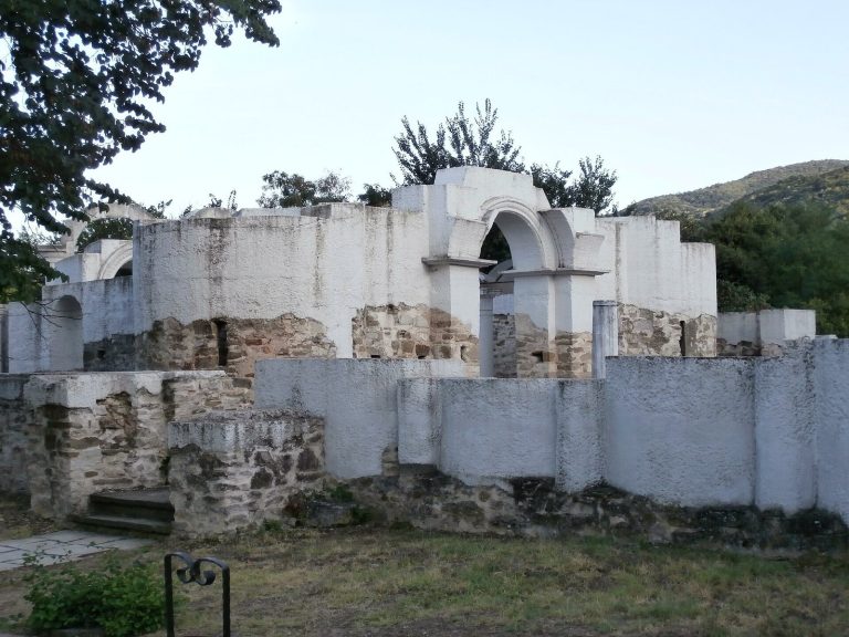
At Chisarlik beside the Beli Lom River, the late-antique fort occupied a slight rise west of the earlier civilian settlement. The river protected its northern and eastern sides. The fort covered about 10 hectares; the area enclosed by the city walls measured about 15 hectares. Its rectangular defenses were built mainly of limestone, with cut-stone facings around a rubble-and-mortar core. Outside them, the civilian city had a rectilinear street plan.
Fortification circuit
Walls and moat
The wall circuit was about 1,400 metres long. Its northern side measured 295 metres, the eastern 358.90 metres, the southern 354 metres, and the western 339 metres. On the east, the wall followed the riverbank before turning about 104 degrees toward the northwest. The walls were 2.40 to 2.85 metres thick and probably reached about 12 metres in height, with the defensive walkway roughly 10 metres above ground.
Foundations about 1.50 metres deep consisted of limestone rubble set in mortar. Carefully worked limestone blocks faced a core of rubble and concrete containing mortar and fragments of yellow and red brick. Reused grave markers and architectural fragments, some bearing reliefs or Greek and Latin inscriptions, formed finishing courses on the inner and outer faces of the upper foundations. They probably came from nearby cemeteries or damaged second-century public buildings and may have helped counter movement under the weight of the masonry.
A moat ran outside the southern and western walls and was later filled in; shallow depressions remain visible in places. The southern side was especially vulnerable because higher ground overlooked it. There the wall was thicker and the south gate set back, while the moat added another barrier.
Main gates
Four principal gates stood on the north, west, and south sides and at the northeast corner, alongside nine smaller secondary entrances. They were not positioned directly opposite one another. Gate chambers followed broadly similar plans, with limestone-block facings held by iron clamps fixed with lead. Semicircular niches about 1.70 metres above the entrances may have held statues.
The north and west gates had central gatehouses about 10 metres high and two storeys tall. Their upper levels housed the winches that raised and lowered the portcullises, and a crenellated fighting platform may have stood above. Each passage was about 4 metres high and could be shut with a double-leaf wooden door. The outer passage measured 4.16 metres across at the north gate and 4.50 metres at the west; each gate chamber was 6.18 metres long. Carefully cut limestone pilasters flanked the north gate’s outer entrance. Its gatehouse stood between fan-shaped tower 10 and horseshoe-shaped tower 11, which were 19 metres apart.
The east gate occupied a square tower at the northeast corner, where the ground dropped toward the river. Its passage was 4.50 metres wide. The south gate sat in a funnel-shaped recess in the wall and had a plan similar to the gate at Iatrus, another Roman fort on the Danube frontier. Stairways inside the north, south, and west gates led to the wall walkway. The north stairway, built with reused material, measured 9.84 by 1.60 metres; projectiles were stored in the recess beneath it. The south stairway measured 12.66 by 2.10 metres and the west one 6 by 1.86 metres.
During Justinian’s reign, the north gate’s inner and outer passages were walled up, as were the outer passages of the south and east gates. The west gate remained open. A narrow defensive wall was also added outside the southern wall between towers 19 and 20.
Defensive towers
The defenses included 35 projecting towers, among them four fan-shaped towers at the corners and 29 horseshoe-shaped towers. Six square intermediate towers were also identified along the eastern and southern walls. Towers originally stood about 15 to 16 metres high and had three storeys, probably connected by simple wooden stairs. Their entrances were centered in the rear walls, with upper-level exits onto the wall walkway. Tower foundations, about 1.50 metres deep, used mortared limestone rubble. Unlike the curtain wall, each tower stood on a base about 60 centimetres high, made of limestone blocks secured with iron clamps fixed by lead. The floors were gravel made from crushed limestone and sandstone.
A defensive walkway ran below the tower roofs. The upper storeys probably had large round-arched openings for defenders, while narrow firing slits served the lower levels; one slit was excavated along the east wall. Horseshoe-shaped towers projected about 10 metres beyond the wall. On the north side, eight horseshoe towers, including the pair beside the north gate, stood 27.80 to 28.33 metres apart. The east side had one horseshoe tower protecting the south side of the east gate and four rectangular towers at intervals of 21.50 to 79.75 metres. The south side had seven horseshoe towers and two elongated rectangular towers spaced 19 to 21.10 metres apart.
Towers 27 and 28 measured about 18.90 by 19 metres, with depths of about 10.25 and 10.45 metres. Their side walls met the curtain wall at right angles; tower 11 had more oblique sides. The elongated eastern towers 19 and 23 had two large rectangular pillars apiece, each 2.10 by 1.50 metres, supporting the upper floors. The pillars used stone-and-brick masonry, and their mortar contained small brick or roof-tile fragments. A projecting limestone ledge ran about 2.10 metres above the ground, with a similar feature at the north gate. The floor had been raised in a later phase. Towers 12 and 13 did not project behind the wall, unlike towers 14 and 15.
Water and buildings
Water supply
Clay pipes brought fresh water from a source near Poroliste, about 5 to 6 kilometres away. The line passed beneath the south gate and reached the fort’s center. A second aqueduct came from Nedoklan, about 3 kilometres northeast of the city. Channels beside the walls carried away rainwater and melting snow.
Buildings within the fort
Excavated buildings included a warehouse against the west wall, the commander’s residence in the east, and two other large structures. The residence had a courtyard surrounded by a portico, or covered walkway, supported by 22 marble columns on its eastern side and 15 on the southern side. A small temple stood within the complex.
A large grain store stood 10 metres south of the west gate. It had a rectangular plan oriented north to south and measured 56 by 20 metres. The building was used from the fourth to the sixth century.
Civilian city
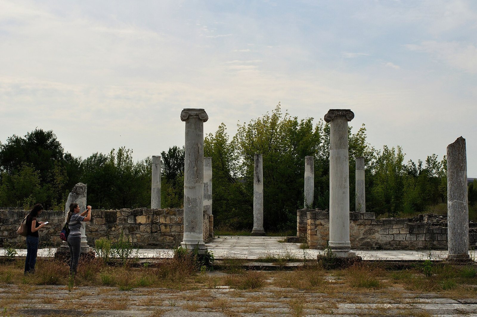
The civilian settlement had a central public square, administrative buildings, and a regular street plan. A large building and several rural agricultural establishments stood along its main street. On the east-west main street, a residential and commercial building covered about 3,000 square metres. Its 25 rooms and shops surrounded a courtyard enclosed by a reused Ionic colonnade, a row of columns with capitals shaped by spiral forms. Another colonnade, 41 metres long, ran beside the pavement along the building’s southern frontage.
Churches and cemeteries
Churches
A sixth-century church stood about 60 metres east of the west gate. Within the fort, one church in the western area had three aisles. Another, at the highest point in the east, had a single aisle and was surrounded by service buildings.
Cemeteries
Burial mounds and cemeteries lay north, west, and east of the city. The northern and eastern burial grounds included graves of members of the Thracian elite. Burials excavated in parts of the southern and eastern cemeteries date from the second to fourth centuries. The eastern cemetery originated in the fifth century and has architectural and burial-furnishing features not previously known in Bulgaria.
Finds and collections
Sculpture and precious objects
In 1921, vine growers found 26 bronze statues and reliefs depicting Greek and Roman deities north of Chisarlik. The objects are now in the Razgrad History Museum. Excavations also recovered gold and silver objects, including a gold figure of Pegasus, the winged horse of Greek mythology, which appears on Razgrad’s coat of arms.
A hoard of 835 gold coins, weighing nearly 4 kilograms and representing ten late Roman emperors, was found just inside the eastern wall. It probably had been hidden during the Gothic invasion of AD 487.
Inscriptions and lapidarium
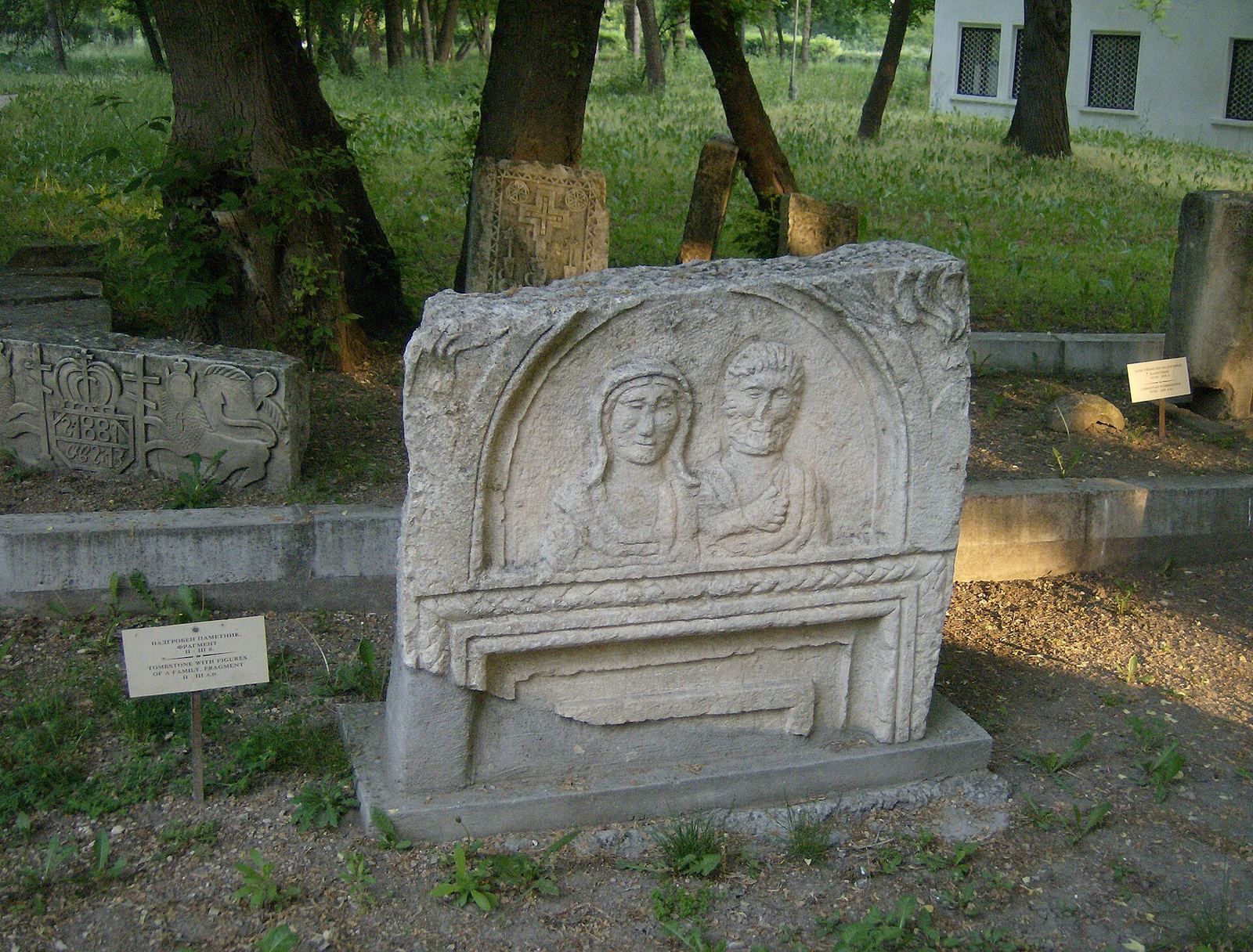
A limestone altar dedicated to Hercules dates to AD 139-161. Its inscription provides evidence for the ancient name of the site. Other finds from Abritus include inscriptions, reliefs, statues, architectural fragments, and votive plaques. A lapidarium, a display of stone antiquities, was established near the museum in 2002 and contains 60 inscribed stones.