Salamis: An Ancient Greek Port and Roman-Byzantine City in Cyprus
Site at a Glance
- Rating
- 4.5
- Popularity
- Low
- Country
- Cyprus
- Primary era
- Classical
- Eras represented
- Iron Age, Classical, Medieval
- Civilizations
- Ancient Greek, Byzantine, Roman
- Site type
- City
On this page25 sections
History
Salamis was an ancient Greek city and port on the eastern coast of Cyprus, near modern Famagusta, whose earliest remains date to the eleventh century BCE. It developed around a natural harbor after the earlier settlement of Enkomi, forming the second of three successive urban centers in the area before medieval Famagusta. Salamis grew into a maritime, royal, commercial, and religious center whose history brought together Cypriot, Greek, Levantine, Egyptian, Assyrian, Phoenician, Persian, Roman, and Byzantine traditions.
Origins and the Cypriot kingdoms
Salamis probably developed after Enkomi was destroyed or became separated from the sea, although finds indicate that the two settlements briefly existed at the same time. The precise sequence remains uncertain. The new settlement first occupied a limited area around its natural harbor and expanded westward from the eleventh century BCE.
Greek tradition attributed the city’s foundation to Teucer, son of Telamon and king of the Greek island of Salamis. According to the foundation myth, Teucer was exiled after failing to avenge the death of his half-brother Ajax in the Trojan War. He reached Cyprus, founded the city, and named it after his homeland. Tradition also connected him with the cult of Zeus Salaminios, the principal male deity associated with Salamis, although direct evidence for the story is slight.
Salamis stood on maritime routes and near Cyprus’s copper resources. From the late eighth century BCE, these advantages helped it become an important commercial center. Its connections extended to the Levant, Egypt, Anatolia, the Aegean, and other Mediterranean regions. The population included Greeks, Phoenicians, Persians, and Egyptians, while imported pottery found in both royal and ordinary graves shows that foreign contacts reached beyond the ruling household.
Assyrian records list Salamis among the Cypriot kingdoms of Iadnana. Esarhaddon’s record of tribute, dating to his reign from 680 to 669 BCE, names Kisu, king of Sillu’ua, probably in connection with Salamis. Assyrian control or influence had been established over Cyprus by the late eighth century BCE, but the island’s kingdoms retained a degree of autonomy through the payment of tribute.
Persian rule and the classical city
Salamis came under Egyptian overlordship during the sixth century BCE and later entered the Persian sphere for approximately two centuries. Its kings retained considerable authority because the city remained relatively autonomous and benefited from extensive commercial connections. Salamis began issuing its own coins in the sixth century BCE, probably from about 515 BCE, using Persian prototypes.
The city’s position between Near Eastern and Aegean worlds is especially clear in its burial customs and imported goods. Greek Geometric pottery from a royal tomb may have formed part of the dowry of a Greek princess who married into the Salaminian royal family. Similar Greek pottery in the graves of ordinary inhabitants indicates that such connections were not confined to the court.
A royal relative named Onesilus led a revolt against Persian rule around 499 or 498 BCE after his brother Gorgus refused to join the Ionian uprising. The Cypriots achieved a naval success, but Persian forces defeated them on land. Onesilus was killed, and Persian control was restored. Salamis later became involved in the wider conflicts between the Persian Empire and the Greek states. In 450 BCE, during the wars of the Delian League, an alliance led by Athens that fought Persia and later became an instrument of Athenian power, a combined land and naval battle took place at Salamis. This was separate from the better-known battle fought near Salamis Island in Attica in 480 BCE.
Under King Evagoras I, who ruled approximately from 411 to 374 BCE, Greek culture and art flourished at Salamis. The city then remained involved in the struggles among the Diadochi, the successors of Alexander the Great who fought over his empire after his death in 323 BCE.
Ptolemaic and Roman transformation
After Alexander’s death, Cyprus became an object of conflict among his successors. Ptolemy I eventually took control of the island. In 311 BCE he forced Nicocreon, the last king of Salamis, to commit suicide, and his brother Menelaus, a Ptolemaic commander, assumed control. In 306 BCE Demetrius I Poliorcetes defeated Ptolemy’s forces in a naval battle at Salamis and captured Cyprus. Ptolemaic rule was restored around 301 BCE and continued until Roman annexation.
During the Hellenistic period, Paphos became the island’s official capital, but Salamis remained a major administrative and commercial center. Under the Ptolemies, it served as the seat of the island’s governor. In 58 BCE, the Roman Republic annexed Cyprus. The Senate commissioned Marcus Porcius Cato the Younger to incorporate the island into Roman territory, while Ptolemy of Cyprus, the last Cypriot king, committed suicide rather than surrender. Salamis became part of the Roman province of Cilicia, although the governor’s residence was transferred to Paphos.
Salamis prospered under Roman rule through trade in copper and timber and remained one of Cyprus’s principal commercial centers. The emperors Trajan and Hadrian favored the city and restored or developed its public buildings. This period shaped much of the urban fabric visible today, since most of the surviving public architecture belongs to the Roman and Late Roman periods.
The city was severely damaged during the Jewish revolt of 115 to 117 CE. Cassius Dio described extensive destruction and a very large number of deaths, although the reported figure is uncertain. Salamis was rebuilt after the revolt. Christianity reached the city during the first missionary journey of Paul and Barnabas, who came from Antioch of Syria and preached in the Jewish synagogues before travelling through Cyprus. Barnabas, traditionally regarded as the founder of the Church of Cyprus, was also believed to have grown up in Salamis, to have been martyred there around 61 or 75 CE, and to have been buried near the city.
Constantia and the end of the city
Major earthquakes in 332 and 342 CE destroyed much of Salamis, and the later event may also have produced a tsunami. The revolt of Calocerus in 334 caused further disturbance and required imperial intervention. Constantius II, the Roman emperor from 337 to 361 CE, rebuilt the settlement on a smaller area, granted its inhabitants temporary tax relief, and renamed it Constantia. The rebuilt city became Cyprus’s principal city and an episcopal, later metropolitan, center.
The harbor gradually silted up, reducing the city’s commercial importance from the fourth century onward. Constantia nevertheless remained an important Christian and administrative center. During the reign of Justinian I, the Byzantine emperor from 527 to 565 CE, its defenses and public buildings were repaired or renewed. Bishop Epiphanius, who lived approximately from 367 to 403 CE, was the city’s most prominent Christian leader. He directed construction of the metropolitan basilica that bears his name, and his successor Sabinus completed it after Epiphanius’s death.
Arab attacks and natural disasters ended the city’s history in the seventh century. A final destruction is dated variously to around 647 to 650 CE. Fire traces, ash, and collapsed building material belong to this destruction layer. The remaining inhabitants moved to Arsinoe, a declining settlement farther along the coast that later developed into Famagusta. Constantia was therefore abandoned before medieval Famagusta was founded.
Excavation and interpretation
Archaeological work began in the late nineteenth century under the Cyprus Exploration Fund. Excavations resumed in 1952 and continued until 1974 through the Cyprus Department of Antiquities and French missions working at Salamis and Enkomi. After the 1974 Turkish invasion, an international embargo prevented the continuation of the principal excavation programs. The site and its museums have since been maintained by the antiquities service.
Excavation has revealed a city whose public buildings, water installations, harbor areas, cemeteries, and churches reflect successive changes from an Early Iron Age port and royal center to a Roman commercial city and finally a smaller Byzantine episcopal settlement. Finds are held in the Saint Barnabas monastery collection, the Famagusta district museum, and the British Museum. Some sculptures were removed from their original settings or mutilated, probably during late-antique Christian opposition to pagan images.
Remains
Salamis extended for approximately 2 km along the coast and about 1 km inland. Its urban area developed around a natural harbor and was surrounded on the landward side by defensive walls. Public squares, temples, baths, a theatre, waterworks, villas, and Christian basilicas occupied the city, while an extensive cemetery stretched westward toward the monastery of Saint Barnabas, north toward Ayios Serghios, and south toward Enkomi. The necropolis covers approximately 7 km2 and contains burials from the Geometric period, an early Greek period associated with geometric decoration on pottery, through the Hellenistic and Early Christian periods.
Harbors, walls, and water supply
Harbors and defenses
The older harbor lay southeast of the city and was protected to the north and south by artificial breakwaters. A second harbor north of the city was generally used for military purposes during the Late Roman period. A long reef formed a lagoon between the harbor areas. Excavations in 1971 and 1973 uncovered harbor installations, roads, and silted areas, and indicated that the city wall may have followed the breakwaters and a submerged coastal ridge.
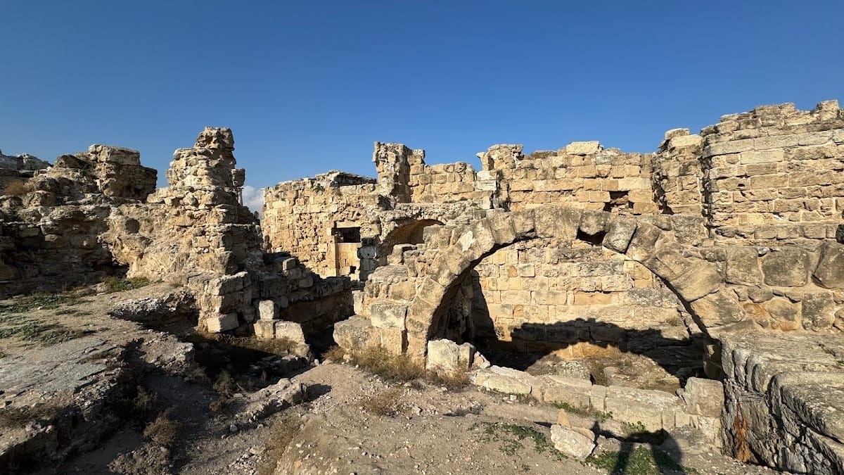
The outer wall visible today was built under Constantius II around the reduced center of Constantia. A smaller inner wall, begun under the same emperor and renewed or rebuilt under Justinian, enclosed the area around the Basilica of Epiphanius and the large reservoir. Its surviving circuit protected the reduced city during the seventh-century Arab attacks.
Aqueducts and reservoirs
The Kythrea-Salamis aqueduct brought water from springs in the Kyrenia range. Its conduit extended approximately 35 to 40 km and had a reported cross-section of about 0.80 by 0.80 m. Scattered pillars and arches survive, including three pillars and two arches north of the Saint Barnabas monastery. The surviving pointed arches are attributed to a later Lusignan restoration.
An inscription has been used to place the aqueduct’s foundations in the Neronian period during the mid-first century CE, while other inscriptions and interpretations assign parts of the system to the Severan or sixth-century periods. A later Byzantine aqueduct, probably connected with Justinian’s reorganization of the water supply, may have replaced or supplemented the earlier installation. The conduit divided near the city into branches leading toward the large reservoir beside the agora and toward the palaestra and baths.
The main reservoir, known as the Loutron or Vouta, stood beside the agora. This rectangular, vaulted basin was supported by 36 square pillars, each approximately 1.1 m across. Its sandstone walls were 2 to 2.5 m thick, while the basin measured about 52.5 by 15.3 m and was roughly 5 m deep. Its capacity has been estimated at approximately 4,000 m3. Three large openings probably admitted water, and a low outlet and stairs allowed the basin to be cleaned.
Two additional reservoirs stood south of the baths. The larger measured approximately 26 by 4.3 m and may have been 5 m deep, with an estimated capacity of about 550 m3. Its stepped southern wall had previously formed part of the stadium. The smaller basin measured about 10 by 4.9 m and was at least 2 m high, with a capacity exceeding 100 m3. A raised channel near the palaestra used two small basins and underground pipes to form a siphon across a foot passage. Three more basins stood where the Colonnaded Street crossed the modern road.
Gymnasium and baths
Palaestra and gymnasium
The palaestra and baths occupied the northeastern part of the city. The gymnasium was rebuilt under Augustus with a large eastern portico, colonnades, and a columned exercise court. The palaestra had a central entrance in its southern portico, while its roofs were originally supported by stone arches. A central column probably carried an imperial statue, and its stepped grey-marble base survives. Parts of an Early Byzantine pavement with simple geometric designs remain.
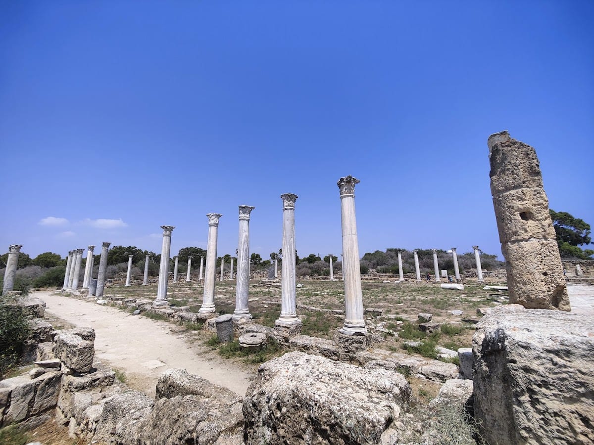
The eastern portico was wider than the others and used fluted columns. Many columns had been reused from earlier buildings and were restored in 1952 and 1953. Marble statues, mostly copies of Greek or Roman originals, once stood along the porticoes. Many are headless. After the fourth-century earthquakes, stone columns were replaced by marble ones, and some columns and statues were transferred from the theatre.
Roman baths
The gymnasium was later converted or expanded into a bath complex. Open rooms with pools stood at both ends of the eastern portico. A large rectangular pool bordered by a Corinthian colonnade lay to its south, while a smaller pool near the northern end began as a round basin and was altered during the fourth-century rebuilding.
The baths included symmetrical antechambers with octagonal pools, a large sudatorium, or heated sweating room, and halls ending in semicircular apses. A hypocaust, an underfloor heating system that circulated hot air beneath the floor, warmed the western hall. The three principal halls were Roman, with side halls serving as sweating rooms and the central hall as the caldarium, or hot room. Furnaces in the northern part supplied the heating system.
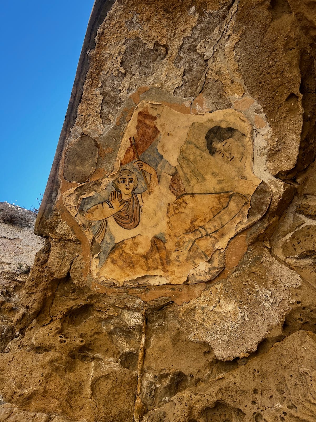
Mosaics and frescoes decorated the walls and niches. One surviving mosaic shows the river god Eurotas within an interlaced-ribbon border, while another depicts the Niobids being killed by the arrows of Apollo and Artemis. A semicircular latrine with 44 seats occupied the southwestern corner behind a fountain. Water flowed through a channel in front of the seats and carried waste toward an outlet.
Theatre, public streets, and agoras
Theatre and amphitheatre
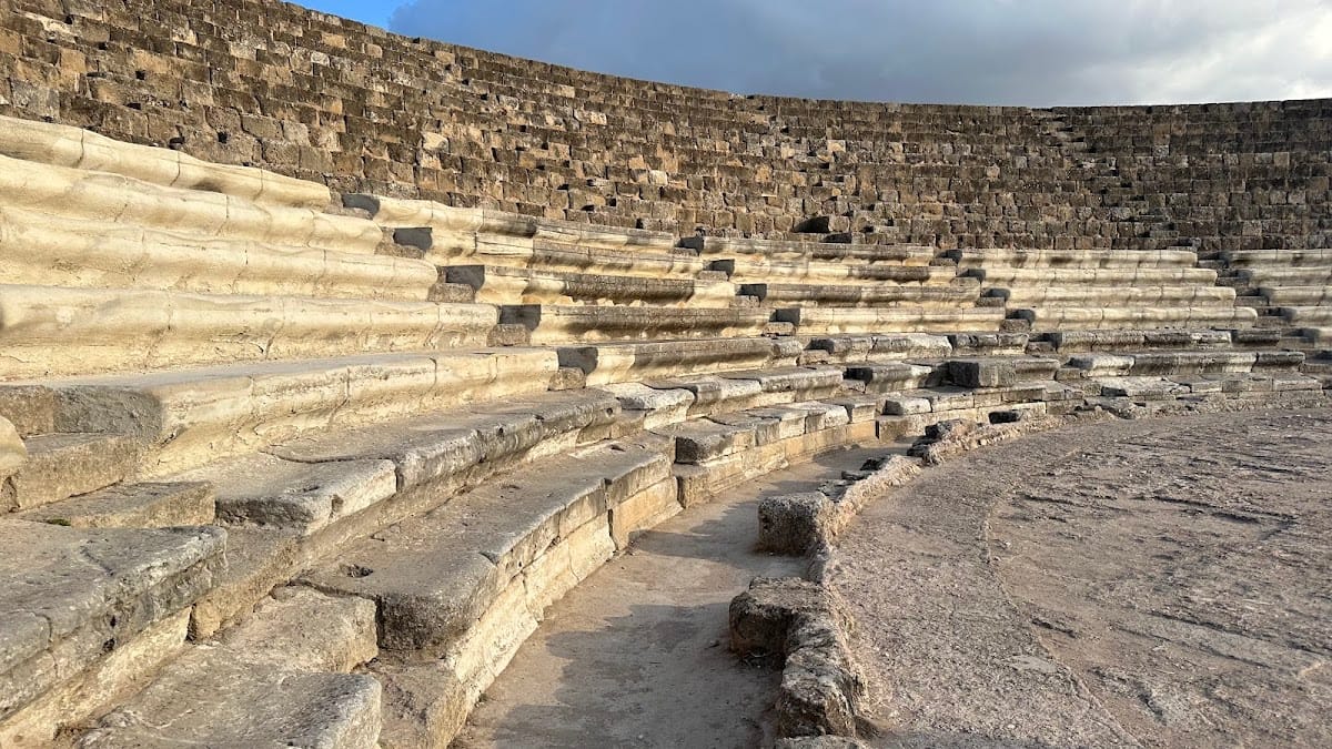
The theatre probably began in the Augustan period and was modified during the first and second centuries CE. It was built on level ground rather than against a natural slope, with an auditorium supported by massive radial retaining walls. The original theatre had about 50 seating rows and could hold approximately 15,000 spectators. The partly reconstructed auditorium contains about 19 or 20 rows, including modern upper seating and surviving lower rows faced with white limestone slabs.
Eight radial stairways divided the auditorium into nine sections. The central section contained more elaborate seats for honored spectators. The theatre included the auditorium, a semicircular orchestra about 27 m across, and a stage building approximately 40 m long. The orchestra was originally paved with marble, and an altar of Dionysus stood at its center. Inscribed bases once supported statues honoring the emperor Commodus and the Caesars Constantine and Maxentius. The raised stage front stood about 2 m above the orchestra.
The theatre was damaged by the fourth-century earthquakes, and some of its materials were reused in the baths. An amphitheatre stood between the palaestra and theatre, while a stadium lay east of it. The stadium was dismantled or cut through by a road, probably during the fourth century.
Colonnaded Street
The Colonnaded Street was a north-south cardo, or principal north-south road, about 4.7 m wide. Excavated from 2002 in an area approximately 40 m east of the Roman baths, it linked the northern public buildings with the southern part of the city. Two superimposed construction levels show two building phases. The street was destroyed by the fourth-century earthquakes, when fallen columns and rubble filled the spaces between the colonnades. Its surface was later repaired and repaved.
Stone and Granite Agoras
The Stone Agora was a rectangular commercial square approximately 230 by 55 m, aligned almost exactly north-south. Built during the Hellenistic period, it was restored around 22 BCE under Augustus, as an inscription on a grey-marble frieze indicates. Monumental colonnades bordered its long sides, with market stalls in covered porticoes behind them. Corinthian capitals, column drums reaching up to 9 m high, and rows of stalls survive.
A five-arched propylon, or monumental entrance, formed the northern access to the Stone Agora. During the Early Byzantine period, some of its arches were incorporated into the wall of the adjacent large reservoir. The Granite Agora lay northwest of the commercial square and served as a civic or public space. Egyptian granite columns surrounded it, and grey column remains survive.
Temple and Christian basilicas
Temple of Zeus
The Temple of Zeus stood south of the agora. Its earliest known phase belongs to the Late Hellenistic period, while the surviving architecture is mainly late Hellenistic and Roman. The Roman temple occupied a high platform approximately 28 by 22 m and contained a rectangular cella surrounded by 12 Corinthian columns. A broad stepped ramp connected it with the agora, and a monumental portico stood before the entrance.
A large marble capital found on the temple esplanade shows caryatid figures between the foreparts of winged bulls. Its function remains uncertain, but its Achaemenid influence places it approximately between 300 and 250 BCE. The capital is now in the British Museum. The temple was probably damaged in the earthquakes of 332 and 342 CE. Its remains were repaired by the reign of Justinian and may then have been converted into a church or episcopal buildings. The precinct was traditionally associated with the cult of Zeus Salaminios and the foundation story of Teucer.
Basilica of Epiphanius
The Basilica of Epiphanius stood between the Granite Agora and a Roman villa, northeast of the Stone Agora and the large reservoir. Built approximately between 380 and 400 CE as the metropolitan church of Constantia, it was directed by Bishop Epiphanius and completed by his successor Sabinus after Epiphanius died in 403.
The basilica originally measured about 57 by 35 m, excluding the entrance hall and atrium, and had seven aisles beneath a wooden roof. Four-sided piers divided the outer aisles, while Corinthian columns reused from ruined Roman buildings framed the central nave. The eastern end contained a three-arched semicircular apse with seats for the bishop and clergy. The raised sanctuary had a projecting central apse and two smaller side apses. Mosaics decorated the walls, and the floor carried a rich geometric pavement.
A major sixth-century rebuilding reduced the church to five aisles, removed the middle colonnades, added a vaulted corridor, and introduced a semicircular synthronon, a set of clergy seats around the apse. A baptistery east of the basilica contained a cross-shaped font heated by a hypocaust, allowing warm-water baptism during winter as well as summer. An empty marble-lined sarcophagus with inscriptions was found at the eastern end of the second southern aisle and has been interpreted as the tomb of Epiphanius. The church was destroyed in the seventh century and replaced by a smaller building to the south.
Kampanopetra Basilica
The Kampanopetra Basilica stood near the harbor in the southeastern part of Salamis on a site overlooking the sea. Its name, meaning “Bell Stone,” derives from a large boulder found during excavation. Its date is disputed between the fourth and late fifth centuries, with alterations in the sixth century.
The basilica was approximately 52 m long and had three aisles, an entrance hall, and western and eastern atria about 45 m and 28 m long. The western court had a central well or fountain, porticoes about 36 m long, and more than 60 surrounding rooms on two levels. These rooms may have included monastic cells, although that interpretation remains uncertain. An episcopal seat and clergy area occupied the central apse, while a room behind it contained a heated bathing installation.
Another room had elaborate opus sectile, a decorative technique made by fitting cut pieces of marble, glass, and other materials into patterned surfaces. A high-quality polychrome circular geometric mosaic survives. The church was richly decorated with Proconnesian marble, and Corinthian capitals above white-marble columns were gilded over a red preparatory layer. The eastern atrium may have contained a relic, possibly a fragment of the True Cross. Three-metre-wide corridors on both sides of the church may have directed movement toward the eastern atrium.
Villas and cemeteries
Roman villa
A two-storey villa south of the theatre was excavated in 1882 and later reburied. Its entrance resembled a church apse and was decorated with columns. Residential rooms surrounded a central courtyard with a columned portico. A mosaic pavement with animal motifs and a central figure was found inside.
Royal necropolis
The royal necropolis contains monumental tombs with rectangular chambers, long dromoi, or approaches leading to underground burial rooms, decorated facades, and, in some cases, tumuli, which are artificial burial mounds. Burials range from the ninth century BCE to the Early Christian period. Grave goods include chariots, horse burials, weapons, furniture, bronze vessels, pottery, jewelry, and imported objects from Egypt and Syria. Child burials in Canaanite jars indicate a Phoenician presence.
The tombs show successive burial phases extending from the mid-eighth century BCE through the Hellenistic, Roman, Byzantine, and medieval periods. Their contents include inscriptions, horse equipment, vessels, furniture, and other objects whose meanings and ritual uses remain uncertain in some cases. Together, the royal graves demonstrate the city’s wealth and its connections with several Mediterranean and Near Eastern traditions.
Cellarka cemetery
The Cellarka cemetery lies approximately 400 m south of the Enkomi-Salamis cemetery and contains more than 114 underground chambers cut into sandstone. Steep stairs, dromoi, and shafts led into the chambers, some of which contained low platforms for bodies. The cemetery was used from the beginning of the seventh century to the end of the fourth century BCE, sometimes by several generations of the same families, and served the general population and probably the middle class.
Objects from the graves include pottery, jewelry, knives, mirrors, and coins. Tomb 21 was sealed with stone slabs and contained four burials in stone niches and on the floor. Its grave goods included a horse-and-rider figure, a lamp, and an incense vessel. Nine additional bodies lay on two stone benches in a side chamber. The royal necropolis and Cellarka cemetery place Salamis within a wider network of Cypriot, Greek, Levantine, Egyptian, Assyrian, Phoenician, and other Mediterranean traditions.