Trekroner Fort: Copenhagen’s Maritime Harbor Defense


Site at a Glance
- Rating
- 4.4
- Popularity
- Low
- Country
- Denmark
- Primary era
- Modern
- External website
- Open
- Eras represented
- Early Modern, Modern
- Civilizations
- Danish
- Site type
- Military
- Remains
- Fort
On this page9 sections
History
Trekroner Fort is a maritime fort in Denmark, positioned before Copenhagen’s old harbor in the Øresund, the strait between Zealand and southern Sweden. Construction of the present fort began in 1787 on a purpose-built artificial island, where it guarded access from the northeast and protected the northern entrance to the Kongedyb, or Royal Channel, a navigable channel leading toward the harbor.
The first Trekroner fortification
The name first belonged to a different installation established in 1713 about 200 meters north of the present fort. Several decommissioned warships were sunk to form its foundation, including a vessel named Trekroner, meaning “Three Crowns.” A battery was mounted on the ships, creating a temporary defense against enemy vessels. The installation deteriorated quickly, although it continued in use between 1713 and 1731. It also served as a quarantine station and a prison before being abandoned in 1732.
Construction and the Battle of Copenhagen
The present fort was built several hundred meters south of the earlier position, with its foundations supported on piles over a newly made island. It had not been completed when it took part in the naval Battle of Copenhagen in 1801. Its battery of 66 guns and garrison of 930 men helped prevent the English fleet commanded by Horatio Nelson, a leading British admiral during the Napoleonic Wars, from entering the harbor.
Trekroner Fort also contributed to Copenhagen’s defense during the British bombardment of 1807. By that time, earth ramparts had been constructed, adding to the fort’s defensive works.
Nineteenth-century expansion and military decline
Between 1818 and 1828, the fort was modified and its military facilities were expanded. Further strengthening followed around 1860, with the addition of a barracks, ammunition magazines, open positions for heavy artillery, and a small harbor on the southern side. Its military role continued until the end of the First World War.
The installation was abandoned as a military fort in 1932. From 1934 until the outbreak of the Second World War, the island became a popular excursion and recreation site for Copenhagen residents. During the mid-1930s, it was transferred to the Copenhagen harbor authority. German forces occupied the fort in 1940 and used its barracks during the war.
Restoration and present protection
After the Second World War, the fort remained unused for almost four decades and deteriorated substantially. In 1984, the Danish state acquired it from the Copenhagen harbor authority for three Danish kroner. The fort was subsequently restored and reopened to the public. It is now used for recreation and is protected by the Danish Agency for Culture and Palaces.
Remains
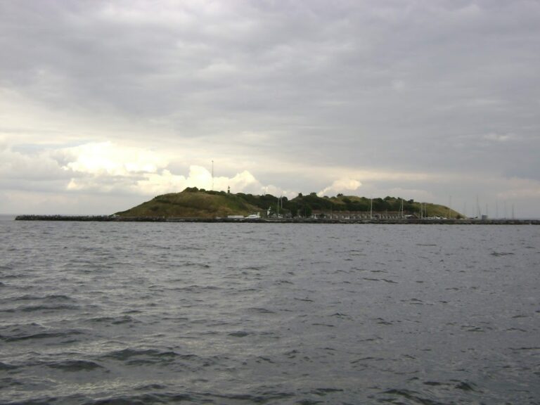
Trekroner Fort occupies an artificial island of approximately 2 hectares, or 0.02 square kilometers. The island measures about 270 meters by 160 meters and has a triangular form open toward the west. The fort stands directly before the entrance to Copenhagen’s old harbor, with its principal defensive arrangement facing the waters approaching the harbor.
Harbor and defensive setting
A small harbor on the island’s southern side is enclosed by breakwaters. Other stone breakwaters extend from the fort toward Copenhagen and Amager, protecting the entrance to the harbor. These maritime works form part of the fort’s physical relationship with the surrounding waters and the approach through the Kongedyb.
Battery and artillery works
In 1801, the battery held 66 guns consisting of one 96-pounder carronade, 35 38-pounder guns, and 30 24-pounder naval guns. A carronade was a short, large-caliber naval weapon intended mainly for powerful fire at relatively short range. The guns were shielded by a timber breastwork, a defensive wall or parapet, 10 feet thick. At that time, the breastwork was thicker than a ship’s hull but had not yet received a stone facing.
The defensive layout directed the guns on the left, or northern, face toward the outer roadstead, an area of water near a harbor where ships could anchor. The frontal and right faces covered the Royal Channel. This arrangement concentrated fire on both the open anchorage and the navigable approach to Copenhagen.
Buildings and later installations
Nineteenth-century works added a concrete casemate building, meaning a fortified enclosed chamber from which guns could be operated or fired, together with additional batteries and a mine station for deploying or controlling underwater mines. The fort also included the barracks, ammunition magazines, and open artillery positions for heavy guns. Natural stone is the principal building material, alongside the documented concrete, timber, and earth defensive works.
A lighthouse built in 1868 remains on the island. Together with the harbor, breakwaters, batteries, military buildings, and defensive earthworks, it forms part of the surviving physical complex of Trekroner Fort.