Fort du Mont-Dauphin: A Vauban Alpine Fortress in France


Site at a Glance
- Rating
- 4.5
- Popularity
- Medium
- Country
- France
- Primary era
- Early Modern
- External website
- Open
- Eras represented
- Early Modern, Modern
- Civilizations
- French
- Site type
- Military
- Remains
- Fort
On this page12 sections
History
Fort du Mont-Dauphin is a fortified military complex in Mont-Dauphin, France, built by French engineers from 1693 as a late-seventeenth-century defense of the Alpine frontier. Designed under Sébastien Le Prestre de Vauban, the French military engineer and marshal who developed and improved defensive systems, it occupies a strategic plateau above the meeting of the Guil and Durance rivers and forms part of the Fortifications of Vauban World Heritage property.
Foundation and construction
Around 1690, Louis XIV occupied the Duchy of Savoy, an Alpine state whose occupation shaped France’s frontier strategy, and ordered Vauban to strengthen the mountain border. After inspecting existing defenses, Vauban proposed Mont-Dauphin as a central position in the defensive line. In a report to Louis XIV written late in 1692, he emphasized the meeting of several valleys, the plateau’s steep cliffs on three sides, and the availability of suitable local building materials. The northern side, where an enemy could approach most readily, became the principal construction front.
Work began in spring 1693. When Vauban returned for his second and final visit in 1700, the northern defenses were nearly complete. Barracks, weapons and ammunition magazines, the governor’s residence, and other structures had either been completed or were still being built. Around 25 houses were also finished or under construction, establishing the settlement as more than an isolated military position.
Changing military role
Mont-Dauphin became a fortified town in 1713, the year the Treaty of Utrecht ended the War of the Spanish Succession. The treaty extended French territory and left the fortress farther from the frontier, reducing its immediate military importance. Strategic attention shifted toward Briançon, although Mont-Dauphin remained a refuge and a training camp for more important fortifications farther east.
France continued to improve the defenses despite this change in status. A demi-lune, a detached defensive work placed in front of a wall or bastion, was added before the Royal Bastion in 1728. After the Battle of Assietta in 1747, fought during the War of the Austrian Succession, the fortress received soldiers moving toward the front and cared for many wounded. Facilities for sick and injured personnel, additional magazines, and new soldiers’ accommodation followed, together with stronger defenses on the more vulnerable southern side. Further changes were made in 1791 under plans by General Michaud d’Arçon.
Later history and decline
The Rochambeau Barracks was built around 1765 as part of the southern rampart, within the defensive improvements that followed the events of 1747. An attic floor was added in 1820. During the nineteenth century, the civilian population reached about 400 inhabitants. The unfinished Saint-Louis church was partly dismantled during that century, and its bricks were reused in ammunition bunkers and additional storage facilities.
Changes in artillery during the 1860s and 1870s created a new vulnerability. Rifled artillery, whose spiral-grooved barrels improved range and accuracy over earlier smoothbore guns, made it possible to bombard the fortress from other mountain peaks, a possibility previously regarded as impossible. The fort was adapted for these weapons, more ammunition stores were constructed, and earth was laid over the magazines to shield them from shells.
Mont-Dauphin then lost still more of its military role, and troops were gradually withdrawn. The hospital deteriorated, and the last soldier left shortly after the Second World War. The fort is protected as a French historic monument and belongs to the Fortifications of Vauban, a group of French fortified sites inscribed together on the UNESCO World Heritage List in 2008.
Remains
The fortified complex occupies a plateau approximately 1,050 metres above sea level. Steep cliffs bound it on three sides, while the northern side forms the principal approach for attack. The nearby confluence of the Guil and Durance rivers helps explain the choice of this elevated position. The surviving ensemble includes the main fortified enclosure, detached defensive works, artillery positions, barracks, water installations, powder magazines, the governor’s residence, houses, and the parish church of Saint-Louis. The World Heritage property covers approximately 570,000 square metres, with a buffer zone of about 2,000,000 square metres.
Defensive works
Walls, bastions, and entrance defenses
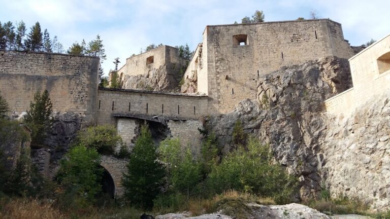
The defensive layout combines the main enclosure with an entrance gate, the Royal Bastion, its associated demi-lune, Bastion Dauphin, Battery 84, and Lunette 64. A bastion is a projecting section of a fortification that allows fire along the adjoining walls. The northern front includes Bastion Dauphin, while the southern rampart received additional protection because the natural cliffs there offered less security. The demi-lune before the Royal Bastion and the comparable detached work known as Lunette 64 formed parts of this layered defensive arrangement.
Southern rampart
The Rochambeau Barracks forms part of the southern defensive line and extends for more than 260 metres. Built around 1765, it combined accommodation with the rampart’s defensive function. Its attic floor, added in 1820, reflects a later alteration to the structure. The southern works belong to the side of the plateau that required particular reinforcement, and the barracks remains one of the principal architectural elements of that line.
Military and civic buildings
Water tank and powder magazine
A large water tank stood beside a powder magazine. Its arrangement provided an emergency safeguard: water could be released into the magazine to make the gunpowder unusable before an enemy could seize it. Together with the weapons and ammunition stores, the tank illustrates how the complex integrated supply, storage, and defensive contingencies within its built layout.
Barracks, residence, and houses
The interior contains barracks for troops, a governor’s residence, and approximately 25 houses that had been completed or were under construction by 1700. These buildings formed the inhabited core of the fortified town around the military works. The complex also includes Citerne X and its water-drawing post, as well as additional magazines associated with the fortress’s changing military needs.
Saint-Louis church
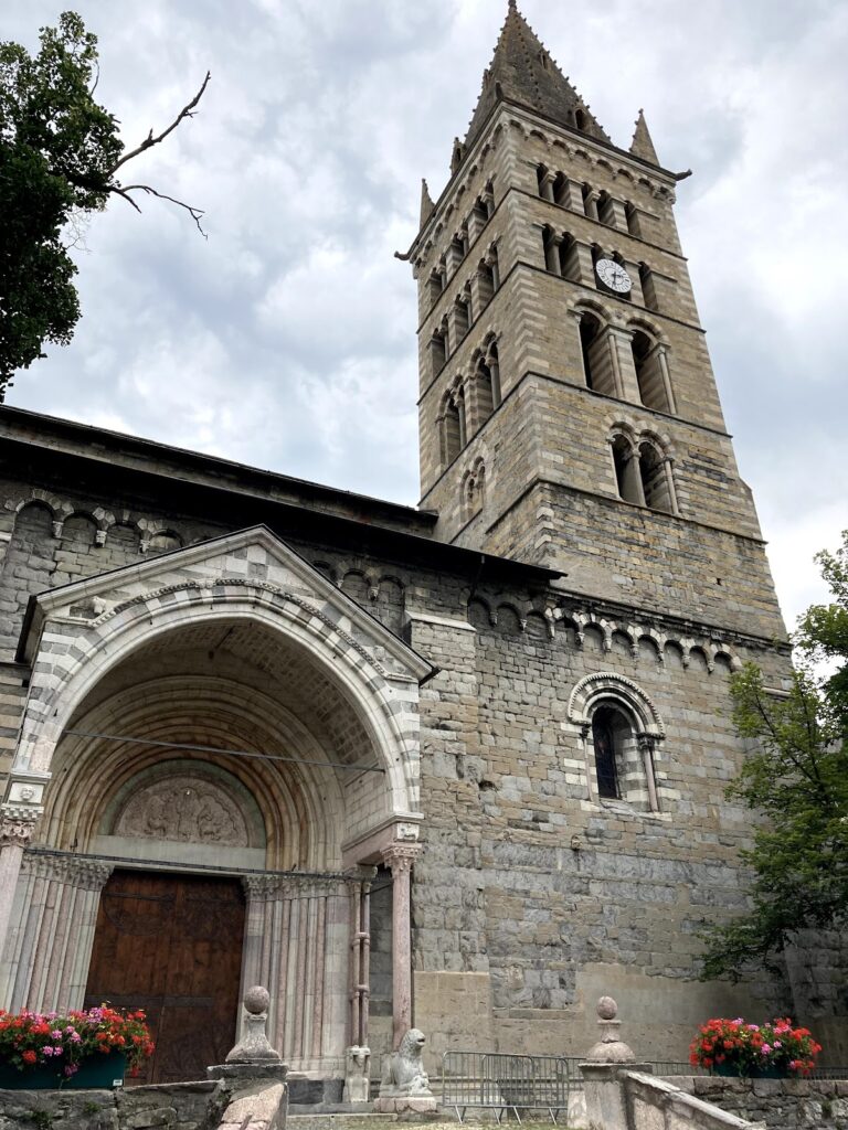
The parish church of Saint-Louis was planned as a major building dedicated to Louis XIV and the Catholic faith in a predominantly Protestant region. It was never completed. During the nineteenth century, parts of the church were dismantled, and its bricks were reused in military ammunition installations, including bunkers and additional storage areas. Its surviving fabric therefore also records the later adaptation of the fortified town to changing military requirements.