Roman Town of Cosa: A Roman Colony and Port in Italy



Site at a Glance
- Rating
- 4.5
- Popularity
- Low
- Country
- Italy
- Primary era
- Classical
- External website
- Open
- Eras represented
- Classical, Medieval
- Civilizations
- Byzantine, Roman
- Site type
- City
On this page29 sections
History
Roman Town of Cosa is an ancient Roman settlement in Italy, founded in 273 BC as a colony with Latin legal status on territory seized after Rome defeated the Etruscan cities of Volsinii and Vulci. Probably named after the earlier Etruscan centre of Cusi or Cusia, associated with modern Orbetello, Cosa occupied a strategic coastal position and developed through the Republican, Imperial, late antique, and medieval periods.
Foundation and Republican expansion
The colony administered an area of about 550 square kilometres known as the ager Cosanus, the rural territory connected with Cosa. Its position allowed Rome to supervise recently conquered Etruscan lands and maritime traffic, including movement connected with the threat from Carthage during the Punic Wars. The Via Aurelia linked Cosa with Rome from approximately 241 BC, strengthening the colony’s connection with the wider Roman road system.
In 217 BC, during the Second Punic War, Carthaginian forces captured Roman transport ships carrying supplies for the army in Hispania near Portus Cosanus. Cosa probably suffered during Hannibal’s invasion of Italy, although the precise effects are uncertain. A new group of about 1,000 colonists was assigned to the colony in 197 BC, beginning its principal period of urban and economic development.
Cosa served military, administrative, agricultural, commercial, and maritime purposes. Its territory supported farming, quarrying, fishing, fish processing, salt production, ceramic manufacture, wine production, and the making of garum, a fermented fish sauce traded throughout the Roman Mediterranean. The port and lagoon became the economic centre of the surrounding territory, particularly during the second and first centuries BC, when wine and garum were exported through its maritime connections.
Destruction and Augustan rebuilding
The colony prospered through its roads, land, and sea links before being plundered and destroyed during the first half of the first century BC, probably around 70 BC. The circumstances remain uncertain. Much of the urban area was then abandoned, while large landowners intensified agricultural exploitation in the countryside.
Under Augustus, the city was partly rebuilt, especially on the Capitolium hill and around the Forum. Occupation remained concentrated in the central area, and the economy probably continued to depend substantially on the port, the lagoon, and fish farming. From the middle of the first century AD, the territory became part of the imperial possessions of the Domitii Ahenobarbi, the family of Emperor Nero. During Nero’s authority, the Forum was renovated and the Basilica was converted into an odeum, a building for performances, probably after an earthquake around AD 51.
Late Roman and Byzantine phases
Cosa experienced a limited revival under the Severan emperors, particularly Septimius Severus and Caracalla. The creation of the Res Publica Cosanorum is interpreted as an effort to revive the city and its territory, although its identification with Cosa remains uncertain.
By the later third century, the city was again largely abandoned and maintenance of the port had ceased. Only minimal occupation is known for the fourth century. The fifth-century poet Rutilius Claudius Namatianus described Cosa as deserted ruins and preserved a story that its inhabitants had left after an invasion of rats.
In the sixth century, a small settlement occupied parts of the Roman ruins. A Christian church was built against the surviving Roman Basilica, while other ancient structures were reused as storage areas, workshops, ovens, and shelters. Byzantine records described Cosa-Ansedonia as a civitas, or civic settlement, and it may have served as a fortified Byzantine position against the advancing Lombards. The name may have changed from Cosa to Ansedonia during this period. In 805, Charlemagne donated the territory as a fief to the Abbey of the Three Fountains in Rome after it had passed to the Franks.
Medieval fortification and archaeological study
From approximately the tenth century, a fortified settlement occupied the eastern end of the former Roman city. Between the twelfth and fourteenth centuries, the territory passed successively to the Aldobrandeschi, the Republic of Orvieto, and the Republic of Siena. A Sienese army attacked and destroyed the fortifications in 1329, after which the site remained deserted.
Archaeological research began in 1948 under the American Academy in Rome, initially directed by Frank Edward Brown. Excavations between 1948 and 1954 and between 1965 and 1972 revealed the urban plan, Forum, Arx, port, houses, and principal religious buildings. Lawrence Richardson continued work in the Forum from 1952, and Russell T. Scott participated in the later campaign. Elizabeth W. B. Fentress directed excavations from 1991 to 1997, with particular attention to the late antique and medieval history of Cosa.
The Universities of Granada and Barcelona excavated a Roman house between 2005 and 2012. Since 2013, the Florida State University, Bryn Mawr College, and the University of Tübingen have investigated the bath complex through the Strade di Cosa project. Since 2016, the University of Florence has excavated the southern Forum and processional street P. Since 2024, the archaeological park and National Archaeological Museum of Cosa have formed part of the Archaeological Parks of the Maremma. The site is an important centre for studying Roman colonisation, urban planning, harbour construction, and the intermittent occupation of ancient towns.
Remains
Walls, gates, and street plan
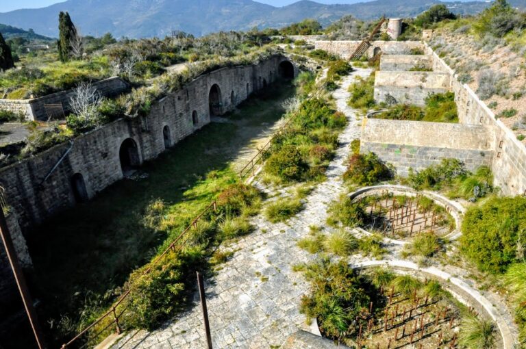
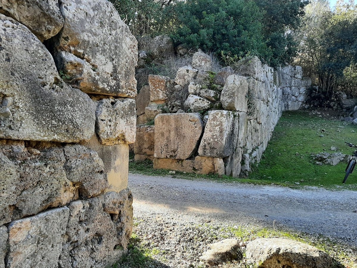
Cosa occupied a rocky promontory about 113 to 114 metres above sea level. The site consisted of a southern height, the Arx or Capitolium hill, and an eastern height separated by a broad saddle, where the Forum was placed. A circuit wall about 1,500 metres long enclosed the city. It was built mainly from locally quarried stone in large blocks fitted without mortar, using a form of polygonal masonry. Later repairs employed more regular rectangular blocks.
The wall had eighteen towers at irregular intervals. Seventeen were square, while a circular tower near the Porta Romana was built with mortar. The Arx also had a separate enclosing wall, including a small postern that was blocked during the early medieval fortification phase.
City gates and roads
Three gates served the settlement. Porta Fiorentina stood to the northwest, Porta Romana to the northeast, and Porta Marina to the southeast. Each had an outer and inner gate separated by an intermediate space. Wooden lintels, rather than stone arches, supported the gateways, while Porta Romana retains grooves associated with a portcullis. Roads connected the gates with the surrounding territory. From Porta Marina, a road descended towards Portus Cosanus; Porta Romana connected with the Via Aurelia towards Rome; and Porta Fiorentina led towards Pisa.
The street system followed an orthogonal grid adapted to the irregular hilltop. Processional roads were about 27 Roman feet, or 8 metres, wide. Main roads measured approximately 20 to 21 feet, or 5.9 to 6.2 metres, while secondary roads beside the city boundary were about 15 feet, or 4.45 to 4.5 metres, wide. Their surfaces consisted of large local limestone blocks laid on sand and earth over the underlying rock. Via Sacra, also called street P, linked the Forum with the Arx, and street R led towards the Eastern Height. Main streets O and 5 crossed near the Forum, while another road ran inside the city walls. Some streets remain buried, including a section exposed at the intersection of streets P and 5.
The grid created rectangular blocks of buildings. Most ordinary houses had frontages of about 29 feet, or 8.5 metres. Larger houses near the Forum and along the processional roads had frontages of about 60 feet, or 18 metres. The original plan probably contained between 224 and 248 houses, including approximately 20 to 24 larger residences for higher-status colonists.
Forum and public buildings
The Forum measured about 88 by 35 metres. Its principal entrance on the northwest side had a monumental triple-arched gateway. The northern side contained the Basilica, the Curia-Comitium complex, and Temple B, identified with the Temple of Concordia. Shops, eating places, and houses occupied the other sides.
Basilica and later church
Built around 140 BC, the Basilica was the final major addition to the Republican Forum. Its rectangular plan measured 35.89 by 27.05 metres. Sixteen internal columns formed a central nave and surrounding passage, while a six-column portico faced the Forum. A niche at the rear probably held a tribunal, and travertine slabs indicate that statues may have stood inside. The building probably had an upper colonnade and a pitched wooden roof.
Two large rock-cut cisterns lay beneath the Basilica. One belonged to the foundation period of the colony and the other was later. In the middle of the first century AD, rectangular piers replaced the lower nave columns so that a raised stage and seating could be installed for an odeum. In the sixth century, a Christian church was built against the surviving structure. Rooms were also formed along the southeast side, containing ovens and probable dwellings.
Curia-Comitium complex and Mithraeum
The Curia-Comitium complex, east or southeast of the Basilica, was the oldest major public building in Cosa. The circular Comitium was a public meeting place for assemblies and other activities. Its seating area measured about 8.6 metres in diameter and could accommodate approximately 596 to 600 people. The adjacent Curia housed the magistrates and may also have held an archive.
The Curia was a small two-storey building entered from the upper part of the Comitium. Its upper floor formed the principal administrative room, while the lower floor may have been a tabularium, or archive. After the arrival of the new colonists in 197 BC, two side rooms were added, probably for an archive and offices used by magistrates. During the second or third century AD, a Mithraeum, a sanctuary of the mystery cult of Mithras, was installed beneath the southeast Curia room. It had side platforms, possible bases for images of Cautes and Cautopates, and a masonry altar at the rear.
Temple B and the Carcer
Temple B, identified with the Temple of Concordia, was built around 175 BC, possibly over an earlier sanctuary. It had a single main chamber and a front porch with two rows of two columns. Its altar was unusually off-centre, perhaps because the temple respected an earlier structure. Terracotta decoration in the Etrusco-Italic tradition included antefixes, mouldings, and revetment slabs.
Fragments from the temple’s pedimental composition show a bearded man wearing a Phrygian cap, two children, draped female figures, and other male and female figures. The identities remain uncertain, but the scene was probably mythological. Other fragments may come from a frieze showing chariots and horses. A building southwest of Temple B is interpreted as the Carcer, or prison. It had two levels, including a lower vaulted underground cell.
Sanctuary of Liber Pater
The Sanctuary of Liber Pater was probably built in the third century AD southeast of the Forum. Liber Pater was a Roman god associated with agriculture, fertility, and wine. An inscription bearing the name Liber led to the identification of the sanctuary, which was constructed with reused material taken from elsewhere in the city.
Arx and the eastern height
The Arx occupied the highest and southernmost point of Cosa. It was principally a sacred enclosure covering about one-twentieth of the town and bounded by the city wall, cliffs, and its own separate wall. Some Republican domestic occupation may also have existed there.
Cosa Quadrata and the Temple of Jupiter
At the highest point of the Arx, Cosa Quadrata consisted of a square limestone platform about 7.4 metres on each side and a natural rock fissure 2 to 2.5 metres deep. Ash and carbonised plant remains filled the fissure. Together, these features may represent an early ritual area or auguraculum, a place used for religious observation. The central chamber of the later Capitolium was built above them.
The Temple of Jupiter, the oldest known sanctuary on the Arx, was built around 240 to 220 BC and probably destroyed by fire during the first century BC. Its plan and orientation are uncertain. Decorative fragments include representations of Minerva and Hercules, although the identification of the temple with Jupiter remains uncertain. Sculptural fragments preserved in the museum include a male torso wearing a short tunic and armour.
Temple of Mater Matuta
Formerly called Temple D, the Temple of Mater Matuta was built around 170 to 160 BC on a polygonal-stone podium measuring about 11 by 14.5 metres. Mater Matuta was an Italic goddess associated with dawn, birth, growth, and protection of maritime activity. The single chamber measured approximately 9 to 9.25 metres square. Four Tuscan-order columns stood at the front, reached by a frontal stairway, and the foundations of the altar survive.
The temple was extensively renovated around the beginning or first quarter of the first century BC. Its decoration and columns were renewed, the side walls were extended, and the original central columns were removed. Terracotta elements included revetment slabs, antefixes, mouldings, and pierced decorations. A standing draped female statue, fragments of a dolphin frieze, and two inscriptions mentioning a matronal college support the identification with Mater Matuta without conclusively proving it.
Capitolium
The Capitolium was built around 150 BC at the end of Via Sacra. Its remains rise to about 9 metres. The temple measured approximately 20.7 by 25.9 metres and stood on a terrace faced with polygonal masonry, reached by a tufa stairway. It had three chambers, a deep front porch, and a frontal colonnade of four columns, with two additional columns between the side walls. The columns may have reached nearly 7 metres, while the whole building may have stood about 18 metres high.
The three chambers led to the interpretation that the Capitolium was dedicated to Jupiter, Juno, and Minerva. A deep cistern lay beneath the porch in front of them. It had an external measurement of about 14.54 by 3.26 metres and an internal measurement of approximately 14.21 by 2.37 metres, with a capacity of about 125,000 litres. Its inner surface was finished with ceramic fragments set in thick concrete, many of them taken from the earlier Temple of Jupiter.
In the late first century BC, the sacred terrace was enlarged, a new stairway was built, and a high enclosing wall with a single arched entrance screened the approach. Terracotta revetment, antefixes, friezes, and cornices were repeatedly repaired or replaced. The original pedimental sculpture probably contained at least fourteen figures of different sizes. A later group, probably installed around the middle of the first century BC, consisted of figures of uniform height and probably represented a gathering of deities including Jupiter, Juno, and Minerva.
Temple E and medieval fortifications
The Eastern Height was artificially levelled during the first half or middle of the second century BC for Temple E. The small sanctuary stood on a terrace facing the sea and measured approximately 6.25 by 11.25 metres. Its podium was built from large, regularly coursed limestone blocks. Only limited remains survive, and the deity is unknown. Its date is indicated by a second-century BC Greco-Italic amphora fragment found in the podium and by similarities between its terracotta decoration and that of the Capitolium and Temple B. The sanctuary may have survived only until Cosa’s destruction around 70 BC.
Medieval activity on the Eastern Height included timber buildings, sunken-floored structures, a tower, external earthwork defences, and a fortified settlement. In the twelfth century, a tower was built over or beside a large cistern. A circular structure may have supported a catapult or trebuchet. The cistern was probably reused as a prison, and graffiti on its plaster lining includes the date 1211.
Domestic buildings
House of Diana
The House of Diana, also called Atrium Building V, stood on the southwest side of the Forum and was built during the first half of the second century BC. Its large atrium plan included two shops facing the Forum, an entrance vestibule, a passage from the entrance, a central rainwater basin, bedrooms, side rooms, a reception room, a dining room, a garden, and a private bathing area. The shops probably sold wine and prepared food.
The house was destroyed during the early first century BC, probably in the attack that damaged Cosa, and was rebuilt under Augustus. Much of the original earth construction was replaced with plastered and painted masonry. Floors were altered, rooms were joined to create a winter dining room, and the dining room was opened towards the garden for summer meals. Between approximately AD 50 and 60, a small shrine to Diana was built in the garden. It had three steps, two columns, and a small chamber containing a cult statue. An inscription from the house may refer to a Via Dianae or to a passage between the road and garden, but its meaning is uncertain.
House of the Treasure
The House of the Treasure, also known as the House of Quintus Fulvius, was built between approximately 90 and 80 BC over two earlier houses. Its name comes from a hoard of 2,004 silver denarii hidden beneath the floor of a storeroom. The latest coins date to 74 to 72 BC, indicating that the money was concealed around 70 BC.
Two black-glazed vessels marked Q. FVL. helped associate the house with Quintus Fulvius. The building contained three rooms and a larger room later divided into two. Wall fragments preserve First Pompeian Style decoration, and red opus signinum floors, a concrete-like material made with lime and crushed ceramic, were decorated with white tesserae. The National Archaeological Museum of Cosa was built over the remains.
House of the Skeleton
The House of the Skeleton occupied the same city block as the House of the Treasure. Its name derives from the skeleton of an adult male found in its cistern, probably connected with the destruction of the city around 70 BC, when the house was burned.
The house had an atrium with a central rainwater basin and a large cistern beneath it. Kitchens, a bathroom, storerooms, a possible animal shelter, a weaving workroom, a bedroom, and an upper floor formed part of the plan. Summer and winter reception rooms, a covered dining room, a colonnaded passage, and a large garden were also present. Most rooms had geometrically decorated opus signinum floors, and part of the wall painting survives.
House of the Birds and House with the Cryptoporticus
The House of the Birds was created under Augustus by joining two smaller Republican houses. It takes its name from red, white, and brown birds painted or otherwise represented among vine branches.
The House with the Cryptoporticus was excavated between 2005 and 2012. It stood along street 5 opposite the Forum, with its entrance on processional street P. The atrium house included an entrance passage, a central rainwater basin, a reception room, a garden, a colonnaded court, and a rainwater reservoir. It also contained the only cryptoporticus so far identified at Cosa, a covered passage within the house.
Water supply and baths
Because the hill had no natural water source, Cosa depended on collected rainwater. Public and private buildings used cisterns and channels to gather and redistribute it. Atrium houses had reservoirs holding approximately 30,000 to 75,000 litres.
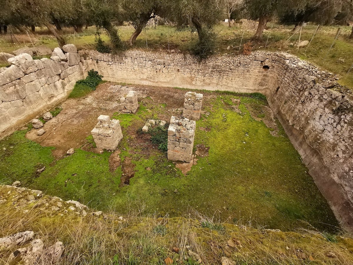
The oldest major reservoir stood at the eastern corner of the Forum and was built when the colony was founded. This public cistern had an estimated capacity of about 750,000 litres and later supplied the baths. It was originally open and was subsequently covered by a wooden roof supported by four large central pillars, whose foundations remain visible.
Bath complex
The bath complex lay northwest of the Forum between streets O, N, 5, and 6, with its entrance on street O. Built during the late Republican period, it may have remained in intermittent use into the Imperial period. Its principal water supply came through an underground conduit from the Forum reservoir.
A high wall built with irregular stones set into concrete supported a rectangular basin lined with waterproof cocciopesto, a concrete-like material containing crushed ceramic. The method used to raise water into the elevated basin remains uncertain. Other rooms are interpreted as a cold room, warm room, hot room, latrines, changing rooms, and exercise areas. A furnace heated water that travelled through hollow wall tiles to the bathing rooms. A nearby circular brick-faced concrete room with an underfloor heating system and mosaic floor is interpreted as a sauna.
Necropolises
The eastern and northwestern cemeteries were used from the third century BC to the fourth century AD. The eastern cemetery lay along the road to the port and included small shrine-like tombs in a style associated with Magna Graecia, probably dating from the early second century BC. A later tomb had a cubic base and a rectangular upper structure with concave sides, faced with sandstone slabs and stucco.
The northwestern cemetery was established in the early Imperial period and contained a mausoleum, monument remains, graves, and the first-century BC Santi columbarium. A columbarium was a funerary building with niches for cremation urns. The Santi structure had a roughly square plan, concrete walls faced with brickwork, and niches for the urns.
Outside Porta Fiorentina, graves covered with roof tiles held inhumed or cremated remains dating from the late first to early second century AD. One grave contained a young woman who had experienced malnutrition and was buried with gold and bronze jewellery, including a gold ring set with green chalcedony. DNA analysis identified coeliac disease.
Ports and lagoon installations
Cosa had two port areas. Portus Cosanus lay south or southeast of the promontory, while Portus Feniliae, also called Portus Herculis, occupied the Feniglia tombolo west of Cosa. Portus Feniliae was used for fish farming from the Republican period and contained fish-processing installations and habitation.
Portus Cosanus
Established with the colony, Portus Cosanus remained in use from the third century BC to approximately the third century AD. Channels connected it with the sea, while limestone breakwaters, piers, and other hydraulic works protected and organised the harbour. The natural fissure called Spacco della Regina initially helped regulate the lagoon and reduce silting.
In the early first century BC, possibly after a landslide made Spacco della Regina unusable, the channel was replaced by La Tagliata. This rock-cut channel extended about 80 metres between the sea and lagoon. Wooden sluices regulated the circulation of water, removal of sediment, movement of fish, and salinity.
The lagoon contained a rectangular fishpond divided into two compartments and isolated on its northeast side by a dam. A freshwater spring at the foot of the promontory supplied the fishpond and harbour, and an aqueduct carried this water into the port. Concrete structures included five piers, a bridge, a dock or platform, fish tanks more than 100 metres long, aqueduct supports, and a breakwater now underwater. These works represent some of the earliest known Roman uses of tufa and pozzolana concrete in a marine setting.
A lighthouse probably stood on the outer pier. Its base measured about 5 metres, and its total height may have been approximately 30 metres. Large quantities of amphora fragments, including vessels stamped SES and SEX DOMITI, may relate to wine trading and ceramic production associated with the Sesti and Domitii. A small Italic temple near the northern lagoon was dedicated either to Poseidon or Neptune. Its terracotta decoration included a warrior bust now preserved in the museum.
Fishing, fish farming, fish processing, wine export, and garum production supported the port and lagoon. Their principal period of prosperity was the second and first centuries BC. Imperial silting and reduced commercial exchange later weakened the port. A first-century AD maritime villa, the Villa della Tagliata, was built over or near the former Sesti production area. It had a rectangular plan, monumental entrance, tower, and bathing complex, was restored in the third century, and probably survived until the fifth century. Its remains now lie beneath a fourteenth-century watchtower.
Spring House and buried remains
The port’s spring facility, known as the Spring House, used a wooden mechanism to raise water and an associated aqueduct. A later water-capture building was destroyed by fire around AD 150 and may have supplied the baths of the Villa della Tagliata.
A recently excavated section of road lies at the intersection of streets P and 5. Casa 10.1, excavated by the Universities of Granada and Barcelona at that intersection, was reburied for conservation and is not visible.