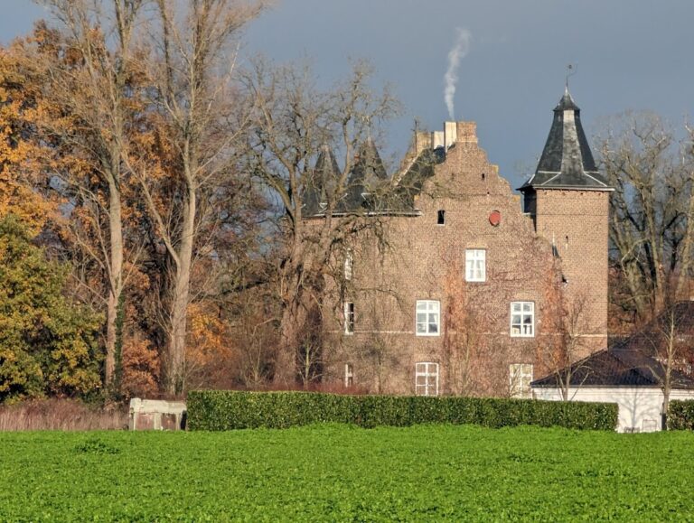
Schloss Tüschenbroich: A Baroque Castle Complex and Historic Mill Estate in Germany



Site at a Glance
- Rating
- 4.5
- Popularity
- Low
- Country
- Germany
- Primary era
- Early Modern
- Eras represented
- Medieval, Early Modern, Modern
- Civilizations
- Holy Roman Empire
- Site type
- Domestic
- Remains
- Castle
On this page14 sections
History
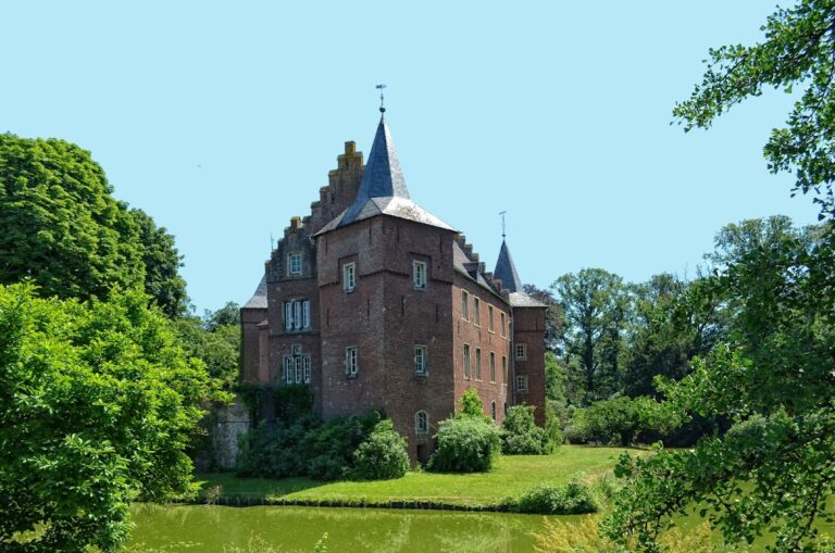
Schloss Tüschenbroich is a castle complex in Germany whose medieval core was a water castle on a fortified mound, later rebuilt as a Baroque brick palace after 1624. It stands in the source area of the Schwalm near Wegberg and is associated with the Tüschenbroich Forest, a large mill pond, and several archaeological features.
Medieval Origins and Territorial Rule
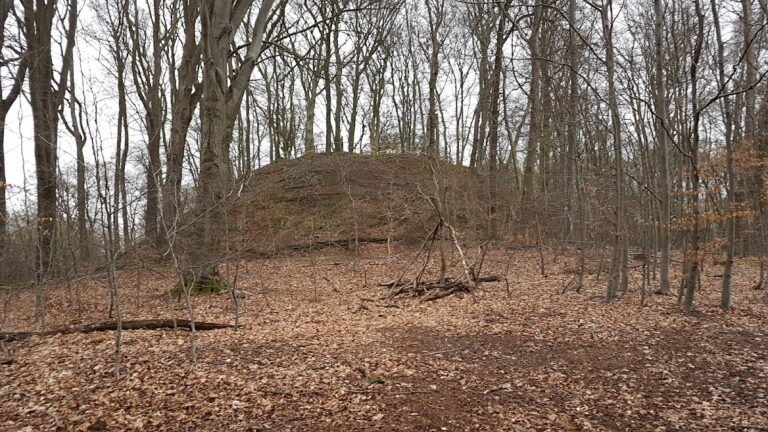
The historical core was a motte, an artificial fortified mound, on an island in the Mühlweiher. The island was probably separated from the mainland by a ditch, and the mound may have been raised artificially. Tüschenbroich first appears in 1172 under the name “Thuschinbroc.” Its early territorial connection was with Wassenberg, an earlier lordship affiliation, before the estate entered the sphere of the Duchy of Jülich, a major principality in the Rhineland.
The castle’s religious history also reaches back into the medieval period. In 1456, the Bishop of Liège confirmed the re-endowment of a St Ulrich chapel by the castle owner Heinrich von Mehlich. A further record from 1546 places a chapel of St Ulrich within the castle. This date belongs to an earlier chapel or chapel phase rather than securely dating the building that survives in the forest.
War Damage and Baroque Reconstruction
The buildings of Tüschenbroich burned during the Thirty Years’ War, the European conflict of 1618 to 1648 that caused widespread destruction across the German territories. Between 1624 and 1630, the old castle was damaged or destroyed, including part of the chapel on the fortified island.
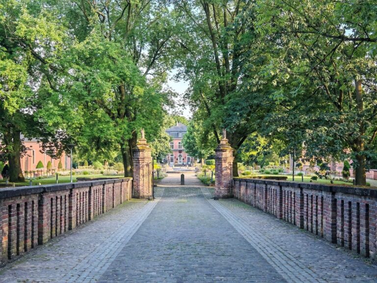
In 1624, Franz von Spiering acquired the war-damaged estate for 24,200 Reichstalers and began rebuilding it as a Baroque palace complex in brick. The 1720 Codex Welser, an illustrated inventory of the knightly fiefs of the Duchy of Jülich, shows both the main-castle island and the partly surviving outer bailey, an enclosed area for domestic, administrative, and economic functions. After later destruction, the outer-bailey complex became the main castle.
The palace was repaired in 1876 after severe storm damage. The estate is privately owned. Its principal motte remains a protected archaeological monument, preserving the physical core of the earlier castle beneath its later history.
Mills and Lordly Control
The oil mill and grain mill were separate buildings within the wider estate. The oil mill was a compulsory mill, meaning that inhabitants of a defined surrounding territory were legally required to use it and thereby provided its lord with a controlled source of income. An order dated 20 December 1628 required all inhabitants of the Tüschenbroich lordship to use the local compulsory mills, imposing a penalty of three gold guilders. The arrangement gave the castle lords both revenue from milling and control over an important local activity.
This obligation was abolished during the French period in the early nineteenth century as a remnant of serfdom. The oil mill continued producing linseed oil until 1912. From about 1850, diminishing water availability reduced its operation from six hours a day to approximately three. The grain mill passed to Justice Councillor Gormanns in 1834, two years before the oil mill, and had been run by successive tenants since 1826. Its milling operation ended permanently in 1940.
The Forest Chapel and Local Tradition
A member of the von Spiering family built the Ulrich Chapel in the Tüschenbroich Forest around 1640, probably after the destruction of the earlier castle chapel. The building’s later material fabric retains connections with that earlier structure. A local legend links the chapel with Count Heinrich von Melich, who condemned a robber captain to death without realizing that the condemned man was his own son Ulrich, whom he had disowned years before.
A Second Motte and the Brühler Hof
East of the Tüschenbroich Forest, near the Schwalm, a second lowland motte belonged to another settlement area. Its economic settlement is thought to have been abandoned, after which its inhabitants may have established the Brühler Hof about 300 metres farther downstream. The farm first appears in 1397 as “ten Breul” and remained marked on the 1846 Prussian survey map. Afforestation work in 2001 revealed its foundations.
Remains
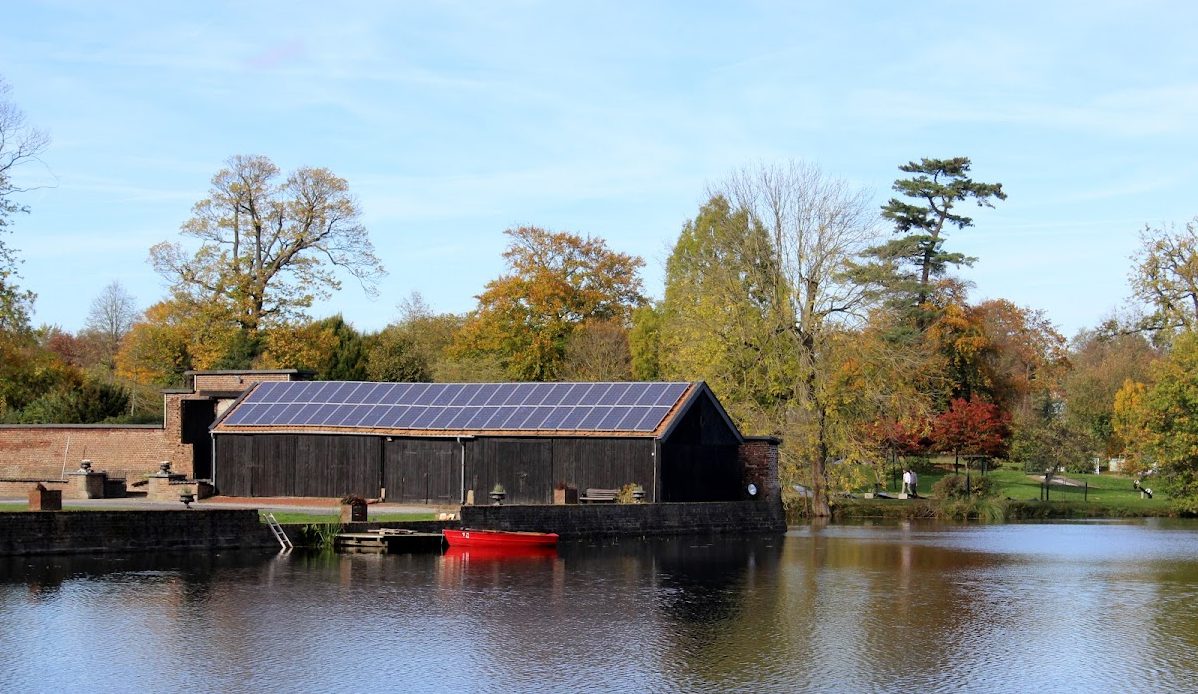
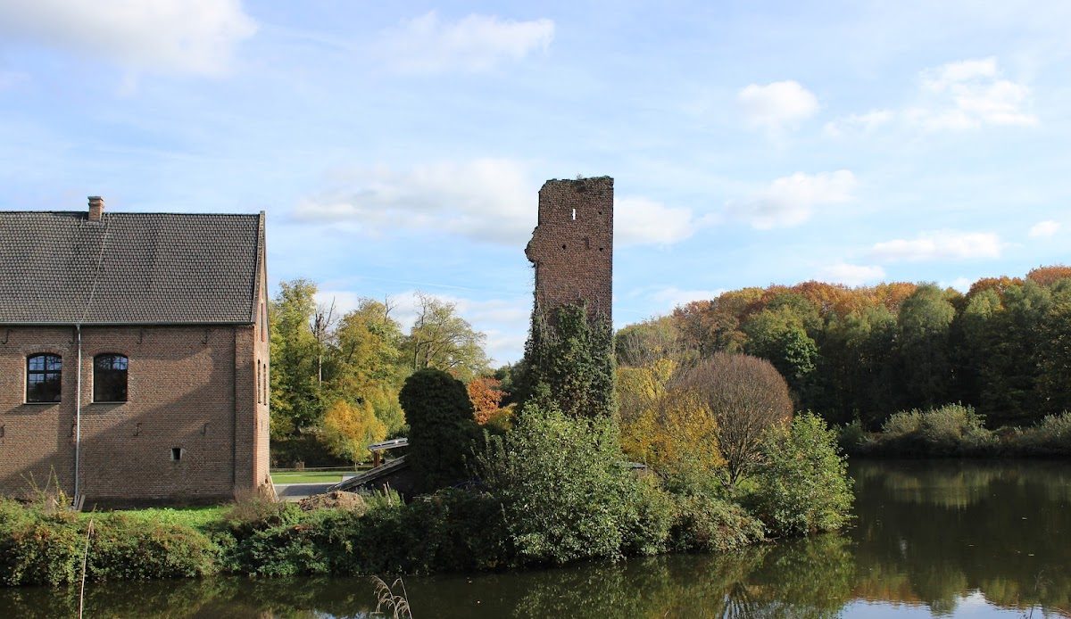
The surviving site combines wooded archaeological mounds, water-filled mill ponds, historic mill buildings, and a seventeenth-century chapel. The principal castle motte forms a truncated-conical, tree-covered island in the middle of the Mühlweiher. Its upper plateau carried the high-medieval castle, while the surrounding water helped define the defensive setting. The wider complex developed around this island and the associated outer-bailey and milling areas.
Castle Mottes and Settlement Remains
Principal Castle Motte
The main motte is an overgrown island with a level summit. It may have been divided from the mainland on its northeastern side by a ditch and artificially enlarged before carrying the high-medieval stronghold. The mound now survives as an archaeological landform within the Mühlweiher, linking the visible water landscape with the earliest castle phase.
Lowland Motte and Brühler Hof
The second motte near the Schwalm survives as a low mound within a silted ditch in overgrown ground at Kummerter Busch. Additional ditches connect with the motte ditch and indicate an outer bailey, where the economic part of the settlement may have stood. About 300 metres downstream, the foundations of the former Brühler Hof were found during afforestation work in 2001.
Historic Mills
Grain Mill
The grain mill stands below a large upstream storage pond. A marshy depression was flooded to create the pond, which also strengthened the castle’s defenses. The mill building used a water drop of approximately 2.50 metres. It contained two milling mechanisms, although they could not work at the same time, and one mechanism operated for an average of six hours each day. Its water wheel is described as the only overshot wheel among the mills of the Schwalm, meaning that water reached it from above. In 1877, owner Jungbluth replaced the wooden weir, the structure controlling the mill water, with a stone construction that still survives. The former mill later became a restaurant, which operated until the end of 2022.
Oil Mill
The oil mill is an eighteenth-century thatched timber-frame building with an undershot water wheel, driven by water passing beneath it, and an edge runner, a heavy wheel that crushes material around a circular track. Its structural core dates from the fourteenth or fifteenth century, and a mill may have occupied the location even earlier. The former oil mill is now used as a glass-art studio and for events.
Ulrich Chapel
The Ulrich Chapel in the Tüschenbroich Forest is an octagonal early-Baroque building from the seventeenth century, situated on the route toward Geneiken. Its roof-rider bell was cast in 1587 by the Aachen bell founder Heinrich von Trier. The carved Renaissance oak door is older than the present chapel and probably came from the earlier castle chapel. Its straight lintel does not match the present opening’s basket-arch shape, while its internal lock is also Renaissance in date. Until around 1944, a wooden inscription above the entrance read “St. Ulrich’s Chapel 1546.” The door, bell, and inscription together indicate that material from the earlier chapel was incorporated into the later building.