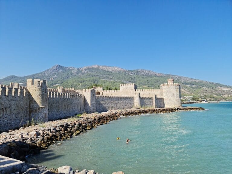
Meydancık Castle: A Fortified Settlement in Rough Cilicia


Site at a Glance
- Rating
- 4.2
- Popularity
- Very Low
- Country
- Turkey
- Primary era
- Classical
- Eras represented
- Iron Age, Classical
- Civilizations
- Achaemenid, Ptolemaic
- Site type
- Military
- Remains
- Fort
On this page12 sections
History
Meydancık Castle is a fortified settlement in Turkey’s Rough Cilicia, occupied from the late seventh century BC. Rough Cilicia was the mountainous southeastern coastal region of ancient Cilicia. Aramaic inscriptions identify the ancient name as KRŠ, also rendered Kiršu, and the fortress may be the Kiršu named in a Neo-Babylonian chronicle.
Kiršu and the Babylonian campaign
The chronicle describes a campaign in 557/556 BC by Nergal-šarra-usur, king of the Neo-Babylonian Empire, the Mesopotamian state ruled from Babylon during the late seventh and sixth centuries BC. His army attacked Appuašu, king of Pirindu, a small kingdom in southern Anatolia. Kiršu is described as the old capital after the seat of government had moved to Ura, and the Babylonians destroyed it during the campaign.
Persian and Hellenistic rule
During the Achaemenid period, when the Persian Empire ruled much of western Asia before the conquests of Alexander the Great, Meydancık became the seat of a Persian governor. A palace was built there, and the fortifications of this period were later altered under Hellenistic rule.
The settlement changed political control and function more than once during the Hellenistic period. It was incorporated successively into the Ptolemaic realm and the Seleucid Empire. The Ptolemaic dynasty ruled Egypt after Alexander’s death, while the Seleucid Empire controlled much of the former eastern Hellenistic realm. Foundations of a monumental building are attributed to Ptolemy III, a third-century BC ruler of the Ptolemaic dynasty. Greek inscriptions bearing the name of Ptolemy reinforce the site’s connection with the Ptolemaic period.
Later use and archaeological investigation
Early Christian and Byzantine activity continued at the settlement. During the Ottoman period, the ruins were known as Beydili Kale. Excavations directed by Emmanuel Laroche between 1971 and 1982 examined the entrance, administrative and palatial remains, graves, inscriptions, and other features. A large hoard found during the 1980 excavations came from three terracotta vessels. Parts of the finds, including the coins and tomb caryatids, are exhibited at the Silifke Archaeological Museum.
Reports by Laroche raised a possible earlier Hittite connection. In 1972 he stated that a cartouche, an enclosing frame around a royal name, belonging to Muwatalli II had been found on a column near the entrance. Muwatalli II was a thirteenth-century BC king of the Hittite Empire. In 1974 Laroche also reported relief fragments with Luwian hieroglyphic inscriptions, a monumental writing system used in ancient Anatolia, together with a princely relief resembling one at Hemite. These claims would place the structures in the thirteenth century BC, but the reports supplied no photograph, drawing, or detailed description. Later visits found no trace of the alleged remains, and Olivier Casabonne argued that they had never existed.
Remains
Hill and fortifications
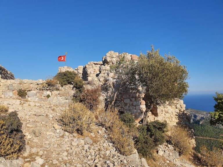
Meydancık Castle occupies a ship-shaped hill approximately 700 metres above sea level, south of Gülnar and west of Silifke. Its roughly rectangular fortification plan extends about 750 metres along its north-south axis and about 150 metres across. Military installations occupied the northern part of the hill, where the strongly fortified entrance stands at the northeastern corner.
The defensive walls belong to the Persian period and were modified during the Hellenistic period. Aramaic inscriptions naming the city were found on the fortification wall and in a burial chamber on the western side of the hill. A wide shaft or hollow at the southern end of the fortification extends at least 23 metres below the surface. Its purpose remains uncertain, with proposed interpretations including a cistern, an altar, or a concealed passage.
Central buildings and burial areas
Palace and administrative center
The central area contained a palace, an administrative building, foundations of a monumental structure attributed to the reign of Ptolemy III, foundations, and residential buildings. The palace area also produced the major Hellenistic coin hoard, connecting the surviving central remains with the settlement’s political and administrative activity.
Tomb building and caryatids
Graves occupy the slopes of the hill. At the eastern foot of the rock, excavations uncovered a tomb building from the first half of the sixth century BC. Two caryatids stood before its facade. A caryatid is a sculpted female figure used as an architectural support in place of a column or pilaster. The tomb caryatids are among the finds exhibited at the Silifke Archaeological Museum.
Inscriptions, reliefs, and the coin hoard
Inscriptions and reliefs
Aramaic inscriptions on the western burial chamber and fortification wall preserve the ancient name KRŠ. Two Achaemenid reliefs were also found at the site. The reported cartouche of Muwatalli II and the Luwian-relief remains remain disputed because later investigations identified no trace of them.
Hellenistic silver hoard
The palace area yielded 5,215 silver coins from Hellenistic states. The hoard contains 2,400 coins of Alexander the Great, 126 of Philip III, 31 of Demetrius Poliorcetes, 114 of Lysimachus, 62 associated with kings of Pergamon, 246 associated with Seleucid rulers, and 2,206 associated with Ptolemaic rulers. Its denominations include drachms, tetradrachms, oktadrachms, and dekadrachms. The coin hoard is exhibited at the Silifke Archaeological Museum.
Nearby sites