Burgruine Beilstein: A Medieval Hilltop Castle Ruin in Germany


Site at a Glance
- Rating
- 4.2
- Popularity
- Very Low
- Country
- Germany
- Primary era
- Medieval
- Eras represented
- Medieval
- Civilizations
- Holy Roman Empire
- Site type
- Military
- Remains
- Castle
On this page4 sections
History
Burgruine Beilstein is the ruin of a small high-medieval hilltop castle in Jossgrund, Germany, probably built in the late thirteenth or early fourteenth century. It stands on the Beilstein between Villbach and Lettgenbrunn, in what was then the northern part of the Electorate of Mainz, the territory governed by the archbishop of Mainz through both ecclesiastical and secular authority. The mountain itself was first named in 1059.
Castle Origins and Mainz Control
The castle probably protected Mainz possessions around Aschaffenburg and the Spessart. Its position also allowed those controlling it to oversee an old road and to protect and supervise glassworks established in the northern Spessart. The small stronghold probably included an outer bailey, a subsidiary enclosed area outside the main fortified enclosure that could accommodate additional buildings and practical activities.
In 1313, Mainz acquired Orb from the heirs of the Büdinger line, the lords of Trimberg, and the Hohenlohe-Brauneck family. Beilstein was first referred to as a castle in 1343, when a charter issued by Archbishop Heinrich III of Virneburg named Fritz Forstmeister of Gelnhausen as its hereditary castleman. This office involved the defence and administration of the castle.
Mainz did not control Beilstein alone. It was a jointly held castle, or Ganerbenburg, governed by several co-heirs or noble families at the same time. The other joint holders are not identified in the surviving records. In 1346, the castle was pledged to the Forstmeister of Gelnhausen, von Thüngen, and Hoelin families.
In 1359, Archbishop Gerlach of Nassau of Mainz reached a formal agreement with the knights Diez von Tüngeda, also known as Thüngen, and Friedrich Forstmeister of Gelnhausen, together with their families, over the portion of Beilstein that his predecessor Heinrich III had pledged to them.
Decline and Later Protection
After political control of the region passed to the counts of Hanau, Beilstein lost its importance and deteriorated. It was already described as ruined in 1427. The foundation of the hamlet of Villbach is associated with the castle. Villbach became the first location of the court for the Jossa valley, before the court moved to Burgjoß in 1571 and to Orb in 1616.
Paul Pfinzing’s regional map of the Spessart, produced between 1562 and 1594, shows Villbach, Beilstein, and Lettgenbrunn. It depicts Beilstein as a ruin that still contained several identifiable buildings, offering a later view of the castle’s surviving state.
The Beilstein mountain and ruin became part of a nature reserve established in 1930, the first nature reserve in the Main-Kinzig district. The mountain and ruin, together with their near-natural mixed forests, are a wintering site for bat species protected throughout Europe. The mountain was consequently designated by the state of Hesse as a Fauna-Flora-Habitat area, a protected site in the European conservation network for important habitats and species.
Remains
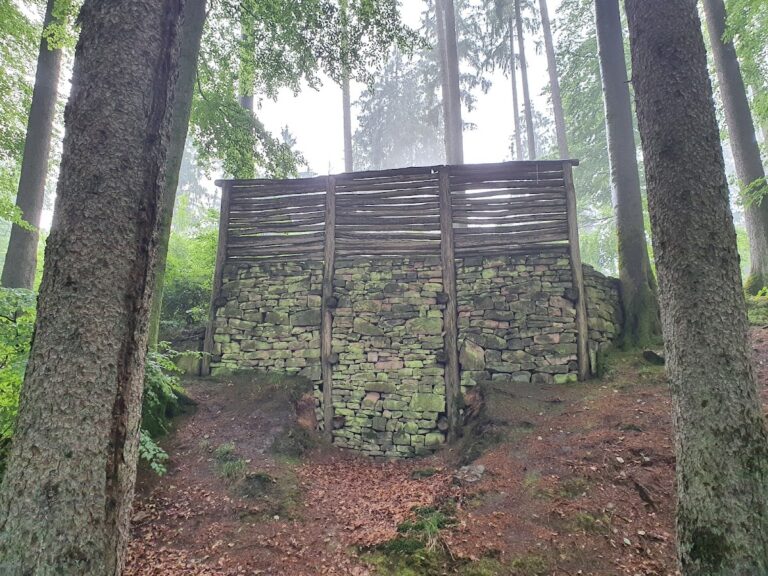
Burgruine Beilstein occupies the northern edge of the basalt cone of the Beilstein at approximately 500 metres above sea level. The Villbach flows around the nature reserve to the south and west. The surviving castle fabric consists of part of a formerly rectangular enclosing wall, measuring approximately 12 metres on each side. Its remaining masonry follows a U-shaped line along the sharply descending edge of the mountain.
The wall rises as much as 1.8 metres on its inner side and exceeds 3 metres in places on its outer side. It was built as continuous sandstone masonry rather than as a two-shell wall with a rubble-filled interior, a construction method used for many other castles. Only remnants of the enclosure survive today, while Pfinzing’s sixteenth-century map shows that several buildings were still recognizable within the ruin at that time.