Castillo de Chera: A Muslim-Origin Hill Fortress in Spain


Site at a Glance
- Rating
- 4.5
- Popularity
- Very Low
- Country
- Spain
- Primary era
- Medieval
- Eras represented
- Medieval
- Civilizations
- Almohad, Almoravid
- Site type
- Military
- Remains
- Castle
On this page9 sections
History
Castillo de Chera is a Muslim-origin fortress near Chera in Valencia, Spain, probably founded during the Almoravid period in the early twelfth century. Its construction date is uncertain, but its barbican, an outer defensive work before a wall or gate, may indicate an early twelfth-century date. The fortress probably protected Muslim communities that lived and cultivated land in 25 neighbouring villages.
Almoravid and Almohad phases
The Almoravids and Almohads were successive Muslim ruling dynasties that controlled parts of the Iberian Peninsula between the eleventh and thirteenth centuries. At the end of the twelfth century or the beginning of the thirteenth, the Almohad Caliphate strengthened Castillo de Chera by doubling its walls and excavating a moat.
Conquest and frontier warfare
In 1238, James I of Aragon conquered the castle and granted it to the Aragonese nobleman Hurtado de Lihory, who had accompanied him during the conquest of the area. James I was the thirteenth-century king whose campaigns brought much Muslim-ruled territory into the Crown of Aragon.
The fortress stood in a border zone between Castile and the Kingdom of Valencia and was regarded as the last castle in Valencia. Castilian forces captured it in 1356 during the War of the Two Pedros, a fourteenth-century conflict between the Crown of Aragon and the Crown of Castile, and held it until 1361. The castle was abandoned in the fifteenth century.
Protection and archaeological work
Castillo de Chera was designated a monument in April 1998. Stabilization and renovation works began in October 2023, and excavation during those works exposed parts of the outer wall.
Remains
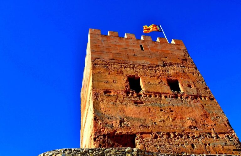
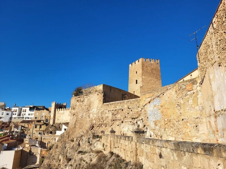
The ruined fortress occupies a hill about one kilometre from Chera. Its position commanded the surrounding agricultural plain, the Tormagal gorge, and the route between Requena and Chulilla. The castle has a square or quadrangular plan, high defensive walls, four corner towers, and a centrally placed keep, the principal fortified tower. The towers and other elements have battered forms, with sloping outer faces. Rammed earth, made by compacting earth within formwork, and rubble masonry were used throughout the fortifications.
Outer fortifications
Walls and barbican
The four corner towers were joined by a wall of rammed earth and rubble masonry. Approximately 27 metres of this wall survive, while two small solid towers attached to its longer sides have almost entirely disappeared. These structures probably reinforced the wall and may have helped define an angled entrance. A barbican followed the outer line of the walls and towers. In the west it functioned as a second wall; in the east it acted as a foundation and retaining structure, levelling the bases of the other elements and forming a slope that helped prevent the ground from sliding towards the cliffs. Its entrance probably stood in the southern wall, where the barbican formed an angled section.
Corner towers
The southern corner tower, known as the Tower of Pedriza, is about 7 metres high and has walls approximately 0.7 metres thick. The eastern Tower of the Cave lost its outer walls when they collapsed, leaving the sections attached to the enclosing wall. The western Tower of the Hermitage is the best-preserved corner tower. It stands on the hill’s plateau, while the other three towers were built on slopes above the cliffs, and it rises to about 10 metres. An entrance from outside survives, although its function is unknown. The northern corner tower is almost completely destroyed, with only the lower wall sections of its battered base remaining.
Central keep and inner area
The central keep retains all four walls, although its upper part has disappeared. It is slightly more than 10 metres high, with walls about 0.5 metres thick and sides measuring approximately 7 to 7.1 metres. Its southern entrance was originally smaller than it is today. A basement filled with debris from the collapsed roof served as a storeroom, while a possible upper floor has been entirely lost. Opposite the entrance, an open enclosed area served as an albacar, a fortified space that could shelter livestock or people. Some researchers also consider that it may have contained a cistern.
Nearby sites