Burgruine Birkenfeld: A Medieval Spur Castle in Germany


Site at a Glance
- Rating
- 4.2
- Popularity
- Very Low
- Country
- Germany
- Primary era
- Medieval
- Eras represented
- Medieval
- Civilizations
- Holy Roman Empire
- Site type
- Military
- Remains
- Castle
On this page11 sections
History
Burgruine Birkenfeld is the ruin of a small medieval spur castle in Germany, on the southern edge of Rübeland in the town of Oberharz am Brocken, Saxony-Anhalt. Probably built in the twelfth century, it used the natural strength of a limestone ridge to protect the surrounding ironworks and to serve as a border post for the Bodfeld Forest. Rübeland itself was formerly known as Birkenfeld, and the castle is associated with the noble Berckefeldt family of the Principality of Grubenhagen.
Origins and medieval administration
The Berckefeldt family is recorded as early as 914. Werner von Berckefeldt appears in the region in 1134. He lived at Pipinsburg near Osterode and served as castellan, an official responsible for administering and defending a castle, at Burg Windhausen. These connections place Birkenfeld within a wider network of fortified sites and noble service in the Harz region.
The castle stood under the feudal authority of the Prince-Bishopric of Halberstadt, an ecclesiastical principality whose bishop also exercised secular territorial power. The place was called Bergvelt in 1260, Berichsvelde in 1319, and Bergkfelde in 1652. A Halberstadt ministerial family, meaning a service noble who held administrative or military office for a lord, took its name from the castle and is recorded between 1335 and 1443.
Birkenfeld was also connected with the nearby Königshof, or Königsburg. On 22 January 1361, Bishop Ludwig appointed Heisin and Dytherich van Barkinvelde as bailiffs there. A bailiff exercised delegated administrative or judicial authority, so the appointment indicates the castle’s place within the local organization of Halberstadt’s territory.
Destruction and later memory
The castle was destroyed in the early fourteenth century. Its destruction probably took place in 1365 during the feud between Landgrave Frederick III of Thuringia and Duke Albert I of Brunswick-Grubenhagen. A landgrave was a high-ranking territorial prince, while a duke was a ruler or member of a ducal ruling house. The nearby Pipinsburg and Burg Windhausen were destroyed during the same conflict.
By the seventeenth century, Birkenfeld was already regarded as a ruin. Matthäus Merian’s engravings in Topographia Ducatus Brunswick et Lüneburg, published in 1654, depicted it as the “Old Castle Birckenfelt.” The lower- and outer-ward areas later underwent substantial alteration. Part of this ground is now used as a shooting ground, and a modern shooting-club building occupies part of the former lower ward.
Remains
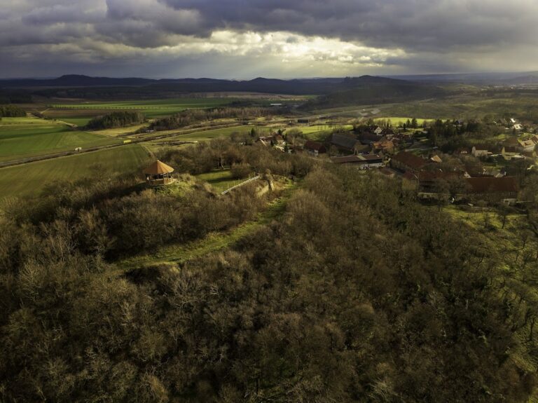
Burgruine Birkenfeld occupied a sharply west-pointing limestone ridge at about 450 metres above sea level, south of the Bode River. As a spur castle, it was built on a projecting ridge whose slopes and narrow approach strengthened its defences. The upper castle stood at the exposed southwestern end. Its masonry used angular, rectangularly dressed rubble from the Devonian limestone of the Iberg, with ashlar blocks at the corners. Large hollow roof tiles indicate that the castle buildings probably carried tiled roofs.
Upper castle
Residential tower
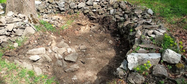
The principal surviving structure is the foundation of a rectangular residential tower. Its foundations were about 1.65 metres thick, and the tower measured approximately 8.40 by 11.55 metres. The northern foundation rested on a rocky ridge around five metres higher than the southern foundation, reflecting the uneven ground on which the tower was built. A later shooting-house superstructure stands on the original foundations, while a modern staircase provides access to them.
Upper-castle courtyard
East of the tower was an upper-castle courtyard measuring about 7 by 20 metres. It lay several metres below the tower and formed a separate level within the upper castle. Sections of its enclosing perimeter wall survive, providing part of the remaining outline of the defended compound.
Lower castle and outer defences
Lower castle
The lower castle lay slightly below and north of the upper castle. Arranged as a defensive outer enclosure, it covered approximately 15 by 30 metres. A rock-cut staircase connected it with the upper-castle courtyard, and auxiliary buildings may have occupied this lower level. The surviving ground has been levelled or heavily altered, and the modern shooting-club building occupies part of the former lower-ward area.
Neck ditch and drawbridge
On the western side, the lower castle opened toward a neck ditch, a trench cut across the narrow connection of a ridge or spur. The ditch was about 13 metres wide, cut through the ridge, and extended westward along the upper and lower castles. An outer ditch lay farther west, substantially below the two castle levels at the foot of the rocky ridge. The outer ward and lower castle were linked by a drawbridge, a movable bridge that could be raised to control passage across the neck ditch.
Outer ward
South of the bordering rocky ridge and east of the neck ditch was an outer ward containing an economic courtyard. A further ditch adjoined it on the eastern side. Foundations of a large building were found in this area. The ridge protected the ward on its northern side, while brushwood obstacles and palisades may have defended its southern and western sides. The outer-ward ground is now levelled or substantially altered, leaving the upper castle’s wall sections and tower foundations as the clearest surviving elements of the site.