Fort du Mont Bart: A Séré de Rivières Defensive Fort in France


Site at a Glance
- Rating
- 4.4
- Popularity
- Low
- Country
- France
- Primary era
- Modern
- External website
- Open
- Eras represented
- Modern
- Civilizations
- French
- Site type
- Military
- Remains
- Fort
On this page13 sections
History
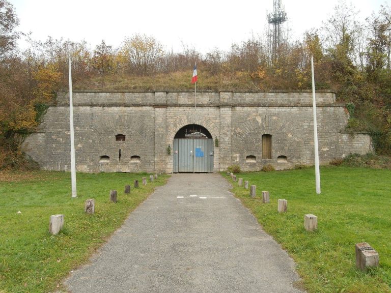
Fort du Mont Bart is a nineteenth-century French fortification at Bavans, France, built between November 1874 and July 1877 as part of the Séré de Rivières system and the Lomont defensive strongpoint. This network of forts, batteries, and other positions was created mainly after the Franco-Prussian War to protect France’s frontiers and strategic centers. The fort stood behind the fortified region of Belfort, overlooking the Doubs and Allan valleys and controlling the route toward Besançon. Its purpose was to prevent an enemy from bypassing Belfort after France lost Alsace and Lorraine and its eastern frontier changed.
Construction and Strategic Role
The fort was built by the company of Adrien Hallier in response to the Franco-Prussian War of 1870 and the improvements made to nineteenth-century artillery. It was planned as a second-line position within the Lomont defenses. Its garrison was given as 700 men, while a later plan allowed for 508 men in peacetime and 718 during war.
A second Mougin casemate, an armored artillery position intended to protect a heavy gun, was proposed in 1878 but never constructed. In 1889, an underground magazine was excavated into the rock beneath the fort in response to the threat posed by explosive torpedo shells. The fort was not modernized through the later 1900 program, and a complementary scheme proposed in 1908 was not carried out.
Twentieth-Century Changes and Military Use
In 1913 and 1914, the central barracks and court were protected with reinforced concrete and earth against aerial attack. This work covered the former open court and changed it into a roofed interior street. During the Second World War, troops of the 159th Position Heavy Artillery Regiment occupied the fort as part of the Defensive Sector of Montbéliard, a military command responsible for a designated part of a fortified region. On 16 March 1940, that sector became the Fortified Sector of Montbéliard.
The fort was stripped of its armament during the Second World War, although military forces continued to use it until 1960. The defensive ditches were filled in that year, and the fort was then abandoned. It is now owned by Pays de Montbéliard Agglomération, managed by an association, preserved, and undergoing restoration. No name is known for the fort, despite a decree by General Boulanger that provided for each fortification to receive a baptismal name.
Remains
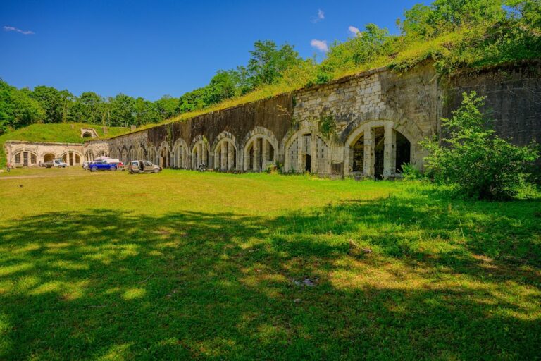
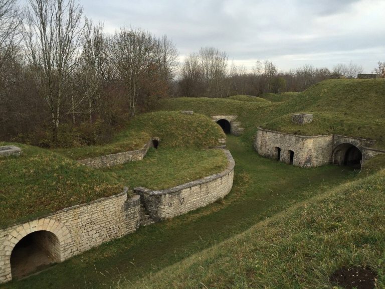
Fort du Mont Bart is a pentagonal fort covering about 3.5 hectares at roughly 500 metres above sea level on Mont Bart, near Bart and south of Montbéliard. It consists of an outer envelope and a central fortified mass. A rocky escarpment backs the western front, while a defensive ditch once surrounded the position. Entry was through a drawbridge, and weapons in the caponieres, fortified structures projecting into the ditch, covered the ditch from protected positions.
Outer Defenses and Artillery
Outer Envelope
The outer envelope contains a guardhouse, an officers’ building, an eastern battery for two guns, and a northern observation post known as the Corbeau post. The central barracks lies below ground level and is surrounded at the surface by firing platforms. These platforms originally carried four 155 mm guns, five 120 mm guns, one 138 mm gun, and four 220 mm mortars.
Casemates and Batteries
The casemates included one 155 mm Mougin gun and four 138 mm guns, with smaller weapons assigned to wall defense. A separate battery held four 95 mm guns. By 1914, the surface armament also included four 90 mm guns and three additional 120 mm guns. Revolving guns and machine guns defended the outer walls. Several direct-fire casemates remain within the fort, including one on the outer side of the rampart street and an indirect-fire casemate on its inner side.
Interior Buildings and Underground Works
Central Barracks and Interior Street
Two barracks blocks face one another across the court known as the interior street, or “the street.” Together, the blocks contain 28 chambers on two levels for soldiers and officers. The court was covered with railway rails and a layer of reinforced concrete and earth measuring about 160 centimetres, with another description giving the concrete covering as 1.65 metres thick. The bakery still contains a functional Lespinasse bread oven fired by wood or coal.
Magazine-Cave
The 1889 magazine-cave, an underground ammunition store excavated into rock, lies beneath the foundations. A gallery with a railway track links the rampart street to the magazine, and a stairway provides access. The powder and cartridge magazines were lit by one to three oil lamps placed behind glass 2 centimetres thick in lamp recesses. A separate lamp room provided access to the lamps.
Communication and Ditch Defenses
Caponieres
The fort contains two simple caponieres and one double caponiere. These structures projected into the defensive ditch so that defenders could fire along or across it while remaining protected. Since the ditches were filled in 1960, the exterior is now almost impossible to view from inside a caponiere.
Optical Posts
Two optical posts provided communication with other forts through coded visual signals. The northern post linked Fort du Mont Bart with Mont-Vaudois, Salbert, and Lachaux. The southern post communicated with the Roches battery, Fort du Lomont, and Fort de Chailluz near Besançon. Signals used sunlight reflected by a heliostat, an instrument that directed sunlight toward a chosen point, or an acetylene lamp in bad weather. Messages were encoded in Morse code.
The fort’s masonry came from the Bavans quarry at the foot of the massif. Above Mont Bart, a stele commemorates Moroccan riflemen.