Castle of Ródão: A Medieval Fortification Overlooking the Tagus in Portugal


Site at a Glance
- Rating
- 4.6
- Popularity
- Low
- Country
- Portugal
- Primary era
- Medieval
- Eras represented
- Medieval, Early Modern
- Civilizations
- Crusader, Knights Templar, Portuguese
- Site type
- Military
- Remains
- Castle
On this page11 sections
History
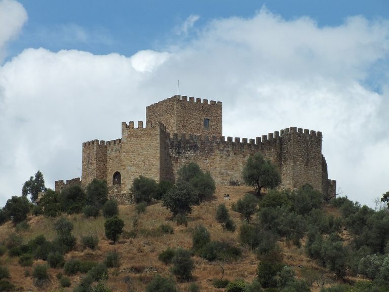
Castle of Ródão is a medieval fortification in Portugal, located at Vila Velha de Ródão above the Tagus River valley. Its present form probably developed during the eleventh and twelfth centuries, likely through the initiative of the Knights Templar, over an earlier fortified settlement. The castle commands the valley and the Portas do Ródão, a dramatic geological passage through which the river flows.
Tradition and Medieval Origins
Local tradition attributes an earlier castle on the site to Wamba, a Visigothic king who ruled in Hispania from 672 to 680. The Visigoths were a Germanic people who established a kingdom in the Iberian Peninsula before the Muslim conquest of most of the region in the early eighth century. Archaeological excavation has not confirmed the connection with Wamba. The medieval fortification was probably built between the eleventh and twelfth centuries over a pre-existing castro, a fortified settlement associated with pre-medieval occupation in Iberia.
In 1199, the Portuguese king Sancho I donated the Herdade da Açafa to the Knights Templar, a medieval military-religious order involved in territorial administration and the defense of Christian frontier regions. The castle and its lookout tower may belong to this period of frontier organization. The tower could have served either as a watchtower or as a keep, a fortified residential or defensive tower.
Military Adaptation
By 1505, the castle’s encircling walls had already undergone extensive destruction. Its defensive role later changed as military technology and strategic needs developed. By the middle of the eighteenth century, the site was being used as an artillery position protecting the passage of the Tagus. Battlements and artillery posts were constructed on the river-facing flank, in the area known as Batarias.
At the beginning of the nineteenth century, the castle was reconstructed in preparation for the First French Invasion of the Iberian Peninsula during the Napoleonic Wars. These conflicts, associated with Napoleon Bonaparte, included the French invasions of the Iberian Peninsula. The reconstruction was undertaken through the initiative of the Marquês de Alorna, a Portuguese noble and military figure.
Archaeology and Recovery
In August 1999, the municipal council of Castelo Branco, IPPAR, and IPA established a program to recover the Castle of King Wamba and its surrounding area, including the walls. IPPAR and IPA were Portuguese public heritage and archaeology institutions. Archaeological surveys followed in 2000 and 2001, conducted by the municipal council and the Tagus Higher Studies Association under the direction of Fernando Branco of the University of Évora.
By June 2004, a project initiated by the municipal council of Vila Velha de Ródão included the consolidation and rehabilitation of the tower and walls by DREMC, a regional public body involved in work on buildings and monuments. From 2004 to 2006, the General Directorate for Buildings and National Monuments carried out further recovery work. In 2006, Pilar Reis excavated the area around the tower and the interior courtyard.
Remains
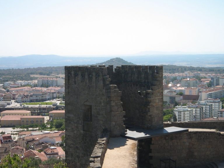
The fortification occupies the southern extremity of the Serra das Talhas, also called Serra de São Miguel. It stands on a mountaintop formed of schist, with arboreal and scrub vegetation, at an elevation of about 315 metres above sea level. From this position, the site overlooks the Tagus valley and the Portas do Ródão. The castle follows an irregular oval plan, with surviving defensive elements distributed around the mountaintop.
Walls and Enclosed Area
Fortification Walls
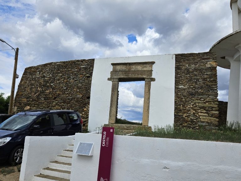
The surviving enclosure includes two partial sections of masonry wall. Their irregular course reflects the oval plan of the fortification and the form of the rocky summit. The northern, southern, and western elevations retain similar embrasures, openings in a defensive wall or parapet from which weapons could be used. Their decoration is incomplete and has been partly destroyed. One undulation in the wall carries a sculpted mark shaped like a horizontal “S.”
Granite Structure and Courtyard
Within the fortified area are the vestiges of a built structure made from small granite blocks set across a zone dominated by a large granite surface. Excavation also produced ceramic fragments outside the walls. The area around the tower and the interior courtyard were examined during the 2006 archaeological work, while recovery projects consolidated and rehabilitated the surviving walls and carried out related external works.
Lookout Tower
Tower Form and Access
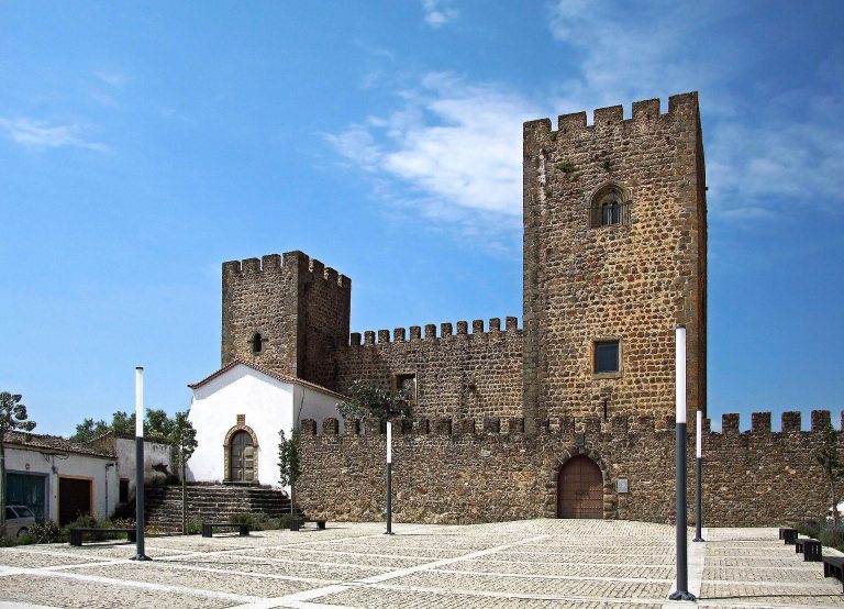
The lookout tower stands on the northeastern side of the fortification. It has a rectangular plan and survives as a prominent element of the enclosure. Restoration added an interior staircase and floor, allowing the tower to function as a viewpoint while consolidating its surviving fabric.
Doorway and Sculpted Cross
The southern elevation of the first floor contains a large rhombus-shaped feature. On the second floor, a rounded doorway has a rectangular lintel and a tympanum, the framed area above a doorway, bearing a sculpted cross of the Order of the Temple. This carved emblem connects one of the tower’s surviving architectural details with the medieval military-religious order associated with the castle’s probable construction.