Bock: The Fortified Promontory of Luxembourg City


Site at a Glance
- Rating
- 4.4
- Popularity
- Medium
- Country
- Luxembourg
- Primary era
- Early Modern
- External website
- Open
- Eras represented
- Medieval, Early Modern
- Civilizations
- French, Habsburg, Holy Roman Empire, Spanish
- Site type
- Military
- Remains
- Fort
On this page8 sections
History
Bock is a fortified rocky promontory in Luxembourg City, Luxembourg, acquired by Count Siegfried in 963 as the defensible center of his possessions. Its position above the Alzette River later made it a central element of the Fortress of Luxembourg and of the city’s military history.
Early occupation and the foundation of Luxembourg
The earliest historical reference connected with the Bock concerns a watchtower or fortification on the Roman road linking Reims with Trier. In 723, Charles Martel, the leading Frankish military ruler of the early eighth century, ceded it to the Abbey of Saint-Maximin in Trier, a major Benedictine landholder. Roman and Frankish occupation of the Bock itself is possible, although the archaeological evidence is limited. Traces of a fourth-century Roman watchtower survive near the Fish Market, where the roads from Reims to Trier and from Metz to Liège crossed.
On 7 April 963, Viker, abbot of Saint-Maximin, signed the deed transferring the Bock and its surroundings to Count Siegfried in exchange for land at Feulen in the Ardennes. Siegfried obtained the consent of Otto I, the German king and emperor, before completing the acquisition. The deed calls the property “the castle called Lucilinburhuc,” suggesting that a castle may already have stood there. The name was therefore not necessarily created by Siegfried, who intended the location to serve as a defensible central point for his lands.
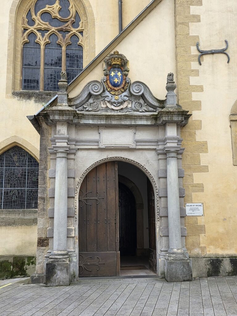
The castle was enlarged and strengthened over subsequent centuries. In 987, a chapel was built at the nearby Fish Market on the site now occupied by Saint Michael’s Church. Under Conrad I, a medieval Count of Luxembourg, the castle became the residence of the Counts of Luxembourg.
Sieges and the development of the fortress
The stronghold was repeatedly damaged, captured, destroyed, and rebuilt during conflicts involving the Burgundians in 1473, the Habsburgs in 1477, and the Spaniards in 1555. The Bock later formed part of the Fortress of Luxembourg, a strategically important European stronghold contested by Burgundian, Habsburg, Spanish, Prussian, and French forces. It also held the formal status of a Bundesfestung, meaning a fortress maintained as a federal military stronghold.
Under Spanish rule in the 1640s, the Swiss engineer Isaac von Treybach substantially remodelled the defences. In 1684, Vauban, the French military engineer and marshal renowned for improving fortified cities, captured Luxembourg during a month-long siege conducted on behalf of Louis XIV. The Bock fortifications were completely demolished. Vauban then made major additions to the wider defences, increasing the importance of protected underground passages and chambers.
The resulting fortifications enabled Luxembourg to withstand a seven-month French siege in 1794, during the French Revolutionary Wars. When the garrison surrendered, the walls remained unbreached. Lazare Carnot, a French politician and military engineer associated with organizing the Revolutionary armies, consequently described the Fortress of Luxembourg as the best in the world apart from Gibraltar. This assessment gave rise to the nickname “Gibraltar of the North.”
Demolition and heritage
The Treaty of London of 1867 required the demolition of Luxembourg’s fortifications. The work continued for 16 years and cost 1.5 million gold francs. The surviving ruins of the Bock and its underground casemates now form part of the area included in Luxembourg’s UNESCO World Heritage designation.
The Bock is also associated with the tradition of Melusine, a legendary figure linked to nearby waters. People were reportedly said to have seen her there, adding a layer of local tradition to the promontory’s military history.
Remains
The rocky promontory and defensive sections
The Bock rises above the Alzette River, which surrounds the promontory on three sides and provides a natural defensive barrier. Its fortifications were arranged from west to east in three sections separated by rock and linked by bridges: the Large Bock, the Middle Bock, and the Small Bock. The successive construction of these defences left little of the medieval castle visible.
The Large Bock and underground casemates
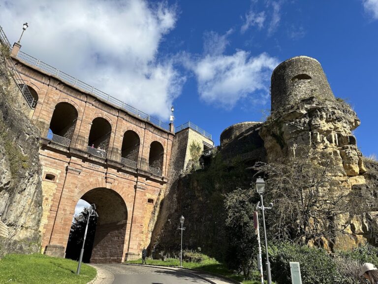
The Large Bock was linked to the old town by the Castle Bridge and became the principal part of the later fortress. A wall 12 metres high enclosed it. The surviving ruins of the old castle are connected with underground casemates, fortified galleries and chambers used for cannon positions, troop accommodation, and protected movement. These spaces developed from the cellars of the medieval castle and were greatly enlarged in 1744 during the Austrian period by General Neipperg.
The main surviving passage through the casemates is 110 metres long and reaches up to 7 metres in width. Branches from it contained at least 25 cannon emplacements, with 12 on the northern side and 13 on the southern side. The casemates covered approximately 1,100 square metres and could accommodate up to 1,200 soldiers during wartime. An internal well 47 metres deep supplied their water.
Castle Bridge and associated structures
Built by the Austrians in 1735, the two-storey Castle Bridge connects the Bock with the old town. It provides four routes between the cliffs: a road across the top, a passage through its four upper arches, a spiral staircase through the main arch, and a tunnel beneath the road at the bottom. Together with the surviving galleries, casemates, and castle ruins, the bridge remains a physical element of the Bock complex.
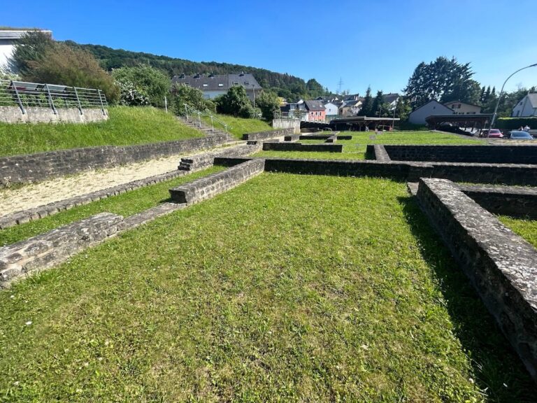
Saint Michael’s Church occupies the site of the former castle chapel built in 987. The church therefore preserves the location of an early religious structure associated with the medieval castle, while the ruins and underground works preserve the later military development of the promontory.