Ljubuški Fortress: A Medieval and Ottoman Border Fortress in Bosnia and Herzegovina


Site at a Glance
- Rating
- 4.7
- Popularity
- Low
- Country
- Bosnia and Herzegovina
- Primary era
- Medieval
- Eras represented
- Medieval, Early Modern
- Civilizations
- Kingdom of Bosnia
- Site type
- Military
- Remains
- Castle
On this page10 sections
History
Ljubuški Fortress is a medieval and Ottoman fortress in Ljubuški, Bosnia and Herzegovina. Built during the fifteenth century, it belonged to Stjepan Vukčić Kosača, a powerful Bosnian nobleman known as Herzog of Saint Sava and Grand Duke of Bosnia. The title Herzog explains the fortress’s association with the name Herceg Stjepan. The site later became an Ottoman border stronghold and the centre of a larger fortified enclosure.
Medieval Stronghold
In the medieval period, Ljubuški formed part of the župa of Večenike, also known as Večerić. The fortress is mentioned in 1452, during a conflict between Stjepan Vukčić Kosača and his sons, Prince Vladislav and Prince Vlatko. Stjepan took refuge there, while Vladislav unsuccessfully attempted to seize Ljubuški in the same year.
The fortress appears in a 1454 charter of King Alfonso V of Aragon under the name civitas Lublano. Its appearance after references dated 1444 and 1448 places its construction between 1448 and 1454, although it may have been built in 1452. The settlement below the fortress most likely developed on the Crkvice terrace beneath the southern part of the town, before a later town grew in the valley to the west.
Ottoman Conquest and Administration
The Ottomans captured Ljubuški in 1463, but held it for only about a month, from June to July, before withdrawing because supplies were inadequate. Prince Vlatko Hercegović quickly restored the town to his control. The Ottomans conquered Ljubuški permanently between 1468 and 1477. By 1477, it was a border fortress with a strong garrison belonging to the Drina kadiluk, an Ottoman judicial and administrative district governed by a judge. An Ottoman-Hungarian agreement of 1503 listed Ljubuški among the border towns that remained under Ottoman rule.
Ottoman authorities expanded the medieval stronghold between 1472 and 1565, surrounding it with a larger enclosure. A vakufnama, a legal deed regulating a charitable religious endowment, described Ljubuški as a k’ala, or fortress, in February 1565. During the same period, Nesuh-aga Vučjaković built a mosque in the town. Ljubuški later functioned as an independent kadiluk in 1633. In the eighteenth century, the Ljubuški nahiyah, a smaller administrative subdivision, existed within the district, and a Ljubuški captaincy, an Ottoman frontier military district commanded by a captain, was established.
Abandonment and Conservation
The fortress was abandoned in 1835. On 8 October 2003, the Commission to Preserve National Monuments of Bosnia and Herzegovina designated the Old Fort of Ljubuški a National Monument of Bosnia and Herzegovina. The site is gradually undergoing repair.
Remains
Setting and Overall Layout
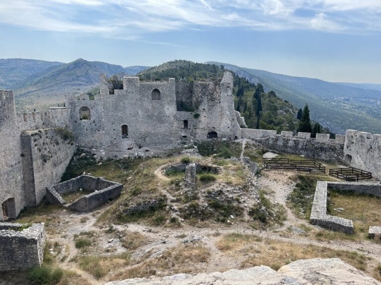
Ljubuški Fortress occupies a rocky position on the prominent karst ridge of Buturovice Hill, at the eastern end of Ljubuško Polje, approximately 396 metres above sea level. Karst is a limestone landscape shaped by the dissolution of the rock, often producing rugged ridges and caves. The fortress has an irregular polygonal plan, measuring about 93 metres from north to south and an average of 49.5 metres from east to west. It covers approximately 3,350 square metres and combines a medieval inner stronghold with a larger Ottoman enclosure built around it.
Medieval Fortress
The medieval fortification includes the massive quadrangular Herceguša Tower and a stable positioned in front of it. The tower measures approximately 9.7 by 5 metres externally, with walls between 2 and 4 metres thick. Its northern wall survives to roof level, at about 15 metres, while the side walls have largely collapsed. Loopholes once existed at the top of the tower. An earthquake in the 1960s demolished its southern longitudinal wall. Steps along the eastern half of that wall connect with the eastern enclosure wall, while stones from the collapse cover the stairway leading to the tower.
Ottoman Enclosure and Defensive Works
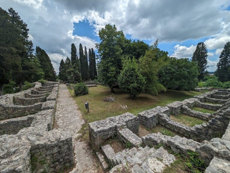
The Ottoman enlargement surrounds the medieval fortress on all sides and made it the central core of a larger, high defensive complex. The northern part contains the entrance gate and a large lower bailey with a tabia, a fortified artillery platform or projecting defensive work. The southern part contains an upper bailey divided by a wall and set among rocks. The main defensive area retains two massive towers facing east on the southeastern side.
The perimeter walls survive in places to heights of between 4 and 12 metres and retain numerous loopholes. Two massive defensive towers stand on the northeastern side. The northwestern section contains two additional defensive towers and a cistern measuring approximately 5.1 by 3.7 metres internally. Across the rugged western side, the perimeter rampart follows a relatively regular line. The approach path was cobbled.
Internal Installations
Within the walls are remains of a watchtower, granary, bakeries, gunpowder mills, and four cisterns. Three cisterns retain their original ground form. Together with the surviving walls, towers, baileys, and loopholes, these installations illustrate the military infrastructure of the enlarged fortress.
Sixteenth-Century Mosque
About 250 metres northwest of the entrance are the ruins of a mosque from the mid-sixteenth century, probably built by Nesuh-aga Vučjaković. Its quadrangular base measures about 7 metres in length, and the surviving walls rise approximately 4.5 metres. The minaret at the western corner has been demolished. A simple quadrangular mihrab, the prayer niche indicating the direction of Mecca, stands in the middle of the southeast wall. It measures about 2 metres high and 1.5 metres wide. The last remains of a cemetery lie near the mosque’s northern walls.