Burg Stolpen: A Medieval Castle and Renaissance Fortress in Germany


Site at a Glance
- Rating
- 4.6
- Popularity
- Medium
- Country
- Germany
- Primary era
- Early Modern
- External website
- Open
- Eras represented
- Medieval, Early Modern, Modern
- Civilizations
- Electorate of Saxony, French, Holy Roman Empire
- Site type
- Military
- Remains
- Castle
On this page22 sections
History
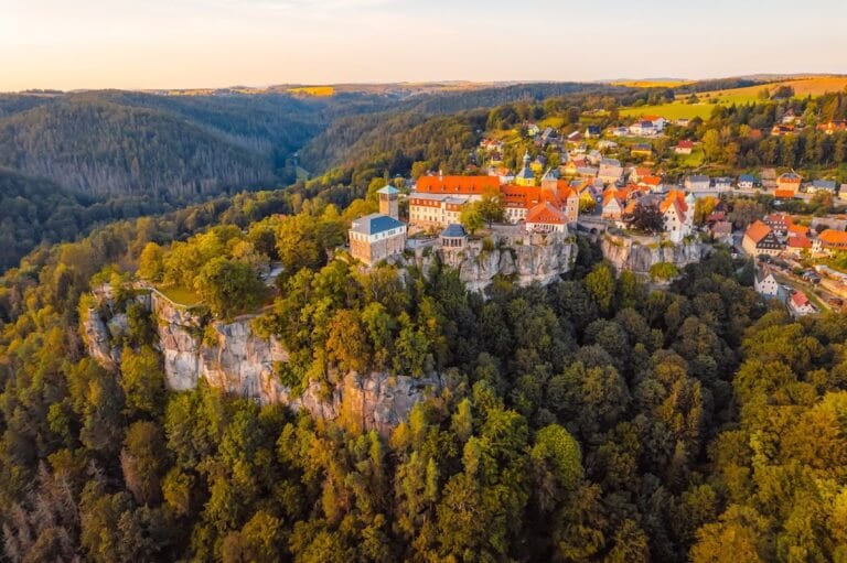
Burg Stolpen is a partially preserved section castle in Germany whose first fortification probably dates to around 1100 and which was later transformed into a Renaissance fortified palace. It stands on a 356-metre-high volcanic hill south of Stolpen’s historic centre, near the former boundary between the Margraviate of Meissen and territories settled by Sorbian communities east of the Elbe.
Medieval foundation and episcopal rule
The hill occupied a strategic position at the meeting point of long-distance trade routes. A reference from 1121 is uncertain, while the site may have contained a Slavic fortified court around 1200. The first secure mention of Burg Stolpen dates from 1222. Around 1218, Bishop Bruno II of Porstendorf recovered the Stolpen fief from Moyko de Stulpen, after which Stolpen developed as an independent landed lordship belonging to the Bishopric of Meissen. This was a church territory ruled by the bishops of Meissen, including their temporal authority over land and administration.
By about 1320, the castle had become the administrative centre of the newly established Stolpen district. During the Hussite Wars, a conflict associated with the reform movement founded by Jan Hus, Hussite forces besieged the castle in 1429. The siege lasted eight weeks and ended without success. A settlement north of the castle, which had developed in the early fifteenth century, expanded rapidly into a town, partly because the bishops of Meissen moved one of their principal residences to Stolpen.
Bishops Caspar von Schönberg and Dietrich III von Schönberg enlarged the castle. Together with Wurzen Castle, Stolpen became one of the principal residences of the Bishop of Meissen. The difficult water supply of the volcanic hill also shaped its medieval administration. Cisterns served the castle and town, while the village of Lauterbach was required to bring fresh water to the castle by wagon during the episcopal period.
Transfer to Saxony and Renaissance rebuilding
In 1559, Elector Augustus of Saxony compelled the bishop to exchange Stolpen Castle, the town, and the district for a less important administrative territory. This ended approximately 250 years of episcopal rule. Augustus then undertook extensive Renaissance construction, reshaping the hill castle into a fortified palace. Residential rooms received rich painted decoration, and an animal and tree garden was established on the southern side of the castle hill.
The change of rule also brought a major improvement to the water supply. The Freiberg mining master Martin Planer constructed a waterworks from 1561, and by 1563 the system was pumping water to the castle. It was repeatedly improved and eventually supplied the castle’s full water requirement. In 1571, surplus water could also be provided to the citizens of Stolpen.
Because the waterworks were strategically important, they were destroyed during both the Thirty Years’ War, the major European conflict of 1618 to 1648, and the Seven Years’ War, fought from 1756 to 1763. They were rebuilt after each conflict with technical improvements. In 1608, Elector Christian II ordered a deep well to provide a more secure source during warfare. Four miners from Berggießhübel settled in Stolpen with their families to undertake the work. A mining commission led by Chief Mining Master Martin Weygel recommended stopping the shaft in 1617, when it had reached almost 46 metres without finding groundwater, but Christian II ordered the project to continue. After twenty-two years, the miners reached water and completed the well in 1632.
War, fortress, and decline
Imperial Croatian troops besieged Stolpen in 1632, but the citizens of the town successfully defended the castle. Fires on 1 August that year destroyed large parts of the complex, which were rapidly rebuilt. A Swedish siege in 1639 was repelled. In 1675, Wolf Caspar von Klengel expanded Stolpen into a state fortress, a strategically maintained fortification controlled by the territorial ruler.
A town fire in 1723 damaged and partly destroyed sections of the castle. Constantia von Cosel, the former mistress of Augustus the Strong, was imprisoned at Stolpen from Christmas 1716 until her death. She was initially held under strict conditions because she knew state secrets, but was later allowed to move around the castle grounds. After a fire in 1743 and the deterioration of the arsenal rooms where she had first lived, she moved to the converted Johannisturm for the final two decades of her imprisonment. She died on 31 March 1765, aged eighty-five, and was buried in the castle chapel.
After the Prussian army took possession in 1756, the fortress was demolished in 1757 to make it unusable. Saxony recaptured Stolpen in 1758, but the garrison was dissolved in 1764 after the end of the Augustan era. The neglected fortress then decayed, and buildings threatened with collapse were demolished for safety in 1773.
Military revival and preservation
During the French occupation of Saxony after Prussia and its allies were defeated at Jena and Auerstedt in October 1806, defensive works at Stolpen were rebuilt or newly constructed. The deep well was also cleared. During the French retreat on 25 September 1813, extensive parts of the castle were blown up and the well was buried again. Stolpen thereafter lost its importance as a major strategic position.
Medieval revivalism later gave the castle renewed cultural importance. King John of Saxony ordered extensive restoration in 1859, and the castle opened to the public on 1 June 1877. The well was cleared again in 1883 at the suggestion of the Royal Saxon Archaeological Society. Building work from 1935 to 1939 prepared additional areas for cultural use, followed by further postwar development.
In 1992, the Free State of Saxony assumed legal responsibility from the town of Stolpen, and the castle became a state-operated palace and castle site. A museum devoted to Constantia von Cosel and the history of the castle operates on the premises. In 2006, the Stolpen volcanic vent was designated one of Germany’s 77 most important national geotopes.
Remains
Burg Stolpen is a partially preserved section castle extending for approximately 220 metres. Its defensive works divide the hilltop into four principal areas: a lower outer bailey or first courtyard, an upper outer bailey or second courtyard, a lower main courtyard or third courtyard, and an upper main courtyard or fourth courtyard. Local volcanic stone forms much of the complex. On the western side of the hill, angular columnar rock is exposed. Geological investigations published in 2018 identified this rock as basanite, specifically olivine-augite-nephelinite, formed in a maar-diatreme volcano, an explosive volcanic structure with a crater and pipe-like vent later filled with lava.
Outer baileys and entrance structures
First courtyard and Kornhaus
The first courtyard contains the entrance to the casemates, which are vaulted protected chambers used for defence or storage, and a three-metre-deep cistern. The courtyard is closed by the Kornhaus, built in 1518 to store grain and other natural dues delivered by peasants subject to service obligations in the Stolpen district.
The Kornhaus measures 36 metres in length and has three grain-storage floors. Its passage contains the main guard post and forms the only access route into the main castle. The former princely stables stand opposite the guard post, with the castle torture chamber adjoining them. The building divided the outer bailey into the first and second courtyards.
Bridge and principal portal
A stone bridge crosses a second cistern on the way to the main castle. Built after the Seven Years’ War, it replaced a wooden drawbridge destroyed during that conflict. The entrance to the principal castle areas is marked by a portal decorated with the Electoral Saxon arms.
Schösserturm
The Schösserturm adjoins the portal directly. Built between 1476 and 1487, it housed the district fiscal official, whose office occupied part of the tower. Two dungeons, known as the Ketzerloch and Mönchsloch, are also located within it.
A large Welsch dome, a curved bulbous tower roof, distinguishes the Schösserturm. The present dome was reconstructed in 1936 without restoring the second storey, which had been removed in 1787 because of the danger of collapse. Between the Schösserturm and Johannisturm lies a zwinger, a fortified outer space between defensive walls. Its wall walks were removed at the end of the eighteenth century, and further sections were destroyed by explosions in 1813.
Lower main courtyard
Cannon courtyard
The third courtyard served defensive and economic purposes and was also called the cannon courtyard. Original seventeenth-century cannon stand along its southern side in front of pentagonal gun embrasures. The courtyard also contained a bakery, smithy, stables, slaughterhouse, and bathhouse.
The former two-storey wall walks in this courtyard no longer form the principal surviving structures. The Johannisturm and Seigerturm instead stand as prominent free-standing towers within the area.
Johannisturm
Bishop Johann VI of Saalhausen commissioned the Johannisturm in 1509. The tower originally included a stair tower and a cell vault on the ground floor. During the Renaissance, an additional spiral stair tower gave access to its upper floors.
The tower was later converted into a residential tower and prison for Constantia von Cosel during the final years of her imprisonment. Its association with her gave rise to the popular name Coselturm. The tower’s role as her last residence explains the continued connection between this structure and the museum history of Burg Stolpen.
Seigerturm
The Seigerturm was built around 1455 and heightened under Elector Augustus in 1560. Its name derives from the clock installed in 1562. The clock had a single dial facing the town and only one hand.
Upper main courtyard
Residential and service buildings
The fourth courtyard was formerly approached only by a drawbridge crossing a cistern. It was surrounded mainly by representative residential buildings, many of them lavishly fitted out under Elector Augustus. A distillery was inserted into the northern castle wall from 1559. Kitchens, dining rooms, an arsenal, and the castle chapel also occupied the upper main castle, where only wall remains survive from many of these buildings.
Castle chapel
The castle chapel was once richly furnished and had an entrance through which citizens of Stolpen could attend services. The grave of Constantia von Cosel lies inside the chapel.
Deep well
The upper main castle contains the deep well sunk through the volcanic rock by miners from Freiberg. The shaft reaches approximately 84.4 metres, with a technical measurement of 84.39 metres. The miners used fire-setting, a method that heated the rock before cooling it with water so that it fractured. Progress averaged about one centimetre per day, and two metres of depth cost approximately 140 gulden.
The well at Königstein Fortress cost about 32 gulden for the same depth, although it reached 152.5 metres in two and a half years. Raising water from the Stolpen shaft required a 175-kilogram rope. The well’s technical difficulties meant that its first water was not raised until about thirty years after completion, while the external waterworks remained the principal supply because they required less labour. The shaft was buried during the wars in 1756 and 1813 and cleared again in 1883.
Western castle and volcanic geology
Hochschloss
At the western end of the complex stood the Hochschloss, which contained the representative rooms of the bishops of Meissen and later those of the Saxon electors. Built and richly furnished at the end of the fifteenth century, it was neglected from 1750. Its remaining ruins were blown up in 1773, and the building no longer survives as a standing structure.
Siebenspitzenturm
The Siebenspitzenturm was built at approximately the same time as the Hochschloss. Its square ground plan changes to a hexagonal form higher up. Small turrets once stood at its corners beneath a central roof, creating seven points. Fire destroyed this roof arrangement in 1632, after which it was replaced by a simple helmet roof. The tower retained its name.
Waterworks and volcanic rock
The historic waterworks incorporated approximately 1,200 tree trunks and a waterwheel more than 10 metres in diameter. The installation raised water through a vertical difference of about 100 metres. Models and surviving pipes preserve evidence of how the system operated.
The volcanic rock and the well are integral features of the castle hill. The formation originated approximately 30 million years ago. It was first securely mentioned in 1510, examined by Georgius Agricola in 1546, and drawn by the physician and naturalist Johannes Kentmann in 1565. The formation later became central to the eighteenth- and early nineteenth-century dispute between Neptunists and Plutonists. Neptunists explained rocks chiefly through deposition from water, while Plutonists emphasized heat and molten rock.
Nearby sites