Kaunos Ancient City: A Carian Port and Archaeological Site in Türkiye


Site at a Glance
- Rating
- 4.6
- Popularity
- Medium
- Country
- Turkey
- Primary era
- Classical
- Eras represented
- Classical, Medieval
- Civilizations
- Achaemenid, Ancient Greek, Byzantine, Carian, Roman
- Site type
- City
On this page20 sections
History
Kaunos Ancient City is an ancient city of Caria in Türkiye, located near modern Dalyan. Its history reaches back traditionally to the tenth century BC, while archaeological finds indicate activity by the ninth century BC or earlier. Kaunos developed as a maritime and trading center, later passing through Persian, Hellenistic, Roman, Byzantine, and Turkish periods.
Origins and Early Kaunos
Kaunos first existed as a separate city-state before becoming part of Caria and later being assigned to Lycia. The Calbys River formed the boundary between the two regions. The city’s earlier Carian name was Kbid, while later forms included Xbide in Lycian, Kaunos in Greek, and Caunus in Latin. During the Hellenistic period, the Carian name gradually fell out of use.
According to the city’s foundation mythology, Kaunos was established by King Kaunos, the son of the Carian King Miletus and Kyane and the grandson of Apollo. The story says that Kaunos fled with his followers after his twin sister Byblis developed an incestuous love for him. Her tears were believed to have formed the Calbys River. This tradition probably took shape in the fifth or fourth century BC, when the name Kaunos increasingly replaced Kbid.
Kaunos was mentioned by Herodotus, the fifth-century-BC Greek historian, in his account of the Persian invasion of 546 BC. The Persian general Harpagus defeated the Kaunians after they resisted his attacks. Herodotus regarded them as indigenous to the region because their language resembled Carian while differing from it, although the Kaunians themselves claimed Cretan origins. He also described their distinctive social drinking gatherings, which included men, women, and children.
The city took part in the Ionian Revolt, the uprising of Greek cities and their allies against Persian rule between 499 and 494 BC. Inscriptions from Kaunos dating to around 400 BC include a Greek-Carian bilingual text discovered in 1996. Such inscriptions helped scholars decipher the Carian alphabet.
Persian and Hellenistic Transformation
After the defeat of Xerxes I in the Second Persian War, Kaunos joined the Delian League, an alliance of Greek states led by Athens after the Persian Wars. Its tribute increased from one talent to ten talents in 425 BC. This rise reflects the expansion of the city’s economic activity as a prosperous port. Its exports probably included salt, salted fish, slaves, pine resin, black mastic used in boat-building tar, and dried figs. During the Peloponnesian War, both opposing sides used Kaunos as a harbor.
The Peace of Antalcidas in 387 BC returned Kaunos to Persian authority and incorporated it into the Persian province of Caria. Major urban changes followed, especially under Mausolos, the Persian-appointed satrap, or provincial governor, of Caria from 377 to 353 BC. The city was enlarged, laid out on terraces, and enclosed by extensive fortifications. It also acquired a more Greek character through the construction of an agora and temples dedicated to Greek deities.
Alexander the Great brought Kaunos under Macedonian rule in 334 BC. After his death, the city became contested among the Diadochi, the rival successors and former commanders of Alexander. Antigonids, Ptolemies, and Seleucids successively competed for control of the region. In the early second century BC, Rhodes obtained Kaunos from Ptolemy’s generals for 200 talents. In 189 BC, the Roman Senate placed it under Rhodian authority, when it was known as the Rhodian Peraia.
A revolt against Rhodes in 167 BC led Rome to remove the island from the city’s administration. In 129 BC, Kaunos was placed in or near the Roman Province of Asia and assigned to Lycia. An inscription from the late Hellenistic period records a Samaritan family at Kaunos. Its father, Simon, came from Shechem, while other family members had Greek names.
Roman Prosperity and Christian Kaunos
Kaunos supported Mithridates VI during his invasion of the Roman province in 88 BC, and the city’s Roman inhabitants were killed. After the peace of 85 BC, Rome punished Kaunos by restoring Rhodian administration. By the end of the first century BC, the city was again independent, although Rhodian control may later have returned.
Under Roman rule, Kaunos again prospered as a port. The theater was enlarged, Roman baths and a palaestra were constructed, the agora fountain was renovated, and new temples were built. A palaestra was an exercise complex associated especially with wrestling and physical training. These works reshaped the public center while the city continued to depend on its harbor and maritime connections.
Kaunos was Christianized at an early date. After Christianity became the official religion of the Roman Empire, the city was renamed Caunos-Hegia. During the Byzantine period it belonged to Lycia, and its bishop ranked fifteenth among the suffragans of Myra. A suffragan bishopric was a subordinate diocese under a metropolitan archbishopric.
Resident bishops are known from the fourth century onward. Basil attended the Council of Seleucia in 359, Antipater attended the Council of Chalcedon in 451, Nicolaus signed a letter to Emperor Leo in 458, and Stephanus attended the Council of Nicaea in 787. Byzantine administrative records continued to place Kaunos in Lycia as a suffragan bishopric of Myra into the twelfth or thirteenth century.
Decline, Rediscovery, and Archaeology
From 625 onward, Kaunos suffered attacks by Muslim Arabs and pirates. Turkish incursions in the thirteenth century led to the fortification of the old acropolis castle, giving it a medieval appearance. Turkish conquests in Caria during the fourteenth century caused a major decline in maritime trade, and many inhabitants moved elsewhere.
In the fifteenth century, after Turkish control extended across the region north of Caria, Kaunos was struck by a severe malaria epidemic and abandoned. An earthquake heavily damaged the city, which was gradually covered by sand and dense vegetation.
The ruins returned to wider attention after Richard Hoskyn, a Royal Navy surveyor, found a law tablet referring to the Council of Kaunos and the city’s inhabitants. He visited the site in 1840 and published his account in 1842. Excavations began in 1966 under Professor Baki Öğün and have continued under Professor Cengiz Işık. Research has also extended beyond the main city to the area near Sultaniye Spa, where a sanctuary dedicated to Leto once stood.
Kaunos lies within the Köyceğiz-Dalyan Special Environmental Protection Area and is included on Türkiye’s UNESCO World Heritage Tentative List under criteria (i), (ii), (iii), and (iv). Its archaeological remains, ecological setting, wildlife, and landscape contribute to its recognized heritage value. The former bishopric of Caunus was restored as a Catholic titular see no later than 1911. A titular see preserves the name of a former bishopric as an ecclesiastical title, and Caunus has been vacant since 1972.
Remains
The ruins occupy the western bank of the ancient Calbys River, on the slope of a mountainous height that the river once flowed around. The city was arranged across terraces and protected by approximately 3 km of walls. Changes to the coastline began around 200 BC as silting formed the Dalyan Delta and İztuzu Beach. The former shore moved away from Kaunos, leaving the city approximately 8 km from the sea.
Ports and Fortifications
Kaunos had two ports. The southern harbor lay southeast of Küçük Kale and served the city from its foundation until approximately the end of the Hellenistic period, when silting made it inaccessible. The inner or commercial harbor lay northwest of Küçük Kale at present-day Sülüklü Göl. Chains could close this port. Continued silting eventually disconnected both harbors and ended Kaunos’s importance as a commercial port.
The city walls follow a southern and southeastern orientation that points to occupation in the sixth century BC. More extensive defenses were developed during the Persian period under Mausolos, alongside the terraced urban plan.
Acropolis and Heraklion
The Acropolis, also called Persikon, stands on a rock approximately 152 m high and is enclosed by Byzantine walls. It was known as Imbros and stood at the foot of Mount Tarbelos, identified with present-day Mount Ölemez. The fortified height formed the dominant defensive position within the city.
Heraklion was a smaller fortified enclosure adjoining the acropolis. Its approximately 50 m-high promontory reached the sea as late as the fifth century BC, with a port on each side. The acropolis overlooks the ancient city, Dalyan, the Dalyan River, its mouth, and İztuzu Beach.
Theater and Public Center
Theater
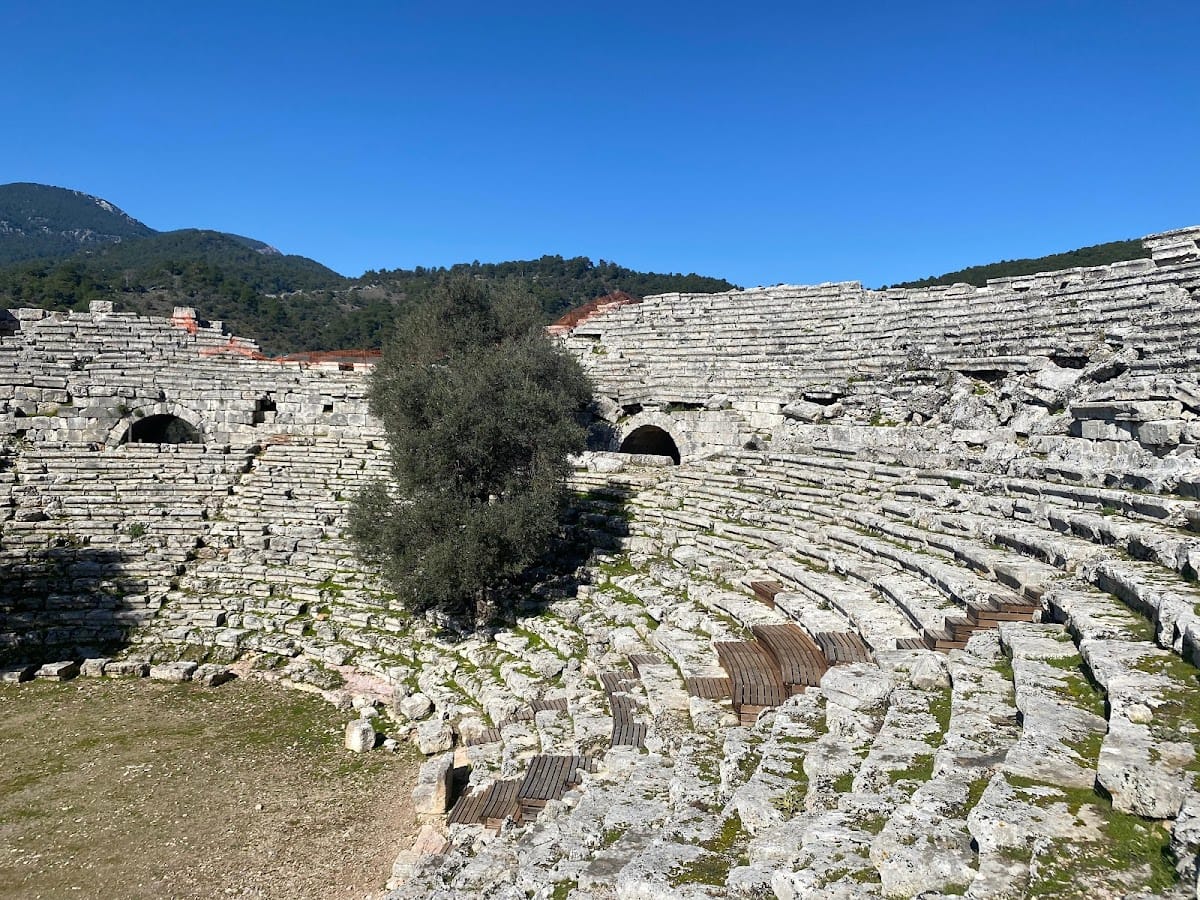
The theater was built on the acropolis slope and combines Hellenistic and Roman characteristics. It has a diameter of approximately 75 m and was constructed at an angle of about 27 degrees. Its seating accommodated approximately 5,000 spectators. The structure remains in relatively good condition and is still occasionally used for performances.
Agora, Stoa, and Nymphaeum
The port agora, stoa, and nymphaeum formed part of the city’s principal public remains. An agora was a public square, a stoa was a covered colonnade, and a nymphaeum was a monumental fountain or water shrine. The agora fountain was renovated during the Roman period.
Palaestra Terrace
Roman Baths
The palaestra complex included Roman baths that served as a place for social gathering as well as bathing. During the Byzantine period, the baths were dismantled, and their cold room, or frigidarium, was reused as a church.
Wind-Measuring Platform
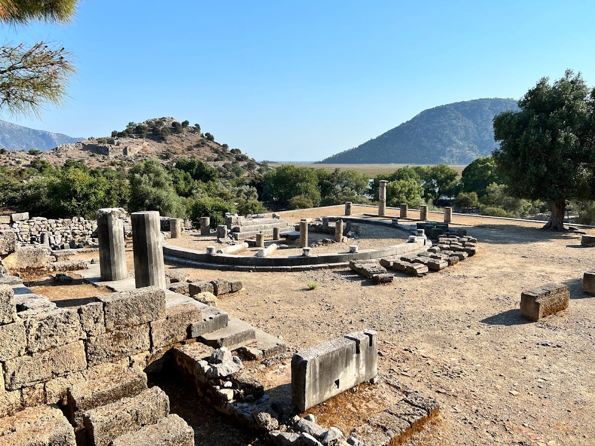
A wind-measuring platform dating to about 150 BC was used in planning the city. It probably consisted of a circular structure with a basal diameter of 15.80 m and an upper diameter of 13.70 m. The structure collapsed, probably in an earthquake, leaving the precise method of measurement uncertain.
Byzantine Basilica
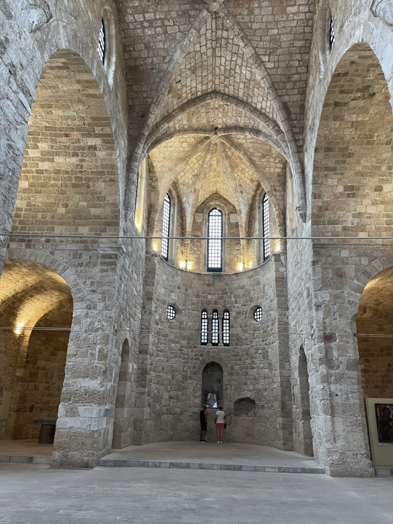
The domed Byzantine basilica on the palaestra terrace dates to the fifth century AD. Builders used reused material and placed it over the foundations of a fourth-century building that may also have served as a place of worship. Its interior walls were probably plastered and decorated with frescoes. It is the only surviving standing Byzantine structure at Kaunos, and mosaics have been uncovered beside it.
Temples and Religious Features
Excavations have revealed six temples, including two Hellenistic and four Roman buildings. The most prominent may be a third-century-BC terrace temple that was probably surrounded by columns. An obelisk found among the columns also appears on ancient Kaunian coins. In the foundation mythology, it was regarded as the symbol of King Kaunos.
Ancient coins from Kaunos depict Iris, the Greek goddess associated with the rainbow and the messenger of the gods, or a winged female figure on the front. The reverse shows a baitylos, a sacred stone or pillar regarded as possessing divine significance and often associated with a meteorite. Early coins bear the letters KB, derived from Kbid, while other issues use the signs Delta-Gamma, corresponding to KB in Carian.
Rock Tombs and Archaeological Finds
Dalyan River Tombs
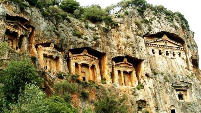
Six rock tombs along the Dalyan River date from the fourth to the second century BC. Their facades imitate Hellenistic temples, with two Ionic columns, triangular pediments, architraves with dentil friezes, and palm-leaf-shaped acroteria. Inside, the Lycian-type tombs contain three stone beds for the dead.
Çandır Niche Tombs
Niche tombs are located at the port of Çandır. The rock-cut burial monuments along the river are especially visible from Dalyan and form part of the wider archaeological landscape associated with Kaunos.
Early Objects and Inscriptions
The neck of a Protogeometric amphora, dating to the ninth century BC or earlier, provides evidence for activity before the surviving architectural remains. A statue found at the western city gate and fragments of imported Attic pottery also point to habitation in the sixth century BC.
Kaunos has yielded Carian inscriptions, including the Greek-Carian bilingual inscription discovered in 1996 and dated to around 400 BC. The texts helped decipher the Carian alphabet. Silver coins and stone inscriptions preserve both the Carian name Kbid and the term used for Kaunian citizens, linking the physical remains with the city’s changing names and identities.